- Yarnell, Arizona
Infobox Settlement
official_name = Yarnell, Arizona
settlement_type = CDP
imagesize =
image_caption =
image_
imagesize =
image_caption =
image_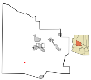
mapsize = 250x250px
map_caption = Location inYavapai County and the state ofArizona
mapsize1 =
map_caption1 =
subdivision_type = Country
subdivision_type1 = State
subdivision_type2 = County
subdivision_name =United States
subdivision_name1 =Arizona
subdivision_name2 = Yavapai
government_type =
leader_title =
leader_name =
established_date =
area_magnitude =
area_total_km2 = 22.8
area_total_sq_mi = 8.8
area_land_km2 = 22.9
area_land_sq_mi = 8.8
area_water_km2 = 0.0
area_water_sq_mi = 0.0
elevation_ft = 4780
elevation_m = 1457
population_as_of = 2000
population_footnotes =
population_total = 645
population_metro =
population_density_km2 = 28.2
population_density_sq_mi = 73.1
timezone = MST
utc_offset = -7
latd = 34 |latm = 13 |lats = 21 |latNS = N
longd = 112 |longm = 44 |longs = 59 |longEW = W
timezone_DST =
utc_offset_DST =
postal_code_type =ZIP code
postal_code = 85362
area_code = 928
blank_name = FIPS code
blank_info = 04-84980
blank1_name = GNIS feature ID
blank1_info = 0014039
footnotes =
website =Yarnell is a
census-designated place (CDP) in Yavapai County,Arizona , USA. The population was 645 at the 2000 census. Yarnell's economy is based on ranching, mining and services to travelers and retirees. Peeples Valley, three miles north, is closely linked to Yarnell.History
Gold was discovered in Yarnell about 1865 by Charles Genung (1839-1916), a well-known area pioneer. The community is named for Harrison Yarnell, a later prospector, who discovered the Yarnell mine in 1873. Old U.S. Route 89 (now State Route 89), which goes through Yarnell, was paved in 1933, and for many years was the main highway from Phoenix to
Wickenburg , Prescott and northern Arizona.Geography
Yarnell is located at coor dms|34|13|21|N|112|44|59|W|city (34.222569, -112.749608)GR|1.
According to the
United States Census Bureau , the CDP has a total area of 8.8square mile s (22.9km² ), all of it land.Attractions
Yarnell Hill, which Highway 89 descends 2,500 feet in four miles, is a popular scenic drive. There is a developed lookout point at the top.
The
ghost towns of Stanton, Octave, andCongress, Arizona are nearby.Weaver, Arizona features Rich Hill, the richest placer gold discovery in Arizona, discovered in 1863 by a party lead bymountain man Pauline Weaver and prospector A. H. Peeples. All are popular with amateurprospectors and ghost-town buffs.Demographics
As of the
census GR|2 of 2000, there were 645 people, 359 households, and 188 families residing in the CDP. Thepopulation density was 73.1 people per square mile (28.2/km²). There were 516 housing units at an average density of 58.5/sq mi (22.6/km²). The racial makeup of the CDP was 96.90% White, 0.16% Black or African American, 0.16% Native American, 0.16% Pacific Islander, 1.09% from other races, and 1.55% from two or more races. 1.86% of the population were Hispanic or Latino of any race.There were 359 households out of which 10.6% had children under the age of 18 living with them, 41.8% were married couples living together, 6.1% had a female householder with no husband present, and 47.6% were non-families. 40.9% of all households were made up of individuals and 17.5% had someone living alone who was 65 years of age or older. The average household size was 1.80 and the average family size was 2.35.
In the CDP the population was spread out with 11.2% under the age of 18, 1.7% from 18 to 24, 16.4% from 25 to 44, 37.7% from 45 to 64, and 33.0% who were 65 years of age or older. The median age was 57 years. For every 100 females there were 114.3 males. For every 100 females age 18 and over, there were 113.0 males.
The median income for a household in the CDP was $24,792, and the median income for a family was $35,417. Males had a median income of $33,333 versus $23,750 for females. The
per capita income for the CDP was $18,837. About 11.5% of families and 14.0% of the population were below thepoverty line , including 18.0% of those under age 18 and 5.0% of those age 65 or over.Education
The Yarnell Elementary School District #52 serves students in grades pre-k through 8th. High school students are tuitioned to local high school districts. [http://www.yesd52.org]
References
External links
* [http://www.y-pvchamber.com/ Yarnell & Peeples Valley Chamber of Commerce]
* [http://www.delange.org/Yarnell/page54.htm Yarnell history and information] , by a local resident
* [http://www.commerce.state.az.us/doclib/COMMUNE/yarnell-peeples.pdf Yarnell-Peeples Valley community profile] , by Arizona Department of Commerce
* [http://www.mindat.org/loc-63496.html Yarnell Mine] , information and references
Wikimedia Foundation. 2010.