- Prescott Valley, Arizona
-
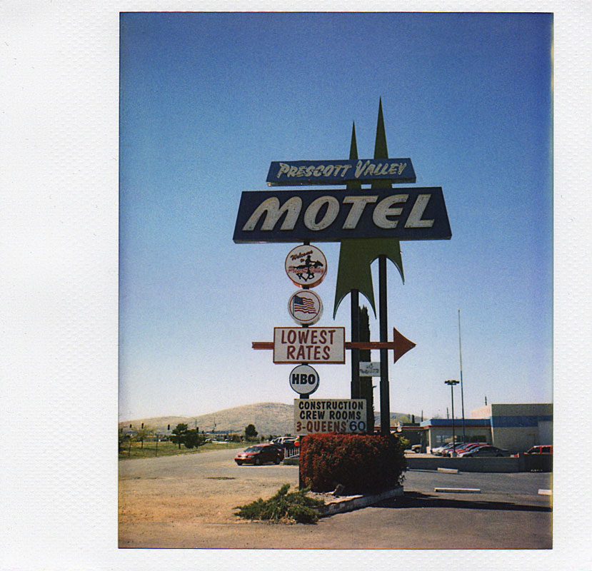
Prescott Valley, Arizona — Town — Historic Prescott Valley Motel, built about 1966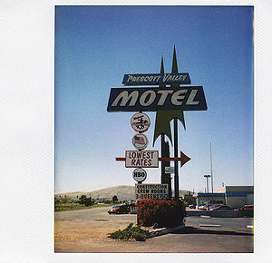

SealLocation in Yavapai County the state of Arizona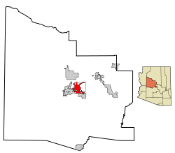
Coordinates: 34°36′8″N 112°19′19″W / 34.60222°N 112.32194°WCoordinates: 34°36′8″N 112°19′19″W / 34.60222°N 112.32194°W Country United States State Arizona County Yavapai Incorporated (town) 1978 Government – Mayor Harvey C. Skoog Area – Town 38.7 sq mi (100.1 km2) – Land 38.7 sq mi (100.1 km2) – Water 0.0 sq mi (0.0 km2) Elevation 5,026 ft (1,532 m) Population (2010)[1] – Town 38,822 – Density 1,004.4/sq mi (387.8/km2) – Metro 103,260 (Tri-City Area), 212,635 (Yavapai County Total) Time zone MST (UTC-7) ZIP codes 86312, 86314 Area code(s) 928 FIPS code 04-57450 Website http://www.pvaz.net/ 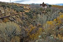 The 1895 Massicks house on Lynx Creek in Fain Park
Prescott Valley is a town in Yavapai County, Arizona, United States, just east of Prescott. Prescott Valley was the seventh fastest-growing place among all cities and towns in Arizona between 1990 and 2000. According to 2010 Census, the population of the town is 38,822.[2]
Contents
Geography
Prescott Valley (locally, PV) is located in central Arizona approximately 85 miles north of Phoenix at 5100 ft. elevation. PV has good access to Arizona State Route 89, SR-89A and SR-69 , connecting to Interstates I-17 and I-40. Air service is available at Ernest A. Love Field, about 8 miles west.
One of PV’s landmarks, Glassford Hill (elevation 6,177 feet) was once an active volcano between 10 and 14 million years ago. Colonel William A. Glassford traveled the area in the 1880s and helped build a system of 27 heliograph stations to monitor the movements of Apache Indians, U.S. military troops and civilians. Glassford Hill was a part of that early communications system.
History
Prescott Valley’s Fitzmaurice Ruins contain artifacts from the early Mountain Patayan people who inhabited the area some 14,000 years ago.
The Walker party discovered gold along Lynx Creek in 1863. The Lynx Creek placers went on to produce a recorded 29,000 troy ounces (900 kg) of gold. Estimates of actual production range up to 80,000 troy ounces (2,500 kg), which would be worth about $85 million at 2011 prices.[3]
Prescott Valley, formerly known as Lonesome Valley, was settled by ranchers in the 1880s, raising beef to supply the miners and new settlers. The Fain family, pioneer ranchers, still ranch in the valley.[4]
Thomas Gibson Barlow-Massicks arrived in the area in the early 1890s and built the historic "castle" that still stands in Fain Park. Massicks had a hydraulic gold mining operation in Lynx Creek Canyon and built the company mining camp of Massicks, Arizona just east of his Victorian home, the Castle. The fireplace with chimney just inside the Castle's fence is all that remains of the Massicks store. Massicks accidentally shot himself and died in April 1899 at the age of 37. In the 1930s, there was a gold dredging operation, the Doodle Bug Diggings, farther east in Lynx Creek Canyon.[5]
In the mid 1960s, Prescott Valley Incorporated, a real-estate company from Phoenix, purchased land in an area 10 miles east of Prescott known as Lonesome Valley. In 1966, representatives from Prescott Valley Inc. began traveling to the Midwest to sell home lots. By 1978, more than 1,500 residents were living in the unincorporated area now known as Prescott Valley. In 1978, 80% of the voters of Prescott Valley voted for incorporation as a town.[4]
Economy
PV's economy consists of industrial, manufacturing, retail and service businesses. PV also serves as a bedroom community for Prescott. Many retirees live here due to relatively inexpensive housing and the mild climate. Recent major community additions include a $61M regional medical center and a $15M regional rehabilitation hospital.[6]
Attractions
Prescott Valley is located within 10 minutes of the Prescott National Forest, with lakes, fishing, hiking and camping. The Entertainment District is located downtown and offers a variety of restaurants, a 6,000-seat events center, a multi-screen movie theater, and retail shops. Fain Park preserves remnants of early 20th century gold mining along Lynx Creek.
The Arizona Sundogs Hockey Team has called Prescott Valley its home since 2006. The team won the Central Hockey League championship in 2008.
The Arizona Adrenaline Football team plays in the Tim's Toyota Center
Notable residents
- Sharlot Hall's family had a ranch between present-day PV and Dewey. She lived there from 1890 to about 1925. The site is now the Orchard Ranch trailer park.[7]
See also
References
- ^ "Annual Estimates of the Population for Incorporated Places in Arizona". United States Census Bureau. 2008-07-10. http://www.census.gov/popest/cities/tables/SUB-EST2007-04-04.csv. Retrieved 2008-07-14.
- ^ "Annual Estimates of the Population for All Incorporated Places in Arizona" (CSV). 2010 Census Summary file 1. U.S. Census Bureau, Population Division. http://factfinder2.census.gov/faces/tableservices/jsf/pages/productview.xhtml?pid=DEC_10_DP_DPDP1&prodType=table.
- ^ Prescott Area Geological Field Guide, 1999, prepared for Earth Science Week. Copy available at Yavapai College library.
- ^ a b Jean Cross, 2009, Images of America: Prescott Valley, Arcadia Publishing. ISBN 0738570702
- ^ Sharlot Hall Museum
- ^ Prescott Valley profile at Arizona Department of Commerce
- ^ Orchard Ranch history
External links
Municipalities and communities of Yavapai County, Arizona Cities Cottonwood | Peoria‡ | Prescott | Sedona‡

Towns Camp Verde | Chino Valley | Clarkdale | Dewey-Humboldt | Jerome | Prescott Valley
CDPs Ash Fork | Bagdad | Big Park | Black Canyon City | Congress | Cordes Lakes | Cornville | Lake Montezuma | Mayer | Paulden | Peeples Valley | Seligman | Spring Valley | Verde Village | Wilhoit | Williamson | Yarnell
Unincorporated
communitiesCherry | Cleator | Crown King | Drake | Iron Springs | Kirkland | Red Rock | Skull Valley
Indian reservation Hualapai Indian Reservation
Ghost towns Alexandra | Big Bug | Bradshaw City | Bumble Bee | Catoctin | Cordes | Jerome Junction | Octave | Piedmont | Stanton | Tip Top | Weaver
Footnotes ‡This populated place also has portions in an adjacent county or counties
Categories:- Towns in Arizona
- Populated places in Yavapai County, Arizona
- Prescott, Arizona
- Prescott Valley, Arizona


Wikimedia Foundation. 2010.