- Dewey-Humboldt, Arizona
-
Dewey-Humboldt, Arizona — Town — Location in Yavapai County and the state of Arizona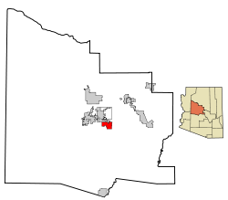
Coordinates: 34°31′57″N 112°15′9″W / 34.5325°N 112.2525°WCoordinates: 34°31′57″N 112°15′9″W / 34.5325°N 112.2525°W Country United States State Arizona County Yavapai Incorporated (town) 2004 Government - Mayor Earl Goodwin Area - Total 18.6 sq mi (48.1 km2) - Land 18.6 sq mi (48.1 km2) - Water 0.0 sq mi (0.0 km2) Elevation 4,581 ft (1,396 m) Population (2010)[1] - Total 3,894 - Density 209.5/sq mi (80.9/km2) Time zone MST (UTC-7) FIPS code 04-19145 Website http://www.dewey-humboldt.net/ Dewey-Humboldt is a town in Yavapai County, Arizona, United States. The estimated population of the town was 3,613 according to the 2005 census estimates.[2] The Dewey-Humboldt area was a census-designated place (CDP) at the 2000 census, at which time its population was 6,295.
Contents
History
Dewey-Humboldt was incorporated on December 20, 2004 from the existing unincorporated towns of Dewey and Humboldt, located adjacent to one another in the Agua Fria River Valley, 15 miles east of Prescott.[3]
The Dewey area was settled around 1863 by pioneer prospector, rancher and Indian-fighter King Woolsey (1832–1879), who founded the Agua Fria Ranch, then better known as "Woolsey Valley". The stage station and post office nearby was also named Agua Fria. By the early 1870s water diversions were being used to irrigate an extensive area of corn and other crops. Apache raids made life difficult for the early American settlers. The ruins of Woolsey's ranch house can still be seen between the old Black Canyon Highway and the Agua Fria River about one mile north of Humboldt.
The Agua Fria post office closed in 1895. When a new post office opened in 1898, the community was renamed Dewey, probably to honor Admiral Dewey's great victory that year at the Battle of Manila, but perhaps after a pioneer settler. Farming continued in a small portion of the area until 2006 when the last working farm was sold to developers. Today Dewey is a low-density residential area.
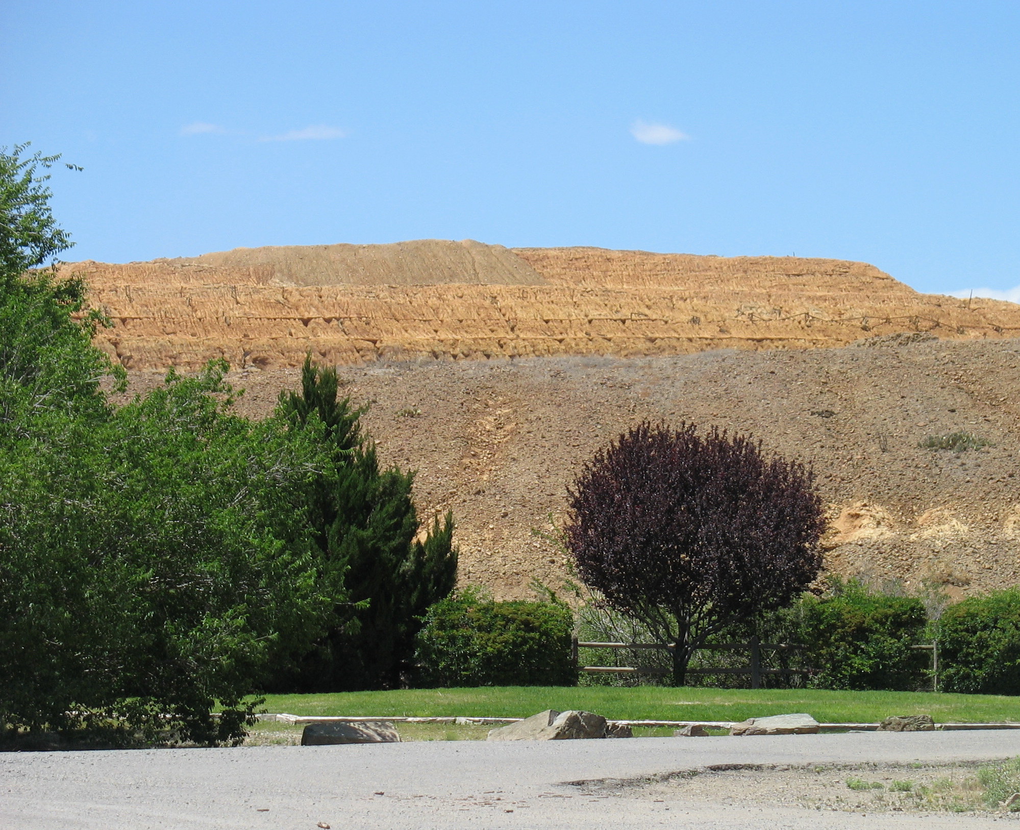
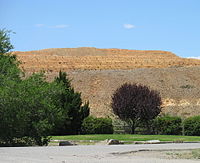 Iron King mine tailings, Humboldt, AZ
Humboldt was also settled in the early 1860s. The town was originally named Val Verde after the company that owned the local smelting operation. The town was renamed Humboldt in 1905 to honor Baron Alexander von Humboldt, who had predicted more than a century earlier that the Bradshaw Mountains would become a rich mining area [4] By 1907 the population had reached 1,000. With two daily trains, business in the town boomed and the city decided to showcase their development by hosting a Labor Day celebration that year. The celebration featuring a parade on Main Street became an annual tradition, now organized by the Agua Fria Chamber of Commerce [1] and held on the last Saturday in September.
The panic of 1907 caused the nearby Iron King Mine to close temporarily. After World War I, the smelter and mine closed again, and by 1930 the population of Humboldt had dwindled to 300. Humboldt had a second but smaller boom in 1934 when the mine reopened and produced $100 million in gold, silver, lead and zinc before its closure in 1968. The mine tailings are presently being reprocessed into iron-rich Ironite fertilizer. There have been questions raised about the lead and arsenic content of the fertilizer, but the company maintains its product is harmless. "The lead and arsenic are in forms that cannot escape into the environment. You can eat them and they'll pass right through you," said Rob Morgan, Ironite's executive vice president and chief operating officer. "They're not harmful." [5] However, the United States Environmental Protection Agency has recently posted a cautionary statement, warning that potentially harmful amounts of arsenic could be released from use of Ironite. Ironite is banned in Canada.[6]
The railroad track which served the mine was removed in 1971. Today in Humboldt, a lone smelter smokestack remains overlooking the historic buildings on Main Street.
Geography
Dewey-Humboldt is located at 34°31′57″N 112°15′9″W / 34.5325°N 112.2525°W (34.532579, -112.252518).[7]
According to the United States Census Bureau, the CDP had a total area of 18.6 square miles (48 km2), all of it land.
Demographics
Historical populations Census Pop. %± 1990 3,640 — 2000 6,295 72.9% 2010 3,894 −38.1% source:[8] As of the census[9] of 2000, there were 6,295 people, 2,795 households, and 2,023 families residing in the CDP. The population density was 274.8 people per square mile (106.1/km²). There were 3,358 housing units at an average density of 146.6 per square mile (56.6/km²). The racial makeup of the CDP was 96.43% White, 0.22% Black or African American, 0.59% Native American, 0.33% Asian, 0.03% Pacific Islander, 1.49% from other races, and 0.91% from two or more races. 5.21% of the population were Hispanic or Latino of any race.
There were 2,795 households out of which 16.8% had children under the age of 18 living with them, 63.8% were married couples living together, 5.3% had a female householder with no husband present, and 27.6% were non-families. 23.0% of all households were made up of individuals and 13.9% had someone living alone who was 65 years of age or older. The average household size was 2.25 and the average family size was 2.59.
In the CDP the population was spread out with 16.8% under the age of 18, 4.0% from 18 to 24, 16.3% from 25 to 44, 31.4% from 45 to 64, and 31.4% who were 65 years of age or older. The median age was 54 years. For every 100 females there were 96.1 males. For every 100 females age 18 and over, there were 93.9 males.
The median income for a household in the CDP was $36,839, and the median income for a family was $41,232. Males had a median income of $35,446 versus $22,484 for females. The per capita income for the CDP was $20,326. About 4.8% of families and 8.7% of the population were below the poverty line, including 14.9% of those under age 18 and 6.2% of those age 65 or over.
Landmarks
Dewey was the home of Young's Farm, a family-owned farm selling turkeys and pumpkins since 1946. Hay rides, pumpkin patches, and a country restaurant made it a popular attraction for city dwellers seeking a taste of farm life. Youngs Farm held a large "Pumpkin Fest" every October, drawing large numbers of tourists from other parts of Arizona. After preservation attempts failed, Young's Farm was sold to developers, and closed in late 2006.[10] As of mid-2010, the site remains undeveloped.
April 2011: Sharla and Gary Martimer of Mortimer Family Farms is tilling and planting the first crops on the 300-acre fertile Yavapai County in Dewey, a 60-year-old and have re-opened the farm that sets the gold standard for its sweet corn in the summer and pumpkins in the fall. [11]
Notes
- ^ "Annual Estimates of the Population for Incorporated Places in Arizona". United States Census Bureau. 2010-04-1. http://factfinder2.census.gov/faces/tableservices/jsf/pages/productview.xhtml?pid=DEC_10_DP_G001&prodType=table. Retrieved 2011-08-4.
- ^ "Table 4: Annual Estimates of the Population for Incorporated Places in Arizona, Listed Alphabetically: April 1, 2000 to July 1, 2005". US Census Bureau. http://www.census.gov/popest/cities/tables/SUB-EST2005-04-04.csv.
- ^ "About the Town of Dewey-Humboldt". Town of Dewey-Humboldt. http://www.dewey-humboldt.net/about/.
- ^ Philip Varney, Arizona Ghost Towns and Mining Towns: A travel guide to history, Phoenix, Arizona Highways Books, 1988; p. 16
- ^ The Ironite Story, from Dallas Morning News
- ^ Release of Heavy Metals from Ironite
- ^ "US Gazetteer files: 2010, 2000, and 1990". United States Census Bureau. 2011-02-12. http://www.census.gov/geo/www/gazetteer/gazette.html. Retrieved 2011-04-23.
- ^ "CENSUS OF POPULATION AND HOUSING (1790-2000)". U.S. Census Bureau. http://www.census.gov/prod/www/abs/decennial/index.html. Retrieved 2010-07-17.
- ^ "American FactFinder". United States Census Bureau. http://factfinder.census.gov. Retrieved 2008-01-31.
- ^ Sale of Young's Farm
- ^ ""New family takes over Young's Farm in Dewey"". AZ Central. http://www.azcentral.com/style/hfe/food/articles/2011/04/15/20110415new-family-takes-over-youngs-farm-dewey.html#ixzz1MeFjsH5e. Retrieved 15 April 2011.
External links
- Official site, town of Dewey-Humboldt
- Community profile
- Humboldt-Val Verde ghost town info
- Prescott eNews - Local News Website
Municipalities and communities of Yavapai County, Arizona County seat: Prescott Cities Cottonwood | Peoria‡ | Prescott | Sedona‡

Towns Camp Verde | Chino Valley | Clarkdale | Dewey-Humboldt | Jerome | Prescott Valley
CDPs Ash Fork | Bagdad | Big Park | Black Canyon City | Congress | Cordes Lakes | Cornville | Lake Montezuma | Mayer | Paulden | Peeples Valley | Seligman | Spring Valley | Verde Village | Wilhoit | Williamson | Yarnell
Unincorporated
communitiesCherry | Cleator | Crown King | Drake | Iron Springs | Kirkland | Red Rock | Skull Valley
Indian reservation Hualapai Indian Reservation
Ghost towns Alexandra | Big Bug | Bradshaw City | Bumble Bee | Catoctin | Cordes | Jerome Junction | Octave | Piedmont | Stanton | Tip Top | Weaver
Footnotes ‡This populated place also has portions in an adjacent county or counties
Categories:- Towns in Arizona
- Populated places in Yavapai County, Arizona
- Former census-designated places in Arizona


Wikimedia Foundation. 2010.