- Cordes Lakes, Arizona
-
Cordes Lakes, Arizona — CDP — Location in Yavapai County and the state of Arizona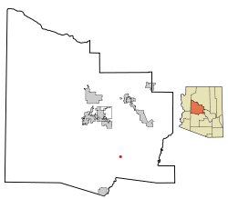
Coordinates: 34°18′44″N 112°6′24″W / 34.31222°N 112.10667°WCoordinates: 34°18′44″N 112°6′24″W / 34.31222°N 112.10667°W Country United States State Arizona County Yavapai Area – Total 10.9 sq mi (28.2 km2) – Land 10.9 sq mi (28.2 km2) – Water 0.0 sq mi (0.0 km2) Elevation 3,700 ft (1,128 m) Population (2000) – Total 2,058 – Density 189.2/sq mi (73.1/km2) Time zone MST (UTC-7) ZIP code 86333 Area code(s) 928 FIPS code 04-15765 GNIS feature ID 0038369 Cordes Lakes is a census-designated place (CDP) in Yavapai County, Arizona, United States. The population was 2,058 at the 2000 census. Arcosanti is just north of Cordes Lakes, and Agua Fria National Monument is a few miles south on I-17. Cordes lakes has one man-made lake, as of 2010.
Cordes Junction is located in the CDP.
Geography
Cordes Lakes is located at 34°18′44″N 112°6′24″W / 34.31222°N 112.10667°W (34.312109, -112.106569).[1]
According to the United States Census Bureau, the CDP has a total area of 10.9 square miles (28 km2), all of it land.
Demographics
As of the census[2] of 2000, there were 2,058 people, 866 households, and 582 families residing in the CDP. The population density was 189.2 people per square mile (73.0/km²). There were 1,079 housing units at an average density of 99.2/sq mi (38.3/km²). The racial makeup of the CDP was 96.50% White, 0.15% Black or African American, 0.87% Native American, 0.15% Asian, 0.24% Pacific Islander, 0.68% from other races, and 1.41% from two or more races. 6.17% of the population were Hispanic or Latino of any race.
There were 866 households out of which 19.9% had children under the age of 18 living with them, 55.0% were married couples living together, 7.9% had a female householder with no husband present, and 32.7% were non-families. 26.6% of all households were made up of individuals and 13.2% had someone living alone who was 65 years of age or older. The average household size was 2.33 and the average family size was 2.77.
In the CDP the population was spread out with 21.2% under the age of 18, 4.9% from 18 to 24, 21.7% from 25 to 44, 27.1% from 45 to 64, and 25.1% who were 65 years of age or older. The median age was 47 years. For every 100 females there were 103.8 males. For every 100 females age 18 and over, there were 103.6 males.
The median income for a household in the CDP was $29,097, and the median income for a family was $32,300. Males had a median income of $27,692 versus $16,250 for females. The per capita income for the CDP was $13,720. About 12.6% of families and 17.7% of the population were below the poverty line, including 37.2% of those under age 18 and 7.1% of those age 65 or over.
References
- ^ "US Gazetteer files: 2010, 2000, and 1990". United States Census Bureau. 2011-02-12. http://www.census.gov/geo/www/gazetteer/gazette.html. Retrieved 2011-04-23.
- ^ "American FactFinder". United States Census Bureau. http://factfinder.census.gov. Retrieved 2008-01-31.
Municipalities and communities of Yavapai County, Arizona Cities Cottonwood | Peoria‡ | Prescott | Sedona‡

Towns CDPs Ash Fork | Bagdad | Big Park | Black Canyon City | Congress | Cordes Lakes | Cornville | Lake Montezuma | Mayer | Paulden | Peeples Valley | Seligman | Spring Valley | Verde Village | Wilhoit | Williamson | Yarnell
Unincorporated
communitiesCherry | Cleator | Crown King | Drake | Iron Springs | Kirkland | Red Rock | Skull Valley
Indian reservation Hualapai Indian Reservation
Ghost towns Alexandra | Big Bug | Bradshaw City | Bumble Bee | Catoctin | Cordes | Jerome Junction | Octave | Piedmont | Stanton | Tip Top | Weaver
Footnotes ‡This populated place also has portions in an adjacent county or counties
Categories:- Census-designated places in Yavapai County, Arizona


Wikimedia Foundation. 2010.