- Crown King, Arizona
-
Crown King, Arizona — Ghost town — Crown King Saloon Location in the state of Arizona
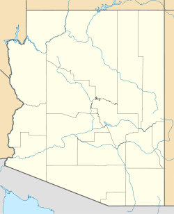
 Crown King, Arizona
Coordinates: 34°12′20″N 112°20′19″W / 34.20556°N 112.33861°WCoordinates: 34°12′20″N 112°20′19″W / 34.20556°N 112.33861°W Country United States State Arizona County Yavapai Founded 1875 Named for Crowned King Mine[1] Elevation[2] 5,771 ft (1,759 m) Population (2000) – Total 133 Time zone MST (no DST) (UTC-7) Post Office opened July 29, 1888 Post Office closed May 15, 1954 Crown King is an unincorporated community in Yavapai County, Arizona, United States, located at an elevation of 5,771 feet (1,759 m).[2] Crown King has a ZIP Code of 86343; in 2000, the population of the 86343 ZCTA was 133.[3] The site of a former gold mining town, Crown King is 28 miles west of Interstate 17 on Senator Highway, high in the Bradshaw Mountains. The community is named after the Crowned King mine, but the name was shortened to Crown King in 1888. Horsethief Basin Lake resides 6.5 miles southeast of Crown King on Crown King Rd/Forest 259 Rd.
An estimated US$2,000,000 in gold was taken from the Crowned King Mine alone; the mines have been closed since the 1950s and for the past half-century tourism has been the only reliable source of income in the area.
Contents
History
The first recorded gold claim in Crown King was "Buckeye" and was filed by Rod McKinnon on July 1, 1875. Over the next 40 years, more than 15 mines or claims were made in the area.
At its height, the town had 500 buildings, including several company stores and boarding houses, two Chinese restaurants and a post office. The town was electrified by 1897 and had one telephone at that time.
While an active mining town, Crown King was served by the Bradshaw Mountain Railroad. Rail service to the area began in 1904 upon completion of "Murphy's Impossible Railroad" — a series of switchbacks and trestles that ascended the mountain terrain between Cleator and Crown King.
Crown King was the terminus (1904–1926) of the railroad, built by Frank M. Murphy to serve the mines of the southern Bradshaw Mountains. However, these mines were never very productive, and the BMRR was a financial failure. The line was abandoned in 1926. Much of the road to Crown King uses the old railbed.[4]
Of the buildings still standing and in use in Crown King, the Crown King Restaurant and Saloon has become the center of activity in the town. The building itself has an interesting history. It was originally constructed in the nearby mining town of Oro Belle (now also a ghost town) and having been brought to Crown King in 1910 in pieces, on the backs of mules, when Oro Belle closed. The building was home to a brothel and bar in both towns.
The red one-room schoolhouse was built in 1917 and still serves seven K-8 students today.
The post office was established on July 29, 1888, and was discontinued on May 15, 1954.[5] It has since reopened inside the Crown King General Store.
References
- ^ Varney, Philip (April, 2005). "Yavapai Ghosts". In Stieve, Robert. Arizona Ghost Towns and Mining Camps: A Travel Guide to History (10th ed.). Phoenix, Arizona: Arizona Highways Books. pp. 20–21. ISBN 1932082468.
- ^ a b U.S. Geological Survey Geographic Names Information System: Crown King
- ^ http://factfinder.census.gov/servlet/SAFFPopulation?_event=Search&_zip=86343
- ^ John W. Sayre, 1985, Ghost Railroads of Central Arizona, Boulder, Colo.: Pruett, ISBN 0-87108-683-2
- ^ Sherman, James E.; Barbara H. Sherman (1969). "Crown King". Ghost Towns of Arizona (First ed.). University of Oklahoma Press. pp. 48–49. ISBN 0806108436.
Further reading
- Bruce M. Wilson, Crown King and the Southern Bradshaws: A Complete History, Mesa, Crown King Press, 1990, 104 pages. ISBN 0-0927573-0-6
External links
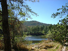 Horsethief Lake near Crown King, Arizona.
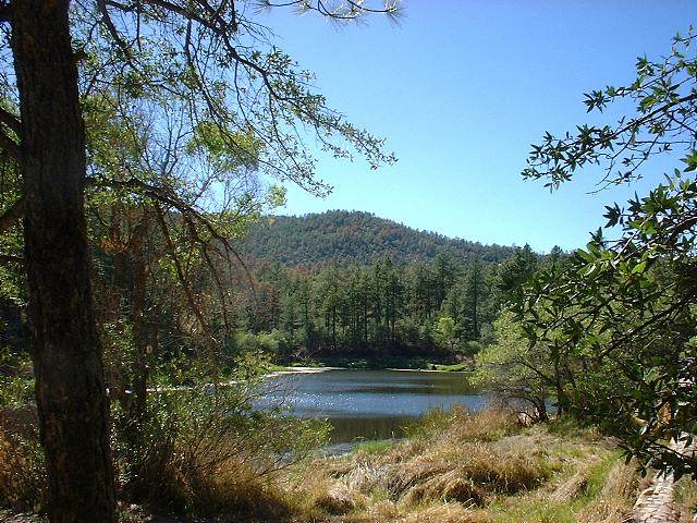

Wikimedia Commons has media related to: Municipalities and communities of Yavapai County, Arizona Cities Cottonwood | Peoria‡ | Prescott | Sedona‡

Towns CDPs Ash Fork | Bagdad | Big Park | Black Canyon City | Congress | Cordes Lakes | Cornville | Lake Montezuma | Mayer | Paulden | Peeples Valley | Seligman | Spring Valley | Verde Village | Wilhoit | Williamson | Yarnell
Unincorporated
communitiesCherry | Cleator | Crown King | Drake | Iron Springs | Kirkland | Red Rock | Skull Valley
Indian reservation Hualapai Indian Reservation
Ghost towns Alexandra | Big Bug | Bradshaw City | Bumble Bee | Catoctin | Cordes | Jerome Junction | Octave | Piedmont | Stanton | Tip Top | Weaver
Footnotes ‡This populated place also has portions in an adjacent county or counties
Categories:- Unincorporated communities in Yavapai County, Arizona


Wikimedia Foundation. 2010.