- Pirtleville, Arizona
Infobox Settlement
official_name = Pirtleville, Arizona
settlement_type = CDP
imagesize =
image_caption =
imagesize =
image_caption =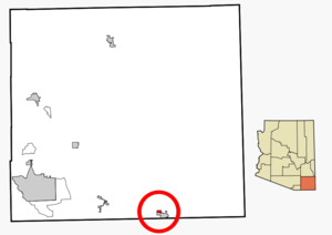
mapsize = 250px
map_caption = Location in Cochise County and the state ofArizona
mapsize1 =
map_caption1 =
subdivision_type = Country
subdivision_type1 = State
subdivision_type2 = County
subdivision_name =United States
subdivision_name1 =Arizona
subdivision_name2 = Cochise
established_title =
established_date =
government_type =
leader_title =
leader_name =
area_magnitude =
area_total_km2 = 4.7
area_total_sq_mi = 1.8
area_land_km2 = 4.7
area_land_sq_mi = 1.8
area_water_km2 = 0.0
area_water_sq_mi = 0.0
elevation_ft = 3970
elevation_m = 1210
population_as_of = 2000
population_footnotes =
population_total = 1550
population_metro =
population_density_km2 = 329.8
population_density_sq_mi = 861.1
timezone = MST (no DST)
utc_offset = -7
latd = 31 |latm = 21 |lats = 32 |latNS = N
longd = 109 |longm = 33 |longs = 58 |longEW = W
website =
timezone_DST =
utc_offset_DST =
postal_code_type =ZIP code
postal_code = 85626
area_code = 520
blank_name = FIPS code
blank_info = 04-56400
blank1_name = GNIS feature ID
blank1_info = 0009538
footnotes =Pirtleville is a
census-designated place (CDP) in Cochise County,Arizona ,United States . The population was 1,550 at the 2000 census.Geography
Pirtleville is located at coor dms|31|21|32|N|109|33|58|W|city (31.358925, -109.566036)GR|1.
According to the
United States Census Bureau , the CDP has a total area of 1.8square mile s (4.7km² ), all of it land.Demographics
As of the
census GR|2 of 2000, there were 1,550 people, 454 households, and 361 families residing in the CDP. Thepopulation density was 861.2 people per square mile (332.5/km²). There were 531 housing units at an average density of 295.0/sq mi (113.9/km²). The racial makeup of the CDP was 53.23% White, 0.65% Black or African American, 1.29% Native American, 0.52% Asian, 0.26% Pacific Islander, 41.35% from other races, and 2.71% from two or more races. 95.03% of the population were Hispanic or Latino of any race.There were 454 households out of which 43.2% had children under the age of 18 living with them, 57.7% were married couples living together, 15.9% had a female householder with no husband present, and 20.3% were non-families. 18.7% of all households were made up of individuals and 8.6% had someone living alone who was 65 years of age or older. The average household size was 3.41 and the average family size was 3.91.
In the CDP the population was spread out with 36.0% under the age of 18, 9.1% from 18 to 24, 24.0% from 25 to 44, 20.6% from 45 to 64, and 10.3% who were 65 years of age or older. The median age was 29 years. For every 100 females there were 99.2 males. For every 100 females age 18 and over, there were 93.4 males.
The median income for a household in the CDP was $19,355, and the median income for a family was $21,301. Males had a median income of $23,359 versus $20,852 for females. The
per capita income for the CDP was $7,244. About 30.1% of families and 38.3% of the population were below thepoverty line , including 49.8% of those under age 18 and 38.4% of those age 65 or over.References
External links
Wikimedia Foundation. 2010.