- Whetstone, Arizona
Infobox Settlement
official_name = Whetstone, Arizona
settlement_type = CDP
imagesize =
image_caption =
imagesize =
image_caption =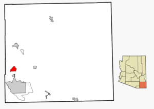
mapsize = 250px
map_caption = Location in Cochise County and the state ofArizona
mapsize1 =
map_caption1 =
subdivision_type = Country
subdivision_type1 = State
subdivision_type2 = County
subdivision_name =United States
subdivision_name1 =Arizona
subdivision_name2 = Cochise
established_title =
established_date =
government_type =
leader_title =
leader_name =
area_magnitude =
area_total_km2 = 30.6
area_total_sq_mi = 11.8
area_land_km2 = 30.6
area_land_sq_mi = 11.8
area_water_km2 = 0.0
area_water_sq_mi = 0.0
elevation_ft = 4072
elevation_m = 1241
population_as_of = 2000
population_footnotes =
population_total = 2354
population_metro =
population_density_km2 = 76.9
population_density_sq_mi = 199.5
timezone = MST (no DST)
utc_offset = -7
latd = 31 |latm = 42 |lats = 14 |latNS = N
longd = 110 |longm = 20 |longs = 53 |longEW = W
website =
timezone_DST =
utc_offset_DST =
postal_code_type =ZIP code
postal_code = 85616
area_code = 520
blank_name = FIPS code
blank_info = 04-82155
blank1_name = GNIS feature ID
blank1_info = 0024685
footnotes =Whetstone is a
census-designated place (CDP) in Cochise County,Arizona ,United States , north of Sierra Vista. The population was 2,354 at the 2000 census.History
Whetstone was once named Sulger City, after a rich landowner who lived in the area.Fact|date=December 2007
Geography
Whetstone is located at coor dms|31|42|14|N|110|20|53|W|city (31.703917, -110.347996)GR|1.
According to the
United States Census Bureau , the CDP has a total area of 11.8square mile s (30.6km² ), all of it land.Demographics
As of the
census GR|2 of 2000, there were 2,354 people, 904 households, and 664 families residing in the CDP. Thepopulation density was 199.5 people per square mile (77.0/km²). There were 1,056 housing units at an average density of 89.5/sq mi (34.6/km²). The racial makeup of the CDP was 84.03% White, 2.93% Black or African American, 1.23% Native American, 0.85% Asian, 6.50% from other races, and 4.46% from two or more races. 13.76% of the population were Hispanic or Latino of any race.There were 904 households out of which 32.7% had children under the age of 18 living with them, 57.2% were married couples living together, 10.7% had a female householder with no husband present, and 26.5% were non-families. 20.7% of all households were made up of individuals and 6.9% had someone living alone who was 65 years of age or older. The average household size was 2.60 and the average family size was 3.02.
In the CDP the population was spread out with 27.4% under the age of 18, 5.6% from 18 to 24, 25.3% from 25 to 44, 28.0% from 45 to 64, and 13.7% who were 65 years of age or older. The median age was 40 years. For every 100 females there were 97.3 males. For every 100 females age 18 and over, there were 95.0 males.
The median income for a household in the CDP was $34,507, and the median income for a family was $37,656. Males had a median income of $32,083 versus $25,424 for females. The
per capita income for the CDP was $16,370. About 13.4% of families and 20.0% of the population were below thepoverty line , including 32.3% of those under age 18 and 1.3% of those age 65 or over.References
External links
Wikimedia Foundation. 2010.