- Chandler, Arizona
-
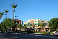
Chandler, Arizona — City — Downtown Chandler 
SealLocation in Maricopa County and the state of Arizona Coordinates: 33°18′N 111°50′W / 33.3°N 111.833°WCoordinates: 33°18′N 111°50′W / 33.3°N 111.833°W Country United States State Arizona County Maricopa Founded May 17, 1912 Government - Mayor Jay Tibshraeny Area - Total 64.58 sq mi (150.2 km2) - Land 57.9 sq mi (149.9 km2) - Water 0.1 sq mi (0.3 km2) Elevation 1,214 ft (370 m) Population (2010)[1][2] - Total 236,123 - Density 4,202.2/sq mi (1,622.7/km2) - Demonym Chandlerite Time zone MST (no DST) (UTC-7) Area code(s) 480 FIPS code 04-12000 Website http://www.chandleraz.gov Chandler is a city in Maricopa County, Arizona, United States, and is a prominent suburb of the Phoenix, Arizona, Metropolitan Statistical Area (MSA). It is bordered to the north and west by Tempe, to the north by Mesa, to the west by Phoenix, to the south by the Gila River Indian Community, and to the east by Gilbert. The population was 236,123 according to the Census Bureau 2010.[3] It also has satellite locations for many technology companies, including Intel and Orbital Sciences Corporation.
History
In 1891, Dr. Alexander John Chandler, the first veterinary surgeon in Arizona Territory, settled on a ranch south of Mesa, studying irrigation engineering. By 1900, he had acquired 18,000 acres (73 km2) of land, and began drawing up plans for a townsite on what was then known as the Chandler Ranch. The townsite office opened on May 17, 1912, the same year that Chandler High School was established.[4] By 1913, a town center had become established, featuring the luxurious Hotel San Marcos, the first golf resort in the state.
Most of Chandler's economy was successfully sustained during the Great Depression (a second San Marcos hotel was canceled due to the Depression however), but the cotton crash a few years later had a much deeper impact on the city's residents. Later, the founding of Williams Air Force Base in 1941 led to a small surge in population, but Chandler still only held 3,800 people by 1950. By 1980, it had grown to 30,000, and it has since paced the Phoenix metropolitan area's high rate of growth, with vast suburban residential areas swallowing former agricultural plots. Some of this growth was fueled by the establishment of manufacturing plants for communications and computing firms such as Microchip, Motorola and Intel, but despite the inclusion of many large businesses, Chandler is often considered a bedroom community for the Phoenix metropolitan area.
While the suburbs boomed, the downtown area of Chandler became more impoverished, and complaints over crime in the downtown area led in 1997 to the ill-fated Chandler Roundup, a joint operation between local police and federal immigration authorities in which 432 illegal immigrants were arrested and deported. However, the racial profiling methods used in the raid caused civil rights violations to local citizens, which led to costly lawsuits and political upheaval.[5][6]
Geography
According to the United States Census Bureau, Chandler has a total area of 58.0 square miles (150 km2), of which, 57.9 square miles (150 km2) of it is land and 0.1 square miles (0.26 km2) of it (0.17%) is water.
Chandler has reached its physical limits save for some remaining county islands and cannot expand outward anymore due to being bound in by the Gila River Indian Community, Tempe, Mesa, Gilbert, and Phoenix.
Climate
Climate data for Chandler, AZ Month Jan Feb Mar Apr May Jun Jul Aug Sep Oct Nov Dec Year Record high °F (°C) 89
(32)95
(35)99
(37)106
(41)118
(48)116
(47)119
(48)115
(46)113
(45)107
(42)97
(36)86
(30)119
(48)Average high °F (°C) 67
(19)71
(22)77
(25)85
(29)94
(34)104
(40)106
(41)104
(40)99
(37)89
(32)75
(24)67
(19)87 Average low °F (°C) 41
(5)45
(7)49
(9)54
(12)61
(16)70
(21)77
(25)76
(24)70
(21)59
(15)47
(8)40
(4)57 Record low °F (°C) 15
(−9)19
(−7)24
(−4)30
(−1)37
(3)43
(6)54
(12)51
(11)40
(4)30
(−1)22
(−6)17
(−8)15
(−9)Precipitation inches (mm) 1.01
(25.7)0.99
(25.1)1.19
(30.2)0.33
(8.4)0.17
(4.3)0.06
(1.5)0.89
(22.6)1.14
(29)0.89
(22.6)0.81
(20.6)0.77
(19.6)0.98
(24.9)9.2
(234)Source: [7] Demographics
Historical populations Census Pop. %± 1930 1,378 — 1940 1,239 −10.1% 1950 3,799 206.6% 1960 9,531 150.9% 1970 13,763 44.4% 1980 29,673 115.6% 1990 89,862 202.8% 2000 176,581 96.5% 2010 236,123 33.7% source:[8] As of the Census of 2010, there were 236,123 people, 86,924 households, and 60,212 families residing in the city. The racial makeup of the city was 73.3% White, 4.8% Black or African American, 1.5% Native American, 8.2% Asian, 0.2% Pacific Islander, 21.9% Hispanic or Latino, and 8.3% other.[9]
There were 62,377 households out of which 41.1% had children under the age of 18 living with them, 57.5% were married couples living together, 10.5% had a female householder with no husband present, and 27.2% were non-families. 19.3% of all households were made up of individuals and 3.6% had someone living alone who was 65 years of age or older. The average household size was 2.82 and the average family size was 3.26.
In the city, the population was spread out with 29.8% under the age of 18, 8.6% from 18 to 24, 38.0% from 25 to 44, 17.8% from 45 to 64, and 5.8% who were 65 years of age or older. The median age was 31 years. For every 100 females there were 99.7 males. For every 100 females age 18 and over, there were 96.9 males.
The median income for a household in the city was $70,456, and the median income for a family was $81,720.[10] Males had a median income of $44,578 versus $31,763 for females. The per capita income for the city was $23,904. About 4.6% of families and 6.6% of the population were below the poverty line, including 7.7% of those under age 18 and 8.0% of those age 65 or over.
Elected officials
Chandler is represented by a mayor, a vice mayor and council members. The vice mayor is elected by the city council from among its members. The mayor, vice mayor and council members represent the entire city and are not elected from districts or wards.
Mayor: Jay Tibshraeny
Vice Mayor: Trinity Donovan
Council Members- Kevin Hartke
- Rick Heumann
- Matt Orlando
- Jack Sellers
- Jeff Weninger
Culture
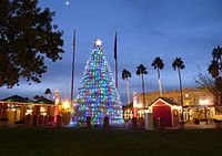 A.J. Chandler Park, located in downtown Chandler, contains a tumbleweed Christmas tree during the holidays.
Chandler is noted for its annual Ostrich Festival.[11] Initially, agriculture was the primary business in Chandler, based on cotton, corn, and alfalfa. During the 1910s, there were ostrich farms in the area, catering to the demand for plumes used in women's hats of the era. This demand ebbed with the increasing popularity of the automobile, but the legacy of the ostrich farms would be commemorated by the Ostrich Festival. The Chandler Center for the Arts, a 1,500-seat regional performing arts venue, is located downtown, and the Arizona Railway Museum is at Tumbleweed Park. A 70,000-square-foot (6,500 m2) Holocaust and Tolerance Museum has been slated for construction in Chandler.[12]
Economy
Computer chip manufacturer Intel has an influential role in city growth strategies with four locations in the municipal area, including its first factory to be designated "environmentally sustainable" under current Leadership in Energy and Environmental Design (LEED) criteria.[13] Other high-technology manufacturing firms have partnerships with the local government,[14] their operations employing approximately twenty-five percent of non-government workers in 2007.[15] Although per capita employment growth in the sector has been in decline in Arizona since 2000, semiconductor and other electronic component manufacturing was largely unaffected;[16] a series of customized grants for the training of net new employees, incorporating the Phoenix urbanized area (twenty-seven thousand workers now commute to work in other communities), resulted in a larger market share of (Californian) industry.
Since 2003, more than 2,900 jobs and investments totalling $3 billion have been created along the Price and Santan freeways,[17] between Arizona Avenue and Gilbert Road in the so-called South Arizona Avenue Corridor.[18] Three shopping malls provide a "strong attraction" to such an open-ended, high exposure[19] trade area: the 1,300,000-square-foot (120,000 m2) Chandler Fashion Center, opened in 2001, has spurred on several courts and laneway developments.[20] In the southern end of the Corridor, Wal-Mart is expected to draw business from as far south as the Hunt Highway, bringing with it a "large consumer population" which will improve "the image and perception of the area" in the mindset of many Greater Phoenix residents and state commercial retailers. The northern portion is "attractive and possesses the historic character" for success, which "can be grown to the south".[21]
CyrusOne, an Internet hosting company, has announced plans to build a 1-million-square-foot data center in the Continuum business park area of Chandler's Price Corridor.[22]
Top employers
According to the City's 2011 Economic Development Report[23] top employers in the city include:
# Employer # of Employees 1 Intel 9,700 2 Bank of America 3,500 3 Wells Fargo 2,243 4 Verizon Wireless 2,000 5 Microchip Technology 1,538 6 City of Chandler 1,511 7 Freescale Semiconductor 1,450 7 Orbital Sciences 1,425 9 Chandler Regional Hospital 1,425 10 Avnet 780 Education
Elementary and secondary
Most of Chandler is served by the Chandler Unified School District. Chandler west of Loop 101 is served by the Kyrene Elementary School District and the Tempe Union High School District. The area east of Loop 101 and north of Warner Road is served by Mesa Public Schools. The San Vincente neighborhood in Chandler is served by Gilbert Public Schools.
Education alternatives include charter schools, Christian schools, parochial schools, magnet schools, as well as "traditional" academies.
Post-secondary
The two-year Chandler-Gilbert Community College, serving 13,000 students, is located in the east of the city near the Gilbert border. Private educational institutions Western International University and Apollo Group subsidiary University of Phoenix have locations here. Arizona State University is located 14 miles (23 km) from downtown in Tempe. Chandler University is planned to begin operations in 2011.
Chandler Public Library
The Chandler Public Library serves Chandler and the greater Phoenix East Valley. The main library is located in downtown Chandler, with three branches located elsewhere in the city: Sunset, Basha (shared with Basha High School), and Hamilton (shared with Hamilton High School).
As part of a family literacy project to encourage literacy and library use among families who live in public housing, the Chandler Public Library visited three public housing locations to offer a four-week series of programs at each.[24]
Chandler Community Services Department (Aquatics, Center for the Arts, Libraries, Museums, Parks, Recreation)
The Chandler Community Services Department serves Chandler residents in a variety of ways by providing recreation, fitness, cultural, artistic and educational opportunities along with classes, programs and special events. The Community Services Department, located in Old Downtown Chandler, operates the community center, senior center, dozens of local neighborhood and community parks, two recreation centers and six aquatic centers.
Chandler's recreational offerings provide residents and visitors with different interests and skill levels with the facilities to participate in many sports, activities and hobbies. The department publishes a quarterly recreation magazine called Break Time that is distributed free at many city facilities, through a free subscription service, and online at www.chandleraz.gov/breaktime.
A sampling of programs available through the Chandler Community Services Department and its Recreation and Aquatics Divisions includes: swim lessons; junior tennis clinics and leagues; youth classes and programs; youth sports; after-school teen recreation centers; summer youth sports camps and arts camps; fitness classes; group aerobics and dance classes; nature and sustainable living courses; adult classes, sports leagues and outdoor recreation programs; senior adult classes and programs; therapeutic recreation and Special Olympics programs for disabled youths and adults.
The city's regional Tumbleweed Park hosts a variety of special events throughout the year, including the annual Ostrich Festival, the Fourth of July Fireworks Festival and the fourth annual Day of Play, attended by an estimated 3,500 people, that was held on Saturday, October 16, 2010. The fifth annual Day of Play will be held on Saturday, Oct. 22, 2011 at Tumbleweed Park.
On September 6, 2008, the Environmental Education Center at the Chandler Heights Community Facilities, a shared-use site with the Municipal Utilities Division and the Chandler Police Department, won the Valley Forward Association's prestigious Crescordia Environmental Excellence Award in the category of "Site Development and Landscape for Parks." In 2008, Chandler also received the American Crown Community Award for Outstanding Leadership in Local Government for Veterans Oasis Park, located at the northwest corner of Chandler Heights and Lindsay roads. This facility and park were an integral part of Chandler's 2010 All-America City award presentation. The city was one of 10 across the U.S. to receive the All-America City honor on June 18, 2010, in Kansas City, Missouri. Veterans Oasis Park is also the site of the city's highest point, at 1,214 feet (370 m).
The Historic McCullough-Price House, a 1938 Pueblo Revival-style home, was donated to the city by the Price-Propstra family in 2001. The city renovated and opened it to the public in 2007. On June 12, 2009, the McCullough-Price House was added to the National Register of Historic Places, the official listing of America’s historic and cultural resources worthy of preservation. The city of Chandler operates the facility, which is located southwest of Chandler Fashion Center at 300 S. Chandler Village Dr.
On August 28, 2009, Chandler's Community Services Department received three Arizona Parks & Recreation Association (APRA) Awards - Outstanding Facility (Mesquite Groves Aquatic Center); Outstanding Community Special Event (Woofstock); and Outstanding Active Adult Program (Chandler Senior Center Patriot Project).
On September 25, 2009, the Chandler Parks Division was honored for its efforts to preserve more than 250 native trees by transplanting and using them for multiple park beautification efforts. The Arizona Community Tree Council, Inc., in cooperation with the Arizona State Land Department – Urban & Community Forestry, presented Chandler with its top award in the Municipal Government Agencies category at its annual meeting in September. The Council recognized 18 other individual, civic, and corporate entities for their efforts to enhance and beautify the local environment with trees. The ACTC noted that Chandler was creative and resourceful in transplanting native trees during the construction and grading for the first phase of Mesquite Groves Park and Aquatic Center.
On September 2, 2010, the Chandler Parks Division received the Natural Resources Award from the Arizona Parks & Recreation Association (APRA) for its development of the Paseo Vista Recreation Area on top of a closed landfill at the northwest corner of McQueen and Ocotillo roads. On October 2, 2010, the Paso Vista project also received the prestigious Crescordia Environmental Excellence Award from the Valley Forward Association.
On September 6, 2011, the national non-profit organization Kaboom! based in Washington, D.C., announced that Chandler was a 2011 Playful City USA community, marking the fifth consecutive year the city earned the distinction (one of just 19 U.S. cities to receive the honor five consecutive years since the program was initiated in 2007). Chandler was recognized for taking an innovative approach to make play a priority throughout the city with its many recreational amenities, parks and aquatic centers.
On September 23, 2011, Chandler's Channel 11 and Chandler Recreation received a second-place finish in the 20011 NATOA (National Association of Telecommunications Officers and Advisors) Government Programming Awards NATOA in the magazine format series category for the bi-monthly "Come Out & Play Chandler!" show's January episode that profiled the November 2010 inaugural Chandler Chuck Wagon Cook-Off event at Tumbleweed Ranch YouTube.
A list of Chandler's other Recreational Division and Community Services Department facilities includes:
Transportation
Addressing
Most incorporated portions of Chandler, along with other East Valley cities Gilbert, Mesa, and Tempe, have their own addressing system distinct from Phoenix and Maricopa County. The north-south meridian is Arizona Avenue, also known as State Route 87. Commonwealth Avenue, two blocks south of Chandler Boulevard, is the east-west baseline. With the significant exception of the stretch of the city from Chandler Boulevard to Ray Road, address numbers follow in mile-long increments of 1000 along the grid. Modern remnants of county addressing from the city's rural agrarian days can be found in some neighborhood street names (90th Place, 132nd Street) and county islands surrounded by the city proper.
Airports
Chandler Municipal Airport is a two-runway general aviation facility located in the heart of the city south of Loop 202. Memorial Airfield in the Gila River Indian Community may serve the city in the future. The city is jockeying for membership in the Phoenix-Mesa Gateway Airport Authority, several miles to the east, which offers service to 16 cities as of August 2009. Most area residents continue to use Phoenix Sky Harbor International Airport, 20 miles (30 km) from downtown Chandler.
City bus
Chandler has very limited bus service compared with other Valley Metro cities of similar size. Most local routes dead end a few miles from the city or have further limited service within its borders. Currently, two express bus routes leave from the city near downtown, and a new park and ride facility was recently completed further south. Faced with increasing congestion, the land-locked city is pursuing transportation alternatives, including enhancement of the local bus system. This goal has partially been achieved through Proposition 400, which converts transit funding from city-based to county-based. The result has been increased frequencies on routes 72, 96 (since July 28, 2008), and 156, as well as Sunday bus service on these three routes. However, other routes have yet to be converted to "supergrid" status.
Freeways
Chandler is served by three limited access highways:
- Loop 202, the Santan Freeway, completed through the city in 2006, cuts through the midsection of the city along the Pecos Road alignment.
- Loop 101, the Price Freeway, was completed in 2001, dividing West Chandler from the rest of the city. A majority of the city's employment, over 10,000 people as of 2007,[25] are along the city's Price Road Corridor. Air Products' industrial pipelines located there are unique to the metropolitan area. South of Pecos, the freeway borders the Gila River Indian Community.
- Interstate 10 is the city's westernmost border. Located on the other side is the Phoenix neighborhood of Ahwatukee.
Railroads
Heavy rail
Chandler is served by two single-track branch lines of the Union Pacific Railroad. One generally traverses the Kyrene Road alignment and currently dead-ends at the Lone Butte Industrial Park. The other runs east of Arizona Avenue and dead-ends near the location of the former World War II company town of Goodyear. Commuter rail service on these lines is under study as of 2007[update].
Light rail
No light rail lines have been approved in the city, although high-capacity corridors including light rail have been identified in other regional and local plans. City officials joined the regional light rail authority, METRO Light Rail, in 2007, expecting service perhaps in 2020. The initial route through the city will most likely be the Tempe South light rail line on Rural Road.[citation needed]
Radio and television licenses
Chandler has only one radio license: KMLE.
Famous people associated with Chandler, Arizona
- Adam Archuleta - professional football player, Chicago Bears.[26]
- Clay Bellinger - former MLB player and coach of Chandler National LL in the 2007 Little League World Series.[27]
- Melissa Buhl - downhill and mountain-cross cycling champion.[28]
- T.J. Clark - NASCAR driver.[29]
- Leonard Davis - professional football player, Dallas Cowboys.[30]
- Louie Espinoza - Arizona's first world champion boxer.[31]
- Andre Ethier - professional baseball player, Los Angeles Dodgers. Attended Chandler-Gilbert Community College.[32]
- Nelson Figueroa - professional baseball player, New York Mets, Pittsburgh Pirates, Milwaukee Brewers, Philadelphia Phillies, Arizona Diamondbacks.
- Zora Folley - former heavyweight boxer. Folley Street is named for him.[33][34]
- Channing Frye - NBA basketball player, Phoenix Suns.[35]
- Barry Gardner - former professional football player.[36]
- Alexa Havins - actress, All My Children.[37]
- Antony Hämäläinen - lead singer of melodic death metal band Nightrage.[38]
- Ice-T - rapper and actor, lives in Chandler with his wife as part-time residents.[39]
- Waylon Jennings
- Tom Linton guitarist of Jimmy Eat World
- Tank Johnson - professional football player, Cincinnati Bengals.[40]
- Mike Kruczek - former professional football player, offensive coordinator for the Arizona Cardinals.[citation needed]
- Matt Leinart - Houston Texans quarterback, former star quarterback at USC.[41]
- Dary Matera - author, columnist.[42]
- Donovan McNabb - professional football player; Quarterback, Washington Redskins, lives in Chandler during NFL offseason with his wife and kids.[43]
- Shawn Michaels - professional wrestler, World Wrestling Entertainment, born in Chandler.[44]
- John O'Callaghan - lead singer of The Maine
- Keith Poole - former professional football player.[45]
- Alberto Ríos - poet, writer, academic.[46]
- Brenna Sakas - Miss Arizona USA 2006.[47]
- Junior Spivey - professional baseball player.[48]
- Dernell Stenson - Major League Baseball player, shot and killed in Chandler Arizona in 2003.
- Terrell Suggs - professional football player, Baltimore Ravens. Graduated from Hamilton High School.[49]
- In Tam - Cambodian politician.[50]
- Lindsay Taylor - WNBA player, Seattle Storm.[51]
- Brian Urlacher - professional football player, Chicago Bears.[citation needed]
- Greg Vanney - MLS player, DC United.[52]
- Lawrence Westbrook - college basketball player for the Minnesota Golden Gophers. Attended Chandler High School.
- Ken Whisenhunt - coach of the Arizona Cardinals.[53]
- Mean Joe Green[citation needed]
- Lance Brown[citation needed]
Miscellaneous
- The street signs in Chandler are brown-colored instead of the more traditional green or blue (similar to Berkeley, California).
- Chandler has three In-N-Out Burger restaurants. It is one of 18 cities outside of California where In-N-Out has located.[54]
- Chandler was the spring training home of the Milwaukee Brewers from 1986 to 1997;[55] the stadium (Compadre Stadium), built in 1985 in the master-planned Ocotillo neighborhood, still stands as of 2009, unused and in a state of disrepair after only being used for twelve seasons. Some of the minor league practice fields on the site were taken over by the city after the Brewers' departure to create a local park, the Snedigar Recreation Center.[56]
- In 2009,Chandler was ranked as one of the most boring cities in America by Forbes.[57]
External links
- City of Chandler web site
- Ostrich Festival
- Chandler Public Library
- City of Chandler Economic Development Division
- Unofficial Chandler web site
- Chandler news, sports and things to do from the Chandler section of the Arizona Republic newspaper
References
- ^ "Annual Estimates of the Population for Incorporated Places over 100,000" (CSV). 2005 Population Estimates. U.S. Census Bureau, Population Division. June 21, 2006. http://www.census.gov/popest/cities/files/SUB-EST2005-all.csv. Retrieved November 14, 2006.
- ^ "Annual Estimates of the Population for Incorporated Places in Arizona". United States Census Bureau. 2008-07-10. http://www.census.gov/popest/cities/tables/SUB-EST2007-04-04.csv. Retrieved 2008-07-14.
- ^ "Annual Estimates of the Population for All Incorporated Places in Arizona" (CSV). 2005 Population Estimates. U.S. Census Bureau, Population Division. http://www.census.gov/popest/cities/tables/SUB-EST2006-04-04.csv. Retrieved November 14, 2006.
- ^ ChandlerAZ.gov, [The Story of Chandler, Arizona http://www.chandleraz.gov/default.aspx?pageid=37]. Retrieved 2009-10-13.
- ^ "Arizona boomtown trips up on illegal immigrant sweep: Legal residents were also singled out because of their Hispanic appearance", Los Angeles Times, December, 1998, As reprinted in Sarasota Herald-Tribune, http://news.google.com/newspapers?id=_8MdAAAAIBAJ&sjid=Q78EAAAAIBAJ&pg=6545,5317710&dq=chandler+operation-restoration&hl=en.
- ^ .
- ^ "Average Weather for Chandler, AZ - Temperature and Precipitation". Weather.com. http://www.weather.com/outlook/health/fitness/wxclimatology/monthly/graph/USAZ0034. Retrieved August 5, 2010.
- ^ Gibson, Campbell. "Population of the 100 Largest Cities and Other Urban Places in the United States: 1790 to 1990." United States Census Bureau. June, 1998. Retrieved on October 7, 2006.
- ^ http://factfinder2.census.gov/faces/tableservices/jsf/pages/productview.xhtml?pid=DEC_10_DP_DPDP1&prodType=table
- ^ Chandler 2007 Income Estimates
- ^ http://www.azcentral.com/community/chandler/articles/2011/03/08/20110308chandler-ostrich-festival0308.html
- ^ Chandler site picked for tolerance museum. The Arizona Republic. December 9, 2009.
- ^ Autumn 2007, Intel Corporate Social Responsibility newsletter, Intel Corporate Affairs.
- ^ Gonzales, Angela (2004-01-02). "Chandler develops biomed center, adds 270 jobs". Phoenix Business Journal. http://www.bizjournals.com/phoenix/stories/2004/01/05/story1.html. Retrieved 2006-06-02.
- ^ Economy of Chandler: January 2008 Update, Arizona Department of Commerce.
- ^ High-technology Activities in Arizona: 2007 Update, Arizona Department of Commerce.
- ^ "Industrial Sites". Chandler Economic Development staff, City of Chandler. http://www.chandleraz.gov/default.aspx?pageid=199. Retrieved 2006-06-02.
- ^ Contracts Awarded September 2007 though March 2008, The Acquirer Spring 2008 newsletter, O. R. Colan Associates.
- ^ Project Methodology: Capter Three, South Arizona Avenue Entry Corridor Study, City of Chandler.
- ^ Project Methodology: Capter One, South Arizona Avenue Entry Corridor Study, City of Chandler.
- ^ Final Report, South Arizona Avenue Entry Corridor Study, RNL Design.
- ^ Lee, Justin (October 31, 2011). "Data Center Firm CyrusOne Buys Land in Arizona for Massive Buildout". thewhir.com. http://www.thewhir.com/web-hosting-news/103111_Data_Center_Firm_CyrusOne_Buys_Land_in_Arizona_for_Massive_Buildout. Retrieved October 31, 2011.
- ^ http://www.chandleraz.gov/default.aspx?pageid=305
- ^ Cultural Inventory Project: Chandler Public Library
- ^ Paterik, Stephanie (2005-05-26). "Price Corridor ripe for development". Arizona Business Gazette. http://www.azcentral.com/abgnews/articles/0526price26.html. Retrieved 2010-04-14.
- ^ Chicago Bears Roster. Retrieved 2008-02-23.
- ^ Obert, Richard. Chandler opens with a blast. The Arizona Republic, August 18, 2007. Retrieved 2008-02-23.
- ^ "Buhl earns Four Cross World Title as U.S. contests gravity events". USA Cycling. 2008-06-21. http://www.usacycling.org/news/user/story.php?id=3684. Retrieved 2010-04-14.
- ^ T.J. Clark Career Statistics. Retrieved 2008-02-23.
- ^ Jensen, Edythe. Ex-Card lauded for saving horse. 'The Arizona Republic, May 21, 2007. Retrieved 2008-03-29.
- ^ Frauenheim, Norm (2003-08-20), "WHAT'S UP WITH: LOUIE ESPINOZA", The Arizona Republic: p. C2
- ^ Player Bio: Andre Ethier. CSTV. Retrieved 2008-02-23.
- ^ BoxRec - Zora Folley. Retrieved 2008-02-23.
- ^ Laurean, Julian and Crowner, Jessica. Folley Street. Retrieved 2008-02-23.
- ^ "Did You Know?". ChanningFrye.com. http://www.channingfrye.com/cfrye-know.html. Retrieved 2010-10-13.[dead link]
- ^ Hammer, Scott (2008-10-16). "Michigan State Game Program Features: Barry Gardner". NUsports.com. http://nusports.cstv.com/sports/m-footbl/spec-rel/101608aay.html. Retrieved 2010-10-13.
- ^ Soap Opera Digest - Alexa Havins. Retrieved 2008-02-23.
- ^ Yara, Georgann. It's a MadHouse at boutique. The Arizona Republic, November 29, 2007. Retrieved 2008-03-29.
- ^ "The Arizona Republic". http://www.azcentral.com/news/articles/0131cr-IceT0201.html.
- ^ Tank Johnson. NFL.com. Retrieved 2008-02-23.
- ^ Creno, Glen. Leinart scrambles to Chandler. The Arizona Republic, February 9, 2007. Retrieved 2008-02-23.
- ^ Retrieved 2008-02-23.
- ^ Brookover, Bob. McNabb stands by his pitch for Eagles to get help. Philadelphia Inquirer, February 1, 2008. Retrieved 2008-02-23.
- ^ Michaels, Shawn (November 2005). Heartbreak & Triumph: The Shawn Michaels Story. WWE Books, 12.
- ^ "Keith Poole Training Zone". http://www.kptrainingzone.com/keith.html. Retrieved 2010-10-13.
- ^ Poets.org - Alberto Ríos. Retrieved 2008-02-23.
- ^ BrennaSakas.com - Biography. Retrieved 2008-02-23.
- ^ Trotto, Sarah (2009-07-25). "He's a hit on his first day". Arizona Daily Star. http://azstarnet.com/sports/baseball/professional/minor/article_b1a187f1-3468-5e13-800c-7a044d9da424.html. Retrieved 2010-10-13.
- ^ Player Bio: Terrell Suggs. CSTV. Retrieved 2008-02-23.
- ^ Erlanger, Steven. In Cambodia, an Ex-Leader Calls for End of Khmer Rouge. The New York Times, August 27, 1989. Retrieved 2008-02-23.
- ^ Player Bio: Lindsay Taylor. CSTV. Retrieved 2008-02-23.
- ^ HSGametime.com - Greg Vanney, soccer.
- ^ Somers, Kent (2009-02-03). "Obama calls Whisenhunt at his Chandler home". The Arizona Republic. http://www.azcentral.com/community/chandler/articles/2009/02/03/20090203cardsobamacall-CR-CP.html. Retrieved 2010-10-13.
- ^ IN-N-OUT Burger locations
- ^ http://pressbox.mlb.com/pressbox/downloads/y2007/mil/springtraining.pdf
- ^ "Abandoned Chandler field going to seed", East Valley Tribune, February 27, 2005
- ^ Zumbrun, Joshua. "America's Most Boring Cities". Forbes. http://www.forbes.com/media/2008/12/10/media-newspapers-news-biz-media-cx_jz_1210boringcities_slide.html?partner=canoe. Retrieved 2009-01-05.
Phoenix Metropolitan Area Core city Largest suburbs
(over 100,000 inhabitants)Other suburbs and towns
(over 10,000 inhabitants)Anthem • Apache Junction • Avondale • Buckeye • Casa Grande • El Mirage • Eloy • Florence • Fountain Hills • Goodyear • Gold Canyon • Luke Air Force Base • Maricopa • New River • Paradise Valley • Queen Creek • San Tan Valley • Sun City • Sun City West • Sun LakesSmaller suburbs and towns
(over 5,000 inhabitants)Black Canyon City • Carefree • Cave Creek • Coolidge • Gila Bend • Guadalupe • Laveen • Litchfield Park • Superior • Tolleson • Wickenburg • YoungtownCounties  State of Arizona
Phoenix (capital) Topics Index | Climate | Delegations | Geography | History | Museums | Music | People | Transportation | Visitor Attractions
Society Culture · Demographics · Economy · Education · Politics
Regions Arizona Strip | Arizona Sun Corridor | Coconino Plateau | Colorado Plateau | Grand Canyon | Kaibab Plateau | Mogollon Plateau | Mogollon Rim | Mojave Desert | Monument Valley | North Central Arizona | Northeast Arizona | Northern Arizona | Oak Creek Canyon | Phoenix Metropolitan Area | Safford area | San Francisco Volcanic Field | Sonoran Desert | Southern Arizona | Verde Valley | White Mountains
Counties Cities Chandler | Flagstaff | Gilbert | Glendale | Kingman | Lake Havasu City | Mesa | Peoria | Phoenix | Prescott | Scottsdale | Sierra Vista | Tempe | Tucson | Yuma
Mayors of cities with populations exceeding 100,000 in Arizona - Scott Smith
(Mesa) - Boyd W. Dunn
(Chandler)
- Elaine Scruggs
(Glendale) - Jim Lane
(Scottsdale)

Other states: AL • AK • AZ • AR • CA • CO • CT • DE • FL • GA • HI • ID • IL • IN • IA • KS • KY • LA • ME • MD • MA • MI • MN • MS • MO • MT • NE • NV • NH • NJ • NM • NY • NC • ND • OH • OK • OR • PA • RI • SC • SD • TN • TX • UT • VT • VA • WA • WV • WI • WY Categories:- Chandler, Arizona
- Phoenix metropolitan area
- Populated places in Maricopa County, Arizona
- Cities in Arizona
- Populated places established in 1912
- Company towns in Arizona
Wikimedia Foundation. 2010.

