- New River, Arizona
-
New River, Arizona — CDP — Location in Maricopa County and the state of Arizona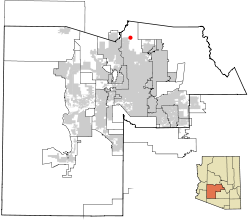
Coordinates: 33°52′9″N 112°5′9″W / 33.86917°N 112.08583°WCoordinates: 33°52′9″N 112°5′9″W / 33.86917°N 112.08583°W Country United States State Arizona County Maricopa Area – Total 70.8 sq mi (183.5 km2) – Land 70.8 sq mi (183.4 km2) – Water 0.0 sq mi (0.0 km2) Elevation 2,014 ft (614 m) Population (2000) – Total 10,740 – Density 151.6/sq mi (58.5/km2) Time zone MST (no DST) (UTC-7) ZIP codes 85027, 85087 Area code(s) 623 FIPS code 04-49360 GNIS feature ID 0008605 New River is an unincorporated community and a census-designated place (CDP) in Maricopa County, Arizona, United States. The population was 14,952 at the 2010 census.[1]
Contents
History
New River is named after the seasonal wash of the same name, part of the Agua Fria River system which drains into the Salt River.[citation needed] It was founded by Lord Darrell Duppa in 1868 as a stagecoach stop.[citation needed] For many years it was the terminus of the old Black Canyon Highway (now Interstate 17).[citation needed] The pavement ended in New River and continued as a dirt road to the city of Prescott.
New River has largely retained its rural character; however, its future[neutrality is disputed] as a rural community is uncertain as the city of Phoenix expands into the region.
In the mid 1990s, the Del Webb Corporation proposed a residential development roughly as large as Flagstaff, Arizona's eleventh largest city (2000 census). This instigated a short-lived self-incorporation campaign which failed due to lack of popular support. Phoenix in 1995 and again in 2003 annexed in the region[citation needed] and Del Webb in 1998 opened the newly built Anthem.
As development of the Phoenix metropolitan area continues northward, the broad area that is defined as New River is reduced closer to New River Road. The General Plan of Phoenix includes the entire New River area, making New River's future uncertain.[neutrality is disputed] Residents of newly built subdivisions often[weasel words] do not identify with the established residents of New River, often[weasel words] identifying instead with Phoenix or Anthem.[neutrality is disputed]
Geography
New River is located at 33°52′9″N 112°5′9″W / 33.86917°N 112.08583°W (33.869149, -112.085759).[2]
According to the United States Census Bureau, the CDP has a total area of 70.8 square miles (183 km2), of which, 70.8 square miles (183 km2) of it is land and 0.01% is water.
Demographics
As of the census[3] of 2000, there were 10,740 people, 3,921 households, and 3,066 families residing in the CDP. The population density was 151.6 people per square mile (58.5/km²). There were 4,514 housing units at an average density of 63.7/sq mi (24.6/km²). The racial makeup of the CDP was 95.87% White, 0.42% Black or African American, 0.60% Native American, 0.46% Asian, 0.05% Pacific Islander, 1.25% from other races, and 1.37% from two or more races. 4.85% of the population were Hispanic or Latino of any race.
There were 3,921 households out of which 35.3% had children under the age of 18 living with them, 68.9% were married couples living together, 5.6% had a female householder with no husband present, and 21.8% were non-families. 15.3% of all households were made up of individuals and 2.9% had someone living alone who was 65 years of age or older. The average household size was 2.73 and the average family size was 3.04.
In the CDP the population was spread out with 26.0% under the age of 18, 4.8% from 18 to 24, 33.2% from 25 to 44, 28.5% from 45 to 64, and 7.5% who were 65 years of age or older. The median age was 38 years. For every 100 females there were 103.9 males. For every 100 females age 18 and over, there were 102.4 males.
The median income for a household in the CDP was $62,307, and the median income for a family was $68,604. Males had a median income of $46,361 versus $31,610 for females. The per capita income for the CDP was $25,932. About 3.6% of families and 5.7% of the population were below the poverty line, including 5.5% of those under age 18 and 3.1% of those age 65 or over.
According to a 2007 estimate, median incomes for households and families and risen to $91,676 and $100,269 respectively.[4]
Local attractions
- Cave Creek Regional Park
- Lake Pleasant Regional Park
- Spur Cross Ranch
- Daisy Mountain Preserve
- Road Runner bar and grill
- New River Park
External links
- Maricopa County General Plan[1]
References
- ^ http://www.usatoday.com/news/nation/census/profile/AZ
- ^ "US Gazetteer files: 2010, 2000, and 1990". United States Census Bureau. 2011-02-12. http://www.census.gov/geo/www/gazetteer/gazette.html. Retrieved 2011-04-23.
- ^ "American FactFinder". United States Census Bureau. http://factfinder.census.gov. Retrieved 2008-01-31.
- ^ http://factfinder.census.gov/servlet/ACSSAFFFacts?_event=Search&geo_id=16000US0658520&_geoContext=01000US%7C04000US06%7C16000US0658520&_street=&_county=new+river&_cityTown=new+river&_state=04000US04&_zip=&_lang=en&_sse=on&ActiveGeoDiv=geoSelect&_useEV=&pctxt=fph&pgsl=160&_submenuId=factsheet_1&ds_name=ACS_2007_3YR_SAFF&_ci_nbr=null&qr_name=null®=null%3Anull&_keyword=&_industry=
Phoenix Metropolitan Area Core city Largest suburbs
(over 100,000 inhabitants)Other suburbs and towns
(over 10,000 inhabitants)Anthem • Apache Junction • Avondale • Buckeye • Casa Grande • El Mirage • Eloy • Florence • Fountain Hills • Goodyear • Gold Canyon • Luke Air Force Base • Maricopa • New River • Paradise Valley • Queen Creek • San Tan Valley • Sun City • Sun City West • Sun LakesSmaller suburbs and towns
(over 5,000 inhabitants)Black Canyon City • Carefree • Cave Creek • Coolidge • Gila Bend • Guadalupe • Laveen • Litchfield Park • Superior • Tolleson • Wickenburg • YoungtownCounties Categories:- Census-designated places in Maricopa County, Arizona
- Populated places established in 1868


Wikimedia Foundation. 2010.