- Tolleson, Arizona
Infobox Settlement
official_name = City of Tolleson, Arizona
settlement_type =City
imagesize =
image_caption =
image_
seal_size = 90px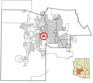
mapsize = 250px
map_caption = Location inMaricopa County and the state ofArizona
mapsize1 =
map_caption1 =
subdivision_type = Country
subdivision_type1 = State
subdivision_type2 = County
subdivision_name =United States
subdivision_name1 =Arizona
subdivision_name2 = Maricopa
government_type =
leader_title =
leader_name =
established_date =
area_magnitude = km
area_total_km2 = 14.4
area_total_sq_mi = 5.6
area_land_km2 = 14.4
area_land_sq_mi = 5.6
area_water_km2 = 0
area_water_sq_mi = 0
elevation_ft = 1014
elevation_m = 309
population_as_of = 2007
population_total = 7078population_footnotes = cite web|url=http://www.census.gov/popest/cities/tables/SUB-EST2007-04-04.csv|title=Annual Estimates of the Population for Incorporated Places in Arizona|publisher=
United States Census Bureau |date=2008-07-10|accessdate=2008-07-14]
population_metro =
population_density_km2 = 345.2
population_density_sq_mi = 894.1
timezone = MST (no DST)
utc_offset = -7
latd = 33 |latm = 27 |lats = 01 |latNS = N
longd = 112 |longm = 15 |longs = 18 |longEW = W
website =
timezone_DST =
utc_offset_DST =
postal_code_type =ZIP code
postal_code = 85353
area_code = 623
GNIS_id = 12564
blank_name = FIPS code
blank_info = 04-74190
blank1_name =
blank1_info =
footnotes =Tolleson IPA|/ˈtɑ.lə.sn̩/ is a city in Maricopa County,
Arizona ,United States . According to 2006 Census Bureau estimates, the population of the city is 6,812. cite web | url = http://www.census.gov/popest/cities/tables/SUB-EST2006-04-04.csv | title = Annual Estimates of the Population for All Incorporated Places in Arizona|format = CSV | work = 2006 Population Estimates | publisher = U.S. Census Bureau, Population Division]Geography
Tolleson is located at coor dms|33|27|01|N|112|15|18|W|city (33.450354, -112.255106)GR|1.
According to the
United States Census Bureau , the city has a total area of 5.6square mile s (14.4km² ), all of it land.Demographics
As of the
census GR|2 of 2000, there were 4,974 people, 1,432 households, and 1,151 families residing in the city. Thepopulation density was 894.1 people per square mile (345.4/km²). There were 1,485 housing units at an average density of 266.9/sq mi (103.1/km²). The racial makeup of the city was 52.21% White, 1.43% Black or African American, 1.23% Native American, 0.46% Asian, 0.16% Pacific Islander, 40.79% from other races, and 3.72% from two or more races. 77.97% of the population were Hispanic or Latino of any race.There were 1,432 households out of which 39.3% had children under the age of 18 living with them, 52.7% were married couples living together, 19.8% had a female householder with no husband present, and 19.6% were non-families. 15.9% of all households were made up of individuals and 7.1% had someone living alone who was 65 years of age or older. The average household size was 3.47 and the average family size was 3.83.
In the city the population was spread out with 32.4% under the age of 18, 10.9% from 18 to 24, 27.4% from 25 to 44, 19.4% from 45 to 64, and 9.8% who were 65 years of age or older. The median age was 29 years. For every 100 females there were 102.8 males. For every 100 females age 18 and over, there were 100.8 males.
The median income for a household in the city was $38,773, and the median income for a family was $43,894. Males had a median income of $26,934 versus $23,511 for females. The
per capita income for the city was $13,747. About 9.9% of families and 13.7% of the population were below thepoverty line , including 19.4% of those under age 18 and 10.9% of those age 65 or over.References
External links
*http://www.tollesonaz.org

Wikimedia Foundation. 2010.