- Salt River (Arizona)
Infobox River
river_name = Salt River
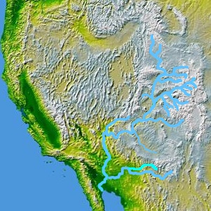
caption = The Salt River, a tributary of the Gila, is shown highlighted on a map of the United States and Mexico
origin =Gila County, Arizona
mouth =Gila River nearAvondale, Arizona
length =
elevation =
mouth_elevation = 928 ft (283 m) Gnis|33995]
discharge = 2570 cfs
watershed = The Salt River ( [O'odham language|O'odham [Pima] : Onk Akimel) is atributary of theGila River , approximately 322 km (200 mi) long, in centralArizona in theUnited States .Description
The river is formed in eastern Arizona in eastern Gila County, by the confluence of the White and Black rivers, in the valley between the
Mogollon Rim and theNatanes Plateau . With the Black, it forms the boundary between theFort Apache Indian Reservation to the north and theSan Carlos Apache Indian Reservation to the south. It flows northwest throughSalt River Canyon , then southwest and west through theTonto National Forest . It passes through the valley between theMazatzal Mountains andSuperstition Mountains and supplies several consecutive reservoirs:Lake Roosevelt (formed byRoosevelt Dam ), Apache Lake (Horse Mesa Dam ),Canyon Lake (Mormon Flat Dam ), and Saguaro Lake (Stewart Mountain Dam ). Near Fountain Hills it is joined by theVerde River . About five miles downstream of this point, theGranite Reef Diversion Dam diverts all remaining water into the Arizona and South canals, which deliver drinking and irrigation water to much of thePhoenix metropolitan area .Below Granite Reef Dam, the riverbed leaves the mountains and runs past the cities of Mesa, Tempe, and Scottsdale, then south of downtown Phoenix, where it passes north of
South Mountain Park . With the exception ofTempe Town Lake , the riverbed winding through the cities is often dry, except when heavy rains upstream force larger than normal releases from Stewart Mountain Dam. However, dangerous flash floods occasionally occur in the arroyo, especially duringmonsoon storms in late July and early August. Water washes out roads that cross the river in drier times of the year, and bridges have been damaged, most notably in 1980, 1993 and 2005. The natural flow of the Salt is 2570 cubic feet per second (cfs) at its mouth, almost three times that of the Rio Grande River. However, except during floods, the Salt is dry below Granite Reef Dam. The river was formerly navigable throughout its course by small craft. The river is still navigable in the majority of the area where it still carries a significant flow.The Salt River joins the Gila on the southwestern edge of Phoenix approximately 24 km (15 mi) from the center of the city. Monument Hill overlooks this confluence of rivers and is the site of the Initial Survey point for Arizona, the
Gila and Salt River Meridian .The river was used for irrigation by Native Americans and by early European settlers in the 19th century. It currently provides a major source of irrigation and drinking water for Phoenix and surrounding communities through the
Salt River Project . The river's water is distributed over more than 1,000 mi (1,609 km) of irrigation canals, used primarily for the growing ofcotton ,alfalfa , fruit, and vegetables.Recreation on the Salt River
Boating Facility Features
"Cherry Creek to Roosevelt Lake": Paved, Gravel and Trail Access, Live Bait Fish (Restrictions in Effect), No Motors Allowed, Primitive Parking Area, Camping Allowed, Area Mostly Inaccessible
"Below Saguaro Lake": Paved and Dirt Access, Live Bait Fish, Swimming, No Motors Allowed, Parking Area, Tables, Restrooms, Camping Allowed - Several camp and picnic areas, Drained in winter
The above facilities are maintained by the
Tonto National Forest .Fish Species
"Cherry Creek to Roosevelt Lake":
Largemouth Bass ,Smallmouth Bass , Sunfish, Catfish (Channel), Catfish (Flathead),Carp - 15 fishable miles"Below Saguaro Lake":
Rainbow Trout ,Largemouth Bass ,Smallmouth Bass ,Yellow Bass ,Crappie , Sunfish, Catfish (Channel), Catfish (Flathead),Walleye ,Tilapia ,Carp ,Bullfrog s - 11 fishable milesVariant names
According to the
Geographic Names Information System , the Salt River has also been known as:
* Assumption
* Assuption
* Black River
* Blau Fluss
* Blue River
* Rio Asuncion
* Rio Azulrio de Lasrio
* Rio de la Asuncion
* Rio de las Balsas
* River of the Rafts
* Salada
* Salinas
* Rio Saladoee also
*
Salt River Project
*List of Arizona rivers External links
* [http://www.gemland.com/hohokam.htm Map of ancient canal systems along the Salt River in the Valley of the Sun]
* [http://www.azgfd.gov/outdoor_recreation/BoatingLocationsMap.shtml Arizona Boating Locations Facilities Map]
* [http://www.azgfd.gov/h_f/FishingLocationsMap.shtml Arizona Fishing Locations Map]
* [http://www.azgfd.gov/h_f/where_fish.shtml Where to Fish in Arizona Species Information]
* [http://www.azgfd.gov/h_f/edits/lake_levels.shtml Arizona Lake Levels]
* [http://www.azgfd.gov/video/SaltRiver.shtml Video of Salt River]References
*Citation |first=Information and Education Division|title=Arizona Fishin' Holes|place=Phoenix, AZ|publisher=
Arizona Game and Fish Department |year=2007
Wikimedia Foundation. 2010.