- New River Mountains
-
New River Mountains Range Country United States State Arizona Region ((northern)-Sonoran Desert)
(SW)-Mogollon Rim & PlateauCounties Yavapai, Maricopa Borders on Bradshaw Mtns & Agua Fria River-W
Perry Mesa & (so.)-Black Hills-N
Phoenix, AZ-S
Verde River & Mazatzal Mtns-ECities New River, Black Canyon City Coordinates 34°03′21″N 111°59′16″W / 34.0559°N 111.9877°W Highest point Squaw Mountain - location New River Mountains - elevation 5,905 ft (1,800 m) - coordinates 34°03′21″N 111°59′16″W / 34.0559°N 111.9877°W Length 14 mi (23 km), SW-NE Width 7 mi (11 km) 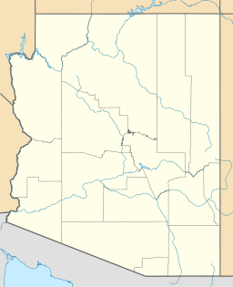

The New River Mountains are a small 14-mi (23 km) long, mountain range in central Arizona, and on the north border of the Phoenix valley; the range is located on the southwest perimeter of the Arizona transition zone. The range is a sub-part of landforms extending south from the Black Hills of Yavapai County. Rivers and canyons border east and west; the south of the range is located in Maricopa County, the location of much of the Phoenix metropolitan area.
Contents
Description
The New River Mountains are part of a region extending southwards from the southeast of the Black Hills of central Arizona. The region contains mesas, hills, and mountain peaks; the region is bordered on the west by the Black Canyon, where the Agua Fria River flows south towards Phoenix, and on the east, canyons where the Verde River also flows south to enter the Phoenix valley.
The small sub-range is about 14 mi long.[1] Hills are attached south and southeastwards of the New River Mesa on the mountain range's south, and meet the cities at the north of Phoenix, Cave Creek and Carefree. The north of the New River Mountains are attached to two mesas: Squaw Creek Mesa which extends west towards the Black Canyon, and Cooks Mesa which extends east towards West Cedar Mountain. West and East Cedar Mountain lie on the southwest of Tangle Creek, whose outfall lies on the Verde River, and borders the west of the extensive north-south Mazatzal Wilderness.
The center of the range is located near Benchmark Mountain, 5,855 feet (1,785 m), and the highpoint of the range is at the range's north, Squaw Mountain, 5,905 feet (1,800 m),[2] located at the east perimeter of Squaw Creek Mesa.
Access
The New River Mountains are easily accessed from Interstate 17 which borders the range on the west. The cities on I-17, directly west and southwest of the range are Black Canyon City, Rock Springs, New River, and Desert Hills.
References
External links
Peaks
Categories:- Arizona transition zone mountain ranges
- Mountain ranges of Arizona
- Landforms of Yavapai County, Arizona
- Arizona geography stubs

Wikimedia Foundation. 2010.