- Mogollon Rim
-

The Mogollon Rim (
 /mʌɡɨˈjoʊn/ or /moʊɡəˈjoʊn/)[1] is a topographical and geological feature running across the U.S. state of Arizona. It extends approximately 200 miles (320 km) from northern Yavapai County eastward to near the border with New Mexico.[2]
Contents
Description
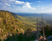
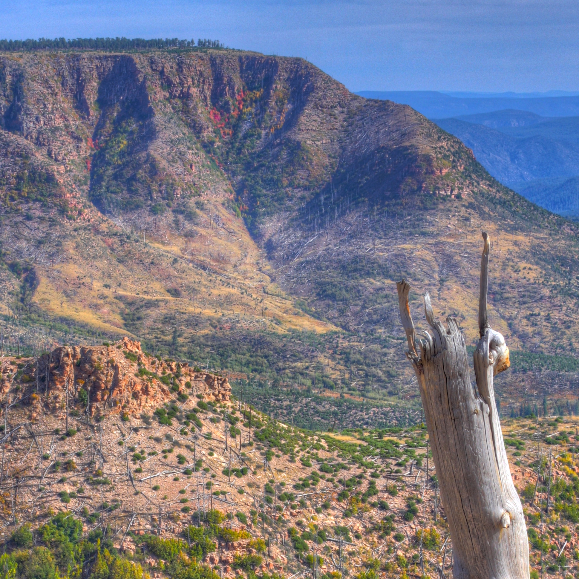
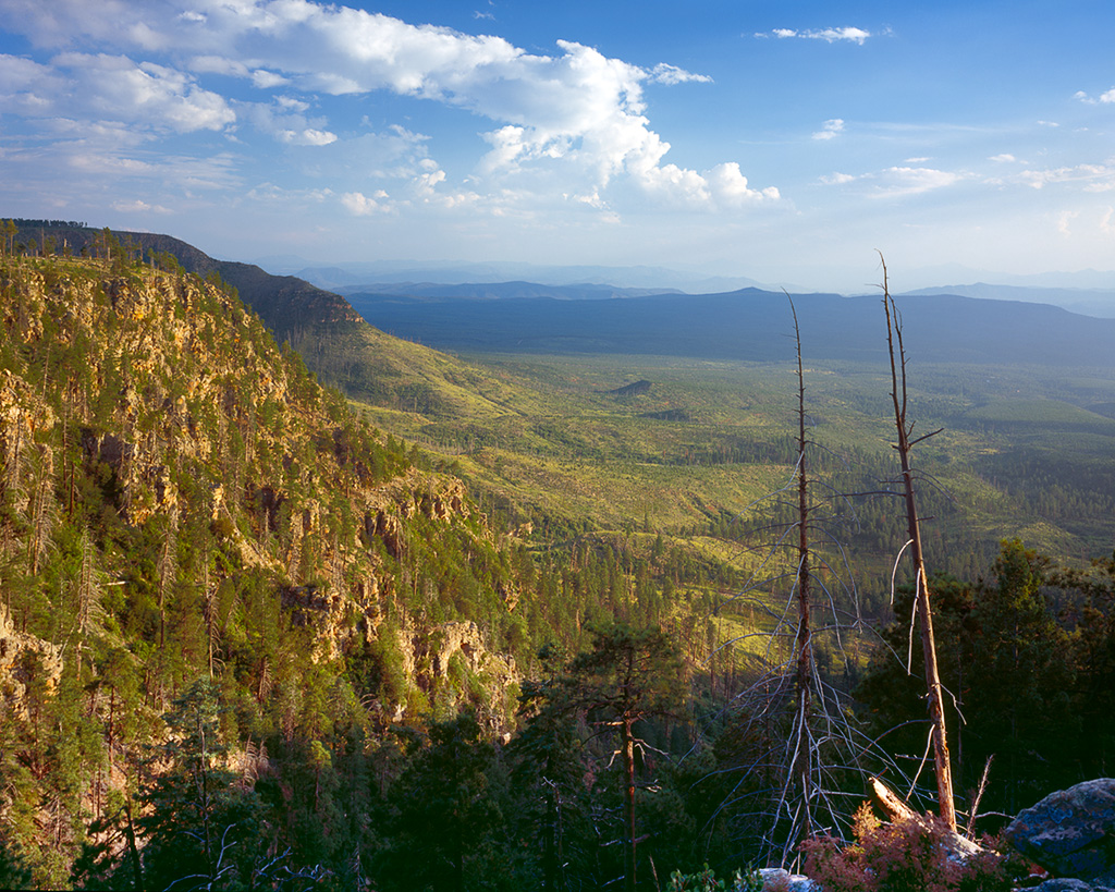
The Rim is an escarpment defining the southwestern edge of the Colorado Plateau, and along its central and most spectacular portions is characterized by high limestone and sandstone cliffs, namely the Kaibab Limestone and Coconino Sandstone. It was formed by erosion and faulting, and dramatic canyons have been cut into it, including Fossil Creek Canyon and Pine Canyon. The name Mogollon comes from Don Juan Ignacio Flores Mogollón, the Spanish Governor of New Mexico from 1712 to 1715.
Much of the land south of the Mogollon Rim lies 4000 to 5000 feet (1,200 to 1,500 meters) above sea level, with the escarpment rising to about 7,000 ft (2,100 m). Extensive Ponderosa Pine forests are found both on the slopes of the Rim and on the plateau north of it. The Mogollon Rim is a major floristic and faunal boundary, with species characteristic of the Rocky Mountains living on the top of the plateau, and species native to the Mexican Sierra Madre Occidental on the slopes below and in the Madrean sky islands (high, isolated mountain ranges) further south.
The Mogollon Rim's limestones and sandstones were formed from sediments deposited in the Carboniferous and Permian Periods. Several of the Rim's rock formations are also seen on the walls of the Grand Canyon. In many places, the Rim is capped or even buried by the extensive basaltic lava flows.
The uppermost sandstone stratum of the Mogollon Rim, called the Coconino Sandstone, forms spectacular white cliffs, sometimes several hundred feet high. This formation of the Permian Period is of aeolian (windblown) origin, and is one of the thickest sand-dune-derived sandstones on earth.
Cities and towns near the Mogollon Rim include Payson, Sedona, Show Low, and Alpine, Arizona. The Mogollon Rim is practically bisected by Interstate 17 which runs north-to-south between Flagstaff and Phoenix. The eastern portion of the Mogollon Rim was the site of Arizona's 2nd largest-known wildfire, during June 2002, the 470,000 acre (1,900 km²) Rodeo-Chediski fire. The Mogollon Rim was also the site of the "Dude Fire" that started on June 25, 1990. This fire grew to cover over 30,000 acres (120 km2), and it killed six wildland firemen. Other large fires have burned along the Mogollon Rim since 1990, and the area's ponderosa pine forests remain vulnerable because of past fire-suppression efforts and the buildup of available dry fuel.
The western novel author, Zane Grey, built a hunting cabin on the actual slopes of the Mogollon Rim just northeast of Payson, above Tonto Creek. This cabin was restored by the Phoenix, Ariz., air-conditioning magnate William Goettl during the late 1960s, but it was destroyed by the Dude Fire in 1990.[3] Grey's book Riders of the Purple Sage and several other of his widely read novels, were either set in this general area of the Old West, or inspired by it.[citation needed] The novel-writer Louis L'Amour's novel The Sackett Brand was also set in the area of the Mogollon Rim, with the cliffs of the Rim being specifically described.
See also
- Mogollon Monster
- Mogollon Mountains
- Pinyon-juniper woodland
References
- ^ "Mogollon". Oxford English Dictionary. Oxford University Press. 2nd ed. 1989.
- ^ The Mogollon Rim should not be confused with the Mogollon Mountains in New Mexico, which are somewhat east of the eastern end of the Rim. The official estimate of the eastern end is near Show Low, although some sources extend it farther east. See U.S. Geological Survey Geographic Names Information System: Mogollon Rim.
- ^ Zane Grey’s Rim country legacy, Payson Roundup, April 8, 2004
External links
 State of Arizona
Phoenix (capital) Topics Index | Climate | Delegations | Geography | History | Museums | Music | People | Transportation | Visitor Attractions
Society Culture · Demographics · Economy · Education · Politics
Regions Arizona Strip | Arizona Sun Corridor | Coconino Plateau | Colorado Plateau | Grand Canyon | Kaibab Plateau | Mogollon Plateau | Mogollon Rim | Mojave Desert | Monument Valley | North Central Arizona | Northeast Arizona | Northern Arizona | Oak Creek Canyon | Phoenix Metropolitan Area | Safford area | San Francisco Volcanic Field | Sonoran Desert | Southern Arizona | Verde Valley | White Mountains
Counties Cities Chandler | Flagstaff | Gilbert | Glendale | Kingman | Lake Havasu City | Mesa | Peoria | Phoenix | Prescott | Scottsdale | Sierra Vista | Tempe | Tucson | Yuma
Categories:- Mogollon Rim
- Escarpments of the United States
- Colorado Plateau
- Landforms of Arizona
- Regions of Arizona
- Regions of the Western United States
- Geography of the United States
- Landforms of Yavapai County, Arizona
Wikimedia Foundation. 2010.