- Payson, Arizona
Infobox Settlement
official_name = Town of Payson, Arizona
settlement_type =Town
image_caption =
imagesize =
image_caption =
imagesize =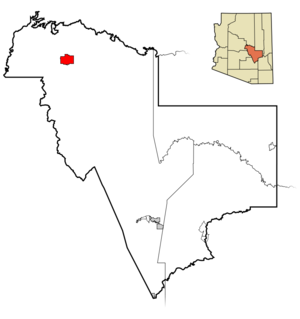
mapsize = 250x250px
map_caption = Location in Gila County and the state ofArizona
mapsize1 =
map_caption1 =
subdivision_type = Country
subdivision_type1 = State
subdivision_type2 = County
subdivision_name =United States
subdivision_name1 =Arizona
subdivision_name2 = Gila
established_title =
established_date =
government_type =
leader_title =Mayor
leader_name =Kenny Evans
area_magnitude =
area_total_km2 = 50.4
area_total_sq_mi = 19.5
area_land_km2 = 50.4
area_land_sq_mi = 19.5
area_water_km2 = 0.0
area_water_sq_mi = 0.0
elevation_ft = 4921
elevation_m = 1500
population_as_of = 2007
population_footnotes =cite web | date =June 21 2006 | url = http://www.census.gov/popest/cities/tables/SUB-EST2005-04-04.csv | title = Annual Estimates of the Population for All Incorporated Places in Arizona | format = CSV | work = 2005 Population Estimates | publisher = U.S. Census Bureau, Population Division | accessmonthday = November 14 | accessyear = 2006] cite web|url=http://www.census.gov/popest/cities/tables/SUB-EST2007-04-04.csv|title=Annual Estimates of the Population for Incorporated Places in Arizona|publisher=United States Census Bureau |date=2008-07-10|accessdate=2008-07-14]
population_total = 15407
population_density_km2 = 283.3
population_density_sq_mi = 732.3
timezone = MST (no DST)
utc_offset = -7
latd = 34 |latm = 14 |lats = 22 |latNS = N
longd = 111 |longm = 19 |longs = 39 |longEW = W
website = http://www.ci.payson.az.us/
timezone_DST =
utc_offset_DST =
postal_code_type =ZIP code s
postal_code = 85541, 85547
area_code = 928
GNIS_id = 32746
blank_name = FIPS code
blank_info = 04-53700
blank1_name =
blank1_info =
footnotes =Payson is a town at the meeting of three roads in Gila County,
Arizona ,United States . Its location puts it almost exactly in the geographic center of Arizona. According to 2006 Census Bureau estimates, the population of the town is 15,257.cite web | url = http://www.census.gov/popest/cities/tables/SUB-EST2006-04-04.csv | title = Annual Estimates of the Population for All Incorporated Places in Arizona|format = CSV | work = 2006 Population Estimates | publisher = U.S. Census Bureau, Population Division]Zane Grey Country
"
Zane Grey Country" is a term for the area around Payson, Arizona. This term was most often used in 1970s and 1980s, and appeared in the header of the local newspaper, "The Payson Roundup". In recent times it has fallen somewhat out of favor, as the term "Rim Country" has become more popular among locals.Geography
Located at coor dms|34|14|22|N|111|19|39|W|city (34.239462, -111.327456)GR|1, at an elevation of 4921 feet, the town has a total area of 50.4 km² (19.5 sq mi). The
Mogollon Rim lies to the north; there are a few small lakes in the area.Neighboring communities include Star Valley and Pine. The smaller communities of Rye and Strawberry are also within Gila County.
History
Payson considers its founding year as 1882, at which time it was known as Green Valley or Union Park. On
March 3 1884 , the town officially established apost office . Postmaster Frank C. Hise recommended that the town be named after a man named Louis Edwin Payson. Senator Payson was very instrumental in the establishment of the Post Office. In honor of Payson’s help, the town (or quite possibly merely Hise) decided to change the name to Payson.Payson had its first
rodeo in 1884, with Charlie Meadows being one of the founders. Payson considers its rodeo the "world's oldest continuous" as it has been held every year since.In 1918 author
Zane Grey made his first trip to the area surrounding Payson. He would come back with regularity through 1929, and would purchase two plots of land nearTonto Creek , including 120 acres from Sampson Elam Boles under Myrtle Point. Grey wrote numerous books about the area and also filmed some movies, such as "To the Last Man", in the Payson area in the 1920s.During prohibition the manufacture, sale, and distribution of liquor was plentiful. The transactions took place on historic Bootleg Alley. [Payson Roundup, December 4, 2002]
During the 1930s an effort began to try to get Payson a better road to connect it to the outside world. At that time Payson was very isolated with a trip from Phoenix to Payson taking four to five hours. Throughout the 1950s work on a paved road from Phoenix to Payson progressed and the paving was completed in 1959. A few years ago this highway, State Route 87 (also known as the "Beeline Highway"), was expanded to four lanes.
Education
Payson Unified School District #10 includes five major schools. Grammar schools include Julia Randall Elementary, Frontier Elementary, and Payson Elementary. Rim Country Middle School and Payson High School are essentially contained within one property. However, each facility is organized and maintained by a separate administration. All schools are subject to district laws enforced by the district board.
The institutions in the school district score an average of 7 with the range being 5 to 8 when meeting the minimum state standards. [greatschools.net]
Payson has two alternative schools, The Payson Center for Success, which serves grades 9-12 and also Payson Community Christian School which serves grades K -12.
A branch of Gila Community College is located in Payson.
Recreation
Ninety-seven percent of the land around Payson is under the jurisdiction of the
United States Forest Service (Payson is surrounded by theTonto National Forest ) or by tribal governments. Consequently much of the land is available forhiking ,horseback riding , and other outdoor activities.Tonto Natural Bridge , the largest knowntravertine natural bridge in the world, is located just northwest of Payson inTonto Natural Bridge State Park , a unit of the Arizona State Park system. The area incorporates three golf courses, two of which belong to private country clubs. Mazatzal Casino, a tribal casino, is operated by theTonto Apache Indian Reservation near the south end of the city.The Payson area is a popular destination for rockhounds. In various areas surrounding the community can be found
quartz crystals rivalingHerkimer diamond s in quality,geode s,agate , andonyx .Fossil s are commonly found in thePaleozoic strata that is exposed along the Mogollon Rim to the north and east of Payson along State Route 87 and State Route 260.Payson is known for its rodeo which is the oldest continuous rodeo in the world. [ cite book
last = Pyle
first = Jynx
authorlink = Jynx Pyle
coauthors= Jayne Peace Pyle
title = Rodeo 101
publisher =Git a Rope! Publishing
year = 2004
isbn = 0972256083 cite news |first= Scott |last= Craven |authorlink= Scott Craven |title= Ropin', rasslin' and bustin' bronc' World's Oldest Continuous Rodeo' in Payson |url=http://www.azcentral.com/travel/arizona/features/articles/0817quicktrip0818-ON.html |publisher= The Arizona Republic|date=August 18 ,2006 |accessdate=2008-04-22 ]Payson has two large parks, Green Valley Park and Rumsey Park. A community swimming pool is located near Rumsey Park and the town hosts free outdoor concerts in the summer. Other activities include intramural sports like baseball and football. Payson also has a small skatepark.
Culture
Payson is the site of the annual Arizona State Championship Old Time Fiddlers Contest, held in September. The fiddle contest features both local and nationally-known players and awards cash prizes. Payson is also home of two rodeos. In May the Multi-Purpose Event Center across from the Tonto Apache Indian Reservation hosts the Gary Hardt Memorial Rodeo. In August, the historic August Doin's Rodeo takes place making Payson, Arizona the "Home of the World's Oldest Continuous Rodeo."
Prescott, Arizona is known as hosting the "World's Oldest Rodeo" but took a hiatus during World War II.Government
The town government consists of the mayor, Kenny Evans, and six council members: Vice-Mayor Tim Fruth, Ed Blair, Su Connell, Andy Romance, John Wilson, and Mike Vogel.
Demographics
As of the
census GR|2 of 2000, there were 13,620 people, 5,832 households, and 4,070 families residing in the town. Thepopulation density was 699.6 people per square mile (270.1/km²). There were 7,033 housing units at an average density of 361.2/sq mi (139.5/km²). The racial makeup of the town was 94.75% White, 0.26% Black or African American, 1.89% Native American, 0.53% Asian, 0.05% Pacific Islander, 1.34% from other races, and 1.17% from two or more races. 5.20% of the population were Hispanic or Latino of any race.There were 5,832 households out of which 21.7% had children under the age of 18 living with them, 58.6% were married couples living together, 8.0% had a female householder with no husband present, and 30.2% were non-families. 26.0% of all households were made up of individuals and 14.6% had someone living alone who was 65 years of age or older. The average household size was 2.30 and the average family size was 2.71.
In the town the population was spread out with 18.1% under the age of 18, 4.6% from 18 to 24, 15.3% from 25 to 44, 25.9% from 45 to 64, and 36.2% who were 65 years of age or older. The median age was 49 years. For every 100 females there were 94.1 males. For every 100 females age 18 and over, there were 93.5 males. [2007 Gila County readjusted Demographics and Marketing Statistics]
The median income for a household in the town was $33,638, and the median income for a family was $38,713. Males had a median income of $30,900 versus $23,750 for females. The
per capita income for the town was $19,513. About 6.5% of families and 9.9% of the population were below thepoverty line , including 15.1% of those under age 18 and 4.7% of those age 65 or over.References
External links
* [http://www.ci.payson.az.us/ Town of Payson website]
Wikimedia Foundation. 2010.