- Peridot, Arizona
Infobox Settlement
official_name = Peridot, Arizona
settlement_type = CDP
image_caption =
imagesize =
image_caption =
imagesize =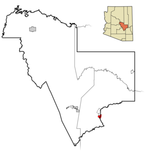
mapsize = 250px
map_caption = Location in Gila County and the state ofArizona
mapsize1 =
map_caption1 =
subdivision_type = Country
subdivision_type1 = State
subdivision_type2 = Counties
subdivision_name =United States
subdivision_name1 =Arizona
subdivision_name2 = Gila, Graham
established_title =
established_date =
government_type =
leader_title =
leader_name =
area_magnitude =
area_total_km2 = 13.5
area_total_sq_mi = 5.2
area_land_km2 = 13.5
area_land_sq_mi = 5.2
area_water_km2 = 0.0
area_water_sq_mi = 0.0
elevation_ft = 2625
elevation_m = 800
population_as_of = 2000
population_footnotes =
population_total = 1266
population_density_km2 = 93.8
population_density_sq_mi = 243.5
timezone = MST (no DST)
utc_offset = -7
latd = 33 |latm = 18 |lats = 14 |latNS = N
longd = 110 |longm = 27 |longs = 18 |longEW = W
website =
timezone_DST =
utc_offset_DST =
postal_code_type =ZIP code
postal_code = 85542
area_code = 928
blank_name = FIPS code
blank_info = 04-54190
blank1_name = GNIS feature ID
blank1_info = 0009325
footnotes =Peridot (Western Apache: Tséé Dotłʼizh [cite |author=William J. de Reuse |title=A Practical Grammar of the San Carlos Apache Language |publisher=Lincom Europa |date=2006 ] ) is a
census-designated place (CDP) in Gila and Graham counties in theU.S. state ofArizona . The population was 1,266 at the 2000 census.Geography
Peridot is located at coor dms|33|18|14|N|110|27|18|W|city (33.303884, -110.455046)GR|1.
According to the
United States Census Bureau , the CDP has a total area of 5.2square mile s (13.5km² ), all of it land.Demographics
As of the
census GR|2 of 2000, there were 1,266 people, 307 households, and 261 families residing in the CDP. Thepopulation density was 242.5 people per square mile (93.6/km²). There were 346 housing units at an average density of 66.3/sq mi (25.6/km²). The racial makeup of the CDP was 1.42% White, 97.95% Native American, and 0.63% from two or more races. 2.76% of the population were Hispanic or Latino of any race. Out of the town's Native Americans, 92.97% are Apache, making Peridot the most Apache community in the United States.There were 307 households out of which 50.2% had children under the age of 18 living with them, 55.4% were married couples living together, 20.5% had a female householder with no husband present, and 14.7% were non-families. 12.4% of all households were made up of individuals and 3.6% had someone living alone who was 65 years of age or older. The average household size was 4.12 and the average family size was 4.50.
In the CDP the population was spread out with 40.4% under the age of 18, 9.7% from 18 to 24, 26.8% from 25 to 44, 17.5% from 45 to 64, and 5.5% who were 65 years of age or older. The median age was 25 years. For every 100 females there were 101.0 males. For every 100 females age 18 and over, there were 93.8 males.
The median income for a household in the CDP was $18,194, and the median income for a family was $18,750. Males had a median income of $19,348 versus $17,102 for females. The
per capita income for the CDP was $5,765. About 49.4% of families and 58.9% of the population were below thepoverty line , including 69.9% of those under age 18 and 36.5% of those age 65 or over.ee also
*
San Carlos Apache Indian Reservation References
External links
Wikimedia Foundation. 2010.