- McMillenville, Arizona
-
McMillenville, Arizona — Ghost Town — Location in the state of Arizona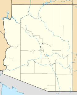
 McMillenville, Arizona
Coordinates: 33°13′26″N 110°40′47″W / 33.22389°N 110.67972°WCoordinates: 33°13′26″N 110°40′47″W / 33.22389°N 110.67972°W Country United States State Arizona County Gila Established circa 1876 Abandoned circa 1886 Named for Charles McMillen Elevation[1] 4,442 ft (1,354 m) Time zone MST (no DST) (UTC-7) Post Office Opened November 12, 1877 Post Office Closed October 12, 1882 McMillenville, also known as McMillianville or McMillanville, is a ghost town in Gila County, Arizona. Silver ore was discovered by chance in 1876 by Theodore H. Harris and Charles McMillen, and the town formed around the ore deposits.
Contents
History
On March 26, 1876 Harris and McMillen were heading 28 miles northeast of Globe on a prospecting trip. While traveling through the White Mountains McMillen got off his horse as he was too hungover to proceed farther. He went to sleep so Harris stopped, dismounted and sat down on a nearby ledge. Boredom led Harris to drive his pick into the rock and discovered silver. The pair founded the Stonewall Jackson mine which eventually turned into McMillenville, named after the drunken McMillen. The town grew fast and a year later on November 12, 1877 a post office was opened. At its peak 1,000 settlers lived there. The town soon was bolstered several adobe saloons, dance halls, boarding houses, casinos, as well as homes for hundreds of people, public buildings and the mining structures. The town's first bloodshed came in 1880 over a mining claim dispute. Jack Brown the founder of the claim established a camp which another prospector intended to exploit. After Jack Brown and his killer had a long argument, the two met on the main street and fought a duel. Both men fired their revolvers true and they both died from a gunshot wound seconds later. McMillenville's peak was in 1880, the original five-stamp mill was replaced with by twenty-stamps. A new hoisting mechanism was erected for lifting ore out of the shaft. Silver ingots here taken about 100 miles to Casa Grande. The town was booming until 1882 when Geronimo's warriors attacked; it became a ghost town by 1886.[2][3][4]
Battle of McMillenville
The Apache attack was one of many engagements of the Indian wars in Arizona, it was fought on July 7, 1882. Geronimo's warriors, who had escaped the nearby San Carlos Reservation, were raiding throughout the area. Hundreds of natives fled after the Battle of Cibecue Creek who then went to Mexico or began raided across the Southwest. Hostilities became pitched when locals reported the large number of Apache warriors approaching the town. The women and children were rushed to the mine shaft with a few men for protection, the rest armed themselves and made a position out of a large two-story adobe building. The Apaches attacked with dozens of warriors, they swarmed the small town until they reached the makeshift fortification. There several settlers defeated the attack with accurate fire. Only one American was wounded in the arm and the natives' casualties are not known, the Apache usually concealed their casualties by removing bodies and wounded men from the field. The warriors retreated after cavalry from Fort Apache began to arrive. Several buildings were damaged in the fighting, some from fire. The natives used primarily rifles and pistols with some bow and arrows compared to various firearms used by the settlers. The battle was an American victory with little loss but McMillenville would still end up being abandoned within the next few years.[2]
Remnants
Almost nothing remains of the mines and mill, and only scattered ruins of the adobe buildings of the town mark the site of McMillenville today.[3][5]
Geography
The town is located off of U.S. Route 60, about 18 miles (29 km) northeast of Globe.[5]
Geology
The Stonewall Jackson mine was one of the best producing mines in the area at the time.,[6] mainly producing silver, copper, and lead.[7]
References
- ^ U.S. Geological Survey Geographic Names Information System: McMillianville
- ^ a b Sherman, James E; Barbara H. Sherman (1969). Ghost Towns of Arizona. University of Oklahoma Press. ISBN 0-8061-0843-6.
- ^ a b Federal Writers' Project. Arizona The Grand Canyon State A State Guide. US History Publishers. p. 468. ISBN 1603540032. http://books.google.com/books?id=mB9Sm6JCnAQC&lpg=PA468&dq=mcmillenville%20ghost%20town&pg=PA468#v=onepage&q=mcmillenville%20ghost%20town&f=false. Retrieved 2010-08-01.
- ^ Bauer, Carolyn (1988). Ghost towns of Arizona: remnants of the mining days. American Traveler Press. p. 29. ISBN 1558380957. http://books.google.com/books?id=QmZEBYrJbLUC&lpg=PA29&dq=mcmillenville%20ghost%20town&pg=PA29#v=onepage&q&f=false. Retrieved 2010-08-01.
- ^ a b "National Park Service - Prospector, Cowhand, and Sodbuster (Survey of Historic Sites and Buildings)". Nps.gov. 2005-05-22. http://www.nps.gov/history/history/online_books/prospector/sited1.htm. Retrieved 2010-07-31.
- ^ Bancroft, Hubert Howe (1889). History of Arizona and New Mexico, 1530-1888. The History Company. p. 588. http://books.google.com/books?id=ss8NAAAAIAAJ&lpg=PA588&ots=23uGmaOgpd&dq=mcmillanville&pg=PA588#v=onepage&q=mcmillanville&f=false. Retrieved 2010-08-01.
- ^ "Stonewall Jackson Mine (McMillan Silver Mines group; McMillan-Stonewall Mine; Stonewall Jackson-Little Mac Mine), McMillanville (McMillanville District), Globe Hills, Globe Hills District, Globe-Miami District, Gila Co., Arizona, USA". Mindat.org. http://www.mindat.org/loc-55316.html. Retrieved 2010-08-01.
External links
- Ghosttowns.com entry for McMillenville
Municipalities and communities of Gila County, Arizona City 
Towns Hayden‡ | Miami | Payson | Star Valley | Winkelman‡
CDPs Canyon Day | Central Heights-Midland City | Claypool | Gisela | Peridot‡ | Pine | San Carlos | Strawberry | Tonto Basin | Top-of-the-World‡ | Young
Unincorporated
communitiesKohls Ranch | Punkin Center | Roosevelt | Rye
Indian reservations Ghost towns Bellevue | McMillenville
Footnotes ‡This populated place also has portions in an adjacent county or counties
{{DEFAULTSORT:McMillenville, Arizona]]
Categories:- Ghost towns in Arizona
- Former populated places in Gila County, Arizona
- Battles involving the Apache
- Apache Wars


Wikimedia Foundation. 2010.