- Arizona State Route 87
Infobox road
marker_
state=AZ
highway_name=
name_notes=
type=state
route=87
alternate_name=
maint=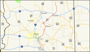
length_mi=272.66
length_round=2
length_ref=cite web |url=http://tpd.az.gov/data/reports/2006SHSLog.pdf |title=2006 ADOT Highway Log |author=Arizona Department of Transportation |accessdate=2008-04-09]
length_notes=
established=
decommissioned=
direction_a=South
starting_terminus=jct|state=AZ|SR|84 near Picacho
junction=jct|state=AZ|SR|202 in Chandler
jct|state=AZ|US|60 in Mesa
jct|state=AZ|SR|202 in Mesa
jct|state=AZ|I|40 in Winslow
direction_b=North
ending_terminus=jct|state=AZ|SR|264 near Second Mesa
previous_type=AZ
previous_route=86
next_type=AZ
next_route=88
commons=
browse=az browse
type=AZroute=65
previous_route=64
next_route=66
previous_type=SR
next_type=SRState Route 87 (SR 87) is a north-south road that travels from SR 84 near
Picacho, Arizona northward to SR 264 near Second Mesa.Route description
The road that becomes SR 87 begins at
Second Mesa, Arizona . It becomes a state route when it crosses the reservation boundary line and it ends at Interstate 10 exit 211, just south ofEloy, Arizona in the unincorporated town of Picacho.SR 87 is known as the Beeline Highway from Payson through Fountain Hills to its terminus at McDowell Road, just north of Mesa. All of this portion of SR 87 is a four-lane highway.
There is a stretch of road where the highway splits, taking different canyons through the
Mazatzal Mountains south of Payson, near the junction with SR 188. The old alignment is currently the southbound lanes, while a new alignment was built for the northbound lanes. There is a stretch where the roads cross-over each other because of the difference in elevations of the two canyons.Once it gets to Mesa, SR 87 is known as Country Club Drive, a major-arterial street, six lanes wide in most sections. It then passes through Chandler where it becomes Arizona Avenue. South of Chandler, at Hunt Highway, SR 87 proceeds southeasterly as a two-lane rural road through the
Gila River Indian Community until it reaches Coolidge.In Coolidge, SR 87 is known as Arizona Blvd. It finally ends 16 miles south of Coolidge, near the unincorporated town of Picacho. The original southern terminus was 1/2 mile to the north of I-10 at its junction with State Route 84 until 2004 when SR 87 was extended to serve the 1/2 mile decertified SR 84 stretch.
ADOT is currently studying a stretch of I-10 to widen and improve interchanges along its stretch from Tucson to Casa Grande, including the interchange with SR 87. [http://www.i10tucsondistrict.com/i8totang2.html]
SR 87 is part of the National Highway System between I-10 and Payson.
Stretches of this road were formerly numbered as State Route 65 and State Route 166.
Notable destinations along SR 87 include the
Mogollon Rim andTonto Natural Bridge .Junctions
*State Route 264 (northern terminus)
*Interstate 40 to Flagstaff or Alberquerque
*Historic U.S. Route 66 (briefly concurrent in Winslow)
*State Route 99
*State Route 260 (concurrent from Strawberry to Payson)
*State Route 188 near Sunflower(Red Mountain Freeway)
*U.S. Route 60 (Superstition Freeway) to Phoenix or Globe
*State Route 202 (Santan Freeway)
*State Route 587 shortcut to I-10
*State Route 187 to I-10 Casa Grande
*State Route 387 to I-10 Casa Grande
*State Route 287 (concurrent from Coolidge to near Picacho Reservoir)
*Interstate 10 (southern terminus) to Casa Grande/Phoenix or TucsonReferences
External links
* [http://arizonaroads.com/arizona/az87.html SR 87 at Arizona Roads]
* [http://www.i10tucsondistrict.com/i8totang2.html

Wikimedia Foundation. 2010.