- Coolidge, Arizona
-
City of Coolidge, Arizona — City — Motto: Line the pockets of our officials. Location of Coolidge, Arizona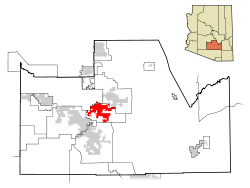
Coordinates: 32°58′38″N 111°31′23″W / 32.97722°N 111.52306°WCoordinates: 32°58′38″N 111°31′23″W / 32.97722°N 111.52306°W Country United States State Arizona County Pinal Incorporated 1945 Government – Type City – Mayor Tom Shope (R) Area – Total 5 sq mi (13.0 km2) – Land 5 sq mi (13.0 km2) – Water 0 sq mi (0.0 km2) 0% Elevation 1,427 ft (435 m) Population (2007)[1] – Total 9,570 – Density 1,549.1/sq mi (597.7/km2) Time zone MST (UTC-7) – Summer (DST) no DST (UTC) ZIP code 85128 Area code(s) 520 FIPS code 04-15500 Website http://www.coolidgeaz.com/ Coolidge is a city in Pinal County, Arizona, United States. According to 2005 Census Bureau estimates, the population of the city is 8,154.[2]
Arizona Highway 87 and Arizona Highway 287 pass through the town. Coolidge is 56 miles southeast of Phoenix, and 69 miles northwest of Tucson. It is 21 miles northeast of Casa Grande and 11 miles southwest of Florence. Picacho Reservoir is just 11 miles south of town.
Coolidge is home of the Casa Grande Ruins National Monument. The monument was the first historic site to receive protected status by the United States Government in 1892. The ancient city was built about 1200 AD. by the Hohokam people.
Coolidge was incorporated as a city in 1945. It is named for Calvin Coolidge, the 30th President of the United States.
Coolidge is home to Central Arizona College.
Contents
Geography
Coolidge is located at 32°58′38″N 111°31′23″W / 32.97722°N 111.52306°W (32.977105, -111.522933).[3]
According to the United States Census Bureau, the city has a total area of 5.0 square miles (13 km2), all of it land. dfa
Demographics
As of the census[4] of 2000, there were 7,786 people, 2,585 households, and 1,938 families residing in the city. The population density was 1,549.1 people per square mile (597.7/km²). There were 3,212 housing units at an average density of 639.1 per square mile (246.6/km²). The racial makeup of the city was 57.85% White, 8.30% Black or African American, 5.63% Native American, 0.72% Asian, 0.05% Pacific Islander, 23.58% from other races, and 3.88% from two or more races. 39.20% of the population were Hispanic or Latino of any race.
There were 2,585 households out of which 38.5% had children under the age of 18 living with them, 48.8% were married couples living together, 19.3% had a female householder with no husband present, and 25.0% were non-families. 20.8% of all households were made up of individuals and 9.9% had someone living alone who was 65 years of age or older. The average household size was 3.00 and the average family size was 3.44.
In the city the population was spread out with 32.9% under the age of 18, 10.4% from 18 to 24, 24.4% from 25 to 44, 18.9% from 45 to 64, and 13.4% who were 65 years of age or older. The median age was 31 years. For every 100 females there were 93.2 males. For every 100 females age 18 and over, there were 88.1 males.
The median income for a household in the city was $29,049, and the median income for a family was $33,536. Males had a median income of $29,159 versus $21,472 for females. The per capita income for the city was $13,663. About 20.9% of families and 24.7% of the population were below the poverty line, including 30.9% of those under age 18 and 20.5% of those age 65 or over.
In 2010 Coolidge had a population of 11,825. The racial and ethnic composition of the population was 43.6% non-Hispanic white, 7.3% non-Hispanic black, 0.5% Hispanic blacks, 3.8% non-Hispanic Native American, 1.9% Hispanic or Latino Native American, 1.0% Asian, 0.1% Pacific Islander, 0.1% non-Hispanic from some other race, 5.0% from two or more races and 42.0% Hispanic or Latino.[5]
Coolidge Cotton Express
Coolidge Cotton Terminal is a shuttle that can take people to certain areas. It is free on Fridays and works with The City of Coolidge.
Coolidge Public Library
The Coolidge Public Library offers many resources to the community, including public access computers, new materials, an extensive DVD catalog, as well as frequent author signings from bestselling authors.
References
- ^ "Annual Estimates of the Population for Incorporated Places in Arizona". United States Census Bureau. 2008-07-10. http://www.census.gov/popest/cities/tables/SUB-EST2007-04-04.csv. Retrieved 2008-07-14.
- ^ "Annual Estimates of the Population for All Incorporated Places in Arizona" (CSV). 2005 Population Estimates. U.S. Census Bureau, Population Division. June 21, 2006. http://www.census.gov/popest/cities/tables/SUB-EST2005-04-04.csv. Retrieved November 14, 2006.
- ^ "US Gazetteer files: 2010, 2000, and 1990". United States Census Bureau. 2011-02-12. http://www.census.gov/geo/www/gazetteer/gazette.html. Retrieved 2011-04-23.
- ^ "American FactFinder". United States Census Bureau. http://factfinder.census.gov. Retrieved 2008-01-31.
- ^ 2010 census report on race, Hispanic or Latino, age and housing occupancy for Coolidge]
External links
- Official City site
- Casa Grande Ruins National Monument @ the National Park Service
- Casa Grande Ruins @ OnlineHighways.com
Municipalities and communities of Pinal County, Arizona Cities Apache Junction‡ | Casa Grande | Coolidge | Eloy | Maricopa

Towns CDPs Ak-Chin Village | Arizona City | Blackwater | Cactus Forest | Campo Bonito | Casa Blanca | Chuichu | Dudleyville | Gold Canyon | Goodyear Village | Kohatk | Oracle | Picacho | Queen Valley | Red Rock | Sacaton | Sacaton Flats Village | Saddlebrooke | San Manuel | Santa Cruz | Santan | San Tan Valley | Stanfield | Stotonic Village | Sweet Water Village | Tat Momoli | Top-of-the-World‡ |
Unincorporated
communitiesBapchule | Chandler Heights‡ | Randolph | Valley Farms
Indian reservations Ghost towns American Flag | Cochran | Copper Creek | Pinal City | Ray | Reymert | Sasco | Tiger
Footnotes ‡This populated place also has portions in an adjacent county or counties
Phoenix Metropolitan Area Core city Largest suburbs
(over 100,000 inhabitants)Other suburbs and towns
(over 10,000 inhabitants)Anthem • Apache Junction • Avondale • Buckeye • Casa Grande • El Mirage • Eloy • Florence • Fountain Hills • Goodyear • Gold Canyon • Luke Air Force Base • Maricopa • New River • Paradise Valley • Queen Creek • San Tan Valley • Sun City • Sun City West • Sun LakesSmaller suburbs and towns
(over 5,000 inhabitants)Black Canyon City • Carefree • Cave Creek • Coolidge • Gila Bend • Guadalupe • Laveen • Litchfield Park • Superior • Tolleson • Wickenburg • YoungtownCounties Categories:- Cities in Arizona
- Populated places in Pinal County, Arizona
- Populated places established in 1945
- Calvin Coolidge


Wikimedia Foundation. 2010.