- Tiger, Arizona
-
Tiger, Arizona — Ghost town — Location in the state of Arizona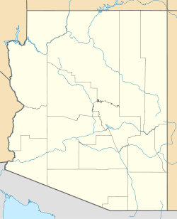
 Tiger, Arizona
Coordinates: 32°42′28″N 110°40′56″W / 32.70778°N 110.68222°WCoordinates: 32°42′28″N 110°40′56″W / 32.70778°N 110.68222°W Country United States State Arizona County Pinal Founded 1881 Abandoned 1954 Named for Princeton Tigers[1] Elevation[2] 3,081 ft (939 m) Population (2009) - Total 0 Time zone MST (no DST) (UTC-7) Post Office dates Schultz: - Opened July 12, 1894 - Closed May 1, 1902 Tiger: - Opened March 15, 1939 - Closed November 26, 1954 Tiger is a ghost town in Pinal County in the U.S. state of Arizona. The town was settled as Schultz around 1881 in what was then the Arizona Territory, then later reestablished as Tiger after World War I.[1]
Contents
History
The area that was to become Tiger was first settled in 1881 after Frank Schultz located gold ore in what was to become the Mammoth Mine. The camp that settled around the mine took the name Schultz, and a post office was established under that name on July 12, 1894.[1][3]
Since water, needed for refinement of ore, was not present near the mine, a mill was established 4 miles (6.4 km) away on the west bank of the San Pedro River, in a town that came to be known as Mammoth, after the mine and the mill. The ore was hauled to the mill by way of mule teams, until just after the turn of the century when an aerial tram was completed between the Mammoth Mine and the Mammoth Mill. As the tram's construction neared completion, and the need for the town waned, the Schultz post office was closed on May 1, 1902.[1]
The mines reopened in 1915 due to World War I's increased demand for the molybdenum and vanadium found in the area. When the war was over, the prices fell, and the mines closed again in 1919.[4] Shortly thereafter, the Mammoth Mine property was purchased by Sam Houghton, who renamed both the mine and the town after his college mascot, the Princeton Tiger.[1] When the price of gold increased in 1933,[4] the town again grew in prosperity, and the new Tiger post office opened on March 1, 1939. It was as Tiger that the town reached its peak in the early 1950s. Soon after, the local mines, as well as the town of Tiger, had run their course, and the post office was discontinued on November 26, 1954.[1]
Remnants
After the San Manuel Copper Company acquired the land, they demolished all remaining structures in order to mine the silica on site. However, the material contained too much lead, and the plan proved fruitless. As such, nothing is left of the town of Tiger today, but the filled-in shaft of the Mammoth mine in the middle of town.[1][5]
Mining
The Tiger or Mammoth mine is a famous mineral locality, especially for Matlockite[6] and wulfenite. In addition, the mineral yedlinite is a hydrated oxychloride of lead and chromium found only at Tiger, and first noted on preexisting specimens in 1967.[7]
Geography
Historical populations Census Pop. %± 1940 500 — 1950 783 56.6% 1960 0 −100.0% Source:[8] The site is located approximately 4 miles (6.4 km) west of the town of Mammoth[1] at 32°42′28″N 110°40′56″W / 32.70778°N 110.68222°W (32.7078463, -110.6823227), at an elevation of 3,081 feet (939 m).[2] The Mammoth Mine (later the Tiger Mine) is located at 32°42′23″N 110°41′05″W / 32.70639°N 110.68472°W.[3]
Demographics
US Census data places the population of the town at 500 in 1940 after its re-founding as Tiger, and 783 in 1950.[8] It was after this final census that the town is said to have reached its peak population of approximately 1,800 residents, before heading into permanent decline and abandonment.[1]
See also
References
- ^ a b c d e f g h i Sherman, James E.; Barbara H. Sherman (1969). "Tiger". Ghost Towns of Arizona (First ed.). University of Oklahoma Press. p. 150. ISBN 0806108436.
- ^ a b U.S. Geological Survey Geographic Names Information System: Tiger
- ^ a b U.S. Geological Survey Geographic Names Information System: Mammoth Mine
- ^ a b "Mammoth-Saint Anthony Mine (Mammoth-St Anthony Mine; Mammoth Mine; St. Anthony Mine), St. Anthony deposit, Tiger, Mammoth District, Pinal Co., Arizona, USA". MineDat.org. http://www.mindat.org/loc-3380.html. Retrieved 2009-09-04.
- ^ "Tiger, Mammoth District, Pinal Co., Arizona, USA". MineDat.org. http://www.mindat.org/loc-16802.html. Retrieved 2009-09-04.
- ^ "Matlockite". Handbook of Mineralogy. http://handbookofmineralogy.org/pdfs/matlockite.pdf. Retrieved 14 January 2011.
- ^ McLean, W. John; Bideaux, Richard A.; Thomssen, Richard W. (1974). "Yedlinite, a New Mineral from the Mammoth Mine, Tiger, Arizona" (PDF). American Mineralogist 59: 1157–1159. http://www.minsocam.org/ammin/AM59/AM59_1157.pdf. Retrieved 2009-08-25.
- ^ a b Moffat, Riley (1996). Population History of Western U.S. Cities and Towns, 1850-1990. Lanham, Maryland: Scarecrow Press, Inc.. pp. 9–17. ISBN 0810830337.
External links
- Minerals of Tiger, Arizona
- Tiger at Ghosttowns.com
- Tiger (Schultz) at Frank and Anne's Canyon Country Notebook
Municipalities and communities of Pinal County, Arizona County seat: Florence Cities Apache Junction‡ | Casa Grande | Coolidge | Eloy | Maricopa

Towns CDPs Ak-Chin Village | Arizona City | Blackwater | Cactus Forest | Campo Bonito | Casa Blanca | Chuichu | Dudleyville | Gold Canyon | Goodyear Village | Kohatk | Oracle | Picacho | Queen Valley | Red Rock | Sacaton | Sacaton Flats Village | Saddlebrooke | San Manuel | Santa Cruz | Santan | San Tan Valley | Stanfield | Stotonic Village | Sweet Water Village | Tat Momoli | Top-of-the-World‡ |
Unincorporated
communitiesBapchule | Chandler Heights‡ | Randolph | Valley Farms
Indian reservations Ghost towns American Flag | Cochran | Copper Creek | Pinal City | Ray | Reymert | Sasco | Tiger
Footnotes ‡This populated place also has portions in an adjacent county or counties
Categories:- Ghost towns in Arizona
- Former populated places in Pinal County, Arizona
- San Pedro Valley


Wikimedia Foundation. 2010.