- Dudleyville, Arizona
-
Dudleyville, Arizona — CDP — Location in Pinal County and the state of Arizona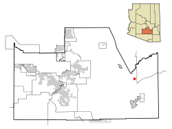
Coordinates: 32°55′47″N 110°44′2″W / 32.92972°N 110.73389°WCoordinates: 32°55′47″N 110°44′2″W / 32.92972°N 110.73389°W Country United States State Arizona County Pinal Area - Total 6.9 sq mi (17.8 km2) - Land 6.9 sq mi (17.8 km2) - Water 0.0 sq mi (0.0 km2) Elevation 1,946 ft (593 m) Population (2000) - Total 1,323 - Density 191.7/sq mi (74.3/km2) Time zone MST (no DST) (UTC-7) FIPS code 04-20680 GNIS feature ID 0024402 Dudleyville is a census-designated place (CDP) in Pinal County, Arizona, United States. The population was 1,323 at the 2000 census.
Geography
Dudleyville is located at 32°55′47″N 110°44′2″W / 32.92972°N 110.73389°W (32.929812, -110.733899).[1]
According to the United States Census Bureau, the CDP has a total area of 6.9 square miles (18 km2), all of it land.
The city includes the San Pedro River Preserve.
Demographics
As of the census[2] of 2000, there were 1,323 people, 454 households, and 345 families residing in the CDP. The population density was 192.3 people per square mile (74.2/km²). There were 572 housing units at an average density of 83.1 per square mile (32.1/km²). The racial makeup of the CDP was 61.98% White, 0.08% Black or African American, 2.12% Native American, 0.08% Asian, 0.30% Pacific Islander, 32.73% from other races, and 2.72% from two or more races. 58.96% of the population were Hispanic or Latino of any race.
There were 454 households out of which 36.6% had children under the age of 18 living with them, 56.4% were married couples living together, 12.3% had a female householder with no husband present, and 23.8% were non-families. 20.0% of all households were made up of individuals and 7.7% had someone living alone who was 65 years of age or older. The average household size was 2.91 and the average family size was 3.35.
In the CDP the population was spread out with 32.8% under the age of 18, 7.4% from 18 to 24, 25.5% from 25 to 44, 22.7% from 45 to 64, and 11.6% who were 65 years of age or older. The median age was 33 years. For every 100 females there were 103.5 males. For every 100 females age 18 and over, there were 101.1 males.
The median income for a household in the CDP was $35,592, and the median income for a family was $37,200. Males had a median income of $31,948 versus $25,800 for females. The per capita income for the CDP was $13,072. About 8.6% of families and 13.6% of the population were below the poverty line, including 22.5% of those under age 18 and 7.9% of those age 65 or over.
References
- ^ "US Gazetteer files: 2010, 2000, and 1990". United States Census Bureau. 2011-02-12. http://www.census.gov/geo/www/gazetteer/gazette.html. Retrieved 2011-04-23.
- ^ "American FactFinder". United States Census Bureau. http://factfinder.census.gov. Retrieved 2008-01-31.
Municipalities and communities of Pinal County, Arizona County seat: Florence Cities Apache Junction‡ | Casa Grande | Coolidge | Eloy | Maricopa

Towns CDPs Ak-Chin Village | Arizona City | Blackwater | Cactus Forest | Campo Bonito | Casa Blanca | Chuichu | Dudleyville | Gold Canyon | Goodyear Village | Kohatk | Oracle | Picacho | Queen Valley | Red Rock | Sacaton | Sacaton Flats Village | Saddlebrooke | San Manuel | Santa Cruz | Santan | San Tan Valley | Stanfield | Stotonic Village | Sweet Water Village | Tat Momoli | Top-of-the-World‡ |
Unincorporated
communitiesBapchule | Chandler Heights‡ | Randolph | Valley Farms
Indian reservations Ghost towns American Flag | Cochran | Copper Creek | Pinal City | Ray | Reymert | Sasco | Tiger
Footnotes ‡This populated place also has portions in an adjacent county or counties
Categories:- Census-designated places in Pinal County, Arizona
- Populated places in Arizona with Hispanic majority populations


Wikimedia Foundation. 2010.