- San Manuel, Arizona
Infobox Settlement
official_name = San Manuel, Arizona
settlement_type = CDP
imagesize =
image_caption =
imagesize =
image_caption =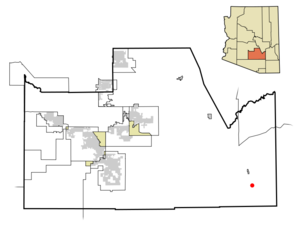
mapsize = 250px
map_caption = Location in Pinal County and the state ofArizona
mapsize1 =
map_caption1 =
subdivision_type = Country
subdivision_type1 = State
subdivision_type2 = County
subdivision_name =United States
subdivision_name1 =Arizona
subdivision_name2 = Pinal
government_type =
leader_title =
leader_name =
established_title =
established_date =
area_magnitude =
area_total_km2 = 54.1
area_total_sq_mi = 20.9
area_land_km2 = 54.1
area_land_sq_mi = 20.9
area_water_km2 = 0.0
area_water_sq_mi = 0.0
elevation_ft = 3451
elevation_m = 1052
population_as_of = 2000
population_footnotes =
population_total = 4375
population_metro =
population_density_km2 = 80.9
population_density_sq_mi = 209.3
timezone = MST (no DST)
utc_offset = -7
latd = 32 |latm = 36 |lats = 18 |latNS = N
longd = 110 |longm = 38 |longs = 0 |longEW = W
website =
timezone_DST =
utc_offset_DST =
postal_code_type =ZIP code
postal_code = 85631
area_code = 520
blank_name = FIPS code
blank_info = 04-63540
blank1_name = GNIS feature ID
blank1_info = 0034022
footnotes =San Manuel is a
census-designated place (CDP) in Pinal County,Arizona ,United States . The population was 4,375 at the 2000 census.San Manuel was built in 1953 as a
company town to serve the then-new San Manuel copper mine, mill and smelter complex. The mine and smelter were permanently closed in 2003.Nearby towns are
Oracle, Arizona andMammoth, Arizona . Both are within ten miles of San Manuel and make up the tri-community area.Geography
San Manuel is located at coor dms|32|36|18|N|110|38|0|W|city (32.605048, -110.633340)GR|1, in the San Pedro River valley at an elevation of about 3500 feet. San Manuel is about 45 miles northeast of
Tucson, Arizona .According to the
United States Census Bureau , the CDP has a total area of 20.9square mile s (54.1km² ), all of it land.Demographics
As of the
census GR|2 of 2000, there were 4,375 people, 1,458 households, and 1,204 families residing in the CDP. Thepopulation density was 209.5 people per square mile (80.9/km²). There were 1,832 housing units at an average density of 87.7/sq mi (33.9/km²). The racial makeup of the CDP was 69.05% White, 0.39% Black or African American, 1.37% Native American, 0.34% Asian, 0.07% Pacific Islander, 24.78% from other races, and 4.00% from two or more races. 46.22% of the population were Hispanic or Latino of any race.There were 1,458 households out of which 43.1% had children under the age of 18 living with them, 66.3% were married couples living together, 10.6% had a female householder with no husband present, and 17.4% were non-families. 15.0% of all households were made up of individuals and 6.7% had someone living alone who was 65 years of age or older. The average household size was 3.00 and the average family size was 3.31.
In the CDP the population was spread out with 32.6% under the age of 18, 8.8% from 18 to 24, 27.0% from 25 to 44, 21.1% from 45 to 64, and 10.5% who were 65 years of age or older. The median age was 32 years. For every 100 females there were 102.5 males. For every 100 females age 18 and over, there were 98.1 males.
The median income for a household in the CDP was $40,019, and the median income for a family was $42,563. Males had a median income of $36,463 versus $21,304 for females. The
per capita income for the CDP was $16,534. About 10.3% of families and 12.8% of the population were below thepoverty line , including 18.4% of those under age 18 and 5.6% of those age 65 or over.References
External links
* [http://www.smorchamber.org/ SMOR Tri-Community Chamber of Commerce]
* [http://www.azcommerce.com/doclib/COMMUNE/san%20manuel.pdf San Manuel Community Profile] , by [http://www.azcommerce.com/ Arizona Department of Commerce]
Wikimedia Foundation. 2010.