- Mogollon Mountains
-
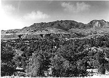 View of the Mogollon Range from Highway 180
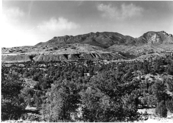
 Location of the Mogollon Mountains within New Mexico
The Mogollon Mountains or Mogollon Range (pronounced /mʌɡɨˈjoʊn/, /moʊɡəˈjoʊn/)[1] are a mountain range east of the San Francisco River in Grant and Catron counties of southwestern New Mexico, between the communities of Reserve and Silver City. They extend roughly north-south for about 30 miles (48 km), and form part of the divide between the San Francisco and the Gila rivers. The crest of the range lies about 15 miles (24 km) east of U.S. Route 180, which traverses parallel to a section of the San Francisco River; the lower altitude smaller range, the Sierra Aguilada borders to the west of Route 180. Most of the Mogollon Mountains is protected within the Gila Wilderness, part of the Gila National Forest.
The highest point in the range is Whitewater Baldy which, at 10,895 ft (3,321 m), is the highest point in southwestern New Mexico. The range also contains five other 10,000+ foot peaks, most notably Mogollon Baldy (10,778 ft, 3,285 m).
The Mogollon Mountains were formed between forty and twenty-five million years ago as part of the Datil-Mogollon Volcanic Plateau. Hot springs existing in the area are a remnant of that volcanic activity.[2] The Mogollon Mountains are named for Juan Ignacio Flores Mogollón, governor of Nuevo Leon 1712 to 1715. [3]
Early inhabitants of the range include the Mimbres Culture, from 300 BC to AD 1300. Later peoples included the Chiricahua and Mimbres bands of the Apache, including Geronimo, said to have been born in the area around 1829. Mining occurred in the area beginning in the 1890s and continuing for some decades.[2]
The Mogollon Mountains should not be confused with the Mogollon Rim, a large escarpment in Arizona, about 100 miles (160 km) to the northwest.
References
- ^ "Mogollon". Oxford English Dictionary. Oxford University Press. 2nd ed. 1989.
- ^ a b Butterfield, Mike, and Greene, Peter, Mike Butterfield's Guide to the Mountains of New Mexico, New Mexico Magazine Press, 2006, ISBN 978-0-937206-88-1
- ^ Calloway, Colin G, One Vast Winter Count, University of Nebraska Press, 2003, ISBN 0-8032-1530-4
Coordinates: 33°19′24″N 108°38′30″W / 33.32336°N 108.64174°W
Topics of Catron County, New Mexico Natural features Aspen Mountain · Jordan Hot Springs · Middle Fork Hot Springs · Mogollon-Datil volcanic field · Mogollon Mountains · Plains of San Agustin · Red Hill volcanic field · San Francisco River · Turkey Creek Hot Springs · Whitewater Baldy
Protected areas Blue Range Wilderness · Catwalk National Recreation Trail · Gila National Forest · Gila Wilderness · Whitewater Canyon National Forest Recreation Area
National Register of Historic
Places listingsBearwallow Park · Bearwallow Mountain Lookout Cabins and Shed · Black Mountain · Black Mountain Lookout Cabin · Ake Site · El Caso Lake · El Caso Lookout Complex · Bat Cave · Mangas Mountain Lookout Complex · Mogollon Historic District · Socorro Mines Mining Company Mill, Fannie Hill · Mogollon Baldy Lookout Cabin · Red Hill · Mogollon Pueblo · Zuni Salt Lake
Historic places and events Categories:- Mountain ranges of New Mexico
- Landforms of Catron County, New Mexico
- Landforms of Grant County, New Mexico
- New Mexico geography stubs
Wikimedia Foundation. 2010.