- Ahwatukee
Infobox Settlement
name =Ahwatukee
official_name =
other_name =
native_name =
settlement_type =Urban village of Phoenix,Arizona
total_type =
motto =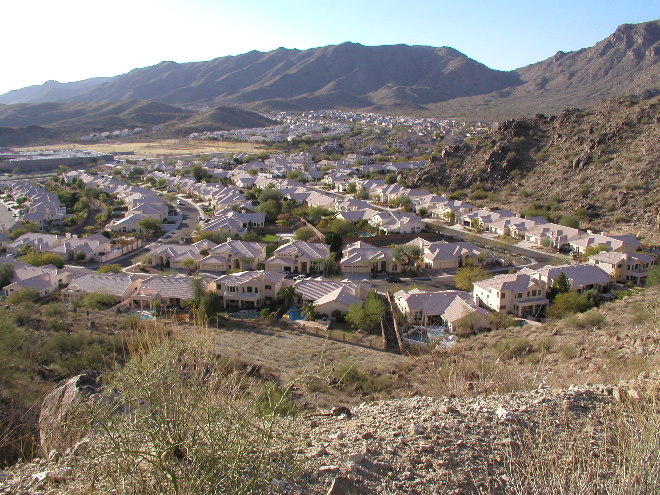
imagesize =
image_caption = A typical Ahwatukee neighborhood seen from South Mountain Park
flag_size =
image_
seal_size =
image_shield =
shield_size =
image_blank_emblem =
blank_emblem_type =
blank_emblem_size =
flag_size =
image_
seal_size =
image_shield =
shield_size =
image_blank_emblem =
blank_emblem_type =
blank_emblem_size =
mapsize =
map_caption = Location of Ahwatukee Foothills highlighted in red.
pushpin_
pushpin_label_position =
pushpin_map_caption =
pushpin_mapsize =
subdivision_type = Country
subdivision_name = United States
subdivision_type1 = State
subdivision_name1 =Arizona
subdivision_type2 = County
subdivision_name2 =Maricopa
subdivision_type3 = City
subdivision_name3 = Phoenix
seat_type =
seat =
parts_type =
parts_style =
parts =
p1 =
p2 =
government_footnotes =
government_type =
leader_title =
leader_name =
leader_title1 =
leader_name1 =
established_title =
established_date =
demonym =
area_magnitude =
unit_pref =
area_footnotes =
area_total_sq_mi =
area_land_sq_mi =
area_water_sq_mi =
area_water_percent =
elevation_footnotes =
elevation_m =
elevation_ft =
elevation_max_m =
elevation_max_ft =
elevation_min_m =
elevation_min_ft =
population_as_of =
population_footnotes =
population_note =
population_total =
population_density_sq_mi =
timezone =
utc_offset =
timezone_DST =
utc_offset_DST =
latd= |latm= |lats= |latNS=
longd= |longm= |longs= |longEW=
postal_code_type =
postal_code =
area_code =
website = [http://phoenix.gov/PLANNING/vpahwatu.html Ahwatukee Foothills Village Planning Committee]
footnotes = Ahwatukee (formally "Ahwatukee Foothills Village") is an L-shaped neighborhood ofPhoenix, Arizona bordered on the north bySouth Mountain Park and Baseline Road, on the east by Interstate 10 and the cities of Chandler, Guadalupe, and Tempe, and on the south and west by theGila River Indian Community . It is the southernmost of the city's 15 urban villages. As of 2000, the 35.8 square-mile (92.7 km²) village has a population of 85,000. [http://www.eastvalley.com/index.php?fuseaction=home.community&a=2]Although annexed by the City of Phoenix between 1978 and 1987, before substantial residential growth, many of Ahwatukee's residents do not strongly associate their region with the rest of the city, due in part to its geographic isolation (South Mountain and South Mountain Park separate Ahwatukee from virtually all of the other 14 urban villages of Phoenix, which lie to the north).
History
Legend has it that in 1921, Dr. and Mrs. W.V.B. Ames built a house on approximately 2,000 acres (8.1 km²) on the southeast side of South Mountain. They gave the area its original name, "Casa de Sueños", which in Spanish means, "House of Dreams." Dr. Ames died within just three months of moving into the house, and after Mrs. Ames' death in 1933 the house and most of the land was willed to St. Luke's Hospital, then bought in 1935 by Miss Helen Brinton, who appeared to have retranslated the name of the house to the Crow word which now serves as the name of the village. The house was demolished in 1979, and parts of it were used to build the Our Lady of Guadalupe church. Marty Gibson was the first to write a book on the history of Ahwatukee, titled, "The History of Ahwatukee."
As it turns out, the Crow translation for "House of Dreams" ("ashe ammeewiawe") sounds nothing like Ahwatukee. More likely, she named the town after the Crow words "awe chuuke", meaning, more aptly for the city than "house of dreams," "land on the other side of the hill," or "land in the next valley." This is, at first glance, a curious choice on her part because the Crow are a native northern plains tribe originally based in Wyoming, now residing in southeast Montana, and have never been associated with Arizona where the Apache, Hopi, Pima and Navajo are indigenous. However, Brinton, actually having spent much time in the Wyoming (Crow) vicinities and finally making her last home there, would have very likely been strongly influenced by her experience in Wyoming enough to use a Crow-derived name for the beloved land she left behind. This seeming inconsistency only serves to add to the lore of Ahwatukee. [ [http://www.azcentral.com/community/ahwatukee/articles/0407ar-joecolZ14.html Reflecting on what we call Ahwatukee ] ]
In 1971 part of the land was purchased, subdivided, and developed into a residential community by the Presley Development Company, owned by Elvis Presley's uncle.
Ahwatukee has grown as the city acquired other land parcels to the west, including land owned by
International Harvester , which operated aproving ground for earth-moving equipment there from 1947 to 1983. The State of Arizona, has bought, sold, or swapped land several times, including transferringstate trust land to developers in controversial auctions in which residents andconservationist s have lobbied for the space to be converted to parkland. [ [http://www.ahwatukee.com/afn/community/articles/010523a.html] Dead link|date=March 2008] [ [http://www.ahwatukee.com/afn/community/articles/020220a.html] Dead link|date=March 2008]Neighborhood characteristics
Surrounded to the northwest by South Mountain Park, blocked to the east by I-10 and to the south by the [http://www.itcaonline.com/tribes_gila.html Gila River Indian Community] , [http://phoenix.gov/PLANNING/vpmapah.html Ahwatukee Foothills] is geographically isolated from the city which it is part of, Phoenix. Due to its relatively few access points (mainly through a few bridges across Interstate 10), it has been called "The World's Largest Cul-de-sac". This could potentially change, however, if the hotly contested South Mountain Freeway is built along the southern edge along what is now Pecos Road; this freeway would provide a truck bypass around downtown Phoenix and connect Ahwatukee to the west valley cities of Laveen, Avondale and Glendale. This freeway is presently under review for environmental impact and has been challenged because of its high cost (currently 4 times the original projected amount), its proximity to schools and homes, its actual value as a useful commuter route (it would be principally used as a bypass around downtown Phoenix by trucks traveling from the east and south on their way to Los Angeles via Interstate 10) and the controversy surrounding the required demolition of over 250 homes, businesses and churches as well as the leveling of a section of South Mountain itself, which the Gila Indian Community claims has religious value as well as its intrinsic value to the Phoenix community as a whole as it is part of the world's largest city park and one of the Phoenix "Points of Pride".
Education
The area's K-8 students are served by the
Kyrene School District . The Kyrene Schools in Ahwatukee include Kyrene Cerritos (K-5), Kyrene De La Colina (K-5), Kyrene de las Lomas (K-5), Kyrene Estrella (K-5), Kyrene Monte Vista (K-5), Kyrene de los Lagos (K-5), Kyrene del Milenio (K-5), and Kyrene Sierra (K-5) elementary schools, and Centennial (6-8), Akimel A-al (6-8), Altadeña (6-8) middle schools. High school students go to one of two in the area: Desert Vista and Mountain Pointe. Both schools are operated by the Tempe Union High School District, the best, by test scores, school district in AZ. There are also a number of private/charter schools, including Keystone Montessori School, Horizon Community Learning Center Charter School, Intelli-School High School, and Skyline Technical High School.Climate
Ahwatukee receives approximately 12 inches of rainfall yearly. [ [http://www.lifeinahwatukee.com/ahwatukee-weather.html Ahwatukee, Arizona Weather, Climate | Average Monthly Temperatures ] ] Temperatures are mild during the winter months and average around 67 degrees F. In the summer, temperatures average around 105 degrees F.
Lows rarely reach freezing temperatures during the winter months. However, cool air can fall from the upper elevations and settle in the lower terrains, causing variations in temperature.
Snow is rare for the area, but can be seen on the Sierra Estrella mountain range to the southwest.
References
External links
* [http://www.ahwatukee.com Ahwatukee Foothills News: Community News & Events]
* [http://www.ahwatukeelife.com Ahwatukee Life: Everything about living in Ahwatukee]
* [http://www.ahwatukee.org Ahwatukee: Homes for Sale, Sold Homes, Businesses, Community Info]
* [http://www.azcentral.com/relocationguide04/planning/ahwatukeeprofile.html Planning a Move: Ahwatukee]
* [http://www.eastvalley.com/index.php?fuseaction=home.community&a=2 EastValley.com: Ahwatukee Foothills]
* [http://www.ahwatukeehoa.com/abm_history.htm ABM History]
* [http://phoenix.gov/PLANNING/vpahwatu.html City of Phoenix Planning: Ahwatukee Foothills Village]
Wikimedia Foundation. 2010.