- Cochiti Dam
-
Cochiti Dam 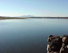
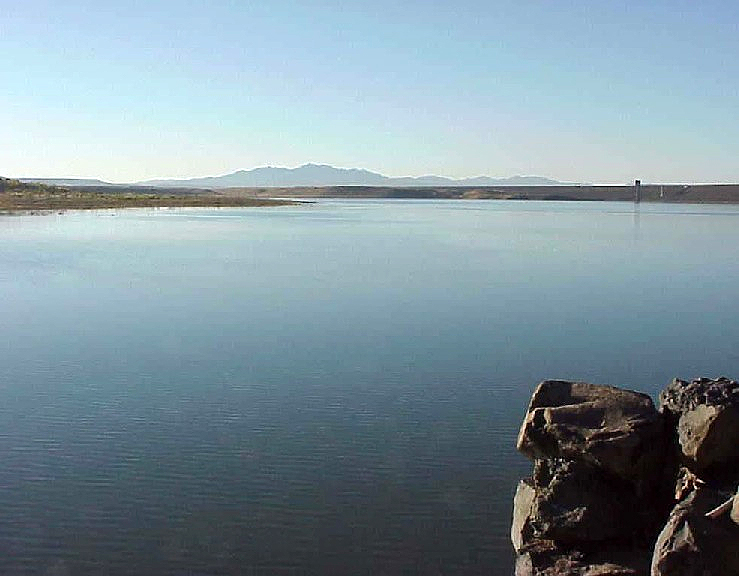
Cochiti Dam from lake sideOfficial name Cochiti Dam Location Cochiti Pueblo, Sandoval County, New Mexico, USA Coordinates 35°36′39″N 106°18′48″W / 35.6107°N 106.3132°WCoordinates: 35°36′39″N 106°18′48″W / 35.6107°N 106.3132°W Construction began 1965 Opening date 1973 Dam and spillways Height 251 ft (76.5 m) Length 29,040 ft (8,852 m) Base width 1,760 ft (536.4 m) Impounds Rio Grande Reservoir Creates Cochiti Lake Capacity 718,019 acre feet (0.885663 km3) Active capacity 49,359 acre feet (0.060883 km3)  A view of the shoreline of Cochiti Lake, impounded by Cochiti Dam
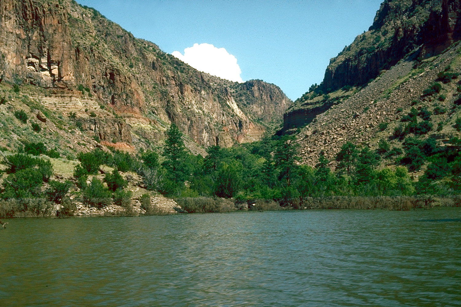
The Cochiti Dam is an earthen fill dam located on the Rio Grande River in Sandoval County, New Mexico approximately 50 miles (80.4 km) north of Albuquerque, New Mexico in the United States. By volume of material, it is the 23rd largest dam in the world at 62,849,000 yd³ (48,052,000 m³) of material,[1] one of the ten largest such dams in the United States,[2] and the eleventh largest such dam in the world.[3] Cochiti Dam is one of the four United States Army Corps of Engineers projects for flood and sediment control on the Rio Grande system, operating in conjunction with Abiquiu Dam, Galisteo Dam and Jemez Canyon Dam.
Contents
Description
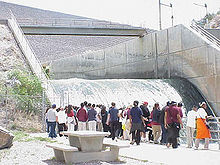 Outlet flow at Cochiti Dam in 2002
Cochiti Dam is primarily a flood control dam built to ameliorate the effects of heavy run off. The dam and the resultant lake also had the secondary purposes of creating recreational and wildlife habitat resources. The outlet works of the dam are capable of 14,790 feet³/s (418.8 m³/s) of outflow.[4]
Cochiti Dam is operated to bypass all inflow to the lake to the extent that downstream channel conditions are capable of safely bypassing the flow. Flood-control operations are initiated when inflow to the lake is in excess of the downstream channel capacity. Stored floodwaters are released when downstream channel conditions permit, all in accordance with the provisions of Public Law 86-645 and the Rio Grande Compact.[5]
Cochiti Dam marks the beginning of the Middle Rio Grande Conservancy District (MRGCD), Cochiti Division. It controls runoff water from an 11,695 square miles (30,290 km2) drainage area.[6]
History
Cochiti Dam was authorized under the Flood Control Act of 1960 for a construction cost of US$94.4 million dollars.[7] The act was further amended in 1964 to allocate water resources for the development of fish and wildlife resources as well as recreational resources. 50,000 acre feet (62,000,000 m3) of water was allocated under this amendment for initial pool fill and sufficient resources were allocated to offset annual evaporation losses. This water was to come from water previously diverted into the Rio Grande system by Public Law 87-843 of 1962[8] from water in the Colorado River basin via the San Juan Diversion Project across the Continental Divide.
Construction began in 1965. Impoundment of water in Cochiti Lake began in 1973.[9] Archaeological surveys were made prior to filling of the lake.[10] The filling of the lake inundated the Cochiti Diversion Dam which had previously been used for irrigation purposes.[11] The new dam replaced this functionality.
Construction of the dam was opposed by the Cochiti Pueblo Indians, who lost significant tracts of agricultural land as a result of the construction and subsequent pool filling. The Cochiti Pueblo Indians filed a lawsuit against the Army Corps of Engineers regarding the inundation of their lands, winning the suit. In 2001, the Army Corps of Engineers made a public apology to the Cochiti Pueblo Indians.[6]
Cochiti Lake
Cochiti Lake has maintained a permanent recreation pool of approximately 62,000,000 m3 (50,000 acre·ft) since the dam was completed. The permanent pool, which includes an intermittent pond in the arm of the Santa Fe River, provides sediment control benefits, trapping about 1,200,000 m3 (970 acre·ft) of sediment per year. The permanent pool was established by and is maintained by San Juan-Chama Project water. The remaining capacity of the reservoir, totaling about 672,000,000 m3 (545,000 acre·ft), is reserved for flood and sediment control. The elevation of the lake at surface of the normal pool is 5,335 ft (1626 m) above sea level.[12]
There are two public recreation areas on the lake, one on the west side of the lake at Cochiti Recreation Area and one on the east at Tetilla Peak Recreation Area.[13] Other lands around the lake are owned by and are part of the Pueblo de Cochiti Indian Reservation and are not open to the public. A visitor center is open to the public near the park headquarters. Fishing is permitted on the lake, with smallmouth bass and northern pike species among other species being available.[14] Cochiti Lake is a no-wake lake, and boats are restricted to trolling speeds.[15]
References
- ^ World's Largest Dams
- ^ Cochiti Lake
- ^ http://www.recreation.gov/nm/Cochiti_Area/Campground/r/campgroundDetails.do?agency=NRRS&parkId=3127
- ^ Upper Rio Grande Water Operations Model Physical Model Documentation: Third Technical Review Committee Draft (2005), 78.
- ^ Ibid., 79.
- ^ a b Cochiti Dam and Reservoir
- ^ Cochiti Dam, NM
- ^ LAW RELATING TO INDIAN AFFAIRS, 1002.
- ^ Upper Rio Grande Water Operations Model Physical Model Documentation, 35.
- ^ Mathien, Frances Joan; Steen, Charlie R.; Allen, Craig D. (1993). The Pajarito Plateau: A bibliography. Professional Paper. Southwest Cultural Resources Center. http://www.cr.nps.gov/history/online_books/band/pajarito_plateau.pdf.
- ^ Middle Rio Grande Project
- ^ Upper Rio Grande Water Operations Model Physical Model Documentation, 79.
- ^ Welcome to the US Army Corps of Engineers Cochiti Lake Recreation Area
- ^ http://www.wildlife.state.nm.us/recreation/fishing/fishing_report.htm
- ^ http://www.wildlife.state.nm.us/publications/documents/fishing/2006/fishing_rib_06-07.pdf, 6.
External links
Categories:- Dams in New Mexico
- Landmarks in New Mexico
- Buildings and structures in Sandoval County, New Mexico

Wikimedia Foundation. 2010.