- Outline of geography
-
See also: Index of geography articles
The following outline is provided as an overview of and topical guide to geography:
Geography – science that studies the lands, features, inhabitants, and phenomena of Earth.[1]
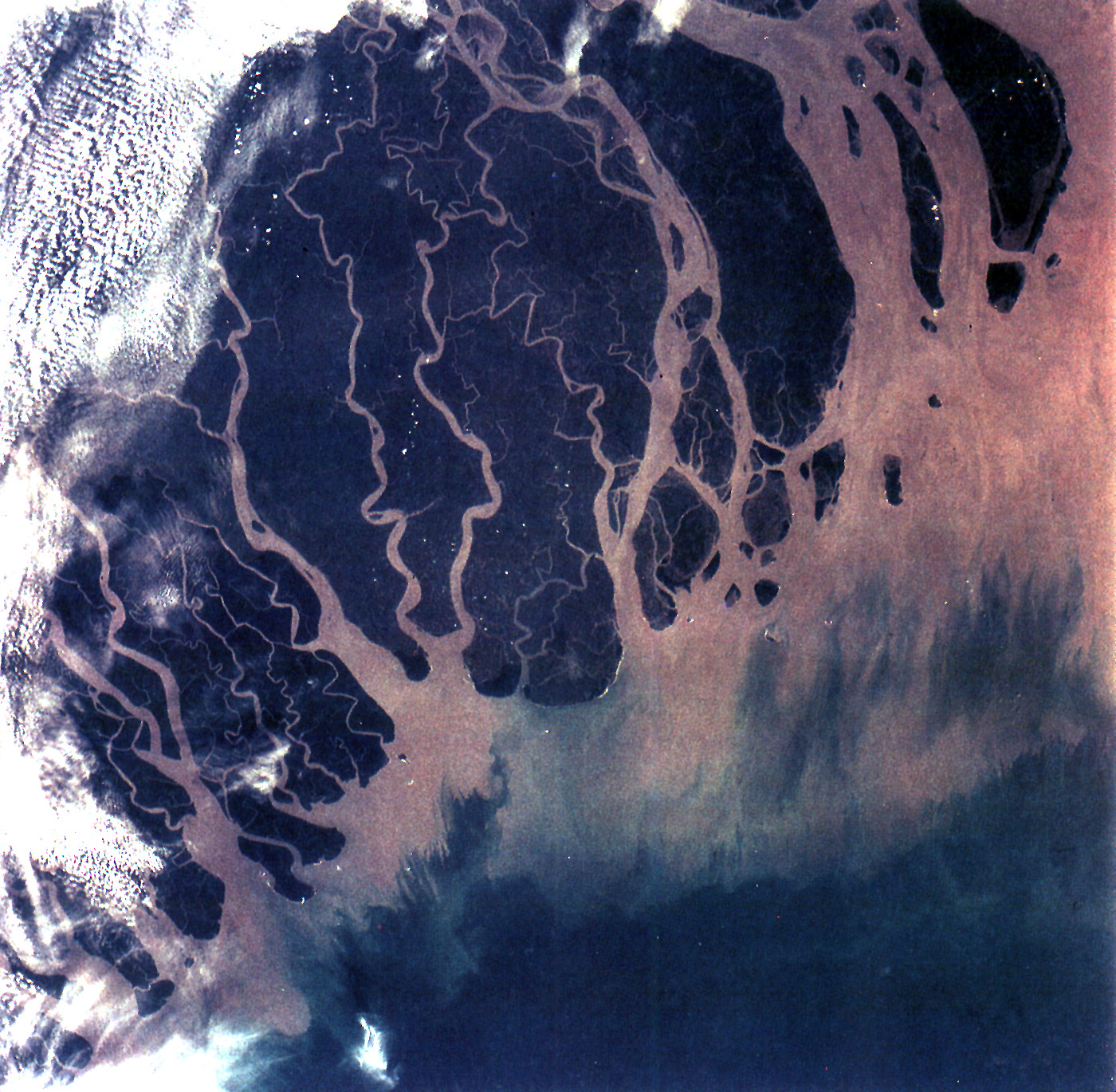
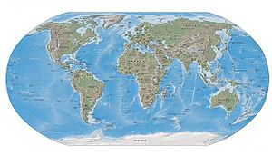 The physical world.
 The human world.
Nature of geography
Geography is
- an academic discipline – a body of knowledge given to - or received by - a disciple (student); a branch or sphere of knowledge, or field of study, that an individual has chosen to specialise in. Modern geography is an all-encompassing discipline that seeks to understand the Earth and all of its human and natural complexities—not merely where objects are, but how they have changed and come to be. Geography has been called 'the world discipline'.[2]
- a field of science – widely-recognized category of specialized expertise within science, and typically embodies its own terminology and nomenclature. Such a field will usually be represented by one or more scientific journals, where peer reviewed research is published. There are many geography-related scientific journals.
- a natural science – field of academic scholarship that explores aspects of natural environment (physical geography).
- a social science – field of academic scholarship that explores aspects of human society (human geography).
- an interdisciplinary field – a field that crosses traditional boundaries between academic disciplines or schools of thought, as new needs and professions have emerged. Many of the branches of physical geography are also branches of Earth science.
Etymology of geography
Etymology of "geography": from Greek γεωγραφία - geographia, lit. "earth describe-write"[3]
- geo- – a prefix taken from the Greek word γη or γαια meaning "earth", usually in the sense of "ground or land". Geo- is a prefix for many words dealing in some way with the earth.
- -graphy – an English suffix. Words that include this suffix usually are about a work, an art, or a field of study.
Branches of geography
As "the bridge between the human and physical sciences," geography is divided into two main branches:
Other branches include:
- integrated geography
- geomatics
- regional geography
All the branches are further described below...
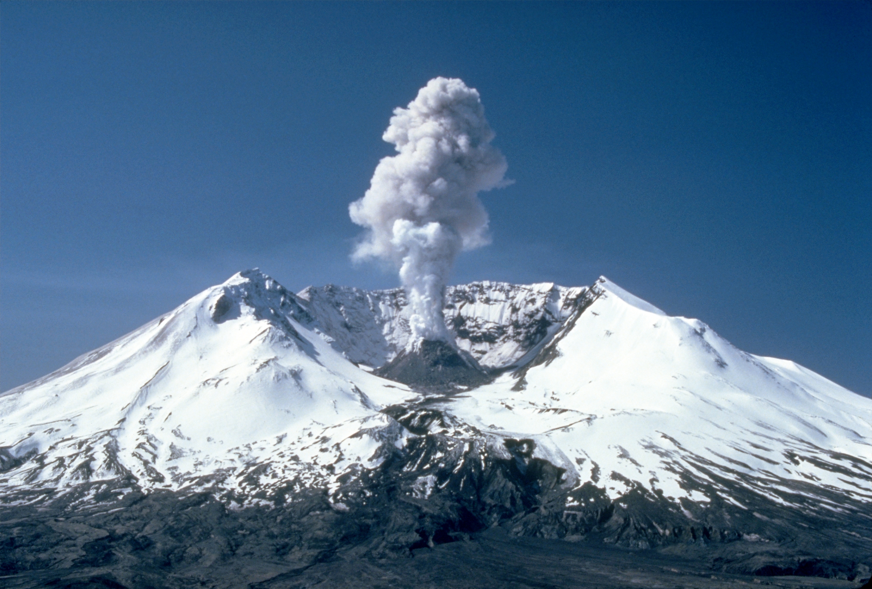
Physical geography
- Physical geography – examines the natural environment and how the climate, vegetation & life, soil, water, and landforms are produced and interact.[7]
Fields of physical geography
- Geomorphology – study of landforms and the processes that shape them, and more broadly, the evolution of processes controlling the topography of any planet. Seeks to understand why landscapes look the way they do, to understand landform history and dynamics, and to predict future changes through a combination of field observation, physical experiment, and numerical modeling.
- Hydrology – study of the movement, distribution, and quality of water throughout the Earth, including the hydrologic cycle, water resources and environmental watershed sustainability.
- Glaciology – study of glaciers, or more generally ice and natural phenomena that involve ice.
- Oceanography – studies a wide range of topics pertaining to oceans, including marine organisms and ecosystem dynamics; ocean currents, waves, and geophysical fluid dynamics; plate tectonics and the geology of the sea floor; and fluxes of various chemical substances and physical properties within the ocean and across its boundaries.
- Biogeography – study of the distribution of species spatially and temporally. Over areal ecological changes, it is also tied to the concepts of species and their past, or present living 'refugium', their survival locales, or their interim living sites. It aims to reveal where organisms live, and at what abundance.[8]
- Climatology – study of climate, scientifically defined as weather conditions averaged over a period of time.[9]
- Meteorology is the interdisciplinary scientific study of the atmosphere that focuses on weather processes and short term forecasting (in contrast with climatology).
- Pedology – study of soils in their natural environment[10] that deals with pedogenesis, soil morphology, and soil classification.
- Palaeogeography – study of what the geography was in times past, most often concerning the physical landscape, but also the human or cultural environment.
- Coastal geography – study of the dynamic interface between the ocean and the land, incorporating both the physical geography (i.e. coastal geomorphology, geology and oceanography) and the human geography (sociology and history) of the coast. It involves an understanding of coastal weathering processes, particularly wave action, sediment movement and weather, and also the ways in which humans interact with the coast.
- Quaternary science – focuses on the Quaternary period, which encompasses the last 2.6 million years, including the last ice age and the Holocene period.
- Landscape ecology – the relationship between spatial patterns of urban development and ecological processes on a multitude of landscape scales and organisational levels.[11][12][13]
Approaches of physical geography
- Quantitative geography – Quantitative research tools and methods applied to geography. See also the quantitative revolution.
- Systems approach –
Human geography
- Human geography – one of the two main subfields of geography, it is the study of human use and understanding of the world and the processes which have affected it. Human geography broadly differs from physical geography in that it focuses on the built environment and how space is created, viewed, and managed by humans as well as the influence humans have on the space they occupy.[7]
Fields of human geography
- Cultural geography – study of cultural products and norms and their variations across and relations to spaces and places. It focuses on describing and analyzing the ways language, religion, economy, government and other cultural phenomena vary or remain constant, from one place to another and on explaining how humans function spatially.[14]
- Children's geographies – study of places and spaces of children's lives, characterised experientially, politically and ethically. Children's geographies rests on the idea that children as a social group share certain characteristics which are experientially, politically and ethically significant and which are worthy of study. The pluralisation in the title is intended to imply that children's lives will be markedly different in differing times and places and in differing circumstances such as gender, family, and class. The range of focii within children's geographies include:
- Children and the city
- Children and the countryside
- Children and technology
- Children and nature,
- Children and globalisation
- Methodologies of researching children's worlds
- Ethics of researching children's worlds
- Otherness of childhood
- Animal geographies – studies the spaces and places occupied by animals in human culture, because social life and space is heavily populated by animals of many differing kinds and in many differing ways (e.g. farm animals, pets, wild animals in the city). Another impetus that has influenced the development of the field are ecofeminist and other environmentalist viewpoints on nature-society relations (including questions of animal welfare and rights).
- Language geography – studies the geographic distribution of language or its constituent elements. There are two principal fields of study within the geography of language:
- Sexuality and space – encompasses all relationships and interactions between human sexuality, space, and place, including the geographies of LGBT residence, public sex environments, sites of queer resistance, global sexualities, sex tourism,[21] the geographies of prostitution and adult entertainment, use of sexualised locations in the arts,[22][23] and sexual citizenship.[24]
- Religion geography – study of the impact of geography, i.e. place and space, on religious belief.[25]
- Children's geographies – study of places and spaces of children's lives, characterised experientially, politically and ethically. Children's geographies rests on the idea that children as a social group share certain characteristics which are experientially, politically and ethically significant and which are worthy of study. The pluralisation in the title is intended to imply that children's lives will be markedly different in differing times and places and in differing circumstances such as gender, family, and class. The range of focii within children's geographies include:
- Development geography – study of the Earth's geography with reference to the standard of living and quality of life of its human inhabitants. Measures development by looking at economic, political and social factors, and seeks to understand both the geographical causes and consequences of varying development, in part by comparing More Economically Developed Countries (MEDCs) with Less Economically Developed Countries (LEDCs).
- Economic geography – study of the location, distribution and spatial organization of economic activities across the world. Subjects of interest include but are not limited to the location of industries, economies of agglomeration (also known as "linkages"), transportation, international trade and development, real estate, gentrification, ethnic economies, gendered economies, core-periphery theory, the economics of urban form, the relationship between the environment and the economy (tying into a long history of geographers studying culture-environment interaction), and globalization.
- Marketing geography – a discipline within marketing analysis which uses geolocation (geographic information) in the process of planning and implementation of marketing activities.[26] It can be used in any aspect of the marketing mix – the product, price, promotion, or place (geo targeting).
- Transportation geography – branch of economic geography that investigates spatial interactions between people, freight and information. It studies humans and their use of vehicles or other modes of travelling as well as how markets are serviced by flows of finished goods and raw materials.
- Health geography – application of geographical information, perspectives, and methods to the study of health, disease, and health care, to provide a spatial understanding of a population's health, the distribution of disease in an area, and the environment's effect on health and disease. It also deals with accessibility to health care and spatial distribution of health care providers.
- Time geography – study of the temporal factor on spatial human activities within the following constraints:
- Authority - limits of accessibility to certain places or domains placed on individuals by owners or authorities
- Capability - limitations on the movement of individuals, based on their nature. For example, movement is restricted by biological factors, such as the need for food, drink, and sleep
- Coupling - restraint of an individual, anchoring him or her to a location while interacting with other individuals in order to complete a task
- Historical geography – study of the human, physical, fictional, theoretical, and "real" geographies of the past, and seeks to determine how cultural features of various societies across the planet emerged and evolved, by understanding how a place or region changes through time, including how people have interacted with their environment and created the cultural landscape.
- Political geography – study of the spatially uneven outcomes of political processes and the ways in which political processes are themselves affected by spatial structures. Basically, the inter-relationships between people, state, and territory.
- Electoral geography – study of the relationship between election results and the regions they affect (such as the environmental impact of voting decisions), and of the effects of regional factors upon voting behavior.
- Geopolitics – analysis of geography, history and social science with reference to spatial politics and patterns at various scales, ranging from the level of the state to international.
- Strategic geography – concerned with the control of, or access to, spatial areas that have an impact on the security and prosperity of nations.
- Military geography – the application of geographic tools, information, and techniques to solve military problems in peacetime or war.
- Population geography – study of the ways in which spatial variations in the distribution, composition, migration, and growth of populations are related to the nature of places.
- Tourism geography – study of travel and tourism, as an industry and as a social and cultural activity, and their impact on places, including the environmental impact of tourism, the geographies of tourism and leisure economies, answering tourism industry and management concerns and the sociology of tourism and locations of tourism.
- Urban geography – the study of urban areas, in terms of concentration, infrastructure, economy, and environmental impacts.
Approaches of human geography
- Behavioral geography –
- Critical geography –
- Feminist geography –
- Marxist geography –
- Non-representational theory –
- Postcolonialism –
- Post-structuralism[27] –
- Qualitative geography – qualitative research tools and methods applied to geography.
Integrated geography
- Integrated geography – branch of geography that describes the spatial aspects of interactions between humans and the natural world. It requires an understanding of the dynamics of geology, meteorology, hydrology, biogeography, ecology, and geomorphology, as well as the ways in which human societies conceptualize the environment.
Geomatics
- Geomatics – branch of geography and the discipline of gathering, storing, processing, and delivering geographic information, or spatially referenced information. It is a widespread interdisciplinary field that includes the tools and techniques used in land surveying, remote sensing, cartography, Geographic Information Systems (GIS), Global Navigation Satellite Systems, photogrammetry, and related forms of earth mapping.
Fields contributing to geomatics
- Photogrammetry –
- Cartography –
- Digital terrain modelling –
- Geodesy –
- Geographic information systems –
- Geospatial –
- Global navigation satellite systems – (GPS, GLONASS, GALILEO, COMPASS)
- Global Positioning System –
- Hydrography –
- Mathematics –
- Navigation –
- Photogrammetry –
- Remote sensing –
- Surveying –
Regional geography
Regional geography – study of world regions. Attention is paid to unique characteristics of a particular region such as its natural elements, human elements, and regionalization which covers the techniques of delineating space into regions. Regional geography breaks down into the study of specific regions.
Region – an area, defined by physical characteristics, human characteristics, or functional characteristics. The term is used in various ways among the different branches of geography. A region can be seen as a collection of smaller units, such as a country and its political divisions, or as one part of a larger whole, as in a country on a continent.
Supercontinents
 Earth may have had a single supercontinent called "Pangaea"
- Main article: List of supercontinents
A supercontinent is a landmass comprising more than one continental core, or craton.
- Afro-Eurasia (formed 5 million years ago)
- Americas (formed 15 million years ago)
- Eurasia (formed 60 million years ago)
Continents
Main article: ContinentA continent is one of several large landmasses on Earth. They are generally identified by convention rather than any specific criteria, but seven areas are commonly regarded as continents. They are:
-
- 1. Africa (outline) –
- 2. Antarctica –
- 3. Australia (outline) –
- The Americas:
- 4. North America (outline) –
- 5. South America (outline) –
- Eurasia:
Subregions
Biogeographic regions
 Map of six of the world's eight ecozonesNearcticPalearcticAfrotropicIndomalayaNeotropic
Ecozone
- Main article: Ecozone
The World Wildlife Fund (WWF) developed a system of eight biogeographic realms (ecozones):
- Nearctic 22.9 mil. km² (including most of North America)
- Palearctic 54.1 mil. km² (including the bulk of Eurasia and North Africa)
- Afrotropic 22.1 mil. km² (including Sub-Saharan Africa)
- Indomalaya 7.5 mil. km² (including the South Asian subcontinent and Southeast Asia)
- Australasia 7.7 mil. km² (including Australia, New Guinea, and neighbouring islands). The northern boundary of this zone is known as the Wallace line.
- Neotropic 19.0 mil. km² (including South America and the Caribbean)
- Oceania 1.0 mil. km² (including Polynesia, Fiji and Micronesia)
- Antarctic 0.3 mil. km² (including Antarctica).
Ecoregions
- Main article: Ecoregion
Ecozones are further divided into ecoregions. The World has over 800 terrestrial ecoregions. See Lists of ecoregions by country.
Geography of the political divisions of the World
Other regions
History of geography
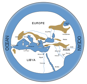 Reconstruction of Hecataeus' map of the World, created during ancient Greek times
- Main articles: History of geography and Historical geography
Topics pertaining to the geographical study of the World throughout history:
By period
- Ancient roads
- Ancient Greek geography
- Age of discovery
- Major explorations after the Age of Discovery
- Critical geography
- Environmental determinism
By region
- Chinese geography
- History of human geography in China
By subject
By field
- History of human geography
- History of physical geography
- History of regional geography
Elements of geography
Topics common to the various branches of geography include:
Tasks and tools of geography
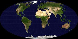 The equal-area Mollweide projection
- Main articles: Geosophy and Philosophy of geography
- Exploration – the act of traveling and searching for resources or for information about the land or space itself.
- Geocode (Geospatial Entity Object Code) – geospatial coordinate system for specifying the exact location of a geospatial point at, below, or above the surface of the earth at a given moment of time.
- Geographic information system (GIS) – set of tools that captures, stores, analyzes, manages, and presents data that are linked to location(s). Combines elements of cartography, statistical analysis, and database technology.
- Globe – a three-dimensional scale model of a spheroid celestial body such as a planet, star, or moon.
- Terrestrial globe – globe of the Earth.
- Map – a visual representation of an area, depicting the elements of that area such as objects, regions, and themes.
- Atlas – a collection of maps, typically of the Earth or a region thereof.
- Cartography – the study and practice of making maps.
- Map projection – any method of representing the surface of a sphere or other shape on a plane. Necessary for creating maps.
- Demographics – the characteristics of a human population as used in government, marketing or opinion research, or the demographic profiles used in such research. Distinct from demography, which is the statistical study of human populations.
- Spatial analysis – a variety of statistical techniques used to study entities using their topological, geometric, or geographic properties.
- Surveying – the technique and science of accurately determining the terrestrial or three-dimensional position of points and the distances and angles between them. These points are usually on the surface of the Earth, and they are often used to establish land maps and boundaries for ownership or governmental purposes.
Types of geographic features
Geographic feature – component of a planet that can be referred to as a location, place, site, area, or region, and therefore may show up on a map. A geographic feature may be natural or man-made.
Location and place
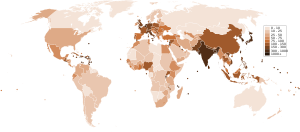 Population density per square kilometre by country, 2006
- Location –
- Place
- Aspects of a place or region
- Lists of places –
Natural geographic features
Natural geographic feature – an ecosystem or natural landform.
Ecosystems
- Biodiversity hotspot
- Ecozone –
- Biome –
- Bioregion –
- Biotope –
- Bioelement –
- Biotope –
- Bioregion –
Natural landforms
 See also: List of landforms
Natural landform – terrain or body of water. Landforms are topographical elements, and are defined by their surface form and location in the landscape. Landforms are categorized by traits such as elevation, slope, orientation, stratification, rock exposure, and soil type. Some landforms are man-made, such as artificial islands, but most landforms are natural.
Natural terrain feature types
- Continent –
- Island –
- Mainland –
- Mountain –
- Mountain range –
- Subcontinent –
Natural body of water types
- Natural bodies of water –
- Bodies of sea water
- Bodies of fresh water
- Bayou –
- Lake (list) –
- Oxbow lake –
- Subglacial lake –
- Tarn –
- Pool –
- Pond –
- Tide pool –
- Vernal pool –
- Puddle –
- River (list) –
- Roadstead –
- Spring –
- Boil -
- Stream –
- Wetland –
- Freshwater marsh –
- Slough (wetland) –
Man-made geographic features
Man-made geographic feature – a thing that was made by humans that may be indicated on a map. It may be physical and exist in the real world (like a bridge or city), or it may be abstract and exist only on maps (such as the Equator, which has a defined location, but cannot be seen where it lies).
- Artificial geographic feature – physical man-made construct that is part of the landscape (and anthrosphere). Some examples include Tokyo, the Great Wall of China, the Suez Canal, Interstate 5, and the Boeing Everett Factory.
- Settlement –
- Village –
- Town –
- City –
- Metropolitan area
- Megalopolis –
- Engineered construct – built feature of the landscape such as a highway, bridge, airport, railroad, building, dam, or reservoir. See also construction engineering and infrastructure.
- Artificial landforms
- Airport – place where airplanes can take off and land, including one or more runways and one or more passenger terminals.
- Aqueduct – artificial channel that is constructed to convey water from one location to another.
- Breakwater – construction designed to break the force of the sea to provide calm water for boats or ships, or to prevent erosion of a coastal feature.
- Bridge – structure built to span a valley, road, body of water, or other physical obstacle such as a canyon, for the purpose of providing passage over the obstacle.
- Building – closed structure with walls and a roof.
- Canal – artificial waterway, often connecting one body of water with another.
- Causeway –
- Dam – structure placed across a flowing body of water to stop the flow, usually to use the water for irrigation or to generate electricity.
- Farm – place where agricultural activities take place, especially the growing of crops or the raising of livestock.
- Manmade harbor – harbor that has deliberately-constructed breakwaters, sea walls, or jettys, or which was constructed by dredging.
- Industrial region
- Marina –
- Orchard –
- Parking lot –
- Pier –
- Pipeline –
- Port –
- Railway –
- Ranch –
- Reservoir –
- Road –
- Highway –
- Race track –
- Street –
- Subsidence crater –
- Ski resort –
- Train station –
- Tree farm –
- Tunnel –
- Viaduct –
- Wharf –
- Settlement –

- Abstract geographic feature – does not exist physically in the real world, yet has a location by definition and may be displayed on maps.
- Geographical zone
- Political division –
- Nation
- Administrative division –
- Country subdivision – a designated territory created within a country for administrative or identification purposes. Examples of the types of country subdivisions:
- Bailiwick –
- Canton –
- Commune –
- County –
- Department –
- District –
- Duchy –
- Emirate –
- Federal state –
- Parish –
- Prefecture –
- Province –
- Region –
- Rural district –
- Settlement –
- Municipality –
- City –
- Village –
- Shire –
- State –
- Subdistrict –
- Subprefecture –
- Voivodeship –
- Wilayat –
- Cartographical feature – theoretical construct used specifically on maps that doesn't have any physical form apart from its location.
Geographic features that include the natural and man-made
Geography awards
 Hubbard Medal awarded to Anne Morrow Lindbergh, showing her flight route
Some awards and competitions in the field of geography:
- Geography Cup –
- Gold Medal –
- Hubbard Medal –
- National Geographic World Championship –
- Victoria Medal –
Persons influential in geography
A geographer is a scientist who studies Earth's physical environment and human habitat. Geographers are historically known for making maps, the subdiscipline of geography known as cartography. They study the physical details of the environment and also its impact on human and wildlife ecologies, weather and climate patterns, economics, and culture. Geographers focus on the spatial relationships between these elements.
Influential physical geographers
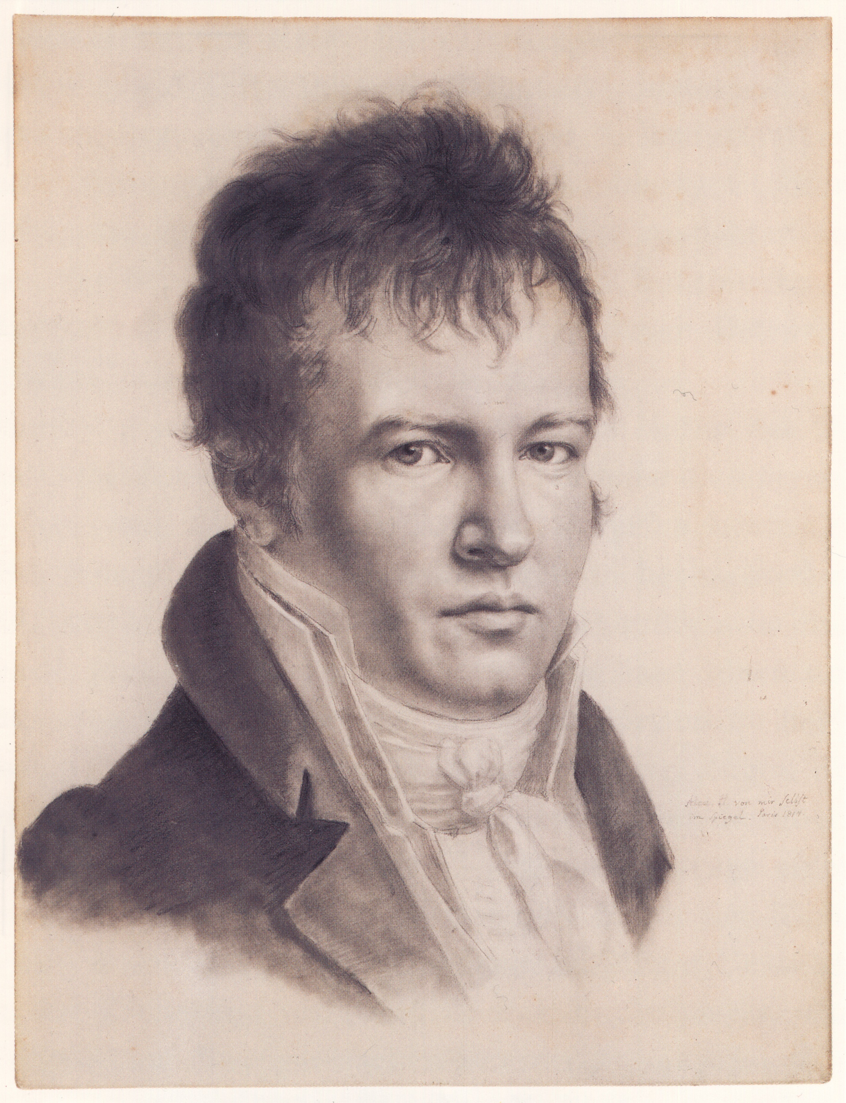
 Alexander Von Humboldt, considered to be the founding father of physical geography.
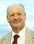 Richard Chorley, 20th-century geographer who progressed quantitative geography and who helped bring the systems approach to geography.
- Eratosthenes (276 – 194 BC) – who made the first known reliable estimation of the Earth's size.[29] He is considered the father of geodesy.[29][30]
- Ptolemy (c.90 – c.168) – who compiled Greek and Roman knowledge to produce the book Geographia.
- Abū Rayhān Bīrūnī (973 – 1048 AD) – considered te father of geodesy.[31][32][verification needed]
- Ibn Sina (Avicenna, 980–1037) – who formulated the law of superposition and concept of uniformitarianism in The Book of Healing.[citation needed]
- Muhammad al-Idrisi (Dreses, 1100 – c.1165) – who drew the Tabula Rogeriana, the most accurate world map in pre-modern times.[33]
- Piri Reis (1465 – c.1554) – whose Piri Reis map is the oldest surviving world map to include the Americas and possibly Antarctica
- Gerardus Mercator (1512–1594) – an innovative cartographer and originator of the Mercator projection.
- Bernhardus Varenius (1622–1650) – Wrote his important work "General Geography" (1650) – first overview of the geography, the foundation of modern geography.
- Mikhail Lomonosov (1711–1765) – father of Russian geography and founded the study of glaciology.
- Alexander Von Humboldt (1769–1859) – considered the father of modern geography. Published Kosmos and founded the study of biogeography.
- Arnold Henry Guyot (1807–1884) – who noted the structure of glaciers and advanced the understanding of glacial motion, especially in fast ice flow.
- Louis Agassiz (1807–1873) – the author of a glacial theory which disputed the notion of a steady-cooling Earth.
- Alfred Russel Wallace (1823–1913) – founder of modern biogeography and the Wallace line.
- Vasily Dokuchaev (1840–1903) – patriach of Russian geography and founder of pedology.
- Wladimir Peter Köppen (1846–1940) – developer of most important climate classification and founder of Paleoclimatology.
- William Morris Davis (1850–1934) – father of American geography, founder of Geomorphology and developer of the geographical cycle theory.
- Walther Penck (1888–1923) – proponent of the cycle of erosion and the simultaneous occurrence of uplift and denudation.
- Sir Ernest Shackleton (1874–1922) – Antarctic explorer during the Heroic Age of Antarctic Exploration.
- Robert E. Horton (1875–1945) – founder of modern hydrology and concepts such as infiltration capacity and overland flow.
- J Harlen Bretz (1882–1981) – pioneer of research into the shaping of landscapes by catastrophic floods, most notably the Bretz (Missoula) floods.
- Willi Dansgaard (born 1922) – palaeoclimatologist and quaternary scientist, instrumental in the use of oxygen-isotope dating and co-identifier of Dansgaard-Oeschger events.
- Hans Oeschger (1927–1998) – palaeoclimatologist and pioneer in ice core research, co-identifier of Dansgaard-Orschger events.
- Richard Chorley (1927–2002) – a key contributor to the quantitative revolution and the use of systems theory in geography.
- Sir Nicholas Shackleton (1937–2006) – who demonstrated that oscillations in climate over the past few million years could be correlated with variations in the orbital and positional relationship between the Earth and the Sun.
- Stefan Rahmstorf (born 1960) – professor of abrupt climate changes and author on theories of thermohaline dynamics.
Influential human geographers
 Sketch of Carl Ritter
 Paul Vidal de la Blache
 David Harvey
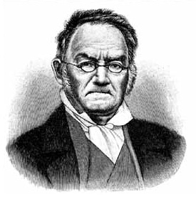
- Carl Ritter (1779–1859) – considered to be one of the founding fathers of modern geography and first chair in geography at the Humboldt University of Berlin, also noted for his use of organic analogy in his works.
- Friedrich Ratzel (1844–1904) – environmental determinist, invented the term Lebensraum
- Paul Vidal de la Blache (1845–1918) – founder of the French School of geopolitics and possibilism.
- Sir Halford John Mackinder (1861–1947) – author of The Geographical Pivot of History, co-founder of the London School of Economics, along with the Geographical Association.
- Carl O. Sauer (1889–1975) – critic of environmental determinism and proponent of cultural ecology.
- Walter Christaller (1893–1969) – economic geographer and developer of the central place theory.
- Richard Hartshorne (1899–1992) – scholar of the history and philosophy of geography.
- Torsten Hägerstrand (1916–2004) – critic of the quantitative revolution and regional science, noted figure in critical geography.
- Milton Santos (1926–2001) winner of the Vautrin Lud prize in 1994, one of the most importants geographers in South America.
- Waldo R. Tobler (born 1930) – developer of the First law of geography.
- Yi-Fu Tuan (born 1930) A Chinese-American geographer.
- David Harvey (born 1935) – world's most cited academic geographer and winner of the Lauréat Prix International de Géographie Vautrin Lud, also noted for his work in critical geography and critique of global capitalism.
- Evelyn Stokes (1936–2005). Professor of geography at the University of Waikato in New Zealand. Known for recognizing inequality with marginalised groups including women and Māori using geography.
- Steve Butcher, Professor of Human Geographical Studies at Kent State University
- Allen J. Scott (born 1938) – winner of Vautrin Lud Prize in 2003 and the Anders Retzius Gold medal 2009; author of numerous books and papers on economic and urban geography, known for his work on regional development, new industrial spaces, agglomeration theory, global city-regions and the cultural economy.
- Edward Soja (born 1941) – noted for his work on regional development, planning and governance, along with coining the terms synekism and postmetropolis.
- Doreen Massey (born 1944) – key scholar in the space and places of globalization and its pluralities, winner of the Vautrin Lud Prize.
- Michael Watts, Class of 1963 Professor of Geography and Development Studies, University of California, Berkeley
- Nigel Thrift (born 1949) – developer of non-representational theory.
- Derek Gregory (born 1951) – famous for writing on the Israeli, U.S. and UK actions in the Middle East after 9/11, influenced by Edward Said and has contributed work on imagined geographies.
- Cindi Katz (born 1954) – who writes on social reproduction and the production of space. Writing on children's geographies, place and nature, everyday life and security.
- Gillian Rose (born 1962) – most famous for her critique: Feminism & Geography: The Limits of Geographical Knowledge (1993) – which was one of the first moves towards a development of feminist geography.
Geography educational frameworks
Educational frameworks upon which primary and secondary school curricula for geography are based upon include:
- Five themes of geography[34] –
- The six "essential elements" identified by the Geography Education Standards Project,[35] under which the National Geography Standards they developed are organized:[36][37]
- The World in spatial terms
- Places and regions
- Physical systems
- Human systems
- Environment and society
- The uses of geography
- The three content areas of geography from the 2010 National Assessment of Educational Progress[38] (U.S.):
- Space and place
- Environment and society
- Spatial dynamics and connections
See also
- Association of American Geographers
- Canadian Association of Geographers
- Gazetteer
- Geographer
- Geographical renaming
- Geography and places reference tables
- International Geographical Union
- Landform
- List of explorers
- Map
- Navigator
- Philosophy of geography
- World map
References
- ^ "Geography". The American Heritage Dictionary/ of the English Language, Fourth Edition. Houghton Mifflin Company. http://dictionary.reference.com/browse/geography. Retrieved October 9, 2006.
- ^ Bonnett, Alastair What is Geography? London, Sage, 2008
- ^ "Online Etymology Dictionary". Etymonline.com. http://www.etymonline.com/index.php?term=geography. Retrieved 2009-04-17.
- ^ http://web.clas.ufl.edu/users/morgans/lecture_2.prn.pdf
- ^ "1(b). Elements of Geography". Physicalgeography.net. http://www.physicalgeography.net/fundamentals/1b.html. Retrieved 2009-04-17.
- ^ Fundamentals of Physical Geography, 2nd Edition, by M. Pidwirny, 2006
- ^ a b "What is geography?". AAG Career Guide: Jobs in Geography and related Geographical Sciences. Association of American Geographers. Archived from the original on October 6, 2006. http://web.archive.org/web/20061006152742/http://www.aag.org/Careers/What_is_geog.html. Retrieved October 9, 2006.
- ^ Martiny JBH et al. Microbial biogeography: putting microorganisms on the map Nature: FEBRUARY 2006 | VOLUME 4
- ^ Climate Prediction Center. Climate Glossary. Retrieved on 2006-11-23.
- ^ Ronald Amundsen. "Soil Preservation and the Future of Pedology" (PDF). http://natres.psu.ac.th/Link/SoilCongress/bdd/symp45/75-t.pdf. Retrieved 2006-06-08.
- ^ Wu, J. 2006. Cross-disciplinarity, landscape ecology, and sustainability science. Landscape Ecology 21:1-4.
- ^ Wu, J. and R. Hobbs (Eds). 2007. Key Topics in Landscape Ecology. Cambridge University Press, Cambridge.
- ^ Wu, J. 2008. Landscape ecology. In: S. E. Jorgensen (ed), Encyclopedia of Ecology. Elsevier, Oxford.
- ^ Jordan-Bychkov, Terry G.; Domosh, Mona; Rowntree, Lester (1994). The human mosaic: a thematic introduction to cultural geography. New York: HarperCollinsCollegePublishers. ISBN 978-0-06-500731-2.
- ^ Delgado de Carvalho, C.M. (1962). The geography of languages. In Wagner, P.L.; Mikesell, M.W. Readings in cultural geography. Chicago: University of Chicago Press, 75-93.
- ^ Pei, M. (1966). Glossary of linguistic terminology. New York: John Wiley.
- ^ Trudgill, P. (1974). Linguistic change and diffusion: description and explanation in sociolinguistic dialect geography. Language in Society 3:2, 215-46.
- ^ Trudgill, P. (1983). On dialect: social and geographical perspectives. Oxford: Basil Blackwell; New York: New York University Press.
- ^ Trudgill, P. (1975). Linguistic geography and geographical linguistics. Progress in Geography 7, 227-52
- ^ Withers, Charles W.J. [1981] (1993). Johnson, R.J. The Dictionary of Human Geography, Gregory, Derek; Smith, David M., Second edition, Oxford: Blackwell, 252-3.
- ^ Constructing tourism landscapes – gender, sexuality and space by Pritchard A. & Morgan N. J. Tourism Geographies, Volume 2, Number 2, 1 May 2000 , pp. 115-139(25)
- ^ Syllabus Poetics: Sexuality and Space in 17th - 19th Century American Literature, University at Buffalo
- ^ Space and Modern (Homo)sexuality in Tsai Ming Liang's Films by Lyn Van Swol
- ^ Sexuality and Space, Course Syllabus Towson University
- ^ Park, Chris (2004). "Religion and geography". In Hinnells, J. Routledge Companion to the Study of Religion. Routledge.
- ^ "Recommending Social Events from Mobile Phone Location Data", Daniele Quercia, et al., ICDM 2010
- ^ Harrison, Paul; 2006; "Post-structuralist Theories"; pp122-135 in Aitken, S. and Valentine, G. (eds); 2006; Approaches to Human Geography; Sage, London
- ^ Henry Petroski (2006). Levees and Other Raised Ground. 94. American Scientist. pp. 7–11.
- ^ a b Avraham Ariel, Nora Ariel Berger (2006)."Plotting the globe: stories of meridians, parallels, and the international". Greenwood Publishing Group. p.12. ISBN 0275988953
- ^ Jennifer Fandel (2006)."The Metric System". The Creative Company. p.4. ISBN 1583414304
- ^ Akbar S. Ahmed (1984). "Al-Beruni: The First Anthropologist", RAIN 60, p. 9-10.
- ^ H. Mowlana (2001). "Information in the Arab World", Cooperation South Journal 1.
- ^ S. P. Scott (1904) – History of the Moorish Empire, pp. 461-2:
The compilation of Edrisi marks an era in the history of science. Not only is its historical information most interesting and valuable, but its descriptions of many parts of the earth are still authoritative. For three centuries geographers copied his maps without alteration. The relative position of the lakes which form the Nile, as delineated in his work, does not differ greatly from that established by Baker and Stanley more than seven hundred years afterwards, and their number is the same.
- ^ Guidelines for Geographic Education—Elementary and Secondary Schools. Joint Committee on Geographic Education of the National Council for Geographic Education and the Association of American Geographers, 1984.
- ^ "The National Geography Standards". http://www.studentsfriend.com/onhist/ngs.html. Retrieved November 6, 2010.
- ^ "National Geography Standards". http://www.ncge.org/i4a/pages/index.cfm?pageid=3314. Retrieved November 6, 2010.
- ^ Richard G Boehm, Roger M Downs, Sarah W Bednarz. Geography for Life: National Geography Standards. National Council for Geographic Education, 1994
- ^ Geography Framework for the 2010 National Assessment of Educational Progress. National Assessment Governing Board, U.S. Department of Education, p. vii:
It focuses on what geography students should know to be competent and productive 21st century citizens, and uses three content areas for assessing the outcomes of geography education. These content areas are Space and Place, Environment and Society, and Spatial Dynamics and Connections.
External links
Outlines General reference · Culture and the arts · Geography and places · Health and fitness · History and events · Mathematics and logic · Natural and physical sciences · People and self · Philosophy and thinking · Religion and belief systems · Society and social sciences · Technology and applied sciencesCategories:- Outlines
- Geography
- Geography-related lists


Wikimedia Foundation. 2010.