- Outline of Jamaica
-
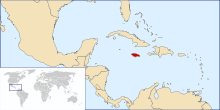 The location of Jamaica
 An enlargeable map of JamaicaSee also: Index of Jamaica-related articles
Jamaica is a sovereign island nation located on the Island of Jamaica of the Greater Antilles archipelago in the Caribbean Sea.[1] It is 234 kilometres (145 mi) long and 80 kilometres (50 mi) at its widest. It lies about 145 kilometres (90 mi) south of Cuba and 190 kilometres (120 mi) west of the Hispaniola. Its indigenous Arawakan-speaking Taíno inhabitants named the island Xaymaca, meaning the "Land of Wood and Water", or the "Land of Springs".[2] Formerly a Spanish possession known as Santiago, it later became the British West Indies Crown colony of Jamaica. It is the third most populous anglophone country in the Americas, after the United States and Canada.
The following outline is provided as an overview of and topical guide to Jamaica:
General reference
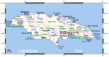
 An enlargeable basic map of Jamaica
- Pronunciation:
- Common English country name: Jamaica
- Official English country name: Jamaica
- Common endonym(s):
- Official endonym(s):
- Adjectival(s): Jamaican
- Demonym(s):
- Etymology: Name of Jamaica
- International rankings of Jamaica
- ISO country codes: JM, JAM, 388
- ISO region codes: See ISO 3166-2:JM
- Internet country code top-level domain: .jm
Geography of Jamaica
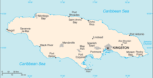
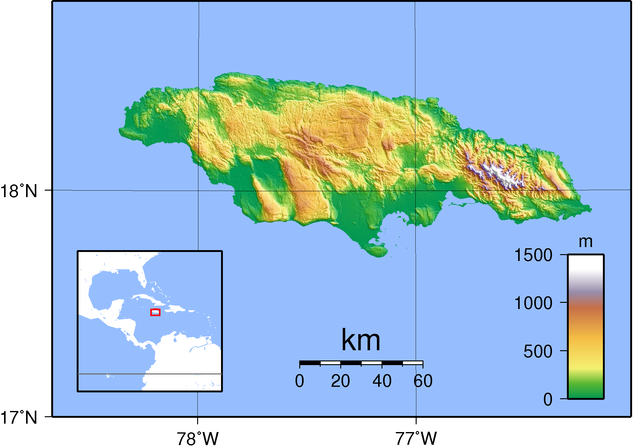
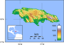 An enlargeable topographic map of JamaicaMain article: Geography of Jamaica
- Jamaica is...
- Location:
- Northern Hemisphere and Western Hemisphere
- North America (though not on the mainland)
- Atlantic Ocean
- North Atlantic
- Time zone: UTC-05
- Extreme points of Jamaica
- High: Blue Mountain Peak 2,256 m (7,402 ft)
- Low: Caribbean Sea 0 m
- Land boundaries: none
- Coastline: Caribbean Sea 1,022 km
- Northern Hemisphere and Western Hemisphere
- Population of Jamaica: 2,714,000 - UN Estimate 137th most populous country
- Area of Jamaica: 10,991 km² - 166th largest country
- Atlas of Jamaica
Environment of Jamaica
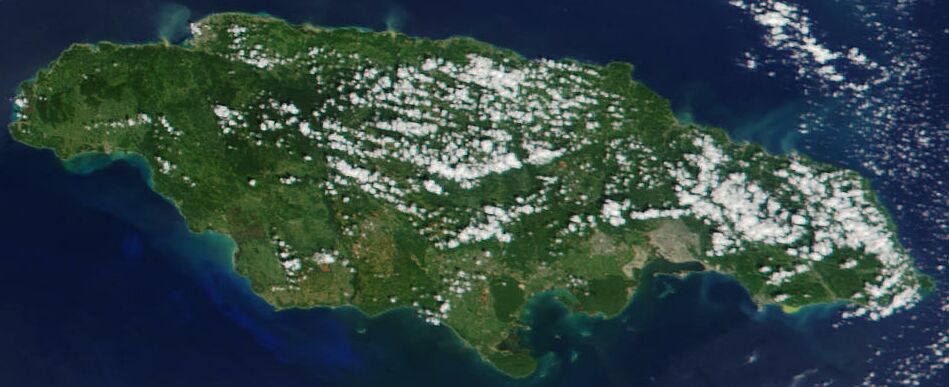
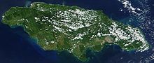 An enlargeable satellite image of JamaicaMain article: Environment of Jamaica
- Climate of Jamaica
- Environmental issues in Jamaica
- Ecoregions in Jamaica
- Renewable energy in Jamaica
- Geology of Jamaica
- Protected areas of Jamaica
- Biosphere reserves in Jamaica
- National parks of Jamaica
- Wildlife of Jamaica
- Flora of Jamaica
- Fauna of Jamaica
- Birds of Jamaica
- Mammals of Jamaica
- Effects of Hurricane Charley in Jamaica
Natural geographic features of Jamaica
Main article: Landforms of Jamaica- Beaches of Jamaica
- Islands of Jamaica
- Lakes of Jamaica
- Mountains of Jamaica
- Volcanoes in Jamaica
- Rivers of Jamaica
- Waterfalls of Jamaica
- Valleys of Jamaica
- World Heritage Sites in Jamaica (none)
Regions of Jamaica
Main article: Regions of JamaicaEcoregions of Jamaica
Main articles: List of ecoregions in Jamaica and Ecoregions in JamaicaAdministrative divisions of Jamaica
Main article: Administrative divisions of JamaicaAdministratively, Jamaica is divided into fourteen parishes. They are grouped into three historic counties, which have no administrative relevance (traditional capitals in parentheses):


- Surrey (Kingston) – yellow
- Middlesex (Spanish Town) – pink
- Cornwall (Montego Bay) – green
Parish Area
km²Population
Census 2001Capital Cornwall County 1 Hanover 450.4 67,037 Lucea 2 Saint Elizabeth 1,212.4 146,404 Black River 3 Saint James 594.9 175,127 Montego Bay 4 Trelawny 874.6 73,066 Falmouth 5 Westmoreland 807.0 138,947 Savanna-la-Mar Middlesex County 6 Clarendon 1,196.3 237,024 May Pen 7 Manchester 830.1 185,801 Mandeville 8 Saint Ann 1,212.6 166,762 Saint Ann's Bay 9 Saint Catherine 1,192.4 482,308 Spanish Town 10 Saint Mary 610.5 111,466 Port Maria Surrey County 11 Kingston (parish)(1) (2) 21.8 96,052 Kingston 12 Portland 814.0 80,205 Port Antonio 13 Saint Andrew(1) 430.7 555,828 Half Way Tree 14 Saint Thomas 742.8 91,604 Morant Bay Jamaica 10,990.5 2,607,631 Kingston (1) The parishes of Kingston and Saint Andrew together form the Kingston and St. Andrew Corporation.
(2) The parish of Kingston does not encompass all of the city of Kingston. Most of the city is in the parish of St. Andrew.Municipalities of Jamaica
Main article: Municipalities of Jamaica- Capital of Jamaica: Kingston
- Cities, towns, villages and neighbourhoods of Jamaica
Demography of Jamaica
Main article: Demographics of JamaicaGovernment and politics of Jamaica
- Main article: Government of Jamaica and Politics of Jamaica
- Form of government: parliamentary multi-party representative democratic constitutional monarchy
- Capital of Jamaica: Kingston
- Elections in Jamaica
- (specific elections)
- Political parties in Jamaica
- Political scandals of Jamaica
- Taxation in Jamaica
Branches of the government of Jamaica
Main article: Government of JamaicaExecutive branch of the government of Jamaica
- Head of state: Elizabeth II, Queen of Jamaica
- Governor General of Jamaica, the Queen's representative
- Head of government: Bruce Golding, Prime Minister of Jamaica
- Cabinet of Jamaica
Legislative branch of the government of Jamaica
- Parliament of Jamaica (bicameral)
- Upper house: Senate of Jamaica
- Lower house: House of Representatives of Jamaica
Judicial branch of the government of Jamaica
Main article: Court system of Jamaica- Supreme Court of Jamaica
- Court of Appeals of Jamaica
- Resident Magistrate's Courts of Jamaica
- Gun Court
- Commercial Court of Jamaica
- Petty Courts of Jamaica
Foreign relations of Jamaica
Main article: Foreign relations of JamaicaInternational organization membership
Jamaica is a member of:[1]
Law and order in Jamaica
Main article: Law of Jamaica- Capital punishment in Jamaica
- Constitution of Jamaica
- Crime in Jamaica
- Human rights in Jamaica
- LGBT rights in Jamaica
- Freedom of religion in Jamaica
- Law enforcement in Jamaica
- List of prisons in Jamaica
Military of Jamaica
Main article: Military of Jamaica- Command
- Commander-in-chief: Queen of Jamaica
- Ministry of Defence of Jamaica
- Commander-in-chief: Queen of Jamaica
- Forces
- Army of Jamaica
- Navy of Jamaica
- Air Force of Jamaica
- Special forces of Jamaica
- Military history of Jamaica
- Military ranks of Jamaica
Local government in Jamaica
Main article: Local government in JamaicaHistory of Jamaica
- Main article: History of Jamaica, Timeline of the history of Jamaica, and Current events of Jamaica
- Economic history of Jamaica
- Military history of Jamaica
Culture of Jamaica
Main article: Culture of Jamaica- Architecture of Jamaica
- Cuisine of Jamaica
- Ethnic minorities in Jamaica
- Festivals in Jamaica
- Humor in Jamaica
- Languages of Jamaica
- Media in Jamaica
- National symbols of Jamaica
- Coat of arms of Jamaica
- Flag of Jamaica
- National anthem of Jamaica
- People of Jamaica
- Prostitution in Jamaica
- Public holidays in Jamaica
- Records of Jamaica
- Religion in Jamaica
- Buddhism in Jamaica
- Christianity in Jamaica
- Hinduism in Jamaica
- Islam in Jamaica
- Judaism in Jamaica
- Sikhism in Jamaica
- World Heritage Sites in Jamaica(none)
- List of National Heritage Sites in Jamaica
Art in Jamaica
- Art in Jamaica
- Cinema of Jamaica
- Literature of Jamaica
- Music of Jamaica
- Television in Jamaica
- Theatre in Jamaica
Sports in Jamaica
Main article: Sports in JamaicaEconomy and infrastructure of Jamaica
Main article: Economy of Jamaica- Economic rank, by nominal GDP (2007): 110th (one hundred and tenth)
- Agriculture in Jamaica
- Banking in Jamaica
- National Bank of Jamaica
- Communications in Jamaica
- Internet in Jamaica
- Companies of Jamaica
- Economic history of Jamaica
- Energy in Jamaica
- Energy policy of Jamaica
- Oil industry in Jamaica
- Mining in Jamaica
- Tourism in Jamaica
- Transport in Jamaica
Education in Jamaica
Main article: Education in Jamaica- List of schools in Jamaica
- List of colleges in Jamaica
- List of universities in Jamaica
Infrastructure of Jamaica
- Health care in Jamaica
- Transportation in Jamaica
- Airports in Jamaica
- Rail transport in Jamaica
- List of railway lines of Jamaica
- List of railway stations in Jamaica
- Roads in Jamaica
- Water transport in Jamaica
- List of lighthouses in Jamaica
- Water supply and sanitation in Jamaica
- Water resources management in Jamaica
See also
Main article: Jamaica- Commonwealth realm
- Index of Jamaica-related articles
- List of Jamaica-related topics
- List of international rankings
- Member state of the Commonwealth of Nations
- Member state of the United Nations
- Monarchy of Jamaica
- Outline of geography
- Outline of North America
- Outline of the Caribbean
References
- ^ a b "Jamaica". The World Factbook. United States Central Intelligence Agency. July 6, 2009. https://www.cia.gov/library/publications/the-world-factbook/geos/jm.html. Retrieved July 23, 2009.
- ^ The United Confederation of Taíno People. "Taíno Dictionary" (in Spanish). Archived from the original on 2007-10-16. http://web.archive.org/web/20071016055722/http://www.uctp.org/VocesIndigena.html. Retrieved 2007-10-18.
External links
- Official website of Queen Elizabeth as Queen of Jamaica
- Official website of the Jamaica Information Service
- The Cabinet Office of the Government of Jamaica
- National Library of Jamaica materials in the Digital Library of the Caribbean
- Wikimedia Atlas of Jamaica
- Outline of Jamaica travel guide from Wikitravel
- Jamaica, an external wiki
- Outline of Jamaica at the Open Directory Project
- Jamaica entry at The World Factbook
- detailed Satellite maps on Google
- Jamaica Environment Trust
Outlines General reference · Culture and the arts · Geography and places · Health and fitness · History and events · Mathematics and logic · Natural and physical sciences · People and self · Philosophy and thinking · Religion and belief systems · Society and social sciences · Technology and applied sciencesCategories:- Outlines of countries
- Jamaica
- Jamaica-related lists


Wikimedia Foundation. 2010.