- Geography of East Timor
-
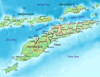 Map of East Timor indicating cities and principal roads.
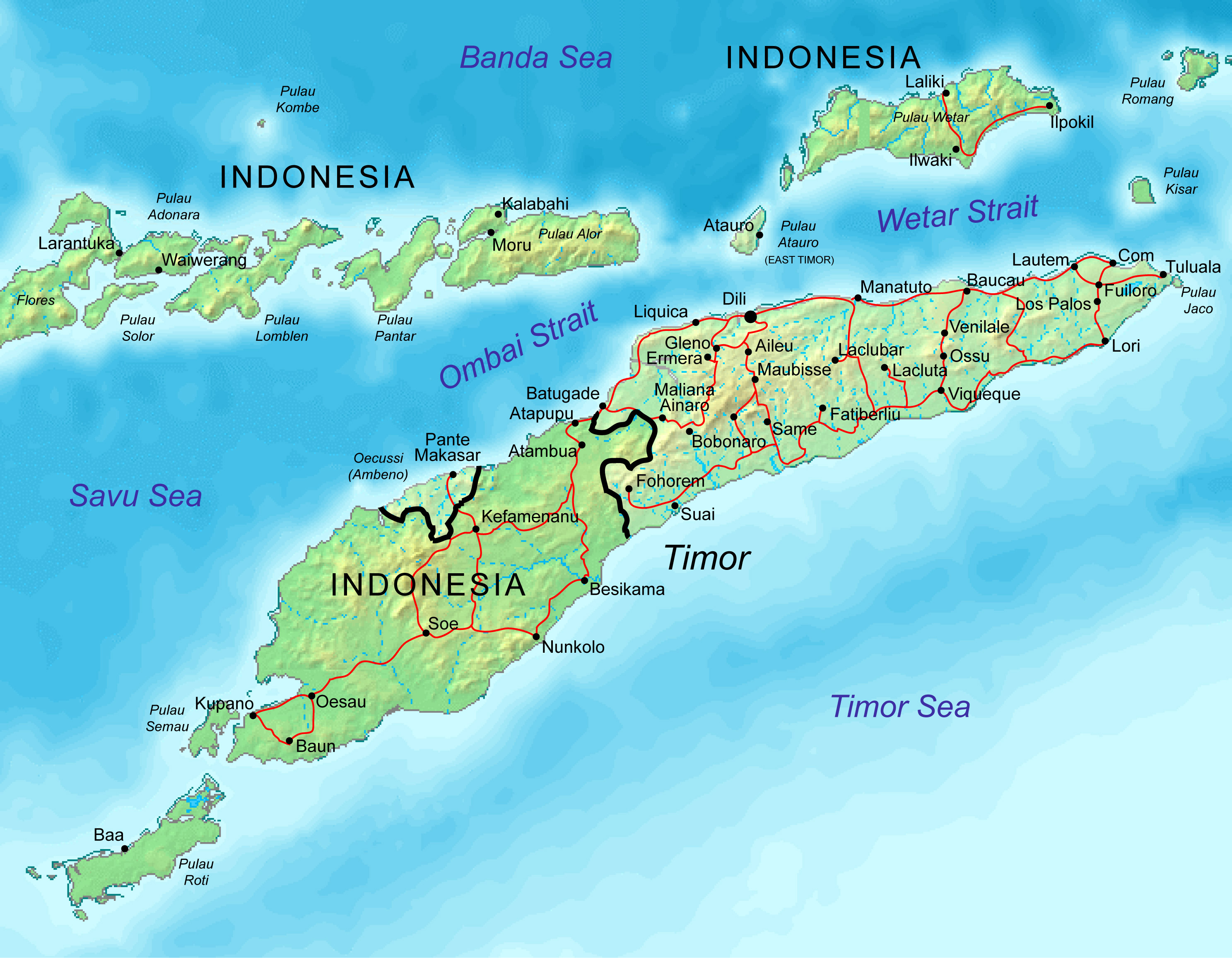
This article describes the geography of East Timor.
- Location
- Southeast Asia (or Oceania depending on definitions) [note A], northwest of Australia in the Lesser Sunda Islands at the eastern end of the Indonesian archipelago; note - East Timor includes the eastern half of the island of Timor, the Ocussi-Ambeno region on the northwest portion of the island of Timor, and the islands of Atauro and Jaco
- Geographic coordinates
- 8°50′S 125°55′E / 8.833°S 125.917°E
- Map references
- Southeast Asia, Wallacea
- Area
-
- Total: 14,874 km²
- Land: NA km²
- Water: NA km²
- Land boundaries
-
- Total: 228 km (142 mi)
- Border countries: Indonesia (228 km/142 mi)
- Coastline
- 6,789 km (4,218 mi)
- Maritime claims
-
- Contiguous zone: NA nmi
- Extended fishing zone: NA nmi
- Territorial sea: NA nmi
- Exclusive fishing zone: NA nmi
- Continental shelf: NA nmi
- Exclusive economic zone: NA nmi
Climate
- Tropical; hot, humid; distinct rainy and dry seasons
- Terrain
- Mountainous
- Elevation extremes
-
- Lowest point: Timor Sea, Savu Sea, and Banda Sea 0 m
- Highest point: Tatamailau (2,963 m/9,721 ft)
- Natural resources
- Gold, petroleum, natural gas, manganese, marble
- Land use
-
- Arable land: NA%
- Permanent crops: NA%
- Other: NA%
- Irrigated land
- 1,065 km2 (411 sq mi) (est.)
- Natural hazards
- Floods and landslides are common; earthquakes, tsunamis
- Environment - current issues
- Widespread use of slash and burn agriculture has led to deforestation and soil erosion
- Environment - international agreements
- NA
- Geography - note
- Timor is the Malay word for "Orient"; the island of Timor is part of the Malay Archipelago and is the largest and easternmost of the Lesser Sunda Islands. It was a portuguese territory until 1975, when it was invaded by Indonesia.
- East Timor is the only Asian nation to lie entirely within the Southern Hemisphere.
References
- Much of the material in this article is adapted from the CIA World Factbook 2000 and 2003.
Geography of Asia Sovereign
states- Afghanistan
- Armenia
- Azerbaijan
- Bahrain
- Bangladesh
- Bhutan
- Brunei
- Burma (Myanmar)
- Cambodia
- People's Republic of China
- Cyprus
- East Timor (Timor-Leste)
- Egypt
- Georgia
- India
- Indonesia
- Iran
- Iraq
- Israel
- Japan
- Jordan
- Kazakhstan
- North Korea
- South Korea
- Kuwait
- Kyrgyzstan
- Laos
- Lebanon
- Malaysia
- Maldives
- Mongolia
- Nepal
- Oman
- Pakistan
- Philippines
- Qatar
- Russia
- Saudi Arabia
- Singapore
- Sri Lanka
- Syria
- Tajikistan
- Thailand
- Turkey
- Turkmenistan
- United Arab Emirates
- Uzbekistan
- Vietnam
- Yemen
States with limited
recognition- Abkhazia
- Nagorno-Karabakh
- Northern Cyprus
- Palestine
- Republic of China (Taiwan)
- South Ossetia
Dependencies and
other territoriesClimate of Asia Sovereign
states- Afghanistan
- Armenia
- Azerbaijan
- Bahrain
- Bangladesh
- Bhutan
- Brunei
- Burma (Myanmar)
- Cambodia
- People's Republic of China
- Cyprus
- East Timor (Timor-Leste)
- Egypt
- Georgia
- India
- Indonesia
- Iran
- Iraq
- Israel
- Japan
- Jordan
- Kazakhstan
- North Korea
- South Korea
- Kuwait
- Kyrgyzstan
- Laos
- Lebanon
- Malaysia
- Maldives
- Mongolia
- Nepal
- Oman
- Pakistan
- Philippines
- Qatar
- Russia
- Saudi Arabia
- Singapore
- Sri Lanka
- Syria
- Tajikistan
- Thailand
- Turkey
- Turkmenistan
- United Arab Emirates
- Uzbekistan
- Vietnam
- Yemen
States with limited
recognition- Abkhazia
- Nagorno-Karabakh
- Northern Cyprus
- Palestine
- Republic of China (Taiwan)
- South Ossetia
Dependencies and
other territories- Christmas Island
- Cocos (Keeling) Islands
- Hong Kong
- Macau
Categories:
Wikimedia Foundation. 2010.