- Geography of India
Country geography
name =India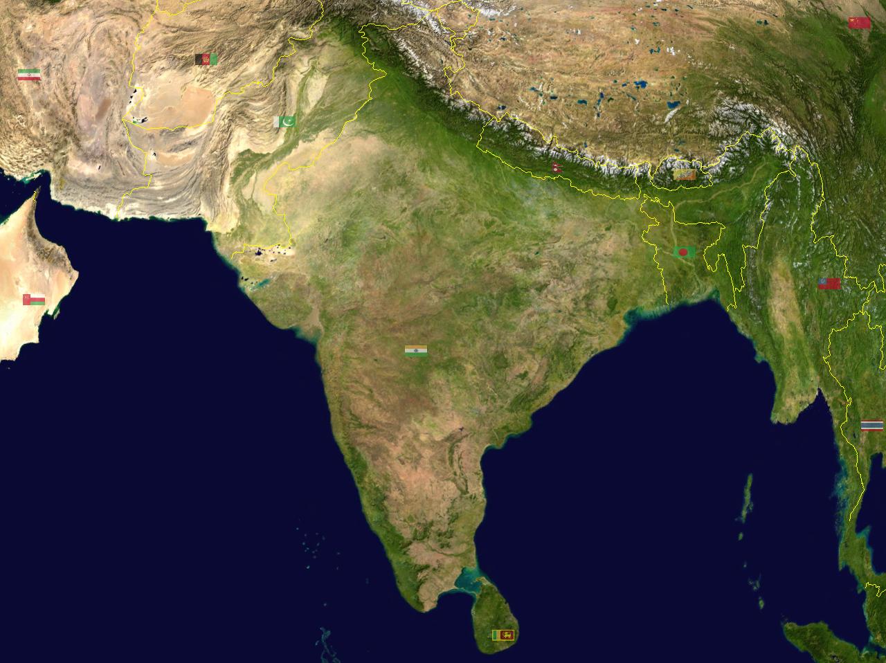
continent =Asia
region =Southern AsiaIndian subcontinent
coordinates =20°00'N 77°00'E
area ranking =7th
km area =3287263
percent land= 90.44
km coastline =7516 | borders =Total land borders:cite web |title=MINISTRY OF HOME AFFAIRS (DEPARTMENT OF BORDER MANAGEMENT) |work=MINISTRY OF HOME AFFAIRS (DEPARTMENT OF BORDER MANAGEMENT)|url=http://mha.nic.in/BM_Div/BM_Intro(E).doc
accessdate=2008-01-09]
convert|15106.70 |km|mi|0|abbr=onBangladesh : convert|4096.70|km|mi|0|abbr=on
China (PRC):
convert|3488|km|mi|0|abbr=onPakistan :
convert|3323|km|mi|0|abbr=onNepal :
convert|1751|km|mi|0|abbr=onMyanmar :
convert|1643|km|mi|0|abbr=onBhutan :
convert|699|km|mi|0|abbr=onAfghanistan :
convert|106|km|mi|0|abbr=on
highest point=K2 India officially regardsK2 , located inPakistan Occupied Kashmir as its highest peak. ] convert|8611|m|ft|0|abbr=on
lowest point=Kuttanad
convert|-2.2|m|ft|1|abbr=on| longest river=Ganges –Brahmaputra
largest lake=Chilka Lake
The geography of India is diverse, with landscape ranging from snow-capped mountain ranges to deserts, plains, rainforests, hills, and plateaus.India comprises most of theIndian subcontinent situated on theIndian Plate , the northerly portion of theIndo-Australian Plate . Having a coastline of over convert|7000|km|mi|0, most of India lies on a peninsula inSouthern Asia that protrudes into theIndian Ocean . India is bounded in the southwest by theArabian Sea and in the east and southeast by theBay of Bengal .The fertile
Indo-Gangetic Plain occupies most of northern, central, and eastern India, while theDeccan Plateau occupies most of southern India. To the west of the country is theThar Desert , which consists of a mix of rocky and sandy desert. India's east and northeastern border consists of the high Himalayan range. The highest point in India is disputed owing to aterritorial dispute withPakistan ; according to India's claim, the highest point (located in the disputed Northern areas Pakistan) isK2 , at convert|8611|m|ft|0. The highest point in undisputed Indian territory isKangchenjunga , at convert|8598|m|ft|0|abbr=on. Climate ranges from equatorial in the far south, to Alpine in the upper reaches of the Himalayas.India is bordered by
Pakistan to the northwest, [The Indian government considers the entire state ofJammu and Kashmir to be a part of India. This state borders a part ofAfghanistan . A ceasefire sponsored by theUnited Nations in 1948 freezes the positions of Indian- and Pakistani-held territory. As a result, the region bordering Afghanistan is in Pakistani-administered territory.]China ,Bhutan andNepal to the north,Myanmar to the east andBangladesh to the east ofWest Bengal .Sri Lanka , theMaldives andIndonesia areisland nation s to the south of India. Sri Lanka is separated from India by a narrow channel of sea formed byPalk Strait and theGulf of Mannar .Politically, India is divided into 28 states, and seven federally administeredunion territories . The political divisions generally follow linguistic and ethnic boundaries rather than geographic transitions.Location and extent
India lies to the north of the equator between 8°4' and 37°6' north latitude and 68°7' and 97°25' east longitude.cite book |title=India Yearbook 2007 |publisher=Publications Division, Ministry of Information & Broadcasting, Govt. Of India |isbn=81-230-1423-6 |pages=Pg. 1 ] It is the seventh-largest country in the world, with a total land area of convert|3287263|km2|sqmi|0.cite web | title=India Details on Official India Government website| url=http://india.gov.in/knowindia/profile.php| accessmonthday =June 9 |accessyear=2007] India measures convert|3214|km|mi|0|abbr=on from north to south and convert|2993|km|mi|0|abbr=on from east to west. It has a land frontier of convert|15200|km|mi|0|abbr=on and a coastline of convert|7517|km|mi|0|abbr=on.cite book | title = Manorama Yearbook 2006 "(India - The Country)" | publisher = Malayala Manorama | date = 2006 | pages =Pg 515 | ISSN = 0542-5778]
India is bounded to the southwest by the Arabian Sea, to the southeast by the Bay of Bengal, and the
Indian Ocean to the south. To the north, northeast, and northwest are the Himalayas.Cape Comorin constitutes the southern tip of the mainland Indian peninsula, which narrows before ending in theIndian Ocean . The southernmost part of India isIndira Point in theAndaman and Nicobar Islands in theBay of Bengal . Theterritorial waters of India extend into the sea to a distance of twelve nautical miles measured from the appropriate baseline.cite web |title=Territorial extent of India's waters|publisher=THE INTERNATIONAL LAW OF THE SEA AND INDIAN MARITIME LEGISLATION
date=2005-04-30 |work=developments till 1965
url=http://www.irfc-nausena.nic.in/irfc/ezine/Trans2Trimph/chapters/27_law%20of%20the%20sea1.htm | accessdate=2006-05-16 ]Political geography
India is divided into 28 states (which are further subdivided into districts), seven union territories. States have their own elected government, while union territories are governed by an administrator appointed by the union government.
The state of Jammu and Kashmir is claimed by Pakistan but administered by India, and both administer part of the territory. India also claims
Aksai Chin , a small barren piece of territory inLadakh administered by China. The state ofArunachal Pradesh is claimed byChina but administered byIndia .Physiographic regions
India is divided into seven physiographic regions. They are
#The northern mountains including theHimalayas , which includes theKuen Lun and theKarakoram ranges and the northeast mountain ranges.
#Indo-Gangetic plain s
#Thar Desert
#Central Highlands andDeccan Plateau
#East Coast
#West Coast
#Bordering seas and islandsMountains
A great arc of mountains, composed of the
Himalaya ,Hindu Kush , andPatkai ranges, define the Indian subcontinent. These mountains were formed by the ongoing tectonic collision of theIndian Plate with theEurasian Plate which started some 50 million years ago. These mountain ranges are home to some of the world's tallest mountains and act as a natural barrier to cold polar winds. They also facilitate themonsoon s winds drive climate in India. Rivers that originate in these mountains provide water to the fertile Indo-Gangetic plains. These mountains are recognised by biogeographers as the boundary between two of the earth's great ecozones; thetemperate Palearctic that covers most of Eurasia, and the tropical and subtropicalIndomalaya ecozone that includes the Indian subcontinent extending intoSoutheast Asia and Indonesia. Historically, these ranges have also served as barriers to invaders.India has nine major mountain ranges having peaks of over convert|1000|m|ft|0|abbr=on. The Himalayas are the only mountain ranges to have snow-capped peaks. These ranges are:
#Aravalli Range
#Eastern Ghats
#Himalayas
#Patkai
#Vindhya Range
#Western Ghats ("Sahyadri")
#Satpura Range
#Karakoram
#Kunlun The Himalaya mountain range is the world's highest mountain range.cite book | title = Manorama Yearbook 2006 "(India - The Country)" | publisher = Malayala Manorama | date = 2006 | pages =516 | ISSN = 0542-5778] They form India's northeastern border, separating it from the rest of Asia. The Himalayas are also one of the world's youngest mountain ranges, and extend almost uninterrupted for a distance of convert|2500|m|ft|0|abbr=on, covering an area of convert|500000|km2|sqmi|0|abbr=on. The Himalayas extend from the state of Jammu and Kashmir in the west to the state of Arunachal Pradesh in the east. These states along with Himachal Pradesh, Uttarakhand, and Sikkim lie mostly in the Himalayan region. Some of the Himalayan peaks range over convert|7000|m|ft|0|abbr=on and the
snow line ranges between convert|6000|m|ft|0|abbr=on in Sikkim to around convert|3000|m|ft|0|abbr=on in Kashmir.Kangchenjunga , which lies on theSikkim –Nepal border, is the highest point in the area administered by India. Most peaks in the Himalayas remain snowbound throughout the year.The
Shiwalik , or lower Himalaya, consists of smaller hills towards the Indian side. Most of the rock formations are young and highly unstable, with landslides being a regular phenomenon during the rainy season. Many of India'shill station s are located on this range. The climate varies from subtropical in the foothills to alpine at the higher elevations of these mountain ranges.The mountains on India's eastern border with Myanmar are called as the
Patkai or the Purvanchal. They were created by the same tectonic processes that resulted in the formation of the Himalaya. The features of the Patkai ranges are conical peaks, steep slopes and deep valleys. The Patkai ranges are not as rugged or tall as the Himalayas. There are three hill ranges that come under the Patkai: The Patkai-Bum, the Garo–Khasi–Jaintia, and theLushai hills . The Garo–Khasi range is in the state of Meghalaya.Mawsynram ,a village nearCherrapunji lying on thewindward side of these hills, has the distinction of being the wettest place in the world, receiving the highest annual rainfall. [cite web |url=http://www.nios.ac.in/SecSoccour/English/Lesson07.pdf |title= Physical divisions |archiveurl=http://web.archive.org/web/20041212061106/http://www.nios.ac.in/SecSoccour/English/Lesson07.pdf |archivedate=2004-12-12] TheVindhya range runs across most of central India, covering a distance of convert|1050|km|mi|0|abbr=on. The average elevation of these hills is convert|3000|m|ft|0|abbr=on. They are believed to have been formed by the wastes created by the weathering of the ancient Aravali mountains. It geographically separates northern India from southern India. The western end of the range lies in eastern Gujarat, near its border with the state of Madhya Pradesh, and the range runs east and north almost meeting theGanges River atMirzapur .The
Satpura Range is a range of hills in central India. It begins in eastern Gujarat near the Arabian Sea coast, then runs east across Maharashtra, Madhya Pradesh and ends in the state of Chhattisgarh. It extends for a distance of convert|900|km|mi|0|abbr=on with many of its peaks rising above convert|1000|m|ft|0|abbr=on. It is triangular in shape, with its apex atRatnapuri and the two sides being parallel to the Tapti and Narmada rivers.cite book | title = Manorama Yearbook 2006 "(India - The Country)" | publisher = Malayala Manorama | date = 2006 | pages =517| ISSN = 0542-5778] It runs parallel to the Vindhya Range, which lies to the north, and these two east-west ranges divide the Indo-Gangetic plain of northern India from the Deccan Plateau lying in the south. The Narmada runs in the depression between the Satpura and Vindhya ranges, and drains the northern slope of the Satpura range, running west towards the Arabian Sea.The
Aravali Range is the oldest mountain range in India, running from northeast to southwest across Rajasthan in western India, extending approximately convert|500|km|mi|0|abbr=on. The northern end of the range continues as isolated hills and rocky ridges intoHaryana , ending nearDelhi . The highest peak isMount Abu , rising to convert|1722|m|ft|0|abbr=on, lying near the southwestern extremity of the range, close to the border with Gujarat. The Aravali Range is the eroded stub of an ancient folded mountain system that was once snow-capped. The range rose in aPrecambrian event called the Aravali-Delhiorogen . The range joins two of the ancient segments that make up the Indiancraton , theMarwar segment to the northwest of the range, and the Bundelkhand segment to the southeast.The
Western Ghats or Sahyadri mountains run along the western edge of India'sDeccan Plateau , and separate it from a narrow coastal plain along theArabian Sea . The range starts south of theTapti River near the Gujarat–Maharashtra border, and runs approximately convert|1600|km|mi|0|abbr=on across the states of Maharashtra, Goa, Karnataka, Kerala, and Tamil Nadu, almost to the southern tip of the Indian peninsula. The average elevation is around convert|1000|m|ft|0|abbr=on. TheAnai Mudi in theAnaimalai Hills at convert|2695|m|ft|0|abbr=onin Kerala is the highest peak in the Western Ghats.The
Eastern Ghats are a discontinuous range of mountains, which have been eroded and cut through by the four major rivers of southern India, the Godavari, Mahanadi, Krishna, and Kaveri. These mountain ranges extend from West Bengal in the north, through Orissa and Andhra Pradesh to Tamil Nadu in the south. They run parallel to theBay of Bengal . Though not as tall as the Western Ghats, though some of its peaks are over convert|1000|m|ft|0|abbr=on in height. The Eastern Ghats meet with the Western Ghats meet at theNilgiri hills in Tamil Nadu.Indo-Gangetic plain
The Indo-Gangetic plains are large
floodplain s of the Indus and the Ganga-Brahmaputra river systems. They run parallel to the Himalaya mountains, fromJammu and Kashmir in the west toAssam in the east, draining the states of Punjab,Haryana , parts ofRajasthan ,Uttar Pradesh ,Bihar ,Jharkhand andWest Bengal . The plains encompass an area of 700,000 km² (270,000 mile²) and vary in width through their length by several hundred kilometres. Major rivers that form a part of this system are the Ganga (Ganges) andIndus River along with their tributaries; Beas, Yamuna, Gomti, Ravi, Chambal, Sutlej and Chenab.
The great plains are sometimes classified into four divisions:
* The Bhabar belt- This is adjacent to the foothills of the Himalayas and consists of boulders and pebbles which have been carried down by the river streams. As the porosity of this belt is very high, the streams flow underground. The bhabar is generally narrow about 7-15 km wide.
* TheTerai belt- This belt lies next to the Bhabar region and is composed of newer alluvium. The underground streams reappear in this region. The region is excessively moist and thickly forested. It also receives heavy rainfall throughout the year and is populated with a variety of wildlife.
* The Bangar belt- It consists of older alluvium and forms the alluvial terrace of the flood plains. In the Gangetic plains, it has a low upland covered by laterite deposits.
* The Khadar belt- It lies in lowland areas after the Bangar belt. It is made up of fresh newer alluvium which is deposited by the rivers flowing down the plain.The Indo-Gangetic belt is the world's most extensive expanse of uninterrupted
alluvium formed by the deposition ofsilt by the numerous rivers. The plains are flat and mostly treeless, making it conducive forirrigation throughcanal s. The area is also rich inground water sources.The plains are one of the world's most intensely farmed areas. Crops grown on the Indo-Gangetic Plain are primarily
rice andwheat , grown in rotation. Other crops includemaize ,sugarcane andcotton . Also known as the Great Plains, the Indo-Gangetic plains rank among the world's most densely populated areas.The Desert
The Thar Desert (also known as the "Great Indian Desert") is a hot
desert that forms a significant portion of western India. Spread over four states inIndia —Punjab,Haryana ,Rajasthan , andGujarat it covers an area of 208,110 km² (80,350 mile²). The desert continues intoPakistan as theCholistan Desert . Most of the Thar Desert is situated inRajasthan , covering 61% of its geographic area. Most of the desert is rocky, with a small part of the extreme west of the desert being sandy.The origin of the Thar Desert is uncertain. Some geologists consider it to be 4,000 to 10,000 years old, whereas others state that
aridity began in this region much earlier. The area is characterised by extreme temperatures of above 45 °C (113 °F) in summer to below freezing in winters. Rainfall is precarious and erratic, ranging from below 120 mm (4.72 inches) in the extreme west to 375 mm (14.75 inches) eastward. The lack of rainfall is mainly due to the unique position of the desert with respect to the Aravalli range. The desert lies in the rain shadow area of theBay of Bengal arm of the southwest monsoon. The parallel nature of the range to the Arabian Sea arm also means that the desert does not receive much rainfall.The soils of the arid region are generally sandy to sandy-loam in texture. The consistency and depth vary according to the topographical features. The low-lying loams are heavier and may have a hard pan of clay,
calcium carbonate orgypsum . Because of the low population density, the effect of the population on the environment is relatively less compared to the rest of India.Highlands
The Central Highlands are composed of three main
plateau s—theMalwa Plateau in the west, theDeccan Plateau in the south, (covering most of the Indian peninsula), and theChota Nagpur Plateau inJharkhand towards the east.The Deccan Plateau is a large triangular plateau, bounded by the Vindhyas to the north and flanked by the Eastern and Western Ghats. The Deccan covers a total area of 1.9 million km² (735,000 mile²). It is mostly flat, with elevations ranging from 300 to 600 m (1,000 to 2,000 ft). [ [http://india.punjabilit.com/land/deccan_plateau.htm Deccan Plateau] ]
The name "Deccan" comes from the Sanskrit word "dakshina", which means "the south". The plateau slopes gently from west to east and gives rise to several peninsular
river s such as the Godavari, theKrishna , theKaveri and the Narmada. This region is mostly semi-arid as it lies on the leeward side of both Ghats. Much of the Deccan is covered by thorn scrub forest scattered with small regions ofdeciduous broadleaf forest. Climate ranges from hot summers to mild winters.The Chota Nagpur Plateau is a plateau in eastern India, which covers much of
Jharkhand state as well as adjacent parts ofOrissa ,Bihar , andChhattisgarh . The total area of Chota Nagpur Plateau is approximately 65,000 km² (25,000 mile²). The Chota Nagpur Plateau is made up of three smaller plateaus, the Ranchi, Hazaribagh, and Kodarma plateaus. The Ranchi plateau is the largest of the plateaus, with an average elevation of 700 m (2,300 ft). Much of the plateau is forested, covered by theChota Nagpur dry deciduous forest s. The plateau is famous for its vast reserves of ores andcoal .Besides the Great Indian peninsula, the
Kathiawar Peninsula in Gujarat is another large peninsula of India.East coast
The Eastern Coastal Plain is a wide stretch of land lying between the Eastern Ghats and the Bay of Bengal. It stretches from Tamil Nadu in the south to West Bengal in the north. Deltas of many of India's rivers form a major portion of these plains. The
Mahanadi , Godavari,Kaveri andKrishna rivers drain these plains. The region receives both the Northeast and Southwest monsoon rains with its annual rainfall averaging between 1,000 mm (40 in) and 3,000 mm (120 in). The width of the plains varies between 100 to 130 km (62 to 80 miles). [ [http://www.rainwaterharvesting.org/eco/ecp.htm The Eastern Coastal Plain] ]The plains are divided into six regions: The Mahanadi delta; the southern Andhra Pradesh plain; the Krishna Godavari deltas; the Kanyakumari coast;
Coromandel Coast and sandy coastal.West coast
The Western Coastal Plain is a narrow strip of land sandwiched between the Western Ghats and the Arabian Sea. The strip begins in Gujarat in the north and extends across the states of
Maharashtra ,Goa ,Karnataka andKerala . The plains are narrow, and range from 50 to 100 km (30 to 60 miles) in width.Small rivers and numerous backwaters inundate the region. The rivers, which originate in the Western Ghats, are fast flowing and are mostly perennial. The fast flowing nature of the rivers results in the formation of estuaries rather than deltas. Major rivers flowing into the sea are the Tapi, Narmada,
Mandovi andZuari .The coast is divided into three regions. The northern region of Maharashtra and Goa is known as the Konkan Coast, the central region of Karnataka is known as the Kanara Coast and the southern coastline of Kerala is known as the
Malabar Coast . Vegetation in this region is mostly deciduous. The Malabar Coast has its own unique ecoregion known as theMalabar Coast moist forests .Islands
India has two major offshore island possessions: the
Lakshadweep islands and theAndaman and Nicobar Islands . Both these island groups are administered by the Union government of India as Union Territories.The Lakshadweep islands lie 200 to 300 km (124 to 186 miles) off the coast of Kerala in the Arabian Sea. It consists of twelve
coral atoll s, threecoral reef s, and five banks. Ten of these islands are inhabited.The Andaman & Nicobar Islands are located between 6o and 14o North latitude and 92o and 94o East longitude. [http://india.gov.in/knowindia/ut_andaman.php National Portal of India: Know India: State and UTs ] ] The Andaman and Nicobar islands consist of 572 isles which lie in the Bay of Bengal, near the Myanmar coast. It is located 1255 km (780 miles) from
Kolkata (Calcutta) and 193 km (120 miles) fromCape Negrais in Myanmar. The territory consists of two island groups, theAndaman Islands and theNicobar Islands . The Andaman islands consist of 204 islands having a total length of 352 km (220 miles). The Nicobar Islands, which lie south of the Andamans, consist of twenty-two islands with a total area of 1,841 km² (710 mile²). The highest point isMount Thullier at 642 m (2,140 ft).Indira Point , India's southernmost land point is situated in the Nicobar islands, and lies just 189 km (117 miles) from the Indonesian island ofSumatra to the southeast.Significant islands just off the Indian coast include
Diu , a former Portuguese enclave;Majuli , Asia's largestfreshwater island;Salcette Island , India's most populous island, on whichMumbai (Bombay) city is located;Elephanta inBombay Harbour ; andSriharikota barrier island in Andhra Pradesh.Rivers
All major
rivers of India originate from one of the three main watersheds. They are:
#The Himalaya and the Karakoram ranges
#Vindhya and Satpura range in central India
#Sahyadri or Western Ghats in western IndiaThe Himalayan river networks are snow-fed and have a continuous flow throughout the year. The other two networks are dependent on the monsoons and shrink into rivulets during the dry season.
Twelve of India's rivers are classified as major, with the total catchment area exceeding 2,528,000 km² (976,000 mile²).
Himalayan rivers or the northern rivers that flow westward into Pakistan are the Indus, Beas,
Chenab , Ravi,Sutlej , and Jhelum.The Ganga-Brahmaputra-Meghana system has the largest catchment area of 1,100,000 km² (424,700 mile²). The river Ganga originates at the
Gangotri Glacier inUttarakhand . It flows in a south easterly direction, draining intoBangladesh . TheYamuna andGomti rivers also arise in the Western Himalayas and join the Ganga river in the plains. The Brahmaputra, another tributary of the Ganga originates inTibet and enters India in the far eastern state ofArunachal Pradesh . It then proceeds westwards, unifying with the Ganga in Bangladesh.The Chambal, another tributary of the Ganga originates from the Vindhya-Satpura watershed. The river flows eastward. Westward flowing rivers from this watershed are the Narmada (also called Nerbudda) and
Tapti (also spelled Tapi) rivers which drain into the Arabian Sea in Gujarat. The river network that flows from east to west constitutes 10% of the total outflow.The Western Ghats are the source of all
Deccan rivers. Major rivers in the Deccan include theMahanadi River through theMahanadi River Delta ,Godavari River ,Krishna River , andKaveri River (also spelled Cauvery), all draining into theBay of Bengal . These rivers constitute 20% of India's total outflow.cite book | title = Manorama Yearbook 2006 "(India - The Country)"| publisher = Malayala Manorama | date = 2006 | pages =518| ISSN = 0542-5778]Bodies of water
Major gulfs include the
Gulf of Cambay ,Gulf of Kutch and theGulf of Mannar . Straits include thePalk Strait which separates India from Sri Lanka and theTen Degree Channel , separating the Andamans from the Nicobar Islands and the Eight Degree Channel separating the Laccadive and Amindivi Islands from Minicoy Island towards the south. Important capes include theCape Comorin , the southern tip of mainland India,Indira Point , the southernmost location of India,Rama's Bridge andPoint Calimere . Arabian Sea is to the west of India. Bay of Bengal is to the eastern side of India while India Ocean is to the South of India.Smaller seas include the
Laccadive Sea and theAndaman Sea .There are fourcoral reef s in India and are located in; the Andaman and Nicobar Islands,Gulf of Mannar , Lakshadweep andGulf of Kutch .Important lakes include
Chilka Lake , the country's largest saltwater lake in Orissa;Kolleru Lake in Andhra Pradesh;Loktak Lake inManipur ,Dal Lake in Kashmir,Sambhar Lake in Rajasthan, and theSasthamkotta Lake in Kerala.Wetlands
Wetlands are lands transitional between aquatic and territorial system where water table is usually near the water surface and land is covered by shallow water.cite book |title=India Yearbook 2007 |publisher=Publications Division, Ministry of Information & Broadcasting, Govt. Of India |isbn=81-230-1423-6 |pages=Pg. 306 ] They also act as a buffer against the devastating effect of hurricanes and cyclones, thereby stabilizing the shoreline. It also helps in keeping a check on sea and soil erosion.India's wetland ecosystem is widely distributed from the cold and arid; from ones in the
Ladakh region in the state ofJammu and Kashmir to the ones in the wet and humid climate of peninsula India. Most of the wetlands are directly or indirectly linked to India's river networks. In 1987, National Wetland Conservation Programme was initiated by the government for wetland conservation. Under this programme, the Indian government has identified a total of 71 wetlands for conservation.Mangrove forests occur all along the Indian coastline, in sheltered estuaries, creeks, backwaters, salt marshes and mudflats. The mangrove area covers a total of 4 461 km² (1,722 mile²)cite book |title=India Yearbook 2007 |publisher=Publications Division, Ministry of Information & Broadcasting, Govt. Of India |isbn=81-230-1423-6 |pages=Pg. 309 ] which comprises 7% of the world's total mangrove cover. The Andaman and Nicobar Islands; the
Sundarbans ;Gulf of Kutch ; deltas of the Mahanadi, Godavari and Krishna; and parts of Maharashtra, Karnataka and Kerala have large mangrove covers.cite book | title = Manorama Yearbook 2006 "(India - Environment)" | publisher = Malayala Manorama | date = 2006 | pages =580| ISSN = 0542-5778] Most of the identified wetlands adjoin or are parts of sanctuaries, national parks and are thus protected.The Sundarbans
The Sundarbans delta is the largest
mangrove forest in the world. It lies at the mouth of the Ganges and is spread across areas ofBangladesh andWest Bengal ,India . The Bangladeshi and Indian portions of the jungle are listed in theUNESCO world heritage list separately as the Sundarbans andSundarbans National Park respectively, though they are parts of the same forest. The Sundarbans are intersected by a complex network of tidal waterways,mudflat s and smallisland s of salt-tolerant mangrove forests, and presents an excellent example of ongoing ecological processes.The area is known for its wide range of fauna. The most famous among these is the
Bengal Tiger , but numerous species ofbird s, spotteddeer ,crocodile s andsnake s also inhabit it. It is estimated that there are now 400 Bengal tigers and about 30,000 spotted deer in the area.Rann of Kutch
The Rann of Kutch is a
marsh y region located in the Gujarat state of India, which borders theSindh region of Pakistan. The name "Rann" comes from theHindi word "ran" meaning "salt marsh." It occupies a total area of 27 900 km² (10,800 mile²). [ [http://www.nationalgeographic.com/wildworld/profiles/terrestrial/im/im0901.html Rann of Kutch seasonal salt marsh] "Source":National Geographic Profile of India website]The region was originally a part of the Arabian Sea. Geologic forces, most likely by earthquakes, resulted in the damming up of the region, turning it into a large saltwater
lagoon . This area gradually filled with silt thus turning it into a seasonal salt marsh. During the monsoons, the area turns into a shallow marsh, often flooding to knee-depth. After the monsoons, the region turns dry and becomes parched.oil
Soils in India can be classified into 8 categories namely, alluvial soil, black soil, red soil, laterite soil, forest soil, arid & desert soil, saline & alkaline soil, and finally peaty & organic soil. [cite web | title=India Agronet website|url=http://www.indiaagronet.com/indiaagronet/soil_management/Soil_mgmt.htm| accessmonthday =July 18 |accessyear=2007] cite web | title=Food and Agriculture Organization website|url=http://www.fao.org/docrep/009/a0257e/A0257E02.htm| accessmonthday =August 2 |accessyear=2007] Of the above eight varieties, the first 4 constitute nearly 80% of total land surface. Alluvial soil constitute the largest soil group in India. It is derived from deposition of silt carried by numerous rivers. Alluvial soils are generally fertile but they lack nitrogen and tend to be phosphoric. These are found in the Great Northern plains from Punjab to Assam valley.
Black soil are well developed in the Deccan lava region of Maharashtra, Gujarat, and Madhya Pradesh.cite web | title=Krishi World website|url=http://www.krishiworld.com/html/soils10.html| accessmonthday =July 18 |accessyear=2007] These contain high percentage of clay and are thus moisture retentive. Because of these properties they are preferred for dry farming and growing cotton, linseed etc.
Red soil have a wide diffusion of iron content and are found in Tamil Nadu, Karnataka plateau, and Andhra plateau. The central highlands from Aravallis to Chota Nagpur plateau also have significant tracts of red soil. These are deficient in nitrogen, phosphorus and humus. Laterite soils are formed in tropical regions with heavy rainfall. Heavy rainfall results in leaching out all soluble material of top layer of soil. These are generally found in Western ghats, Eastern ghats and hilly areas of northeastern states which receive very heavy rainfall.
Forest soils occur on the slopes of mountains and hills in Himalayas, Western Ghats and Eastern Ghats. These generally consist of large amounts of dead leaves and other organic matter called humus. These soils are used for tea and coffee plantations.
Climate
The climate of India is comprised of a wide range of weather conditions across a vast geographic scale and varied topography, making generalisations difficult. Based on the Köppen system,
India hosts six major climatic subtypes, ranging from arid desert in the west, alpine tundra and glaciers in the north, and humid tropical regions supporting rainforests in the southwest and the island territories. Many regions have starkly differentmicroclimate s. The nation has four seasons: winter (January–February), summer (March–May), amonsoon (rainy) season (June–September), and a post-monsoon period (October–December).India's unique geography and geology strongly influence its climate; this is particularly true of the
Himalayas in the north and theThar Desert in the northwest. The Himalayas act as a barrier to the frigidkatabatic wind s flowing down fromCentral Asia . Thus,North India is kept warm or only mildly cooled during winter; in summer, the same phenomenon makes India relatively hot. Although theTropic of Cancer —the boundary between the tropics and subtropics—passes through the middle of India, the whole country is considered to be tropical.Summer lasts between March and June in most parts of India. Temperatures exceed 40 °C (104 °F) during the day. The coastal regions exceed 30 °C (86 °F) coupled with high levels of
humidity . In the Thar desert area temperatures can exceed 45 °C (113 °F).Summer is followed by the southwest
monsoon rains that provide most of India with its rainfall. The rain-bearing clouds are attracted to the low-pressure system created by the Thar Desert. The official date for the arrival of the monsoon is1 June , when the monsoon crosses the Kerala coast. The southwest monsoon splits into two arms, the Bay of Bengal arm and the Arabian Sea arm. The Bay of Bengal arm moves northwards crossing northeast India in early June. It then progresses eastwards, crossing Delhi byJune 29 . The Arabian Sea arm moves northwards and deposits much of its rain on the windward side of Western Ghats. By early July, most of India receives rain from the monsoons.The monsoons start retreating by August from northern India and by October from Kerala. This short period after the retreat is known as the retreat of the monsoons and is characterised by still weather. By November, winter starts setting in the northern areas.
Winters start in November in northern India and late December in southern India. Winters in peninsula India see mild to warm days and cool nights. Further north the temperature is cooler. Temperatures in some parts of the Indian plains sometimes fall below freezing. Most of northern India is plagued by
fog during this season.The highest temperature recorded in India was 50.6 °C (123.08 °F) in
Alwar in 1955. The lowest was −45 °C (−49 °F) in Kashmir. Recent claims of temperatures touching 55 °C (131 °F) in Orissa have been met with some scepticism by the Indian Meteorological Department, largely on the method of recording of such data.Geology
India has a varied geology spanning the entire spectrum of the geological time period. India's geological features are classified based on their era of formation.
The
Precambrian formations of Cudappah and Vindhyan systems are spread out over the eastern and southern states. A small part of this period is spread over western and central India.The
Paleozoic formations from the Cambrian, Ordovician, Silurian and Devonian system are found in the Western Himalaya region in Kashmir and Himachal Pradesh.The
Mesozoic Deccan Traps formation is seen over most of the northern Deccan. Geologists believe that the Deccan Traps were the result of sub-aerial volcanic activity. The Trap soil is black in colour and conducive to agriculture. The Carboniferous system, Permian System, Triassic and Jurassic systems are seen in the western Himalayas. The Jurassic system is also seen in Rajasthan.Tertiary imprints are seen in parts of Manipur, Nagaland, parts of Arunachal Pradesh and along the Himalayan belt. The Cretaceous system is seen in central India in the Vindhyas and part of the Indo-Gangetic plains.The Gondowana system is also seen in the Narmada River area in the Vindhyas and Satpuras. The Eocene system is seen in the western Himalayas and Assam. Oligocene formations are seen in Kutch and in Assam.
The
Pleistocene system is found over central India. It is rich in minerals such aslignite ,iron ore ,manganese , andaluminium . The Andaman and Nicobar Island groups are thought to have been formed in this era by volcanoes.cite book | title = Manorama Yearbook 2006 "(India - Geology)" | publisher = Malayala Manorama | date = 2006 | pages =521| ISSN = 0542-5778]The Himalayas are a result of the convergence and deformation of the Indo-Australian and Eurasian Plates. Their continued convergence raises the height of the Himalayas by 1 cm each year.
Natural resources
India is particularly rich in a variety of natural resources. Along with 56% arable land, it has significant sources of
coal (fourth-largest reserves in the world),iron ore,manganese ,mica ,bauxite ,titanium ore,chromite ,natural gas ,diamond s,petroleum ,limestone .cite web |title=CIA Factbook: India |work=CIA Factbook |url=https://www.cia.gov/library/publications/the-world-factbook/geos/in.html
accessdate=2007-06-16] India is self-sufficient inthorium , mined along shores of Kerala, possessing 24% of the world's known and economically available thorium. [cite web|url=http://www.world-nuclear.org/info/inf62.htm|title=Information and Issue Briefs - Thorium|publisher=World Nuclear Association|accessdate=2006-06-01]Petroleum is found off the coast of Maharashtra, Gujarat and in Assam, but meets only 40% of India's demand. Increasing amounts of natural gas are being discovered regularly especially off the coast of Andhra Pradesh.
Uranium is mined in Andhra Pradesh andgold in theKolar gold mine in Karnataka.Natural disasters
Natural disasters cause massive losses of Indian life and property. Droughts, flash floods, cyclones, avalanches, landslides brought on by torrential rains, and snowstorms pose the greatest threats. Other dangers include frequent summer dust storms, which usually track from north to south; they cause extensive property damage in North Indiaharvnb|Balfour|1976|p=995.] and deposit large amounts of dust from arid regions. Hail is also common in parts of India, causing severe damage to standing crops such as rice and wheat
In the Lower Himalaya, landslides are common. The young age of the region's hills result in labile rock formations, which are susceptible to slippages. Parts of the Western Ghats also suffer from low-intensity landslides. Avalanches occur in Kashmir, Himachal Pradesh, and Sikkim. Floods are the most common natural disaster in India. The heavy southwest monsoon rains cause the Brahmaputra and other rivers to distend their banks, often flooding surrounding areas. Though they provide rice paddy farmers with a largely dependable source of natural irrigation and fertilisation, the floods can kill thousands and displace millions. Excess, erratic, or untimely monsoon rainfall may also wash away or otherwise ruin crops.harvnb|Allaby|1998|p=42.] harvnb|Allaby|1998|p=15.] Almost all of India is flood-prone, and extreme precipitation events, such as flash floods and torrential rains, have become increasingly common in central India over the past several decades, coinciding with rising temperatures. Mean annual precipitation totals have remained steady owing to the declining frequency of weather systems that generate moderate amounts of rain. [cite journal |author=Goswami BN, Venugopal V, Sengupta D, Madhusoodanan MS, Xavier PK |title=Increasing trend of extreme rain events over India in a warming environment |journal=Science |volume=314 |issue=5804 |pages=1442–1445 |year=2006 | doi = 10.1126/science.1132027 ]
Indian agriculture is heavily dependent on the monsoon as a source of water. In some parts of India, the failure of the monsoons result in water shortages, resulting in below-average crop yields. This is particularly true of major drought-prone regions such as southern and eastern Maharashtra, northern Karnataka, Andhra Pradesh, Orissa, Gujarat, and Rajasthan. In the past, droughts have periodically led to major Indian famines, including the
Bengal famine of 1770 , in which up to one third of the population in affected areas died; the 1876–1877 famine, in which over five million people died; the 1899 famine, in which over 4.5 million died; and theBengal famine of 1943 , in which over five million died from starvation and famine-related illnesses.harvnb|Nash|2002|pp=22–23.] harvnb|Collier|Webb|2002|p=67.]According to
earthquake hazard zoning of India ,tectonic plate s beneath the earth's surface are responsible for yearly earthquakes along the Himalayan belt and in northeast India. This region is classified as a Zone V, indicating that it is a very high-risk area. Parts of western India, around theKutch region in Gujarat andKoyna in Maharashtra, are classified as a Zone IV region (high risk). Other areas have a moderate to low risk chance of an earthquake occurring.cite book | title = Manorama Yearbook 2006 "(India - The Country)" | publisher = Malayala Manorama | date = 2006 | pages =519| ISSN = 0542-5778]Tropical cyclone s, which are severe storms spun off from theIntertropical Convergence Zone , may affect thousands of Indians living in coastal regions. Cyclones bring with them heavy rains,storm surge s, and winds that often cut affected areas off from relief and supplies. In the North Indian Ocean Basin, the cyclone season runs from April to December, with peak activity between May and November.cite web |author=Atlantic Oceanographic and Meteorological Laboratory , Hurricane Research Division |title=Frequently Asked Questions: When is hurricane season? |publisher=NOAA | accessdate=2006-07-25 |url=http://www.aoml.noaa.gov/hrd/tcfaq/G1.html] Each year, an average of eight storms with sustained wind speeds greater than convert|63|km/h|lk=on form; of these, two strengthen into true tropical cyclones, which have sustained gusts greater than convert|117|km/h|abbr=on. On average, a major (Category 3 or higher) cyclone develops every other year.cite web |author=Atlantic Oceanographic and Meteorological Laboratory , Hurricane Research Division |title=Frequently Asked Questions: What are the average, most, and least tropical cyclones occurring in each basin? |publisher=NOAA |accessdate=2006-07-25 |url=http://www.aoml.noaa.gov/hrd/tcfaq/E10.html] In terms of damage and loss of life, Cyclone 05B, a supercyclone that struck Orissa on29 October 1999 , was the worst in more than a quarter century.A
tsunami caused by the2004 Indian Ocean earthquake struck the Andaman and Nicobar Islands and India's east coast resulting in the deaths of an estimated 10,000. Until then India was thought to have negligible activity related to tsunamis, though there is historical anecdotal evidence of its occurrence in the past.India has one
active volcano : the Barren Island volcano which last erupted in May 2005. There is also adormant volcano called theNarcondum and amud volcano atBaratang . All these volcanoes lie in theAndaman Islands .International agreements
India is a party to several International agreements related to environment and climate, the most prominent among them are:
See also
*
Extreme points of India
*Geology of India
*Climate of India
*Ecoregions of India
*National parks of India
*Regions of India
*Indian subcontinent
*European Digital Archive on Soil Maps of the World
*Cartography of India Notes
References
*.
*.
*.
*.
*
*
*
*
*
*
*
*
* [http://www.adrc.or.jp/publications/databook/databook_2003_eng/PDF_Eng/chapter4-2.pdf Asian and ADRC Member Countries and their Disaster Characteristics] (PDF), Accessed onJune 6 ,2005
*
*
Wikimedia Foundation. 2010.