- Narmada River
-
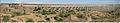
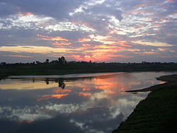 View of Picturesque Narmada Bank Near Jabalpur
 Map of the Narmada River
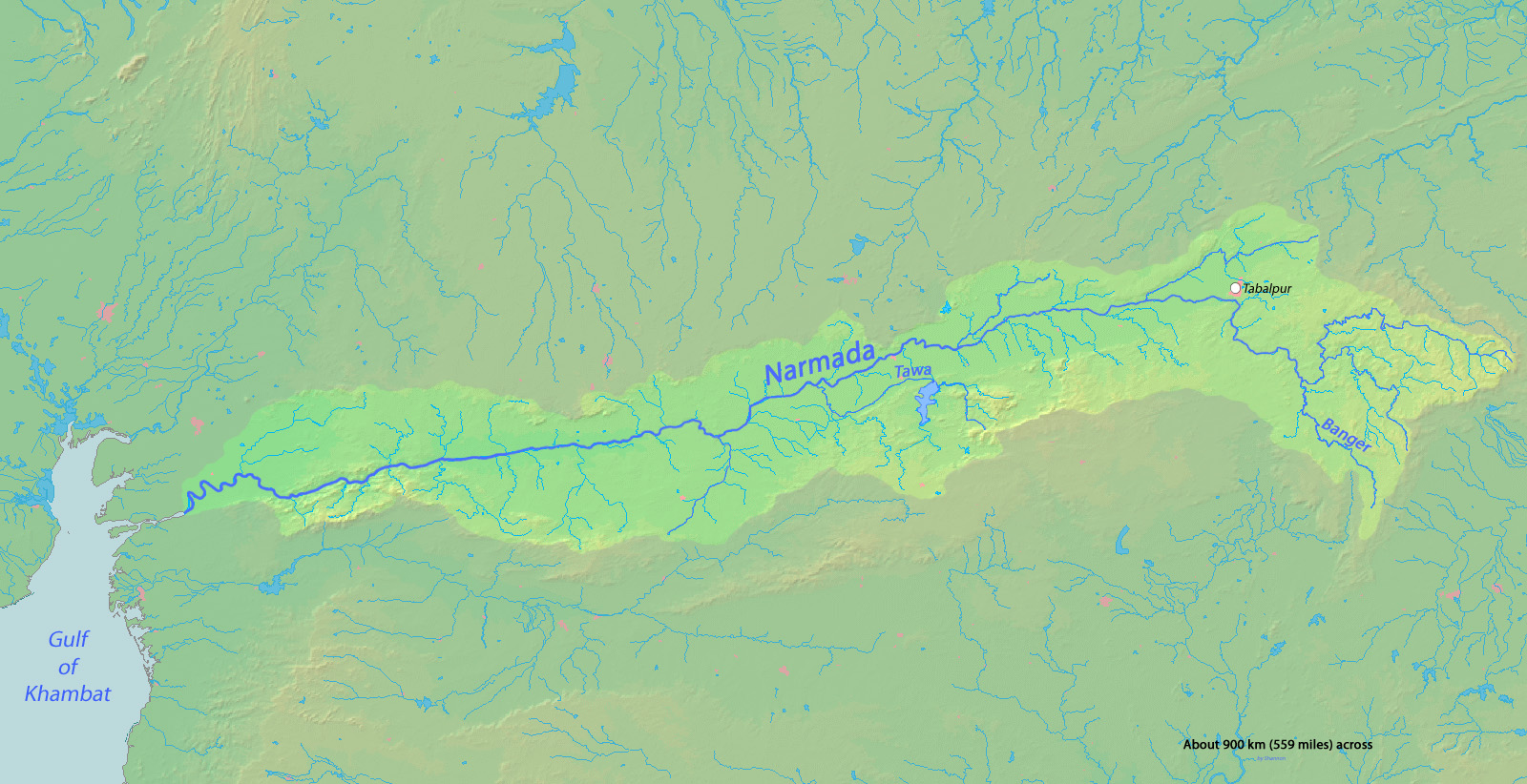
The Narmada (Devanagari: नर्मदा, Gujarati: નર્મદા), also called Rewa is a river in central India and the fifth largest river in the Indian subcontinent. It is the third largest river that completely flows within India after Ganges and Godavari. It forms the traditional boundary between North India and South India and flows westwards over a length of 1,312 km (815.2 mi) before draining through the Gulf of Cambey (Khambat) into the Arabian Sea, 30 km (18.6 mi) west of Bharuch city of Gujarat.[1] It is one of only three major rivers in peninsular India that runs from east to west (largest west flowing river) along with the Tapti River and the Mahi River. It is the only river in India that flows in a rift valley flowing west between the Satpura and Vindhya ranges although the Tapti River and Mahi River also flow through rift valleys but between different ranges. It flows through the states of Madhya Pradesh (1,077 km (669.2 mi)), Maharashtra, (74 km (46.0 mi))– (35 km (21.7 mi)) border between Madhya Pradesh and Maharashtra and (39 km (24.2 mi) border between Madhya Pradesh and Gujarat and in Gujarat (161 km (100.0 mi)).[2]
The Periplus Maris Erythraei (c. 80 CE) calls it the Nammadus,[3] and the British Raj called it the Nerbudda or Narbada.[4] Narmadā is a Sanskrit word meaning "the Giver of Pleasure".[5]
River regime
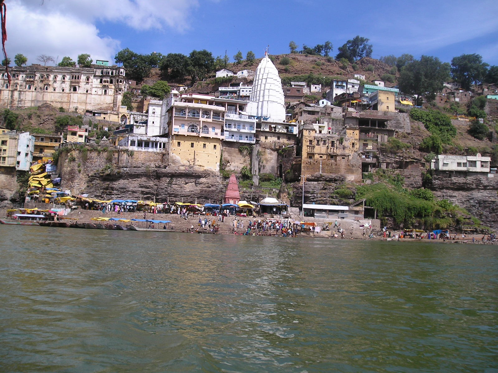
 Narmada river in Omkareshwar
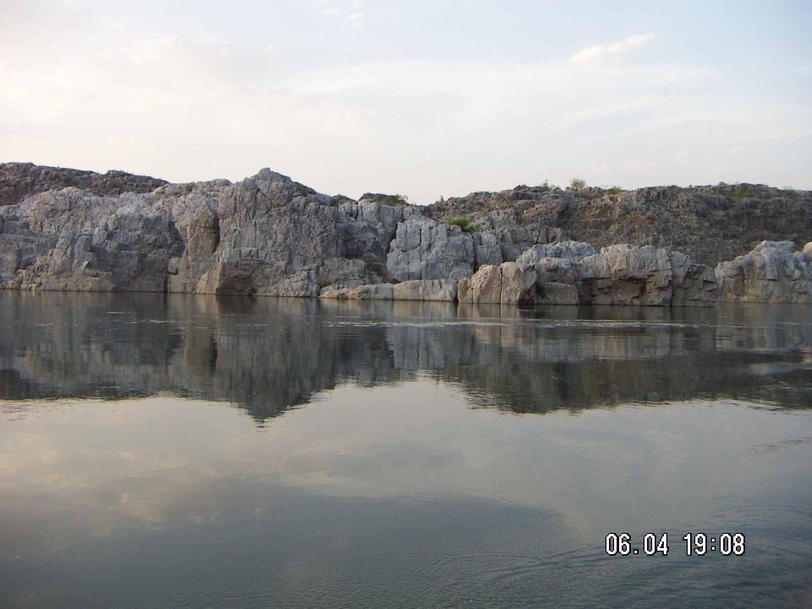
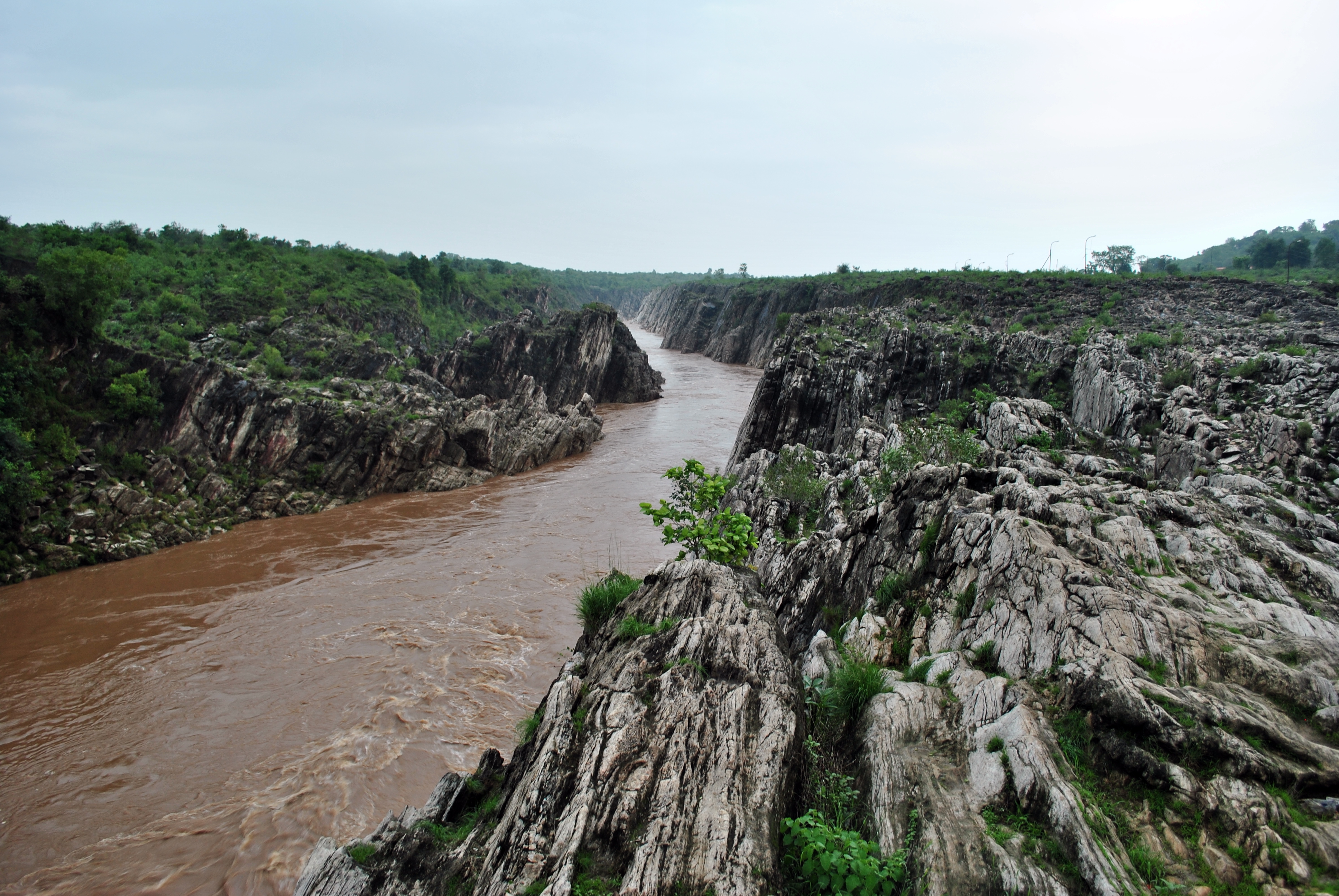
 Marble rocks alongside Narmada River
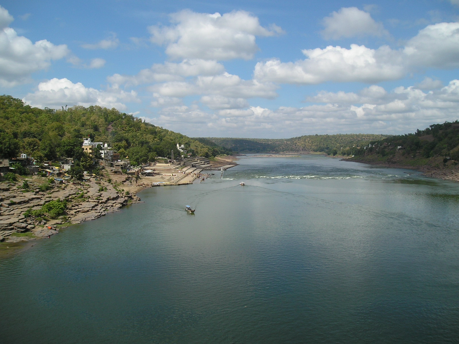
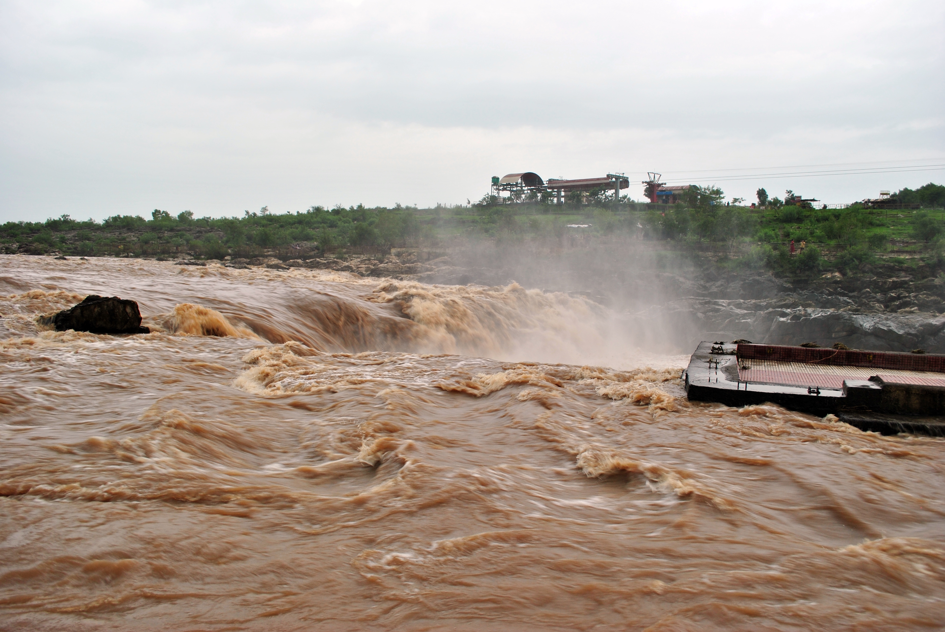
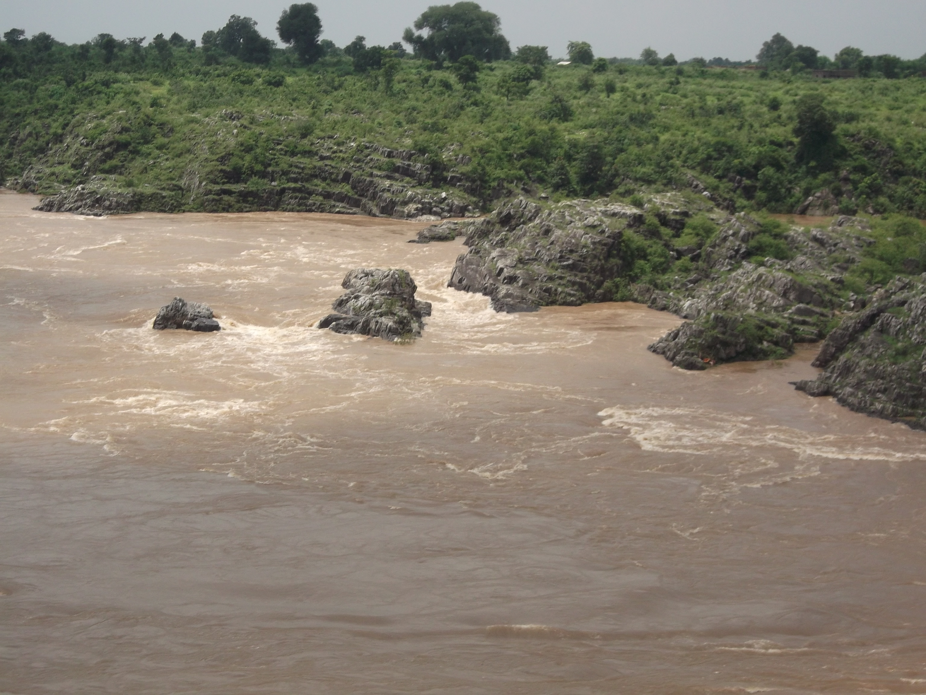
The source of the Narmada is a small tank called Narmada Kund located on the Amarkantak hill[6] (1,057 m (3,467.8 ft)), in the Anuppur District of eastern Madhya Pradesh. The river descends from the Amarkantak hill range at the Kapildhara falls over a cliff and meanders in the hills flowing through a tortuous course crossing the rocks and islands up to the ruined palace of Ramnagar. Between Ramnagar and Mandla, (25 km (15.5 mi)), further southeast, the course is comparatively straight with deep water devoid of rocky obstacles. The Banger joins from the left. The river then runs north–east in a narrow loop towards Jabalpur. Close to this city, after a fall of some (9 m (29.5 ft)), called the Dhuandhara, the fall of mist, it flows for (3 km (1.9 mi)), in a deep narrow channel through the magnesium limestone and basalt rocks called the Marble Rocks; from a width of about 90 m (295.3 ft), above, it is compressed in this channel of (18 m (59.1 ft)), only. Beyond this point up to its meeting the Arabian Sea, the Narmada enters three narrow valleys between the Vindhya scarps in the north and the Satpura range in the South. The southern extension of the valley is wider at most places. These three valley sections are separated by the closely approaching line of the scarps and the Satpura hills.
Emerging from the Marble Rocks the river enters its first fertile basin, which extends about 320 km (198.8 mi), with an average width of 35 km (21.7 mi), in the south. In the north, the valley is limited to the Barna–Bareli plain terminating at Barkhara hills opposite Hoshangabad. However, the hills again recede in the Kannod plains. The banks are about (12 m (39.4 ft)) high. It is in the first valley of the Narmada that many of its important tributaries from the south join it and bring the waters of the northern slopes of the Satpura hills. Among them are: the Sher, the Shakkar, the Dudhi, the Tawa (biggest tributary) & the Ganjal. The Hiran, the Barna, the Choral, the Karam and the Lohar are the important tributaries joining from the north.
Below Handia and Nemawar to Hiran fall (the deer's leap), the river is approached by hills from both sides. In this stretch the character of the river is varied. The Omkareshwar island, sacred to the Lord Shiva, is the most important river island in Madhya Pradesh. At first, the descent is rapid and the stream, quickening in pace, rushes over a barrier of rocks. sukanya The Sikta and the Kaveri join it below the Khandwa plain. At two points, at Mandhar, about40 km (24.9 mi), below Nemawar, and Dadrai, 40 km (24.9 mi), further down near Punasa, the river falls over a height of about 12 m (39.4 ft).
A few kilometres further down near Bareli and the crossing ghat of the Agra to Mumbai road, National Highway 3, the Narmada enters the Mandleshwar plain, the second basin about 180 km (111.8 mi) long and 65 km (40.4 mi) wide in the south. The northern strip of the basin is only 25 km (15.5 mi). The second valley section is broken only by Saheshwar Dhara fall. The early course of about 125 km (77.7 mi) up to Markari falls is met with a succession of cataracts and rapids from the elevated table land of Malwa to the low level of Gujarat plain. Towards the west of this basin, the hills draw very close but soon dwindle down.
Below Makrai, the river flows between Vadodara district and Narmada district and then meanders through the rich plain of Bharuch district of Gujarat state. The banks are high between the layers of old alluvial deposits, hardened mud, gravels of nodular limestone and sand. The width of the river spans from about 1.5 km (0.9 mi) at Makrai to 3 km (1.9 mi) near Bharuch and to an estuary of 21 km (13.0 mi) at the Gulf of Khambat. An old channel of the river, 1 km (0.6 mi) to 2 km (1.2 mi) south from the present one, is very clear below Bharuch. The Karanjan and the Orsing are the most important tributaries in the original course. The former joins at Rundh and the latter at Vyas in Vadodara district of Gujarat, opposite each other and form a Triveni (confluence of three rivers) on the Narmada. The Amaravati and the Bhukhi are other tributaries of significance. Opposite the mouth of the Bhukhi is a large drift called Alia Bet or Kadaria Bet.
The tidal rise is felt up to 32 km (19.9 mi) above Bharuch, where the neap tides rise to about a metre and spring tide 3.5 m (11.5 ft). The river is navigable for vessels of the burthen of 95 tonnes (i.e., 380 Bombay candies) up to Bharuch and for vessels up to 35 tonnes (140 Bombay candies) up to Shamlapitha or Ghangdia. The small vessels (10 tonnes) voyage up to Tilakawada in Gujarat. There are sand bases and shoals at mouth and at Bharuch.[6] The nearby island of Kabirvad, in the Narmada River, features a gigantic Banyan tree, which covers 10,000 square metres (2.5 acres).[7]
Narmada basin
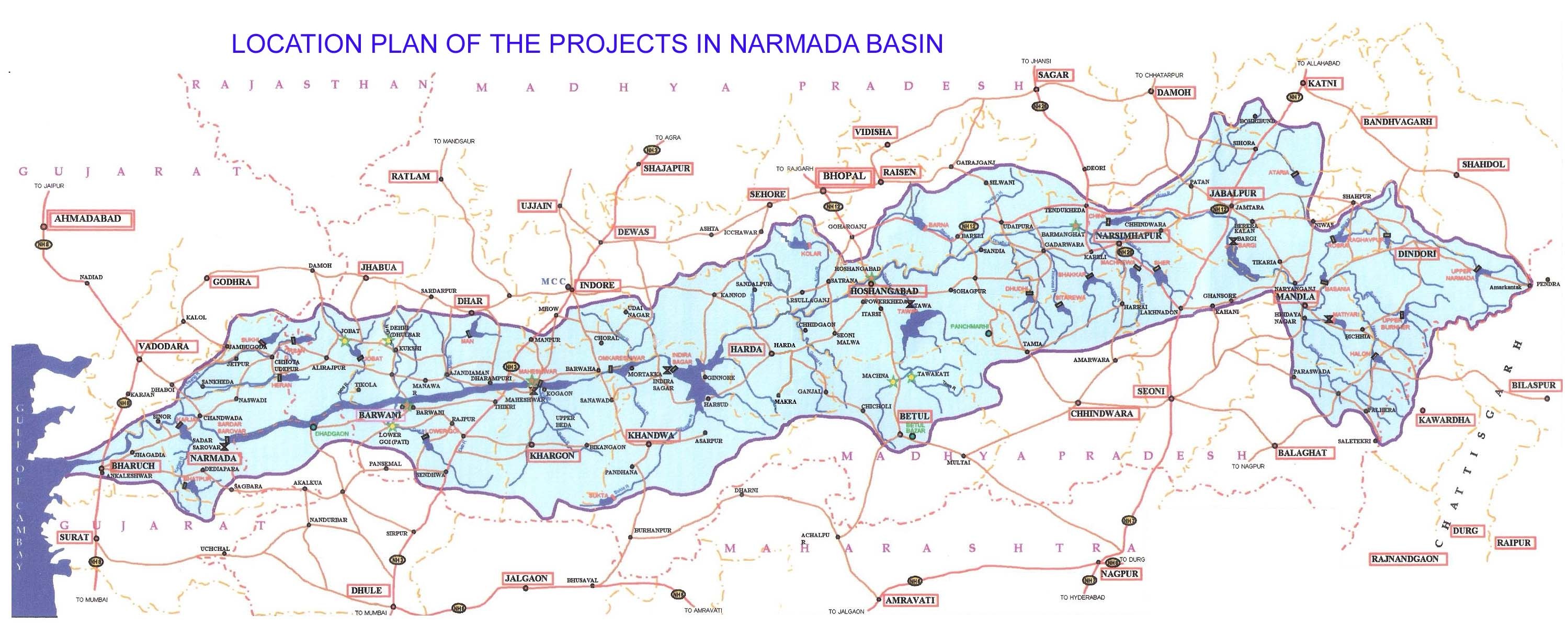
The Narmada basin, hemmed between Vindya and Satpura ranges, extends over an area of 98,796 km2 (38,145.3 sq mi) and lies between east longitudes 72 degrees 32' to 81 degrees 45' and north latitudes 21 degrees 20' to 23 degrees 45' lying on the northern extremity of the Deccan Plateau. The basin covers large areas in the states of Madhya Pradesh (86%), Gujarat (14%) and a comparatively smaller area (2%) in Maharashtra. In the river course of 1,312 km (815.2 mi) explained above, there are 41 tributaries, out of which 22 are from the Satpuda range and the rest on the right bank are from the Vindhya range.[2]
The basin has five well defined physiographic regions. They are:(1) The upper hilly areas covering the districts of Shahdol, Mandla, Durg, Balaghat and Seoni, (2) The upper plains covering the districts of Jabalpur, Narsimhapur, Sagar, Damoh, Chhindwara, Hoshangabad, Betul, Raisen and Sehore, (3) The middle plains covering the districts of East Nimar, part of west Nimar, Dewas, Indore and Dhar, (4) The lower hilly areas covering part of the west Nimar, Jhabua, Dhulia, Narmada and parts of Vadodara, and (5) the lower plains covering mainly the districts of Narmada Bharuch, and parts of Vadodara. The hill regions are well forested. The upper, middle and lower plains are broad and fertile areas, well suited for cultivation. The Narmada basin mainly consists of black soils. The coastal plains in Gujarat are composed of alluvial clays with a layer of black soils on the surface.[8]
The valley experiences extremes of hydrometeorological and climatic conditions with the upper catchment having an annual precipitation in the range of 1,000 mm (3.3 ft) to 1,850 mm (6.1 ft) and with half or even less than half in its lower regions (650 mm (2.1 ft)–750 mm (2.5 ft)); the diversity of vegetation from lush green in the upper region to dry deciduous teak forest vegetation in the lower region is testimony to this feature.[2]
The Irrigation Commission (1972) identified the Narmada basin in Madhya Pradesh as drought affected and a large part of North Gujarat, Saurashtra and Kutch as semi-arid or arid scarcity regions on account of extreme unreliability of rainfall, rendering them ‘chronically’ drought prone and subject to serious drinking water problems.
Geology
The Narmada Valley is a graben, a layered block of the Earth's crust that dropped down relative to the blocks on either side due to ancient spreading of the Earth's crust. Two normal faults, known as the Narmada North fault and Narmada South fault, parallel to the river's course, and mark the boundary between the Narmada block and the Vindhya and Satpura blocks or Horsts which rose relative to the Narmada Graben. The Narmada's watershed includes the northern slopes of the Satpuras, and the steep southern slope of the Vindhyas, but not the Vindhyan tableland, the streams from which flow into the Ganges and Yamuna. The Narmada valley is considered extremely important for paleontological studies in India. Several dinosaur fossils have been found in the area including Titanosaurus indicus found in 1877 by Richard Lydekker and the recently discovered Rajasaurus narmadensis.
Religious significance
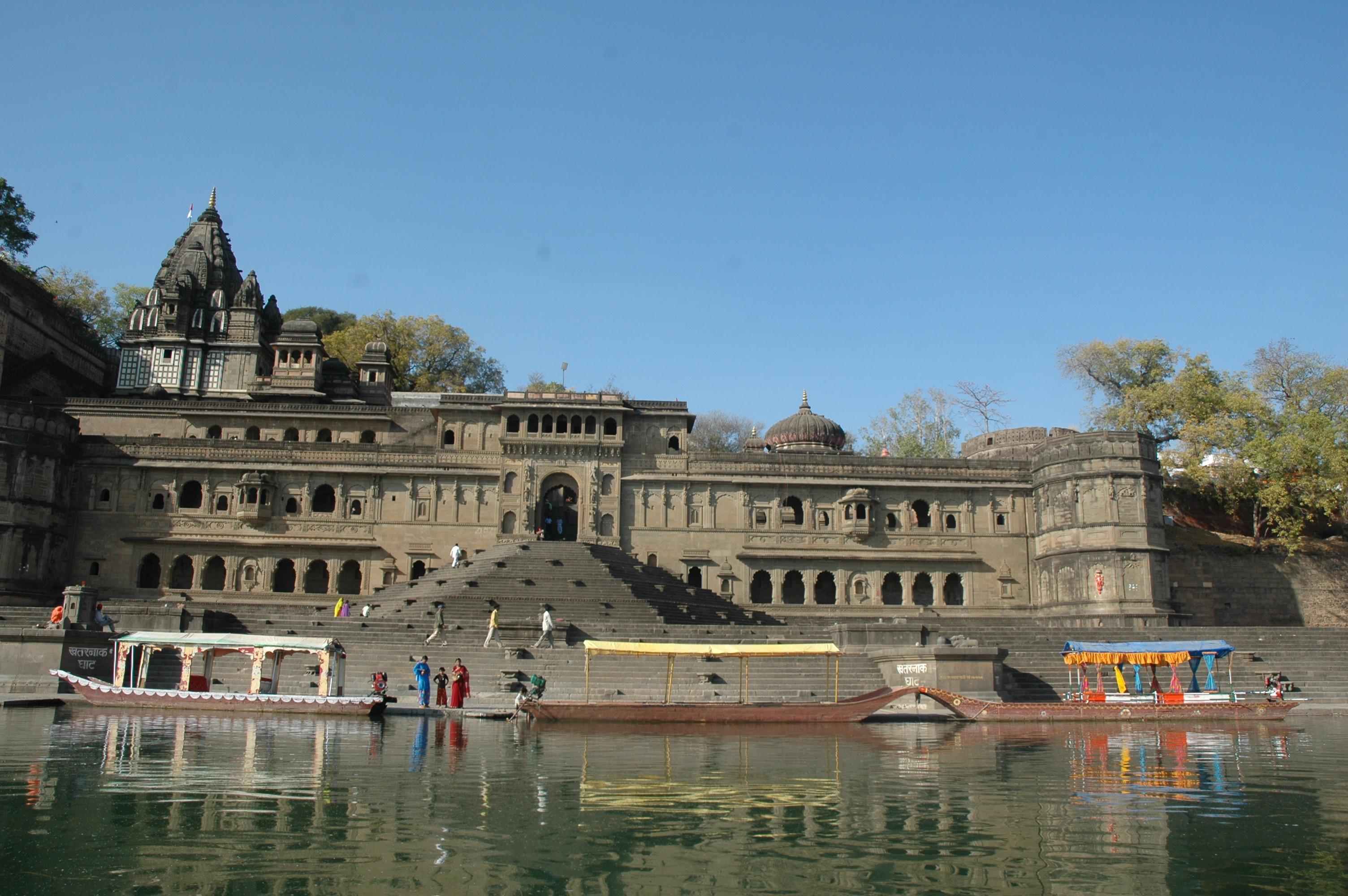
 A Scenic view of Maheshwar on the banks of Narmada
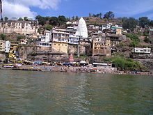 Omkareshwar temple on the banks of Narmada river
The Narmada happens to be one of the most sacred of the five holy rivers of India; the other four being Ganges, Yamuna, Godavari and Kaveri. It is believed that a dip in any of these five rivers washes ones sins away. According to a legend, the river Ganges is polluted by millions of people bathing in it. To cleanse herself, Ganges acquires the form of a black cow and comes to the Narmada to bathe in its holy waters. Legends also mention that the Narmada River is older than the river Ganges.
The river has been mentioned by Ptolemy in the Second century AD as Namade[9] and the author of the Periplus.[10][11] The Ramayana,[12] the Mahabharat and Puranas refer to it frequently. The Rewa Khand of Vayu Purana and the Rewa Khand of Skanda Purana are entirely devoted to the story of the birth and the importance of the river and hence Narmada is also called Rewa.
There are many fables about the origin of the Narmada. According to one of them, once Lord Shiva, the Destroyer of the Universe, meditated so hard that he started perspiring. Shiva’s sweat accumulated in a tank and started flowing in the form of a river – the Narmada. Another legend has it that two teardrops that fell from the eyes of Lord Brahma, the Creator (*of the Universe, yielded two rivers – the Narmada and the Son.[13]
Legends also say that for Lord Shiva, the Hindu God, the river is especially sacred on account of its origin, and it is often called Shankari, i.e., daughter of Shankar (Lord Shiva). All the pebbles rolling on its bed are said to take the shape of his emblem with the saying, "Narmada Ke Kanker utte Sankar" (a popular saying in the Hindi belt of India), which means that ‘pebble stones of Narmada gets a personified form of Shiva’. These lingam shaped stones (cryptocrytalline quartz), called Banalinga also called (Banashivalingas) are much sought after for daily worship by the Hindus. The Brihadeeswara Temple in Thanjavur, Tamil Nadu, constructed by Rajaraja Chola, has one of the biggest Banalingas. Adi Shankara met his guru Govinda Bhagavatpada on the banks of river Narmada.
Narmada is also said to have been in love with the Sonbhadra, another river flowing on the Chota Nagpur Plateau. According to the Puranas, the Narmada is also called the Rewa, from its leaping motion (from the root 'rev') through its rocky bed.
Important religious places and Ghats along the course of the river, starting with its origin at Narmadakhund at Amarkantak hill, are a) the Amarkantak (in Sanskrit: Neck of Shiva) or Teerathraj (the King of Pilgrimages), b) Omkareshwar, Maheshwar, and Mahadeo temples, Nemawar Siddeshwar Mandir in the middle reach of the river – all named after Shiva, c) Chausath Yogini (sixty four yoginis) temple, d) Chaubis Avatar temple, e) Bhojpur Shiva temple and Bhrigu Rishi temple in Bharuch. The Narmada River is also worshipped as mother goddess by Narmadeeya Brahmins.
The importance of the Narmada River as sacred is testified by the fact that the pilgrims perform a holy pilgrimage of a Parikrama or Circumambulation of the river. The Narmada Parikrama, as it is called, is considered to be a meritorious act that a pilgrim can undertake. Many sadhus (saints) and pilgrims walk on foot from the Arabian Sea at Bharuch in Gujarat, along the river, to the source in Maikal Mountains (Amarkantak hills) in Madhya Pradesh and back along the opposite bank of the river. It is a 2,600-kilometre (1,600 mi) walk.[14] Important towns of interest in the valley are Jabalpur, Barwani, Hoshangabad, Harda, Narmada Nagar, Omkareshwar, Dewas (Nemavar, Kity, Pipri), Mandla and Maheshwar in Madhya Pradesh, and Rajpipla and Bharuch in Gujarat. Some places of historical interest are Joga Ka Quilla, Chhatri of Baji Rao Peshwa and Bhimbetka, and among the falls are – Dugdhdhara, Dhardi falls, Bheraghat, Dhuandhara, Kapiladhara and Sahastradhara.[15]
Titbits of the valley
In Indian history,Kannada emperor from Chalukya dynasty Pulakeshin II is said to have defeated emperor Harshavardhana of Kannauj on the banks of Narmada.
The valley is famous for the gorgeous Maheshwari saris, which are handwoven; comfortable in warm and cold weather, dressy and yet light; these saris have a dedicated, select following among Indian women.
Forests and sanctuaries
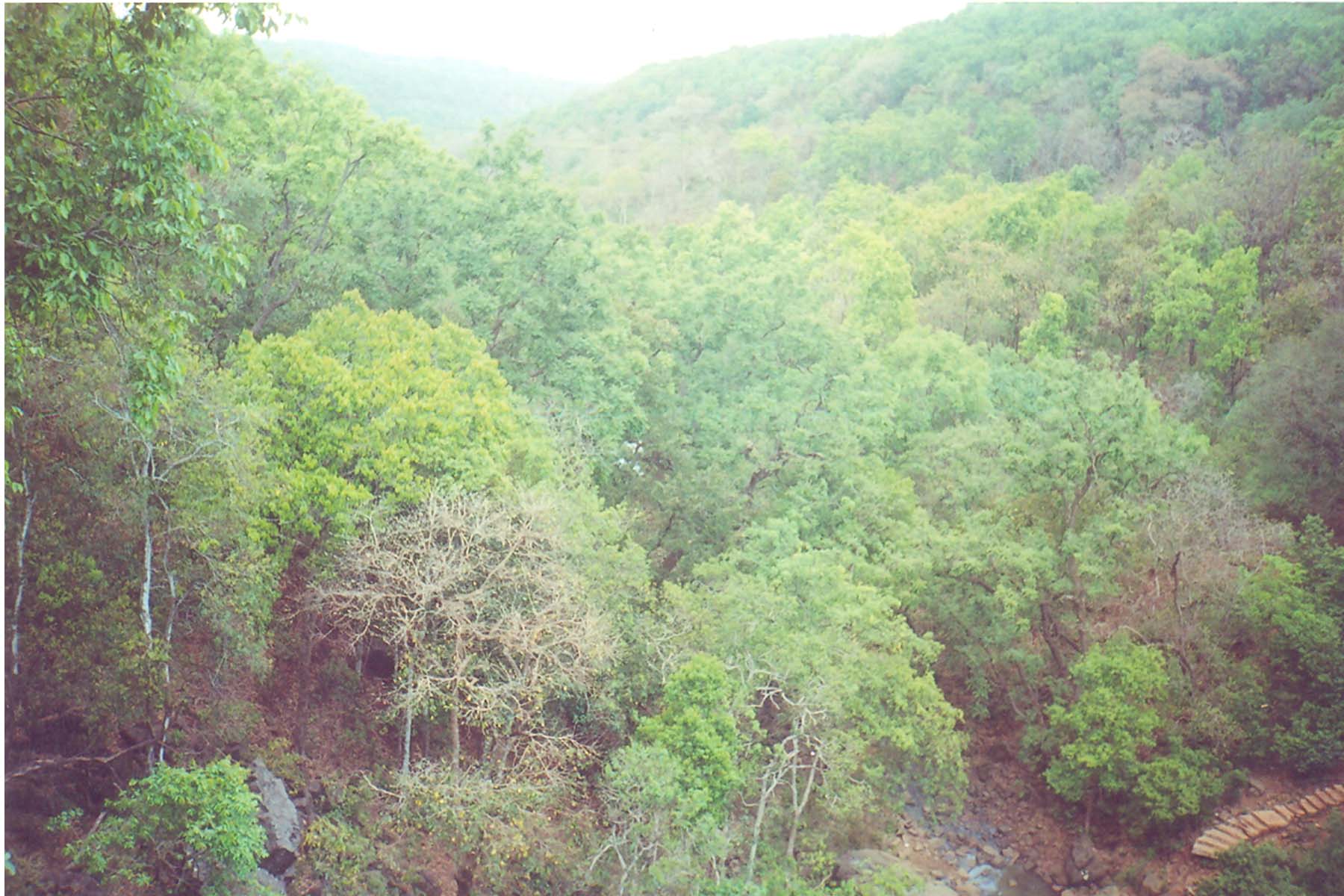
 Forests of Amarkantak
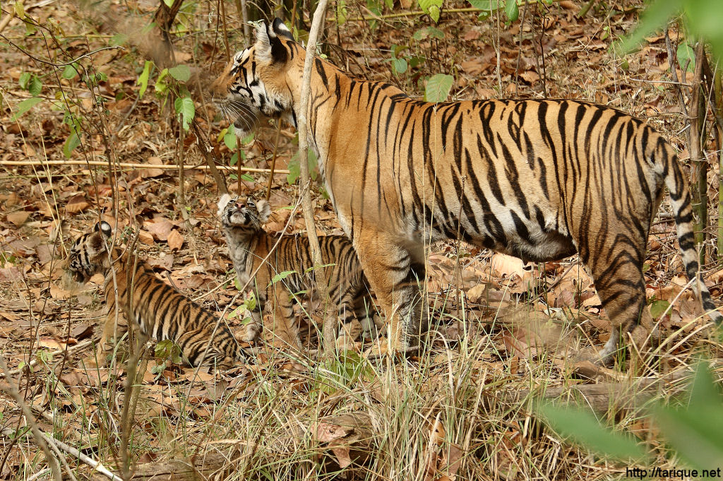
 Tigress with her two cubs in Kanha National Park
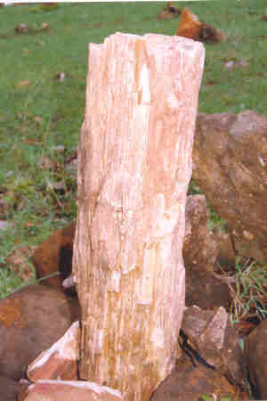
 Fossil of a tree trunk at National fossils park Ghughuya
Teak and India’s best hardwood forests are found in the Narmada River basin and they are much older than the ones in the Himalayas. The lower Narmada River Valley and the surrounding uplands, covering an area of169,900 km2 (65,598.8 sq mi) consists of dry deciduous forests. The ecoregion lies between moister forests to the northeast, southeast, and southwest, which receive greater rainfall from the southeast monsoon, and the drier forests and scrublands of the Deccan to the south and Malwa and Gujarat to the west and northwest. The natural vegetation of the region is a three–tiered forest. Tectona grandis is the dominant canopy tree, in association with Diospyros melanoxylon, Dhaora (Anogeissus latifolia), Lagerstroemia parviflora, Terminalia tomentosa, Lannea coromandelica, Hardwickia binata and Boswellia serrata. Riparian areas along the regions' rivers and streams, which receive year– round water, are home to moist evergreen forests, whose dominant tree species are Terminalia arjuna, Syzygium cumini (Jambul), Syzygium heyneanum, Salix tetrasperma, Homonoia riparia, and Vitex negundo.
The ecoregion is home to 76 species of mammals and to 276 bird species none of which are endemic. According to the World Wildlife Fund (WWF), about 30% of the ecoregion is covered in relatively intact vegetation. The ecoregion includes some large blocks of habitat in the Vindhya and Satpura ranges. About 5% of the ecoregion lies within protected areas, including Bandhavgarh, Panna, and Sanjay National Parks.
Some of the important national parks and wild life sanctuaries in the valley are the following. Kanha National Park located in the upper reaches of Narmada, about 18 km (11.2 mi) from Mandla, boasts of several wild animals including the Tiger. Two tributaries of Narmada, namely, Hallon and Banjar, flow through this park. It is one of the best National Parks of Asia, which has been described vividly by Rudyard Kipling in his famous creation "Jungle Book".
Satpura National Park, set up in 1981, is located in Hoshangabad district of Madhya Pradesh. Its name is derived from Satpura hill ranges (Mahadeo hills) and covers an area of 524 km2 (202.3 sq mi) and along with the adjoining Bori and Panchmarhi Sanctuaries, provides 1,427 km2 (551.0 sq mi) of unique Central Indian Highland ecosystem. Satpura National Park, being part of a unique ecosystem, is very rich in biodiversity. The fauna comprises tiger, leopard, sambar, chital, bhedki, nilgai, four-horned antelope, chinkara, bison (gour), wild boar, wild dog, bear, black buck, fox, porcupine, flying squirrel, mouse deer, Indian joint squirrel etc. There are a variety of birds. Hornbills and peafowl are the common birds. The flora of the national park consists of mainly sal, teak, tendu, aonla, mahua, bael, bamboo, and a variety of grasses and medicinal plants.
Mandla Plant Fossils National Park, Dindori National fossils park Ghughuya is situated in Dindori district of Madhya Pradesh in India. This national park has plants in fossil form that existed in India anywhere between 40 million and 150 million years ago spread over seven villages of Mandla District (Ghuguwa, Umaria, Deorakhurd, Barbaspur, Chanti-hills, Chargaon and Deori Kohani). The Mandla Plant Fossils National Park is an area that spreads over 274,100 m2 (2,950,387.8 sq ft). Such fossils are found in three other villages of the district also, but they lie outside the national park.
One theory is that the area in which the fossils are located, i.e., the Narmada Valley near Mandla, was actually a deep inundation of the sea into peninsular India till the Post- Cambrian Tertiary age, about 40 million years ago. This means that Narmada was a very short river which terminated in the inland sea above Mandla, and that the recession of the sea caused geological disturbances, which created the present rift valley through which the Narmada River and Tapti River flow in their present journey to the Arabian Sea. All this, however, is speculation and conjecture because it is only recently that an interest has developed in the fossils of Mandla and detailed scientific studies are still wanting.
The Pachmarhi Biosphere Reserve covers part of three civil districts viz., Hoshangabad, Betul and Chhindwara of Madhya Pradesh. The total area is 4,926.28 km2 (1,902.0 sq mi). It envelops three wildlife conservation units viz., Bori Sanctuary (518.00 km²), Satpura National Park (524.37 km2 (202.5 sq mi)), and Pachmarhi Sanctuary (461.37 km2 (178.1 sq mi))). Satpura National Park comprises the core zone and the remaining area of 4,501.91 km2 (1,738.2 sq mi)), surrounding the core zone serves as buffer zone. The area comprises 511 villages. The area exhibits variety of geological rock and soil formations. There is a wide spectrum of floral and faunal features that occupy the Satpura conservation area. It is one of the oldest forest reserves, which has an established tradition of scientific management of forests. It constitutes a large contiguous forest block that harbours a community of plant and animal species typical of the central highland region.[16]
Apart from the above national parks, there are also a number of natural preserves such as the Amarkantak, the Bagh Caves and the Bhedaghat. In compliance of the Environmental Action Plan for the Narmadasagar and Omkareswar HEPs, as per the recommendations of the Wildlife Institute of India three new protected areas may be created, which are, a) the Narmada National Park (496.70 km2), b) the Surmanya Sanctuary (126.67 km2) and c) Omkareshwar Sanctuary (119.96 km2) comprising a total area of 788.57 km2.[17]
Shoolpaneshwar Sanctuary in Gujarat, near the Sardar Sarovar dam site, previously called the Dumkal Sloth Bear Sanctuary (old sanctuary has been expanded four times) now covers an area of about 607 km2 (234.4 sq mi), comprises a major watershed feeding the Sardar Sarovar and Karjan reservoir (on the Karjan River, a tributary of Narmada in Gujarat). It is the habitat of mammals and a variety of birds, including eagles and hawks.[18] and.[19]
Anthropological sites
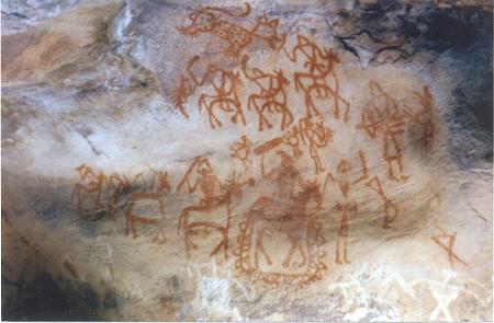
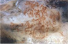 Bhimbetka rock painting
The sprawling caves of Bhimbetka located in a dyke of the Narmada valley at about 45 km (28.0 mi) northeast of Bhopal (between Bhopal and Hoshangabad highway) depicts pre–historic rock shelter paintings (considered an invaluable chronicle in the history of man) which are sculpted on the crest of the Vindhyan heights. The Bhimbetka rock shelters, discovered in 1957–58 is a natural art gallery and an archaeological treasure considered as one of the oldest human habitation in India where the caves house rock paintings, created by man from as early as about 15,000 years ago in vivid and panoramic detail. The rock paintings here track the gradual progress and various adaptations that the prehistoric man was making in his lifestyle. It is a World Heritage site.
 Pandav Caves Pachmarhi
Bhimbetka owes its name to the characters of the longest epic in the world, the Mahabharata. It is believed that when the five brothers, called Pandavas, were banished from their kingdom, they came here and stayed in these caves; the massive rocks seating the gigantic frame of Bhima is the second Pandava. Further evidence, cited in support of this theory, is the resemblance in names of the nearby places with the names of the Pandavas.[20]
Narmada river development (NRD)
The Narmada river has a huge water resources potential, as much as 33,210,000 acre feet (40.96 km3) of average annual flow (more than 90% of this flow occurring during the monsoon months of June – September), which according to estimates is greater than the combined annual flows of the Ravi, Beas and the Sutlej rivers, which feed the Indus basin. The 75% dependable flow is 28,000,000 acre feet (35 km3).[21] Till the beginning of planned development in the country was started in 1946, this huge potential went almost abegging without any effective utilization thus denying much needed succour to the drought stricken people of the valley, both in Madhya Pradesh and Gujarat. Since then plans have been evolved, debated, finally legally examined and adjudicated by a tribunal, and agitated by NGOs. The Supreme Court of India has finally intervened to ensure that the implementation of the projects are not halted.
Early background and dispute
Investigations for harnessing the Narmada waters started around the time of independence, when Central Waterways, Irrigation and Navigation Commission (CWINC) identified several storage schemes and in 1948 the Khosla Committee prioritized the proposals and named Tawa, Bargi, Punasa and Bharuch projects (the last three on the main stem of the river) for preparation of reports.[22] The reports were ready by 1963. A parallel study of the Hydropower potential identified 16 sites with a potential of 1300 MW. While the project in Gujarat called Baruch Weir project (for which Jawaharlal Nehru laid the foundation stone in 1961) went through a series of modifications and improvements with a reformed scheme at Navagam village to extend benefits up to the Rann of Kutch, but following the bifurcation of the erstwhile Bombay state into Maharashtra and Gujarat states and Gujarat’s intent to raise the height of the dam at Navagam to maximize storage benefits at the cost of submergence of potential hydropower sites in Maharashtra and Madhya Pradesh, created a dispute between the states. This resulted in an impasse in the implementation of the agreed projects at Navagam in Gujarat, Punasa in MP and Bargi dam in MP and power benefit sharing among the states; with MP refusing to ratify the agreements. To break the logjam, a high level Committee was appointed by the Government of India(GOI) in September 1964. In 1965, the Committee prepared a Master Plan for the basin which involved construction of 12 major projects in MP and the Navagam dam in Gujarat. It provided priority to irrigation over power; irrigation of 2,630 square kilometres (1,020 sq mi) in MP, 400 square kilometres (150 sq mi) in Maharashtra, 460 square kilometres (180 sq mi) in Gujarat and 4,000 square kilometres (1,500 sq mi) in Rajasthan. The storages it recommended in MP involved Bargi, Tawa and Narmadasagar (Punasa) while its proposed Navagam high dam would submerge the hydelpower project sites of Jalasindhi (in Maharshtra) and Harinphal (MP) but without any more submergence than would be caused by the three dams if separately constructed. Gujarat endorsed this proposal but Maharashtra was not willing to go by it. After intense parleys failed to resolve the problem, GOI decided to set up the Narmada Water Disputes Tribunal (NWDT) in 1969 under the Inter State Water Disputes Act, 1956 to adjudicate on the dispute relating to sharing of water of the inter–state river Narmada and its valley.
Tribunal award.[23]
After ten years of deliberations, the Narmada Water Disputes Tribunal (NWDT) gave its award in December 1979. The NWDT, considering the development of the water resources of the basin as a whole, gave its award, allocating share of water and Hydro Power of the Sardar Sarovar Project.
The Tribunal’s final order determined the utilizable quantum of Narmada waters to be 27,000,000 acre feet (33 km3) at 75% dependability and allocated it to the four states, as in Table below, including share of power benefits. It also stipulated the share of water when utilizable flow was in excess of 28,000,000 acre feet (35 km3). The Navagam dam height was fixed at Full reservoir level (FRL) 460 feet (140 m) with a maximum water level of EL feet. The Full Supply Level of the Navagam canal was fixed at 300 feet (91 m). The cost sharing formula among the states and the consequent requirement of release of regulated releases from the Narmada Sagar dam by MP was also spelt out. The resettlement and rehabilitation package was also clearly specified with all costs to be borne by Gujarat for all resettlement and rehabilitation work of people affected in the three states and also for relocating any ancient or historic monuments, places of worship or idols likely to suffer submergence.
Party States Allocated share of water % share of power Madhya Pradesh 18,250,000 acre feet (22.51 km3) 57 Gujarat 9,000,000 acre feet (11 km3) 16 Maharashtra 250,000 acre feet (0.31 km3) 27 Rajasthan 500,000 acre feet (0.62 km3) Nil Total 28,000,000 acre feet (35 km3) 100 The uniqueness of this Award is that a non riparian state – Rajasthan – has been allocated a share of Narmada waters, for meeting the water requirements of the drought prone districts of Barmer and Jalore, which have no other source of dependable water. The work on the project did not start soon since extensive studies were undertaken for project designing and with World Bank getting involved with funding studies and project costs (Loan agreement with GOI of $450 million was signed in May 1985), the Resettlement and Rehabilitation (R&R) package was substantially revised, over and above what was set in the NWDT, and environmental studies had to be undertaken. But the environmental and forest clearances for the projects from the newly formed Ministry of Environment and Forests (MoE&F) involved extensive inter–ministerial and inter departmental discussions (within the central govt and with state governments.) for a substantial period and it was only in June 1987 (almost 8 years after the NWDT award was given in Dec 1979) that the MoE&F gave a conditional approval to the Sardar Sarovar and Narmada Sagar Projects. The Forest clearance was given in September 1987 for Sardar Sarovar only. The clearance also required the work to be done pari passu with the construction of the dams and the filling of the reservoir. In the mean time, the Narmada Control Authority (NCA), an inter-State Administrative Authority and the Sardar Sarovar Construction Advisory Committee (SSCAC) were set up in 1980 by the Govt. of India in compliance of the NWDT award; the former organization was set up in Dec. 1980 as body corporate with representatives from the four party states and Govt. of India, as a machinery to implement the decisions and directions of the NWDT and the later organization was set up in Sept. 1980 as a statutory body to ensure efficient, economical and timely execution of the Unit I (Dam & appurtenant works) and Unit III (Hydropower works) of the Sardar Sarovar Project (SSP). A Review Committee consisting of the Union Minister for Irrigation (now substituted by Union Minister for Water Resources) as its Chairperson and the Chief Ministers of Madhya Pradesh, Maharashtra, Gujarat and Rajasthan as its members is also in position to review the decisions of the NCA and the SSCAC, as required. For monitoring and implementation of various environmental activities effectively, independent machinery of Environment Sub-Group is functioning since Nov.1987 under NCA. Similarly, for monitoring the progress of the resettlement and rehabilitation of project affected people, R&R subgroup is also functioning under the NCA. At the state level, Sardar Sarovar Narmada Nigam Limited (SSNL) in Gujarat has the mandate to implement and manage the Sardar Sarovar multipurpose project. In Madhya Pradesh, the Narmada Valley Development Authority (NVDA) is vested the responsibility for implementation of the projects.
The overall plan for development ultimately conceived involves 30 major dams including Sardar Sarovar (21 irrigation, 5 hydropower, and 4 multipurpose), some 135 medium dams, and over three minor dams in M.P along the main stem of the river and its 41 tributaries to utilize its allocated share of 18,250,000 acre feet (22.51 km3) before 2025 (within 45 years of the NWDT award). In addition to power generation and irrigation within the basin, water was allocated for domestic and industrial water uses and for multipurpose trans–basin diversions to: Son River and Tons River basins in eastern MP, drought prone areas of Saurashtra, Kutch, northern mainland in Gujarat, and southern Rajasthan. Irrigation benefits to the extent of about 40,000 square kilometres (15,000 sq mi) to 50,000 square kilometres (19,000 sq mi) (of drought prone and scarcity areas) and power generation of 2,600 MW were also envisaged. Thus, the Narmada river development is envisaged as a multi state program for development of hydropower and irrigation dams and their associated irrigation networks. In 1961, the original project envisaged irrigation of almost 2 million acres (8,100 km2) in West India at a cost of $100 million. By 2011, it had escalated to $3 billion.
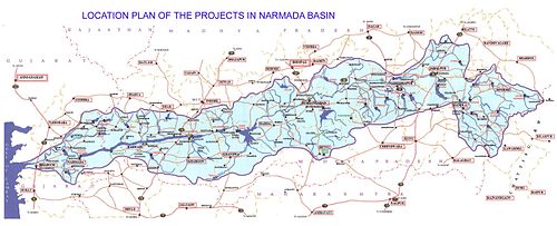 Layout of Water Resources Development Projects in the Narmada Basin in Gujarat & Madhya Pradesh
Even though the tribunal award resolved the initial issue of water sharing, however, the height of dam, benefit sharing and the mode of settlement of project–affected people caused serious difficulties in implementation, particularly of the Sardar Sarovar dam (the terminal dam on the river). Project–affected people agitated under the banner of the dedicated NGO – The Narmada Bachao Andolan (NBA). The NBA followed up by Public Interest Litigation (PIL) in the Supreme Court of India. The NBA questioned the benefits claimed from the major projects, challenged the resettlement and rehabilitation packages for project affected people of the reservoir submergence and canal affected zones and its implementation. It also rejected the environmental impact assessments made and the remedial actions taken by the project authorities. This challenge created worldwide attention to the major development activity planned in the valley. It urged the World Bank to withdraw from the project and the intense world wide pressure resulted in the Bank mounting an Independent Review Mission (IRM) called the Morse Mission to review the SSP. But the IRM’s report was neither accepted by the Government of India or the World Bank. Finally Government of India decided to terminate further drawals from a remaining $180 million World Bank credit from the Bank with the firm resolution that the project would be completed within the national resources.
The Supreme Court has also deliberated on this issue for several years but finally upheld the Tribunal Award and allowed the construction to proceed, subject to conditions. The Court introduced a mechanism to monitor the progress of resettlement pari-passu with the raising of the height of the dam through Grievance Redressal Authorities (GRA) in each of the party states. The court’s decision referred in this document, given in the year 2000, after 7 years of deliberations, has paved the way for completing the project to attain full envisaged benefits. Some of the court’s decisions[24] are essential to be quoted here (quoted in italics), to set at rest many of the distorted or incorrect versions being presented in several of the linked Wikipedia articles on this subject.
*When such projects are undertaken and hundreds of crores of public money is spent, individual or organisations in the garb of PIL cannot be permitted to challenge the policy decision taken after a lapse of time. It is against the national interest and contrary to the established principles of law that decisions to undertake developmental projects are permitted to be challenged after a number of years during which period public money has been spent in the execution of the project.
*Having failed in its attempt to stall the project the petitioner has resorted to court proceedings by filing this writ petition long after the environmental clearance was given and construction started. The pleas relating to height of the dam and the extent of submergence, environment studies and clearance, hydrology, seismicity and other issues, except implementation of relief and rehabilitation, cannot be permitted to be raised at this belated stage.
*It is the Relief and Rehabilitation measures that this Court is really concerned with and the petition in regard to the other issues raised is highly belated.
*The cost and benefit of the project were examined by the World Bank in 1990 and the following passage speaks for itself:
*The argument in favour of the Sardar Sarovar Project is that the benefits are so large that they substantially outweigh the costs of the immediate human and environmental disruption. Without the dam, the long term costs for people would be much greater and lack of an income source for future generations would put increasing pressure on the environment. If the waters of the Narmada river continue to flow to the sea unused there appears to be no alternative to escalating human deprivation, particularly in the dry areas of Gujarat. The project has the potential to feed as many as 20 million people, provide domestic and industrial water for about 30 million, employ about 1 million, and provide valuable peak electric power in an area with high unmet power demand (farm pumps often get only a few hours power per day). In addition, recent research shows substantial economic multiplier effects (investment and employment triggered by development) from irrigation development. Set against the futures of about 70,000 project affected people, even without the multiplier effect, the ratio of beneficiaries to affected persons is well over 100:1.
*The Morse Committee was constituted, as already noted, by the World Bank. Its recommendations were forwarded to the World Bank. Apart from the Criticism of this report from other quarters, the World Bank itself did not accept this report as is evident from its press release dated 22 June 1992 where it was, inter-alia, stated as follows:
*The Morse Commission provided a draft of its report to the Bank for management comments several weeks prior to the final release of the document. About two weeks before this release, the commission provided a draft of its findings and recommendations. The final version of the report is the sole responsibility of its authors; the report was not cleared by the World Bank.
*On resettlement and rehabilitation (R&R), Bank management agrees with the description of the R&R situation in each of the three states and with the report's conclusions about the shortcomings in the preparation and appraisal of the project's R&R aspects. We also agree that work should have been done earlier on the issue of people affected by the canal in Gujarat.
*On environment, bank management agrees with the independent review on the need for a more effective central management in the Narmada Basin on environment impact studies and mitigation programmes. Management also agrees on the need to accelerate work on estuary studies and health matters in Gujarat.
*The Government of India vide its letter dated 7 August 1992 from the Secretary, Ministry of Environment and Forests did not accept the report and commented adversely on it.
*In view of the above, we do not propose, while considering the petitioners contentions, to place any reliance on the report of Morse Committee.
*Again all these contentions were based on the Morse Committee Report which the World Bank and the Union of India had already rejected.
*Apart from the fact that we are not convinced that construction of the dam will result in there being an adverse ecological impact there is no reason to conclude that the Environmental Sub-group is not functioning effectively. The group which is headed by the Secretary, Ministry of Environment and Forests is a high powered body whose work cannot be belittled merely on the basis of conjectures or surmises.
*The Environment Sub-group under the Secretary, Ministry of Environment and Forests, Government of India will consider and give, at each stage of the construction of the dam, environment clearance before further construction beyond 90 meters can be undertaken.
*Even though there has been substantial compliance with the conditions imposed under the environment clearance the NCA and the Environment Sub-group will continue to monitor and ensure that all steps are taken not only to protect but to restore and improve the environment.
*The Grievances Redressal Authorities will be at liberty, in case the need arises, to issue appropriate directions to the respective States for due implementation of the R&R programmes and in case of non implementation of its directions, the GRAs will be at liberty to approach the Review Committee for appropriate orders.
*Every endeavour shall be made to see that the project is completed as expeditiously as possible.
The above Supreme Court judgement was by two of a three judge panel. The third judge, S.P.Bharucha, dissented with the two judges' verdict[25]
Justice Bharucha stated that "...Considering the magnitude of rehabilitation, involving a large percentage of tribals, loss of extensive forest area rich in biological diversity, enormous environmental cost of the project and considering the fact that the basic data on vital aspects are still not available there could be but one conclusion, that the project(s) are not ready for approval..."
The construction of the two multipurpose major projects – the Sardar Sarvoar in Gujarat and Indira Sagar in Madya Pradesh – the two are interdependent to attain full envisaged benefits - is in progress and substantial partial benefits have already been achieved. Hence, details of these two projects are elaborated below.
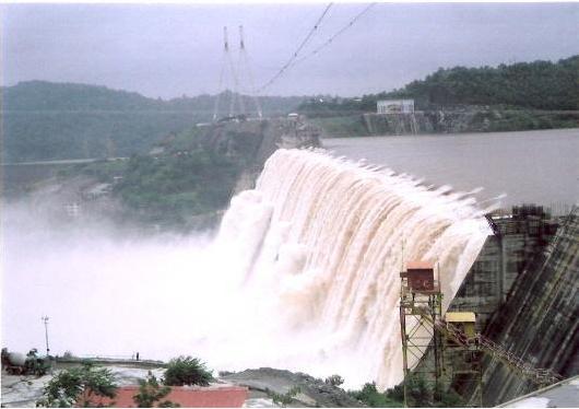
Sardar Sarovar Project (SSP) at Navagam.[26] Subsequent to the Tribunal award and approval to the project in 1987 by the Ministry of Water Resources with due clearances from the MoE&F, implementation of the SSP was taken up as the terminal project on the main stem of the Narmada, in Gujarat, to utilize the share of allocated water to Gujarat and Rajasthan. The concrete gravity dam of 1,210 metres (3,970 ft) length and 163 metres (535 ft) height above foundation with storage capacity of 7,700,000 acre feet (9,500 km2) and reservoir length of 214 kilometres (133 mi) extending into Gujarat, Maharashtra and Madhya Pradesh is designed to provide an annual irrigation of 18,000 square kilometres (6,900 sq mi) in Gujarat (covering 3360 villages of 62 talukas in 14 districts), 4,260 square kilometres (1,640 sq mi) in Rajasthan and hydel power generation of 1450 MW. As a result of construction of the dam over 48,269 families (against 7000 families assessed in 1979, by the Tribunal) will be affected, as per the latest figures of NCA, in the three States spread over 244 villages (4 fully and 240 partially – 39369 in MP in 192 villages, 4163 in Maharshtra in 33 villages and 4737 in Gujarat in 19 villages); the total area affected being 375.33 square kilometres (144.92 sq mi). The submergence area is broadly divided into two areas, fully tribal area which covers the initial reach of about 100 or so villages which are almost 100% tribal and hilly. These include all the 33 villages of Maharashtra (in Nadurbar District), all 19 of Gujarat and many of the Madhya Pradesh. The second part of the submergence area is the mixed population area on the Nimad plains with a very well developed economy that is well connected to the mainstream. Considered as the largest water resources project of India in terms of benefits, some of the special features of the project are the following.
- Dam’s spillway discharging capacity at 3,070,000 cu ft/s (87,000 m3/s) the third highest in the world
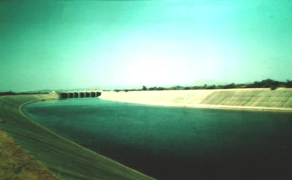
- With 1133 m³/s (40,000 ft³/s) capacity at the head regulator and 532 kilometres (331 mi) length (458 kilometres (285 mi) in Gujarat and 74 kilometres (46 mi) in Rajasthan) with 75,000 kilometres (47,000 mi) length of distribution system including field channel, the Narmada Main Canal is the largest irrigation canal in the world.
- The project aims at supplying 3571,000 m³/day of drinking water (2900,000 m³/day for domestic consumption & 671,000 m³/day for industrial consumption) to 8215 villages & 135 towns in Gujarat, which are presently suffering from acute shortage of water. Also, the project aims to provide drinking water facilities to a population of about 1,371,000 in 1107 villages & two towns in Jallore district & Barmer district of Rajasthan.
- Has the lowest ratio of submergence to area irrigated – being 1.65% of CCA against an average of 4 to 5% of other major irrigation projects.
All the 6 units of River Bed Power House (RBPH) have been commissioned successfully by June 2006 and are in operation. All the five units of Canal Head Power House (CHPH) have been commissioned successfully by end of December 2004 and are in operation.
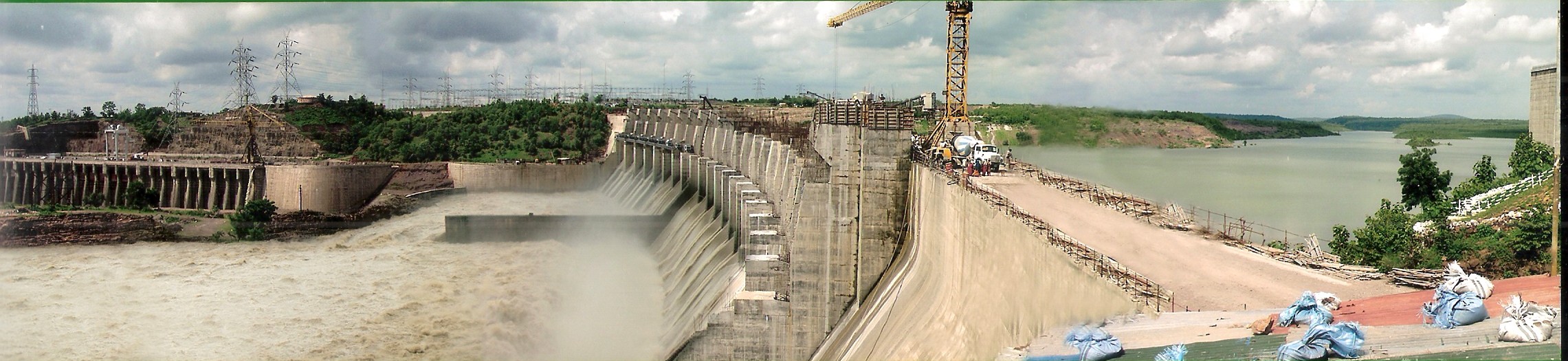
 Sardar Sarovar Dam, Gujarat, partially completed (up to E.L.121.92 m)
 Largest lined canal in the world, Sardar Sarovar Project
The dam has attained a height of EL.121.92 m i.e. the crest level of the spillway. The gates are yet to be erected to attain the FRL of EL 138.68 m for which clearance is required from the Supreme Court after the Grievance Redressal Committee submits its report on completion of R & R up to that elevation. Top level of dam to be attained is EL 146.50 m.
The main irrigation canal has been substantially constructed for a length of 357 kilometres (222 mi). Water has been let into the canal for partial irrigation and water supply needs. Further construction is in progress.
The Indira Sagar Project (ISP) in Madhya Pradesh at Punasa is one of the 30 major projects proposed in the Narmada basin with the largest storage capacity in the country. The project is located near Punasa village in Khandwa District of Madhya Pradesh. This Multipurpose River Valley Project envisages construction of a concrete gravity dam, 653 metres (2,142 ft) long and 92 metres (302 ft) high with gross storage capacity of the reservoir of 12.22 km3 (9,910,000 acre·ft) and live storage of 9.75 km3 (7,900,000 acre·ft) to provide an annual irrigation potential of 1,690 km², and generation of 1000 MW of hydropower. The project shall also ensure supply of 60,000 acre·ft (74,000,000 m3) of drinking water to rural areas in Khandwa district. In accordance with NWDT award, an annual regulated flow of 8,120,000 acre·ft (10.02 km3) shall be released to the Sardar Sarovar Project (SSP), ex– Maheshwar Project. The operation of Indira Sagar Project shall be carried out in such a way as to facilitate the regulation of Sardar Sarovar.
 Indira Sagar dam partially completed in Madhya Pradesh
 Indira Sagar canal for irrigation
The dam and the powerhouse have been completed but storage has been restricted up to EL 260 m under orders of the High Court, Jabalpur from R&R consideration. All the units of the powerhouse have been commissioned and generation of power from the 8 units of 125 MW capacity each commenced from Jan 2004.[27] The irrigation component of the project is under a fairly advance stage of implementation.
Other completed and under construction projects
Existing irrigation projects in the Narmada are the 1) Matiyari (1992), 2) Rani Avantibai Sagar (1988), 3) Barna (1978), 4) Tawa (1992–93), 5) Sukta (1984) all in Madhya Pradesh, and Karjan project in Gujarat.
Projects under implementation are the 1) Bargi diversion, 2) Kolar, 3) Man, 4) Omkareshwar multipurpose (520 MW – commissioned in Nov. 2007) and 5) Maheshwar (400 MW)
A large number of medium and small projects have been completed and many more are under implementation, as conceived under the overall Master Plan.
The river is presently partially navigable in the estuary reach around Bharuch but the river has never been a transport artery. The idea for inland navigation emanated with NWDT giving its award for the two main dams – the Sardar Sarovar in Gujarat 180 kilometres (110 mi) from the coast and the Narmada Sagar in Madhaya Pradesh – the two dams separated by a river distance of about 900 kilometres (560 mi), and the plans to build two other dams in between on the main stem of the river. A feasibility study has been carried out for navigating the Narmada from the sea up to Hoshangabad – a distance of 639 kilometres (397 mi) – or even up to Jabalpur a further distance of309 kilometres (192 mi), upstream. The main challenge in these studies is the arrangements to be planned to negotiate the Maheswar, Indira Sagar, Omkareswar, and Sardar Sarovar projects. As such, the navigation option is still open and probably can only be pursued after all the above dams are completed and other implications examined. As Varghese states, “The notion of seeing barge–trains plying the river up to Hoshangabad or Jabalpur is not far–fetched. They could become major inland ports”
Gallery
Photos of some of the dams and other connected structures in the Narmada basin.
-

Jobat dam
-
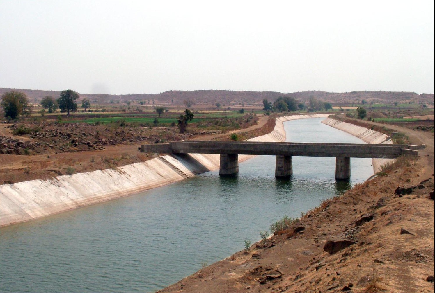
Omkareswar project – Canal aqueduct
-

Sardar Sarovar Canal with flow
-

Dhuandhar falls at dusk
See also
References
- ^ Narmada Valley Development Authority, NVDA, Government of Madhya Pradesh, Narmada Basin, Narmada Water Dispute
- ^ a b c :::| NCA |:::: Narmada Control Authority
- ^ http://www.ntz.info/gen/b00523.html#id05144, paragraph 42.
- ^ 11th edition of Encyclopaedia Britannica.
- ^ Monier Williams, Sanskrit-English Dictionary. Available online at: http://www.sanskrit-lexicon.uni-koeln.de/monier/
- ^ a b Gyandoot.net - Dhar District - Geography
- ^ Gujarat- http://traveliteindia.com/guide/state/gujarat.asp
- ^ http://nwda.gov.in/writereaddata/sublink2images/271.pdf - The Par-Tapi-Narmada link canal
- ^ http://www.answers.com/topic/narmada-river - Narmada river
- ^ Roman Maps and the Concept of Indian Gems -http://www.thebeadsite.com/UNIMPG-1.html
- ^ Roman Maps and Indian Gems 1
- ^ Valmiki Ramayana - Kishkindha Kanda
- ^ Famous rivers of Madhya Pradesh
- ^ Narmada River
- ^ :::| NCA |:::: Narmada Control Authority
- ^ http://www.gisdevelopment.net/application/environment/conservation/pdf/21.pdf - The Satpura conservation area Landscape
- ^ http://www.ruffordsmallgrants.org/files/Rufford%20Final.doc). First Report on The Rufford’s Innovation Grant. 2006. Ritwick Dutta
- ^ :::| NCA |:::: Narmada Control Authority
- ^ http://india.traveltoworld.com/india-travel-guide/509/shoolpaneshwar-sanctuary-gujarat/ - India Travel guide
- ^ Walkthrough of Prehistoric Rock Shelters of Bhimbetka, Madhya Pradesh - Archaeological Survey of India
- ^ http://nca.gov.in/rti_index.html
- ^ Winning the future by B.G.Varghese. (1994).ISBN 81-220-0357-5
- ^ [1]
- ^ - Judgement of the Supreme Court of India 2000
- ^ http://www.cscsarchive.org/MediaArchive/medialaw.nsf/(docid)/6375077F478D5FA5E5256BD40013C846 - Minority Judgement
- ^ Sardar Sarovar Narmada Nigam Ltd
- ^ http://nca.gov.in/forms_pdf/isp_report.pdf -Status report
Further reading
1. Narmada Waters Dispute Tribunal Award (NWDTA)
2. Reports of Irrigation Commission, 1972
External links
- Narmada Parikrama Important places on the banks of Narmada river
- http://www.DiscoverNarmada.info
- http://www.narmada.org
- http://www.nvda.in
Hydrology of Madhya Pradesh Rivers Lakes Waterfalls Dams Hydrology of surrounding areas Uttar Pradesh • Chhattisgarh • MaharashtraHydrology of Maharashtra Rivers Adan • Bhima • Bindusara • Daman Ganga • Dnyanganga • Girna • Godavari • Gomai • Indravati • Karha • Koyna • Krishna • Kundali • Kundalika • Mula • Mula-Mutha • Mutha • Narmada • Nira • Painganga • Panchganga • Panzara • Patalganga • Pavana • Pranahita • Purna • Savitri • Shahanur • Tapti • Ulhas • Vaan • Vashishti • Wainganga • WardhaWaterfalls Kune • PandavgadBeaches Dams Hydrology of surrounding areas Madhya Pradesh • Chhattisgarh • Andhra Pradesh • KarnatakaCategories:- Narmada River
- Gulf of Khambhat
- Rivers of India


Wikimedia Foundation. 2010.