- National Highway 3 (India)
-
"NH 3" redirects here. NH 3 may also refer to New Hampshire's 3rd congressional district.National Highway 3

3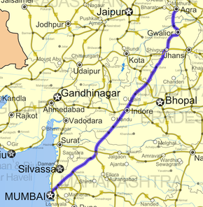
Road map of India with National Highway 3 highlighted in solid red colorRoute information Length: 1,161 km (721 mi)
NS: 95 km (Agra - Gwalior)
Phase III: 375 kmMajor junctions North end: Agra, Uttar Pradesh South end: Mumbai, Maharashtra Location States: Uttar Pradesh: 26 km
Rajasthan: 32 km
Madhya Pradesh: 712 km
Maharashtra: 391 kmPrimary
destinations:Agra - Gwalior - Indore - Dhule - Nashik - Mumbai Highway system Indian Road Network
National • Expressways • State← NH 2A NH 4 → National Highway 3 (NH 3), commonly referred to as the Mumbai-Agra Highway, is a major Indian National Highway that runs through the states of Uttar Pradesh, Rajasthan, Madhya Pradesh and Maharashtra states in India. [1]
The highway originates in Agra in Uttar Pradesh, generally travels South-West through Dhaulpur in Rajasthan, Gwalior, Shivpuri, Guna, Biaora, Maksi and Indore in Madhya Pradesh, and Dhule, Nashik, Thane and terminates at Mumbai in Maharashtra. NH 3 runs for a distance of 1,161 km (721 mi)
The stretch between Agra and Gwalior is marked as the North-South corridor by the National Highways Authority of India. In greater Mumbai area, the highway is also known as Eastern Express Highway which continues as mumbai - nashik expressway(newly built).
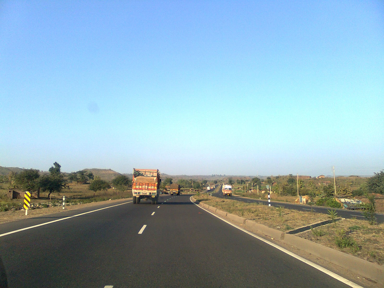
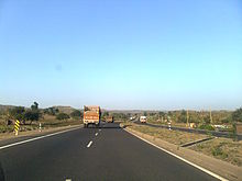 A stretch of NH 3 near Dhamnod
External links
See also
- List of National Highways in India (by Highway Number)
- National Highways Development Project
References
Indian Highways Network National Expressways NE 1 • NE 2


State Expressways Mumbai-Pune • Delhi-Gurgaon • DND Flyway • Bengaluru-Mysore • Chennai HSCTC • Hyderabad Elevated ExpresswaysNational Highways 1 • 1A • 1B • 1C • 1D • 2 • 2A • 3 • 4 • 4A • 4B • 5 • 5A • 6 • 7 • 7A • 8 • 8A • 8B • 8C • 8D • 8E • 9 • 10 • 11 • 11A • 11B • 12 • 12A • 13 • 14 • 15 • 16 • 17 • 17A • 17B • 18 • 19 • 20 • 21 • 21A • 22 • 23 • 24 • 24A • 24B • 25 • 25A • 26 • 26A • 27 • 28 • 28A • 28B • 28C • 29 • 30 • 30A • 31 • 31A • 31B • 31C • 31D • 32 • 33 • 34 • 35 • 36 • 37 • 37A • 38 • 39 • 40 • 41 • 42 • 43 • 44 • 44A • 45 • 45A • 45B • 45C • 46 • 47 • 47A • 47B • 47C • 48 • 49 • 50 • 51 • 52 • 52A • 52B • 53 • 54 • 54A • 55 • 56 • 57 • 57A • 58 • 59 • 59A • 60 • 60A • 61 • 62 • 63 • 64 • 65 • 66 • 67 • 68 • 69 • 70 • 71 • 71A • 71B • 72 • 72A • 73 • 73A • 74 • 75 • 76 • 77 • 78 • 79 • 79A • 80 • 81 • 82 • 83 • 84 • 85 • 86 • 86A • 87 • 88 • 89 • 90 • 91 • 91A • 92 • 93 • 94 • 95 • 96 • 97 • 98 • 99 • 100 • 101 • 102 • 103 • 104 • 105 • 106 • 107 • 108 • 109 • 110 • 111 • 112 • 113 • 114 • 116 • 117 • 119 • 121 • 123 • 125 • 126 • 127 • 128 • 129 • 150 • 151 • 152 • 153 • 154 • 155 • 200 • 201 • 202 • 203 • 203A • 204 • 205 • 206 • 207 • 208 • 209 • 210 • 211 • 212 • 213 • 214 • 214A • 215 • 216 • 217 • 218 • 219 • 220 • 221 • 222 • 223 • 224 • 226 • 227 • 228 • 229 • 234 • 235State Highways Andhra Pradesh • Arunachal Pradesh • Assam • Bihar • Chhattisgarh • Goa • Gujarat • Haryana • Himachal Pradesh • Jammu and Kashmir • Jharkhand • Karnataka • Kerala • Madhya Pradesh • Maharashtra • Manipur • Meghalaya • Mizoram • Nagaland • Orissa • Punjab • Rajasthan • Sikkim • Tamil Nadu • Tripura • Uttarakhand • Uttar Pradesh • West BengalNotable Categories:- National Highways in Uttar Pradesh
- National Highways in Rajasthan
- National Highways in Madhya Pradesh
- National Highways in Maharashtra
- Indian National Highways
- India road stubs


Wikimedia Foundation. 2010.