- National Highways Authority of India
-
भारतीय राष्ट्रीय राजमार्ग प्राधिकरण
National Highways Authority of India
Logo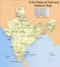
India National Highways MapAbbreviation भाराराप्रा
NHAIFormation 1988[1] Type Autonomous Government Agency Legal status Active Purpose/focus Development and maintenance of National Highways Headquarters G 5&6 Location Sector-10, Dwarka New Delhi-110075 Coordinates Coordinates: 28°35′01″N 77°03′28″E / 28.583689°N 77.057886°E Region served India Official languages Hindi
EnglishChairman A.K.Upadhyay Main organ Board of directors[2] Parent organization Ministry of Road Transport and Highways Website www.nhai.org The National Highways Authority of India (NHAI) (Hindi: भारतीय राष्ट्रीय राजमार्ग प्राधिकरण) is an autonomous agency of the Government of India, responsible for management of a network of over 60,000 km of National Highways in India.[3] The Authority is a nodal agency of the Ministry of Road Transport and Highways.
Contents
Establishment
The NHAI was created through the promulgation of the National Highways Authority of India Act, 1988. In February 1995, the Authority was formally made an autonomous body.[1]
It is responsible for the development, maintenance, management and operation of National Highways, totaling over 70,548 km (43,836 mi) in length.[4]Projects
The NHAI has the mandate to implement the National Highway Development Project (NHDP). The NHDP is under implementation in Phases.[4]
- Phase I: Approved in December 2000, at an estimated cost of INR 300 Billion, it included the Golden Quadrilateral (GQ), portions of the NS-EW Corridors, and connectivity of major ports to National Highways.
- Phase II: Approved in December 2003, at an estimated cost of INR 343 Billion, it included the completion of the NS-EW corridors and another 486 km (302 mi) of highways.
- Phase IIIA: This phase was approved in March 2005, at an estimated cost of INR 222 Billion, it includes an upgrade to 4-lanes of 4,035 km (2,507 mi)of National Highways.
- Phase IIIB: This was approved in April 2006, at an estimated cost of INR 543 Billion, it includes an upgrade to 4-lanes of 8,074 km (5,017 mi) of National Highways.
- Phase V: Approved in October 2006, it includes upgrades to 6-lanes for 6,500 km (4,000 mi), of which 5,700 km (3,500 mi) is on the GQ. This phase is entirely on a DBFO basis.
- Phase VI: This phase, approved in November 2006, will develop 1,000 km (620 mi) of expressways at an estimated cost of INR 167 Billion.
- Phase VII: This phase, approved in December 2007, will develop ring-roads, bypasses and flyovers to avoid traffic bottlenecks on selected stretches at a cost of INR 167 Billion.
The progress of the NHDP can be tracked from the NHAI official website, which updates maps on regular basis.
NHAI helps in implementing Special Accelerated Road Development Programme for North Eastern Region (SARDP-NE); a project to upgrade National Highways connecting state capitals to 2 lane or 4 lane in north eastern region.[5]See also
References
Transport in India Road National Highways Authority of India · National Highways Development Project · Ministry of Road Transport and Highways · List of National Highways in India · Indian Expressways

Rail Indian Railways · High-speed rail in India · Ministry of Railways · Dedicated Freight Corridor Corporation of India · List of railway stations in India
Air Water Shipping Corporation of India · Ports in India · Ministry of Shipping · Inland Waterways Authority of India
Miscellaneous Indian licence plates · Driving licence in India · Road signs in India
Categories:- Roads in India
- Road authorities
- Executive branch of the Indian government
- Indian National Highways

Wikimedia Foundation. 2010.