- National Highway (India)
-
This article is about Indian National Highways. For Indian Expressways, see National Expressway (India).
The National Highways Network of India, is a network of highways that is managed and maintained by agencies of the Government of India. These highways measured over 70,934 km (44,076 mi) as of 2010, including over 1,000 km (620 mi) of limited-access Expressways.[1]
The National Highways Authority of India (NHAI) is the nodal agency responsible for building, upgrading and maintaining most of the national highways network. It operates under the Ministry of Road Transport and Highways. The National Highways Development Project (NHDP) is a major effort to expand and upgrade the network of highway network. NHAI often uses a public-private partnership model for highway development, maintenance and toll-collection.
National highways constituted about 2% of all the roads in India, but carried about 40% of the total road traffic as of 2010.[2] The majority of existing national highways are two-lane roads (one lane in each direction), though much of this is being expanded to four-lanes, and some to six or eight lanes. Some sections of the network are toll roads. Over 30,000 km (19,000 mi) of new highways are planned or under construction as part of the NHDP, as of 2011. This includes over 2,600 km (1,600 mi) of Expressways currently under construction.
Contents
Historical national highways
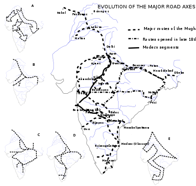 Evolution of the Indian road network — The main map shows routes that have existed since Mughal times, Inset A shows the major cultural currents of the prehistoric period, B shows pre-Mauryan Indian routes, C shows the Mauryan network, D shows the trade routes at the beginning of the Christian era, and E shows the Indian "Z".
In ancient times the ruling monarchs constructed many brick roads in cities. The most famous highway of medieval India was the Grand Trunk Road. The Grand Trunk Road began in Sonargaon[3] near Dhaka now in Bangladesh and ended in Peshawar now in Pakistan. It travelled through or near many important cities of the subcontinent, including Dhaka in Bangladesh, Kolkata, Patna, Varanasi, Kanpur, Agra, Delhi, Panipat, Ludhiana, Jalandhar, and Amritsar in India, and Lahore and Peshawar in Pakistan.
In the 19th century, the British upgraded the existing highway network, and built roads in treacherous areas such as the Western Ghats.
Current system
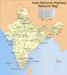 The Network of National Highways in IndiaMain article: List of National Highways in India
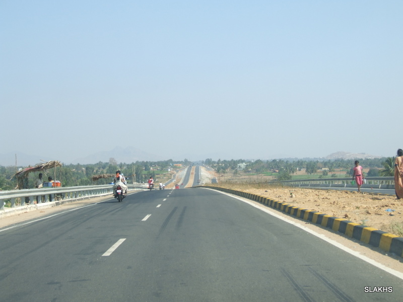
India has 70,934 km (44,076 mi) of national highways (NH) connecting all the major cities and state capitals as of August 2011. Most of them have two lanes. About 10,000 km (6,200 mi) have been widened to four lanes with two lanes in each direction. Only a few of NH are built with cement concrete. As of 2010, 19,064 km (11,846 mi) of NH were still single-laned roads. The government is currently working to ensure that by December 2014 the entire National Highway network consists of roads with two or more lanes.[4] though it is doubtful whether this will be achieved.
India has the distinction of having the world's second highest-altitude motor highway— Leh-Manali Highway, connecting Shimla to Leh in Ladakh, Kashmir.[citation needed]
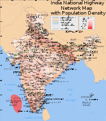 Map showing highway distribution with population density
National highways form the economic backbone of the country and have often facilitated development along their routes, and many new towns have sprung up along major highways. Highways also have large numbers of small restaurants and inns (known as dhabas) along their length. They serve popular local cuisine and serve as truck stops.
Ministry of Road Transport and Highways, Government of India adopted a new systematic numbering of National Highways in April 2010. The new system will indicate the direction of National Highways whether it is East-West (odd numbers) or North-South (even numbers) and also the geographical region where it is located, increasing from east to west and from north to south.[5]
Recent developments
Under former Prime Minister Atal Behari Vajpayee, India launched a massive program of highway upgrades, called the National Highway Development Project (NHDP), in which the main north-south and east-west connecting corridors and highways connecting the four metropolitan cities have been fully paved and widened into four-lane highways. Some of the busier National Highway sectors in India have been converted to four or six lane expressways – for example, Delhi-Agra, Delhi-Jaipur, Ahmedabad-Vadodara, Mumbai-Pune, Mumbai-Surat, Bangalore-Mysore, Bangalore-Chennai, Chennai-Tada, Delhi-Meerut , Hyderabad-Vijayawada and Guntur-Vijayawada. Phase V of the National Highway Development Project is to convert all 6,000 km (3,700 mi) of the Golden Quadrilateral Highways to 6-lane highways/expressways by 2012.
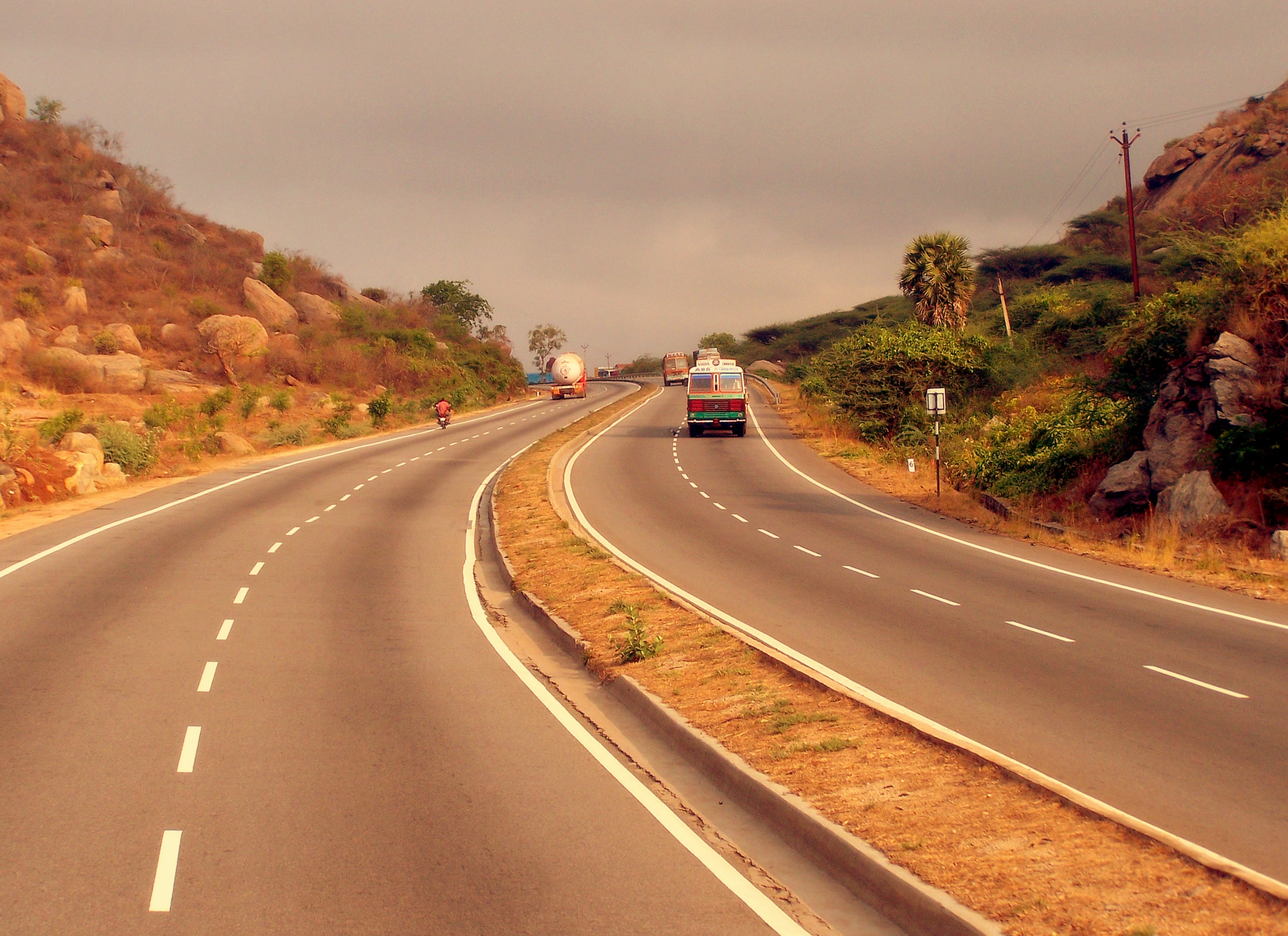
The National Highways Act, 1956, as amended, provides for private investment in the building and maintenance of the highways. Recently, a number of existing roads have been reclassified as national highways. Bypasses have also recently been constructed around larger towns and cities to provide uninterrupted passage for highway traffic. The hugely varied climactic, demographic, traffic, and sometimes political situation in India results in NH being single lane in places with low traffic to six lanes in places with heavy traffic. National highways are being upgraded or are under construction. Some NH are long while some are short spurs off other NH to provide connectivity to nearby ports or harbours.
The longest NH is NH7,[6] which runs between Varanasi in Uttar Pradesh to Kanyakumari in Tamil Nadu, at the southernmost point of the Indian mainland, covering a distance of 2,369 km (1,472 mi), and passes through Hyderabad and Bangalore. The shortest NH is the NH47A,[7] which spans 6 km (3.7 mi), to the Ernakulam - Kochi Port.
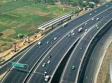
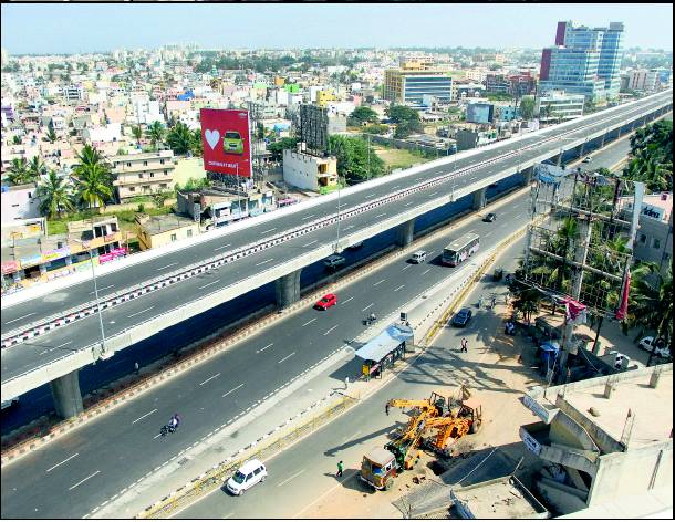
 NH7 Section Between Bangalore to Karnataka-Andhrapradesh Border. It is a part of the North South Corridor.
Indian road network
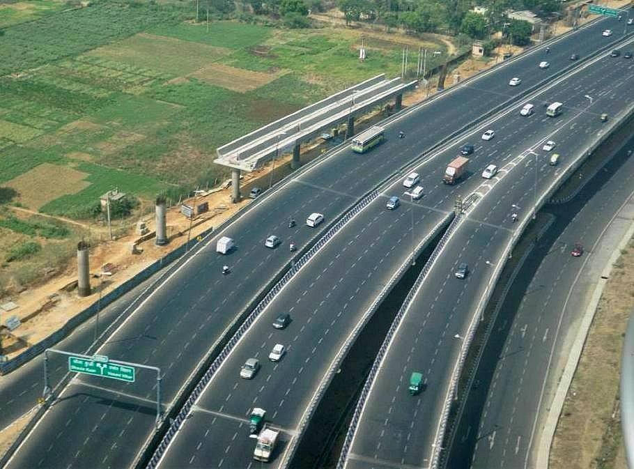
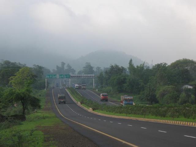
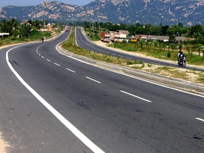
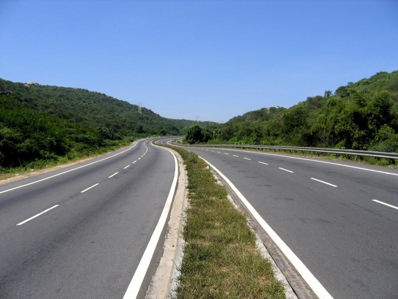
Indian Road Network[8] Class Length (km) Access Controlled Expressways over 1,000 km (620 mi) 4-6 lane Divided Highways (with service roads in congested areas) over 12,000 km (7,500 mi) National Highways 66,590 km (41,380 mi) State Highways 131,899 km (81,958 mi) Major district roads 467,763 km (290,654 mi) Rural & other roads 2,650,000 km (1,650,000 mi) Total (approx) 3,300,000 km (2,100,000 mi) Gallery
References and notes
- ^ http://www.nhai.org/roadnetwork.htm
- ^ http://www.nhai.org/roadnetwork.htm
- ^ Article on Archnet
- ^ K. Balchand (23 March 2010). "Two-laning of entire National Highway network by 2014". Chennai, India: The Hindu. http://www.hindu.com/2010/03/23/stories/2010032360821800.htm.
- ^ http://en.wikipedia.org/wiki/File:Renumbered_National_Highways_map_of_India_(Schematic).jpg
- ^ Indian Road Map-Source-Maps of India
- ^ List Kerala Highways in Kerala,
[1] National Highway 47A-Source-India9.com] - ^ Road Network report by National Highway Authority of India
External links
Indian Highways Network National Expressways NE 1 • NE 2


State Expressways Mumbai-Pune • Delhi-Gurgaon • DND Flyway • Bengaluru-Mysore • Chennai HSCTC • Hyderabad Elevated ExpresswaysNational Highways 1 • 1A • 1B • 1C • 1D • 2 • 2A • 3 • 4 • 4A • 4B • 5 • 5A • 6 • 7 • 7A • 8 • 8A • 8B • 8C • 8D • 8E • 9 • 10 • 11 • 11A • 11B • 12 • 12A • 13 • 14 • 15 • 16 • 17 • 17A • 17B • 18 • 19 • 20 • 21 • 21A • 22 • 23 • 24 • 24A • 24B • 25 • 25A • 26 • 26A • 27 • 28 • 28A • 28B • 28C • 29 • 30 • 30A • 31 • 31A • 31B • 31C • 31D • 32 • 33 • 34 • 35 • 36 • 37 • 37A • 38 • 39 • 40 • 41 • 42 • 43 • 44 • 44A • 45 • 45A • 45B • 45C • 46 • 47 • 47A • 47B • 47C • 48 • 49 • 50 • 51 • 52 • 52A • 52B • 53 • 54 • 54A • 55 • 56 • 57 • 57A • 58 • 59 • 59A • 60 • 60A • 61 • 62 • 63 • 64 • 65 • 66 • 67 • 68 • 69 • 70 • 71 • 71A • 71B • 72 • 72A • 73 • 73A • 74 • 75 • 76 • 77 • 78 • 79 • 79A • 80 • 81 • 82 • 83 • 84 • 85 • 86 • 86A • 87 • 88 • 89 • 90 • 91 • 91A • 92 • 93 • 94 • 95 • 96 • 97 • 98 • 99 • 100 • 101 • 102 • 103 • 104 • 105 • 106 • 107 • 108 • 109 • 110 • 111 • 112 • 113 • 114 • 116 • 117 • 119 • 121 • 123 • 125 • 126 • 127 • 128 • 129 • 150 • 151 • 152 • 153 • 154 • 155 • 200 • 201 • 202 • 203 • 203A • 204 • 205 • 206 • 207 • 208 • 209 • 210 • 211 • 212 • 213 • 214 • 214A • 215 • 216 • 217 • 218 • 219 • 220 • 221 • 222 • 223 • 224 • 226 • 227 • 228 • 229 • 234 • 235State Highways Andhra Pradesh • Arunachal Pradesh • Assam • Bihar • Chhattisgarh • Goa • Gujarat • Haryana • Himachal Pradesh • Jammu and Kashmir • Jharkhand • Karnataka • Kerala • Madhya Pradesh • Maharashtra • Manipur • Meghalaya • Mizoram • Nagaland • Orissa • Punjab • Rajasthan • Sikkim • Tamil Nadu • Tripura • Uttarakhand • Uttar Pradesh • West BengalNotable Categories:- Roads in India
- Indian National Highways
-


.jpg)
Wikimedia Foundation. 2010.