- National Highway 67 (India)
-
National Highway 67

67
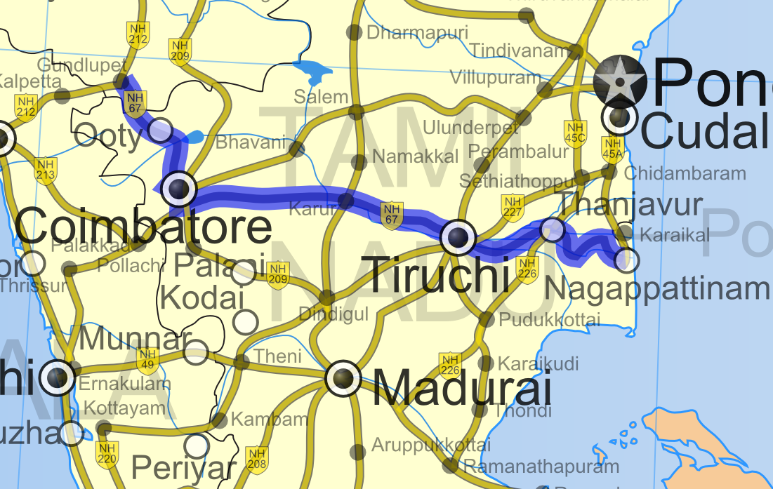
Route information Length: 555 km (345 mi) Major junctions From: Nagapattinam, Tamil Nadu To: Gundlupet, Karnataka Location States: Tamil Nadu: km
Karnataka: kmPrimary
destinations:Nagapattinam - Tanjore - Trichy - Karur - Coimbatore - Ooty - Gudalur - Gundlupet Highway system Indian Road Network
National • Expressways • State
State Highways in ¬← NH 66 NH 68 → National Highway 67 (NH 67) is a National Highway in Southern Indian states of Tamil Nadu and Karnataka. It runs from Nagapattinam, a sea-side town in Tamil Nadu to Gundlupet in Karnataka near the intersection of National Highway 212. The most important cities connected by this highway are Coimbatore and Trichy and the important towns connected by this highway are Nagapattinam, Thiruvarur, Tanjore, Trichy, Karur, Ooty. This highway traverses the wider middle region of Tamil Nadu. The total length of NH 67 runs to 555 km (345 mi).[1] The National Highway 67 along with National Highway 212 connects city of Mysuru via Gundlupete with Ooty. The NH-67 passes through Bandipur National Park in Karnataka region. There has been reports of wild animals being killed by speeding vehicles in this highway.
NH 67 runs along the southern banks of Kaveri river between Trichy and Karur. The road between Karur and Coimbatore for a distance of 114.4 km (71.1 mi) is being widened into two/four lanes and the project is expected to be complete by August 2008.[2] The 67 km (42 mi)distance between Thanjavur and Trichy is widened by Madhucon Projects Ltd. The 79.7 km (49.5 mi) distance between Trichy and Karur is widened by Reliance Energy Limited.[3]Route
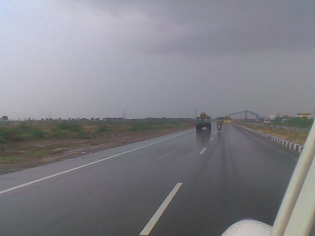
 NH 67 near Coimbatore during Rains
Nagappattinam, Thiruvarur, Thanjavur, Trichy, Kulithalai, Karur, Vellakoil, Kangayam, Coimbatore, Mettupalayam, coonoor, Ooty, Naduvattam and Gundlupet.[4]
And there is a proposal for extension of this highway as NH 67-A, which splits from Karur towards Erode, and reaches Mysore through Sathy & Chamarajanagar and to Bangalore through Anthiyur & Kanakapura.
Road improvement
The works relating to laying of four sections of Coimbatore bypass road from Kangayampalayam to Kallar as part of Coimbatore – Mettupalayam bypass. Coimbatore bypass road would start from kangayampalayam via Muthugoundenpudur, Neelambur, Mayilampatty, Vellanaipatty, Kalapatti, Idigari to join Mettupalayam Road at Narasimhanaickenpalayam. The stretch would measure 26.5 km. The next stretch of bypass road from Chikkadasampalayam would be via Odanthurai and Kallar. The entire stretch of Mettupalayam bypass road from Coimbatore would measure 53.95 km. Three rail overbridges would come up at Sulur, Narashimanaickenpalayam and Karamadai.== References ==
- ^ "National Highways and their lengths". Ministry of Road Transport & Highways, Government of India. National Highways Authority of India. http://www.nhai.org/nh.asp. Retrieved 2009-02-12.
- ^ Karur to Coimbatore road widening
- ^ [1] Thanjavur to Karur widening-Source-National Highways Authority of India (NHAI)
- ^ NHAI website
Indian Highways Network National Expressways NE 1 • NE 2


State Expressways Mumbai-Pune • Delhi-Gurgaon • DND Flyway • Bengaluru-Mysore • Chennai HSCTC • Hyderabad Elevated ExpresswaysNational Highways 1 • 1A • 1B • 1C • 1D • 2 • 2A • 3 • 4 • 4A • 4B • 5 • 5A • 6 • 7 • 7A • 8 • 8A • 8B • 8C • 8D • 8E • 9 • 10 • 11 • 11A • 11B • 12 • 12A • 13 • 14 • 15 • 16 • 17 • 17A • 17B • 18 • 19 • 20 • 21 • 21A • 22 • 23 • 24 • 24A • 24B • 25 • 25A • 26 • 26A • 27 • 28 • 28A • 28B • 28C • 29 • 30 • 30A • 31 • 31A • 31B • 31C • 31D • 32 • 33 • 34 • 35 • 36 • 37 • 37A • 38 • 39 • 40 • 41 • 42 • 43 • 44 • 44A • 45 • 45A • 45B • 45C • 46 • 47 • 47A • 47B • 47C • 48 • 49 • 50 • 51 • 52 • 52A • 52B • 53 • 54 • 54A • 55 • 56 • 57 • 57A • 58 • 59 • 59A • 60 • 60A • 61 • 62 • 63 • 64 • 65 • 66 • 67 • 68 • 69 • 70 • 71 • 71A • 71B • 72 • 72A • 73 • 73A • 74 • 75 • 76 • 77 • 78 • 79 • 79A • 80 • 81 • 82 • 83 • 84 • 85 • 86 • 86A • 87 • 88 • 89 • 90 • 91 • 91A • 92 • 93 • 94 • 95 • 96 • 97 • 98 • 99 • 100 • 101 • 102 • 103 • 104 • 105 • 106 • 107 • 108 • 109 • 110 • 111 • 112 • 113 • 114 • 116 • 117 • 119 • 121 • 123 • 125 • 126 • 127 • 128 • 129 • 150 • 151 • 152 • 153 • 154 • 155 • 200 • 201 • 202 • 203 • 203A • 204 • 205 • 206 • 207 • 208 • 209 • 210 • 211 • 212 • 213 • 214 • 214A • 215 • 216 • 217 • 218 • 219 • 220 • 221 • 222 • 223 • 224 • 226 • 227 • 228 • 229 • 234 • 235State Highways Andhra Pradesh • Arunachal Pradesh • Assam • Bihar • Chhattisgarh • Goa • Gujarat • Haryana • Himachal Pradesh • Jammu and Kashmir • Jharkhand • Karnataka • Kerala • Madhya Pradesh • Maharashtra • Manipur • Meghalaya • Mizoram • Nagaland • Orissa • Punjab • Rajasthan • Sikkim • Tamil Nadu • Tripura • Uttarakhand • Uttar Pradesh • West BengalNotable Categories:- National Highways in Karnataka
- National Highways in Tamil Nadu
- Indian National Highways
- India road stubs


Wikimedia Foundation. 2010.