- Delhi Gurgaon Expressway
-
Delhi Gurgaon Expressway Route information Length: 28 km (17 mi) History: Completed in 2008 Major junctions West end: Delhi East end: Gurgaon Location States: Delhi, Haryana Major cities: Gurgaon Highway system Indian Road Network
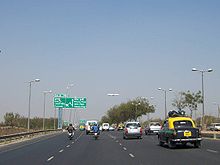
National • Expressways • StateDelhi-Gurgaon Expressway is a 28 km (17 mi) long access-controlled toll expressway connecting Delhi, the national capital of India, and Gurgaon, an important satellite city of Haryana.
The expressway is a part of the Golden Quadrilateral project, which itself is a part of the National Highway Development Project (NHDP) and emphasizes improving road connectivity between four metropolitan cities of India, namely Delhi, Mumbai, Chennai and Kolkata by developing 4–6 lane highways between them. The much-delayed
 10 billion (US$202.8 million), 27.7 km (17.2 mi) expressway was thrown open on January 23, 2008. It has helped reduce the travel time of hundreds of thousands of commuters and international air passengers. Vehicle users have to pay a toll for using the expressway, which is collected at three points, near the Indira Gandhi International Airport, the Delhi-Gurgaon Border and the 42nd Milestone. Since it began operation, it has also achieved notoriety for a large number of accidents involving pedestrians. There are only two overbridges along the entire stretch to cater to the communities living on either side of heavily populated areas through which the expressway runs. The toll plaza at the Delhi-Gurgaon border has also proved inadequate to handle the increasing traffic, leading to traffic jams during peak hours. Though the plaza is tag enabled, only 40 percent of the traffic that passes through avails of this facility.[1]
Contents
Special features
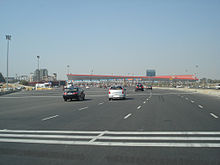
 The 32-lane toll gate at the Delhi-Gurgaon border is the largest in South Asia and second largest in the Asia.[2]
This expressway is the busiest inter-city route in India and handles more than 180,000 PCUs daily.[3]
- Starts at Dhaula Kuan in Delhi and terminates on the outskirts of Gurgaon (Manesar).
- The road has 11 flyovers and overpasses.
- Four toll plazas including the 36-lane toll plaza at Delhi-Haryana Border, which is the biggest toll plaza in South Asia and the second biggest in the Asia.[2]
- CCTV surveillance till IGI airport.
- SOS one-way telephones at every 1.5 km (0.93 mi)
- Elevated sections of the expressway will be open only for vehicles capable of attaining speeds of 80–100 km/h.
- 47 km (29 mi) of service roads for local and slow moving traffic.
Authorities involved
- Delhi Development Authority (DDA)
- Haryana Urban Development Authority (HUDA)
- National Highways Authority of India (NHAI)
- Central Road Research Institute (CRRI)
See also
- Expressways in India
- List of National Highways in India by highway number
- Highways passing from Delhi
- Indian Highways
- National Highways Development Project
- DND Flyway
References
- ^ "Who will build overbridges on expressway?". Indian Express. 2009-01-20. http://www.indianexpress.com/news/who-will-build-overbridges-on-expressway/412740/. Retrieved 2010-09-16.
- ^ a b "Excess cars made tolling a taxing truth at first: Expressway builder". Express India. http://www.expressindia.com/latest-news/excess-cars-made-tolling-a-taxing-truth-at-first-expressway-builder/281668/. Retrieved 2010-09-16.
- ^ TNN, Jan 8, 2009, 03.35am IST (2009-01-08). "Easy entry for Visa card holders- Times of India". Timesofindia.indiatimes.com. http://timesofindia.indiatimes.com/Delhi/Easy_entry_for_Visa_card_holders/articleshow/3949039.cms. Retrieved 2010-09-16.
External links
Indian Highways Network National Expressways NE 1 • NE 2

State Expressways Mumbai-Pune • Delhi-Gurgaon • DND Flyway • Bengaluru-Mysore • Chennai HSCTC • Hyderabad Elevated ExpresswaysNational Highways 1 • 1A • 1B • 1C • 1D • 2 • 2A • 3 • 4 • 4A • 4B • 5 • 5A • 6 • 7 • 7A • 8 • 8A • 8B • 8C • 8D • 8E • 9 • 10 • 11 • 11A • 11B • 12 • 12A • 13 • 14 • 15 • 16 • 17 • 17A • 17B • 18 • 19 • 20 • 21 • 21A • 22 • 23 • 24 • 24A • 24B • 25 • 25A • 26 • 26A • 27 • 28 • 28A • 28B • 28C • 29 • 30 • 30A • 31 • 31A • 31B • 31C • 31D • 32 • 33 • 34 • 35 • 36 • 37 • 37A • 38 • 39 • 40 • 41 • 42 • 43 • 44 • 44A • 45 • 45A • 45B • 45C • 46 • 47 • 47A • 47B • 47C • 48 • 49 • 50 • 51 • 52 • 52A • 52B • 53 • 54 • 54A • 55 • 56 • 57 • 57A • 58 • 59 • 59A • 60 • 60A • 61 • 62 • 63 • 64 • 65 • 66 • 67 • 68 • 69 • 70 • 71 • 71A • 71B • 72 • 72A • 73 • 73A • 74 • 75 • 76 • 77 • 78 • 79 • 79A • 80 • 81 • 82 • 83 • 84 • 85 • 86 • 86A • 87 • 88 • 89 • 90 • 91 • 91A • 92 • 93 • 94 • 95 • 96 • 97 • 98 • 99 • 100 • 101 • 102 • 103 • 104 • 105 • 106 • 107 • 108 • 109 • 110 • 111 • 112 • 113 • 114 • 116 • 117 • 119 • 121 • 123 • 125 • 126 • 127 • 128 • 129 • 150 • 151 • 152 • 153 • 154 • 155 • 200 • 201 • 202 • 203 • 203A • 204 • 205 • 206 • 207 • 208 • 209 • 210 • 211 • 212 • 213 • 214 • 214A • 215 • 216 • 217 • 218 • 219 • 220 • 221 • 222 • 223 • 224 • 226 • 227 • 228 • 229 • 234 • 235State Highways Andhra Pradesh • Arunachal Pradesh • Assam • Bihar • Chhattisgarh • Goa • Gujarat • Haryana • Himachal Pradesh • Jammu and Kashmir • Jharkhand • Karnataka • Kerala • Madhya Pradesh • Maharashtra • Manipur • Meghalaya • Mizoram • Nagaland • Orissa • Punjab • Rajasthan • Sikkim • Tamil Nadu • Tripura • Uttarakhand • Uttar Pradesh • West BengalNotable Categories:- Delhi Roads
- Gurgaon
- Expressways in India
- Toll roads in India
Wikimedia Foundation. 2010.


