- National Highway 45 (India)
-
National Highway 45 
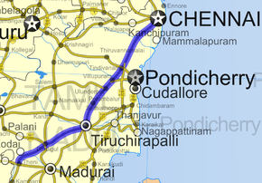
Road map of India with National Highway 45 highlighted in solid blue colorRoute information Length: 472 km (293 mi) Major junctions North end: Chennai, Tamil Nadu South end: Theni, Tamil Nadu Location States: Tamil Nadu Primary
destinations:Chennai - Tambaram - Tindivanam - Villupuram - Trichy - Manapparai - Dindigul- Periyakulam - Theni Highway system Indian Road Network
National • Expressways • State← NH 44A NH 45A → Grand Southern Trunk Road or National Highway 45 is one of the busiest National Highways in Southern India with a total length of 472 km (293 mi). The highway starts from Kathipara junction in Guindy, a very busy confluence of five roads in southern Chennai and extends up to Theni. It connects Chennai to its airport and the southern suburbs. The two important Cities connected by this highway are Chennai and Trichy and the two important towns connected by this highway are Dindigul and Theni in Tamil Nadu. The highway has a 4 lane (2 lanes each direction) system between Chennai and Trichy, though a complete change to 6 lanes is being planned.The Chennai International Airport is located on this highway within the Chennai City limits.
Contents
Traffic
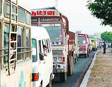
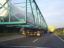
At night, the highway experiences a huge volume of traffic. On an average, around 10,000 lorries use this highway to reach Chennai every night.The highway has several motels and restaurants along the entire stretch. Fatal accidents frequently happen in this highway, mostly due to irresponsible bus drivers and over-speeding lorries colliding head on.[citation needed]The large amount of traffic on NH45 is seen in between Chennai and Trichy.
The Southern Railway line between Chennai and Trichy cuts through this highway in many places resulting in huge pile up of vehicles on both sides of the highway, especially during the night hours. In case of any mishaps on the highway, the emergency services get delayed by at least 3 – 5 hours, due to the volume of traffic.
Road Improvement Projects
In an effort to circumvent these longstanding problems, many infrastructure projects are being carried out on this highway including road over-bridges along the Chennai Meenambakkam Airport road and several rail over-bridges over the railway crossings on the highway, which can cut travel time as well as reduce traffic congestion. The six-lane system is currently extended between Tindivanam and Trichy for a distance of around 225 km (140 mi). Many road sections between Tindivanam and Trichy are opened to public traffic with the newly laid 4-lane system. [1]
Towns Connected
This highway is separated into four major segments from Chennai to Theni based on the traffic volume.
Very Heavy Traffic
Guindy (Chennai) - St. Thomas Mount - Meenambakkam - Tirusulam - Pallavaram - Chromepet - Tambaram - Perungalathur - Vandalur - Urapakkam - Guduvancheri - Potheri - Kattangulathur - Maraimalai Nagar - Chengelpet - Madurantakam - Dindivanam - Vikravandi - Villupuram
Heavy Traffic
Villupuram - Ulundurpettai - Kiranur - Veppur - Ranjangudi - Perambalur - Padalur - Trichy
Moderate Traffic
Trichy - Kulathur - Manapparai - Vaiampatti - Vadamadurai - Dindigul
Low Traffic
Dindigal - Sembatti - Vattalakkundu - Periyakulam - Theni
See also
References
- ^ "National Highways and their lengths". National Highways Authority of India. http://www.nhai.org/nh.asp. Retrieved 2009-02-12.
External links
- [1] NH-45 map
Indian Highways Network National Expressways NE 1 • NE 2

State Expressways Mumbai-Pune • Delhi-Gurgaon • DND Flyway • Bengaluru-Mysore • Chennai HSCTC • Hyderabad Elevated ExpresswaysNational Highways 1 • 1A • 1B • 1C • 1D • 2 • 2A • 3 • 4 • 4A • 4B • 5 • 5A • 6 • 7 • 7A • 8 • 8A • 8B • 8C • 8D • 8E • 9 • 10 • 11 • 11A • 11B • 12 • 12A • 13 • 14 • 15 • 16 • 17 • 17A • 17B • 18 • 19 • 20 • 21 • 21A • 22 • 23 • 24 • 24A • 24B • 25 • 25A • 26 • 26A • 27 • 28 • 28A • 28B • 28C • 29 • 30 • 30A • 31 • 31A • 31B • 31C • 31D • 32 • 33 • 34 • 35 • 36 • 37 • 37A • 38 • 39 • 40 • 41 • 42 • 43 • 44 • 44A • 45 • 45A • 45B • 45C • 46 • 47 • 47A • 47B • 47C • 48 • 49 • 50 • 51 • 52 • 52A • 52B • 53 • 54 • 54A • 55 • 56 • 57 • 57A • 58 • 59 • 59A • 60 • 60A • 61 • 62 • 63 • 64 • 65 • 66 • 67 • 68 • 69 • 70 • 71 • 71A • 71B • 72 • 72A • 73 • 73A • 74 • 75 • 76 • 77 • 78 • 79 • 79A • 80 • 81 • 82 • 83 • 84 • 85 • 86 • 86A • 87 • 88 • 89 • 90 • 91 • 91A • 92 • 93 • 94 • 95 • 96 • 97 • 98 • 99 • 100 • 101 • 102 • 103 • 104 • 105 • 106 • 107 • 108 • 109 • 110 • 111 • 112 • 113 • 114 • 116 • 117 • 119 • 121 • 123 • 125 • 126 • 127 • 128 • 129 • 150 • 151 • 152 • 153 • 154 • 155 • 200 • 201 • 202 • 203 • 203A • 204 • 205 • 206 • 207 • 208 • 209 • 210 • 211 • 212 • 213 • 214 • 214A • 215 • 216 • 217 • 218 • 219 • 220 • 221 • 222 • 223 • 224 • 226 • 227 • 228 • 229 • 234 • 235State Highways Andhra Pradesh • Arunachal Pradesh • Assam • Bihar • Chhattisgarh • Goa • Gujarat • Haryana • Himachal Pradesh • Jammu and Kashmir • Jharkhand • Karnataka • Kerala • Madhya Pradesh • Maharashtra • Manipur • Meghalaya • Mizoram • Nagaland • Orissa • Punjab • Rajasthan • Sikkim • Tamil Nadu • Tripura • Uttarakhand • Uttar Pradesh • West BengalNotable Categories:- National Highways in Tamil Nadu
- Indian National Highways
Wikimedia Foundation. 2010.


