- Peshawar
-
Peshawar
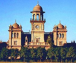
Urdu: پشاور Pashto: پېښور Hindko: پِشور— City District — Islamia College Location within Pakistan Coordinates: 34°01′N 71°35′E / 34.017°N 71.583°ECoordinates: 34°01′N 71°35′E / 34.017°N 71.583°E Country  Pakistan
Province  Khyber Pakhtunkhwa
District Peshawar District Union Councils 25 Government – Nazim (Empress) Asya Abbas (ANP) Area – Total 1,257 km2 (485.3 sq mi) Elevation 510 m (1,673 ft) Population (2010)[1] – Total 3,625,000 – Density 2,883.9/km2 (7,469.1/sq mi) Time zone PST (UTC+5) Area code(s) 091 Peshawar (Pashto: پېښور, Hindko: پِشور, Urdu: پشاور) is the capital of the Khyber-Pakhtunkhwa[2] and the administrative center and the central economic hub for the Federally Administered Tribal Areas of Pakistan.[3]
Peshawar is situated in a large valley near the eastern end of the Khyber Pass, between the eastern edge of the Iranian plateau and the Indus Valley. Known as "City on the Frontier" in Persian, Peshawar's strategic location on the crossroads of Central Asia and South Asia has made it one of the most culturally vibrant and lively cities in the greater region.
Peshawar has evolved into one of Pakistan's most ethnically, linguistically, and religiously diverse cities. In the last three decades, there has been a significant increase in urban population, in part due to internal migration of people in search of better employment opportunities, education, and services, and in part because of the influx of Afghan refugees and other people displaced by military operations and civil unrest in neighboring regions. Peshawar is the major educational, political, and business center of Khyber Pakhtunkhwa.
Contents
History of Peshawar
Peshawar is now officially recognized as being one of the Oldest Living Cities in Asia. Its history and culture has continued uninterrupted since several centuries. This fact was confirmed by the discovery of silver punch-marked coins from the Government House in 1906–07 and the ongoing excavation at Gor Khatri which is the deepest and widest in the world.[4] Being among the most ancient cities of the region between Central, South, and West Asia, Peshawar has for centuries been a centre of trade between Afghanistan, South Asia, Central Asia and the Middle East. As an ancient centre of learning, the 2nd century BCE. Bakhshali Manuscript used in the Bakhshali approximation was found nearby.[5]
Peshawar was a major centre of Buddhist learning until the 10th century.[6] As an indication of its importance, Peshawar was also the site of Kanishka's Great Stupa which housed relics of Gautama Buddha, and was widely considered to be the tallest building in the world at the time of its construction.[7] Ancient Chinese manuscripts tell of Buddhist pilgrims such as Faxian, Sung Yun, and Xuanzang reporting that the 7th century stupa, which was rediscovered in the south east of the city at a site called Shahji-ki-Dheri in 1907–08, had a height of 591–689 feet.[6][8][9][10][11]
The Kushan king Kanishka, moved the capital from Pushkalavati (now called Charsadda in the Peshawar valley) to Purushapura in the 2nd century CE,[12] and in the eighteenth century, the Durrani king Timur Shah Durrani made Peshawar the winter capital of Afghanistan, and it remained as the winter capital until the Sikhs rose to power in the early nineteenth century.[13] The current name "Peshawar" may derive from the Sanskrit Purushapura[14] (meaning "city of men") and is known as Pekhawar or Peshawar in Pashto and Pishor in Hindko. The area originally belonged to Gandhara and the eastern Iranian tribes of Scythian origin and later became part of the Kushan Empire.
Peshawar emerged as a centre of both Hindko and Pashtun intellectuals. Its dominant culture for much of British rule was that of the Hindko speakers, also referred to as "Khaarian" ('city dwellers' in Pashto).[15] Its unique culture, distinct from the surrounding Pashtun areas, led to the city being romanticised by Pashto singers, with songs like larsha Pekhwar tha (go to Peshawar) and more recently Pekhawar kho pekhawar dhay kana (Peshawar is Peshawar after all). This unique culture has gradually disappeared with the massive influx of Afghan refugees and the increasing migration of Pashtuns into the city. The demographics has changed quite dramatically and Pashto is now the dominant language of the city.
Peshawar is located in an area that was dominated by various tribes of Indo-Iranian origin. The region was affiliated with the ancient kingdom of Gandhara and had links to the Harappan civilization of the Indus River Valley and to Bactria and other ancient kingdoms based in Afghanistan. According to the historian Tertius Chandler, Peshawar had a population of 120,000 in the year 100 BCE, making it the seventh most populous city in the world.[16]
Vedic mythology refers to an ancient settlement called Pushkalavati in the area, after Pushkal, the son of King Bharata in the epic Ramayana.[17] but this settlement's existence remains speculative and unverifiable.[18] In recorded history, the earliest major city established in the general area of Peshawar was called Purushapura (Sanskrit for City of Men) and was founded by the Kushans, a Central Asian tribe of Tocharian origin, over 2,000 years ago.[19] Prior to this period the region was affiliated with Gandhara, an ancient Indo-Iranian kingdom, and was annexed first by the Persian Achaemenid empire and then by the Hellenic empire of Alexander the Great. The city passed into the rule of Alexander's successor, Seleucus I Nicator who ceded it to Chandragupta Maurya, the founder of the Maurya Empire in 305 BCE. Buddhism was introduced into the region at this time and may have claimed the majority of Peshawar's inhabitants before the coming of Islam.[20]
Greco-Bactrian Peshawar
The area that Peshawar occupies was then seized by the Greco-Bactrian king, Eucratides (170 – 159 BCE), and was controlled by a series of Greco-Bactrian and later Indo-Greek kings who ruled an empire that spanned from present day Pakistan to North India. Later, the city came under the rule of several Parthian and Indo-Parthian kings, another group of Iranic peoples germane to the region, the most famous of whom, Gondophares (Gandapur in Pashto), ruled the city and its environs starting in circa 46 CE, and was briefly followed by two or three of his descendants before they were displaced by the first of the "Great Kushans", Kujula Kadphises, around the middle of the 1st century CE.
Gandharan Peshawar
Peshawar formed the eastern capital of the empire of Gandhara under the Kushan king Kanishka, who reigned from at least 127 CE. After the 2 or 3 BC, Buddhist missionaries arrived to Zoroastrian and animist Peshawar seeking counsel with the Zoroastrian Kushan rulers. Surprisingly, rather than being repelled, their teachings were embraced by the Zoroastrian Kushans who converted to Buddhism and gave the religion official status in the city. Following this move by the Kushans, Peshawar became a great center of Buddhist learning even though Zoroastrianism and animism seem to have survived in the majority population (particularly the rural areas). Kanishka however, who was now an ardent follower of Buddhism built what may have been the tallest building in the world at the time, a giant stupa, to house the Buddha's relics, just outside the Ganj Gate of the old city of Peshawar.
The Kanishka stupa was said to be an imposing structure as one travelled down from the mountains of Afghanistan onto the Gandharan plains. The earliest account of the famous building is by the Chinese Buddhist pilgrim monk, Faxian, who visited it in 400 and described it as being over 40 chang in height (probably about 120 m or 394 ft) and adorned "with all precious substances". "Of all the stûpas and temples seen by the travellers, none can compare with this for beauty of form and strength." It was destroyed by lightning and repaired several times. It was still in existence at the time of Xuanzang's visit in 634. From the ruined base of this giant stupa there existed a jewelled casket containing relics of the Buddha, and an inscription identifying Kanishka as the donor, and was excavated from a chamber under the very centre of the stupa's base, by a team under Dr. D.B. Spooner in 1909. The stupa was roughly cruciform in shape with a diameter of 286 feet (87 m) and heavily decorated around the sides with stucco scenes.
Sometime in the 1st millennium BCE, modern Pashto began to take shape from old Bactrian and become the dominant language not just in Peshawar, but throughout the area west of the Indus River. It's main centers asides from Peshawar are Kandahar, Kabul (where it shares space with Dari/Persian language ) as well as Quetta. Muslim Arab and Turkic arrived and annexed the region before the beginning of the 2nd millennium.
Arab Invasions
The Pashtuns began to convert to Islam following early annexation by the Arab Empire from Khurasan (in what is today Afghanistan and northeastern Iran).[21]
“ Sebuktagin dying in 997 was succeeded as governor of Khorasan by his son Mahmud, who throwing off all dependence on the Samani princes, assumed the title of Sultan in 999. In the early reign of this celebrated invader the plains of Peshawar were again the scene of some great battles, the first of which was fought on the maira between Nowshera and the Indus, in the year 1001. Mahmud was opposed by Jaipal, who had been constantly endevouring to recover the country wrested from him by Sebuktagin, still aided by some Pathans whose allegiance to the Muslim governor of Peshawar was not of long continuance. The battle took place on November 27. Jaipal himself being taken prisoner, who upon his subsequent release resigned the crown to his son Anandpal. On this occasion Mahmud punished the Pathans who had sided with the enemy, and as they were now converted entirely to the Islam, they stayed true to their new allegiance.[22]
” Afghan and Mughal Rule
The Pashtun conqueror Sher Shah Suri, turned Peshawar's renaissance into a boom when he ran his Delhi-to-Kabul Shahi Road through the Khyber Pass and Peshawar in the 16th century. Peshawar was later incorporated into the larger Mughal domains by the 16th century. The founder of the Mughul dynasty that would conquer South Asia, Babur, who hailed from current Uzbekistan, came to Peshawar and founded a city called Bagram where he rebuilt the fort in 1530. His grandson, Akbar, formally named the city Peshawar, meaning "The Place at the Frontier" in Persian and expanded the bazaars and fortifications. The Muslim technocrat, bureaucrats, soldiers, traders, scientists, architects, teachers, theologians and Sufis flocked from the rest of the Muslim world to Islamic Sultanate in South Asia and many settled in the Peshawar region.[18] Thus the Mughals turned Peshawar into a "City of Flowers" by planting trees and laying out gardens similar to those found to the west in Iran. Khushal Khan Khattak, the Pashtun/Afghan warrior poet, was born near Peshawar and his life was intimately tied to the city. Khattak was an early Pashtun nationalist, who agitated for an independent Afghanistan including Peshawar. As such, he was an implacable foe of the Mughal rulers, especially Aurangzeb.
After the decline of the Mughal Empire, by the 18th century the city came under Persian control during the reign of Nadir Shah. In 1747, following a loya jirga, Peshawar would join the Afghan/Pashtun empire of Ahmad Shah Durrani as a Pashtun region. Pashtuns from Peshawar took part in the incursions of South Asia during the rule of Ahmad Shah Durrani and his successors.
Peshawar under Sikh and British Occupation
In 1812, Peshawar was a suzerainty of Afghanistan, but contested by the Sikh Empire. The arrival of a party led by British explorer and former agent of the East India Company, William Moorcroft was seen as an advantage, both in dealings with Kabul and in protection against the Sikhs of Lahore. He was even offered the governorship of Peshawar and invited to offer the area's allegiance to the East India Company, which he declined. Moorcroft continued to Kabul in the company of Peshwari forces and thence to the Hindu Kush.[23]
In 1818 Peshawar was captured by Maharaja Ranjit Singh and paid a nominal tribute until it was finally annexed in 1834 by the Sikh Empire, after which the city fell into steep decline. Many of Peshawar's famous Mughal gardens were destroyed by the Sikhs at this time. The Italian administrator acting on behalf og the Sikhs, Paolo Avitabile, ruled Peshawar under a reign of fear - his time is Peshawar is known as a time of "gallows and gibbets." An 1835 attempt to retake the city by Dost Mohammad Khan failed when his army declined battle with the Dal Khalsa. His son, Mohammad Akbar Khan, almost retook the city in the Battle of Jamrud in 1837, but was unsuccessful. Peshawar remained under the yoke of the Sikh Maharajahs until they were vanquished by the British empire following the death of Maharaja Ranjit Singh in the Second Anglo-Sikh War in 1849.
The mountainous areas outside of the city were mapped out in 1893 by Sir Mortimer Durand, then foreign secretary of the British Indian government, who demarcated the boundary of British controlled area with the Afghan ruler at the time, Abdur Rahman Khan. It is now known as the Durand Line. The Kabul government has argued that the pact expired when British colonialists left the region – although claims to the region have not been a part of official Afghan policy.
In 1893, Mortimer Durand negotiated with Abdur Rahman Khan the Amir of Afghanistan the frontier between Afghanistan and British India. This line, named the Durand Line after its negotiator, remains the international boundary between Afghanistan and modern-day Pakistan, officially recognized by most nations but an ongoing point of contention between the two countries.In 1893, Sir Mortimer Durand was deputed to Kabul by the government of British India for this purpose of settling an exchange of territory required by the demarcation of the boundary between northeastern Afghanistan and the Russian possessions, and in order to discuss with the Amir Abdur Rahman Khan other pending questions. The Amir showed his ability in diplomatic argument, in tenacity where his own views or claims were in debate, with a sure underlying insight into the real situation.
The territorial exchanges were amicably agreed upon; the relations between the British Indian and Afghan governments, as previously arranged, were confirmed; and an understanding was reached upon the important and difficult subject of the border line of Afghanistan on the east, towards India.
In 1893 during rule of Amir Abdur Rahman Khan of Afghanistan a "Royal Commission for setting up of Boundary" the Durand Line between Afghanistan and the British-governed India was set up, to negotiate terms with the British, for the Agreeing to the Durand line , and the two parties camped at Parachinar, now part of FATA Pakistan, which is near Khost Afghanistan.
From the British side the camp was attended by Sir Mortimer Durand and Sahibzada Abdul Qayyum, Political Agent Khyber.
The Afghanistan side was represented by Sahibzada Abdul Latif and the Governor KhostSardar Shireendil Khan representing the Amir.[24]
Peshawar post-Independence
In 1947, Peshawar became part of the newly independent state of Pakistan after politicians from the Frontier approved merger into the state that had just gained independence from Britain. While a large majority of people approved of this action, a small minority believed that South Asians needed to be united against the British and could form a confederation, such as Abdul Ghaffar Khan. However, the call for a united India was deeply unpopular with the locals, who did not identify at all as Indians. Still others believed that the province should have ascended to Afghanistan – a position which later evolved into a call for the creation of Pashtunistan, a state independent of both Pakistan and Afghanistan.
A segment of the region's populace believed that the province should have been given the option to be fully incorporated into Afghanistan in 1947 - a stance which various Afghan governments actively supported. In attempt to take advantage of Pakistan's post-independence instability, Afghanistan crafted a two-fold strategy to destabilize the NWFP. Firstly, it strongly aligned itself with Pakistan's rival, India, and also the USSR, which later invaded Afghanistan. Secondly, it politically and financially back secessionist leaders in the NWFP in the 1960's. Afghanistan's policies severely strained Pakistan-Afghanistan relations in the 1960's up until the 1970's, when the movement largely subsided as the population came to thoroughly identify with Pakistan, although resentment against the Punjabi elite continued to foster. Pashtun assimilation into the Pakistani state followed years of rising Pashtun influence in Pakistani politics and bureaucracy, and culminated with the Ayub Khan, a Pashtun, being installed as President of Pakistan. The largest nationalist part of the time, the ANP, dropped a secessionist agenda, and openly embraced the Pakistani state, leaving only the small and relatively insignificant Pakhtunkhwa Millat Party to champion to cause of independence from both Pakistan and Afghanistan. Despite the weaknesses of the early secessionist movement, it still negatively influences Pakistan-Afghanistan relations until the present day, and casts a shadow on the province's politics.
Until the mid-1950s, Peshawar was enclosed within a city wall and sixteen gates. Of the old city gates, the most famous was the Kabuli Gate but only the name remains to this date. Peshawar has not grown as much in size or capacity as the population has. As a result it has become a polluted and overcrowded city.[25]
During the 1980s Soviet war in Afghanistan, Peshawar served as a political centre for the CIA and Inter-Services Intelligence-trained mujahideen groups based in Afghan refugees, such as at the Jalozai refugee camp. Soviet agents often infiltrated these organizations, and violence often erupted on Peshawar's streets as it was the scene of a proxy war between Soviet agents and US-backed insurgents.
There were a total of about 100,000 Afghan refugees registered in Peshawar during the 1988 election when Benazir Bhutto was running for Prime Minister of Pakistan, although hundreds of thousands more were in the city illegally.[26] Peshawar managed to assimilate many of the ethnic Pashtun Afghans with relative ease and many of them still remain in Pakistan illegally.
Peshawar continues to be a city that links Pakistan with Afghanistan as well as Central Asia, and has emerged as an important regional city in Pakistan. It remains a focal point for Pashtun culture. Today, like the surrounding region, it is at the crossroads of the struggle between the extremist Taliban and moderates, liberals and Pashtun nationalists. As a demonstration of their determination to destroy Pashtun icons, the Taliban bombed the shrine of the Pashtun poet Rahman Baba in 2009.
Geography and climate
Geography
Peshawar is situated near the eastern end of the Khyber Pass and sits mainly on the Iranian plateau along with the rest of the Khyber-Pakhtunkhwa.
The Vale of Peshawar is covered with consolidated deposits of silt, sands and gravel of recent geological times. The flood Plains/Zones are the areas between Kabul River and Budni Nala. The meander flood plain extends from Warsak in the Northwest towards Southeast in the upper Northern half of the district. The Kabul river enters the district in the Northwest. On entering the Peshawar Plain, the Kabul River is divided into several channels. Its two main channels are the Adizai River Eastward flows along the boundary with Charsadda District. Another channel branching from the right bank of the Naguman River is the Shah Alam, which again merges with Naguman River further in the East. In general the sub-soil strata is composed of gravels, boulders, and sands overlain by silts and clays. Sand, gravel and boulders are important aquifer extends to a depth of about 200 feet (61 m). As further confined water bearing aquifer occurs at depths greater than 400 feet (120 m).
Climate
Peshawar under Koppen's climate classification features a semi-arid climate with very hot summers and mild winters. "Winter" in Peshawar, starts in mid November and ends in late March. Summer months are May to September. The mean maximum temperature in summer is surpasses 40 °C (104 °F) during the hottest month and the mean minimum temperature is 25 °C (77 °F). The mean minimum temperature during winter is 4 °C (39 °F) and maximum is 18.35 °C (65.03 °F).
Peshawar is not a monsoon region, unlike other parts of Pakistan. But still rainfall is received both in winter and in the summer. The winter rainfall due to western disturbances shows a higher record during the months of February and April. The highest winter rainfall of 236 millimetres (9.3 in) has been recorded in February 2007,[27] while the highest summer rainfall of 402 millimetres (15.8 in) has been recorded in the month of July 2010.[28] In which a record breaking rain of 274 millimetres (10.8 in) fell during 24 hours on July 29, 2010.[28] previously 187 mm (7.36 inches) of rain was recorded in April 2009.[27] The average winter rainfall is higher than that of the summer. Based on a 30-year record, the average 30-year annual precipitation has been recorded as 400 millimetres (16 in).The highest annual rainfall of 904.5 millimetres (35.61 in) has been recorded in 2003.[27] Wind speeds vary during the year from 5 knots (5.8 mph; 9.3 km/h) in December to 24 knots (28 mph; 44 km/h) in June. The relative humidity varies from 46% in June to 76% in August.The highest temperature of 50 °C (122 °F) has been recorded on June 18, 1995.[27] While the lowest −3.9 °C (25.0 °F) occurred on January 7, 1970.[27]
Peshawar's environment has suffered tremendously due to an ever increasing population, unplanned growth and a poor regulatory framework. Air and noise pollution is a significant issue in several parts of the city, and the water quality, once considered to be exceptionally good, is also fast deteriorating.[29]
In addition the city has lost 2,700 acres (1,100 ha) of agriculture land during the two decades (1965–85). This in the addition to 400 acres (160 ha) of vacant land that has been also eaten up by expending urban functions. In the same period, the land under parks and green space has shrunk from 163–75 acres (66–30 ha).[30]
Climate data for Peshawar (1961–1990) Month Jan Feb Mar Apr May Jun Jul Aug Sep Oct Nov Dec Year Average high °C (°F) 18.3
(64.9)19.5
(67.1)23.7
(74.7)30.0
(86.0)35.9
(96.6)40.4
(104.7)37.7
(99.9)35.7
(96.3)35.0
(95.0)31.2
(88.2)25.6
(78.1)20.1
(68.2)29.4 Average low °C (°F) 4.0
(39.2)6.3
(43.3)11.2
(52.2)16.4
(61.5)21.3
(70.3)25.7
(78.3)26.6
(79.9)25.7
(78.3)22.7
(72.9)16.1
(61.0)9.6
(49.3)4.9
(40.8)15.9 Precipitation mm (inches) 26.0
(1.024)42.7
(1.681)78.4
(3.087)48.9
(1.925)27.0
(1.063)7.7
(0.303)42.3
(1.665)67.7
(2.665)17.9
(0.705)9.7
(0.382)12.3
(0.484)23.3
(0.917)403.9
(15.902)Sunshine hours 195.3 192.1 195.3 231.0 297.6 300.0 272.8 263.5 258.0 266.6 234.0 182.9 2,889.1 Source: HKO [31] Demographics
Peshawar is a rapidly growing city with a population of 2,982,816 in 1998. The current population growth rate is 3.29% per year, which is higher than the average of many other Pakistani cities.
Peshawar's inhabitants consist mainly of Pashtun and Hindkowans. In addition, tens thousands of Tajiks, Hazaras, Uzbeks, Persians, Punjabis, Chitralis and Gypsies can be found in the city. Languages such as Pashto, Persian, Urdu, Khowar, Dari, Hindko, Saraiki and Punjabi are spoken in Peshawar, although only Urdu, Persian, and Pashto to a much smaller extent, are found as written languages in the city.
- Urban Population: 51.32% (1,536,000 persons)
- Rural Population: 48.68% (1,600,000 persons)
- Male/Female ratio: 1.1:1
- Average annual growth rate 3.56%
In 2002, on the growth rate of 3.56% population doubled in 20 years from 1.1 million in 1981 to 2.242 million in 2002. Peshawar District covers a large area extending over 50 kilometres (31 mi) from north to south and over 30 kilometres (19 mi) from east to west. It is situated at an altitude of 347 m (1,138 ft) above sea level. The Peshawar valley is nearly circular, extending from the Indus to the Khyber Hills. It is bounded on the North and North East by hills, which separate it from the Swat Valley. In the Northwest are the rugged mountains of Khyber and to the South is the continuation of spur which branches off from Safed Koh (the famous white mountain on the Afghan border) and runs to Indus. The lower portion of this branch separates the district of Peshawar and Kohat.
Over 99% of the city's population is Muslim, mostly Sunnis with Twelver Shias as the minority. Despite the overwhelmingly Islamic nature of modern Peshawar, the city was previously home to other smaller communities such as Bukharan Jews, Zoroastrians, and Bahá'ís. There is still a significant number of Sikhs, and smaller communities of Hindus and Christians.
Culture
Peshawar is the centre of culture of Khyber Pakhtunkhwa. Its culture has evolved over the years and has been principally influenced by Ghandhara culture, Pakhtun culture and Hindko culture. Although the province in which Peshawar is located has predominantly Pakhtun population however Peshawar itself till 1980s had predominantly Hindko speaking population. These Hindko speaking people are anicient inhabitants of the land. Although Pakhtun and Hindko culture have many things in common but since the Hindko speaking people are mostly urbanites whereas majority of Pakhtuns until recently came from rural background therefore the customs of these two differ in some respects like marriage ceremonies, living style, etc.
With the Soviet war in Afghanistan in the 1980s and the influx of Afghan refugees into Pakistan, Peshawar became home for many Afghan musicians and artists.[32] The city has become the centre for Pashto music and cinema as well Persian music for the Tajiks. There is also a thriving book publishing activity in the Persian language in Peshawar, concentrated primarily on Islamic Shia literature and located in the Qissa Khawani Bazaar .[citation needed]
However, the election of the Muttahida Majlis-e-Amal (MMA) Islamic coalition in 2002 resulted in restrictions on public musical performances, as well as a ban on playing recorded music on public transports. Peshawar has become host to a thriving underground scene.[33] In 2008, the secular Awami National Party (ANP) swept elections and won power from the Islamic coalition. Since then, some restrictions have been lifted, but there has not been a full restoration of the liberties guaranteed before the MMA victory in 2002.
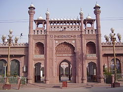
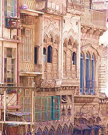
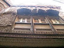
The historic old city of Peshawar was once a heavily guarded citadel with high walls. Today, not much remains of the walls, but the houses and havelis have an essence of days gone by. Most of the houses are made of unbaked bricks with wooden structures for protection against earthquakes. Many of them have beautifully carved wooden doors and latticed wooden balconies. Areas such as Sethi Mohallah still contain many fine examples of the old architecture of Peshawar. There are many historic monuments and bazaars in the Old city, including the Mohabbat Khan Mosque and Kotla Mohsin Khan, Chowk Yadgar and the Qissa Khawani Bazaar. This part of inner Peshawar has been damaged by rapid growth and development and is in need of urgent protection.[34]
The walled city was surrounded by several main gates which served as the main entry points into the city, some of which still survive today. They include: Lahori Gate, Sarasia Gate, Ganj Gate, Sirki Gate, Sard Chah Gate, Kohati Gate Former Gates which were demolished during wars were Kabuli Gate, Berikian Gate, Bajori Gate, Yakatut Gate, Dabgari Gate, Kachahri Gate, and Hasht Nagri Gate.
Educational institutions
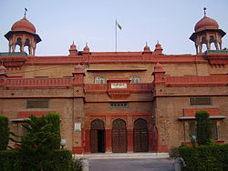
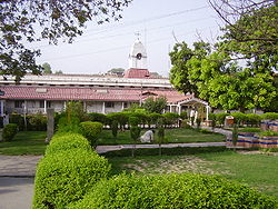
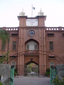
With the level of higher education on the rise, there has been a surge[citation needed] of prestigious educational institutions in Peshawar. The prestigious University of Peshawar (UOP) was established in October 1950 by the first Prime Minister of Pakistan in Peshawar. Edwardes College which was founded in 1900 by Herbert Edwardes is the oldest and one of the finest colleges in the province. The Islamia College was founded in 1913 and is also a well known institution that is now part of the University of Peshawar.
Landmarks
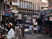
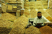
Peshawar is one of the oldest cities of the world[citation needed]. It is a conservative Islamic city with a rich history. It offers everything from goldsmiths and silversmiths, traditional carpets (one of the big exports of Pakistan today), pottery, and clothing to artwork in wood, brass or semi-precious stones. The old walled city was known for its 16 gates: Hashtnagri, Lahori, Ganj, Yakka Thoot, Kohati, Sirki, Sard Chah, Beriskian, Ramdas, Dabgari, Bajouri, Kabuli, Asamai, Kachehri, Reti and Rampura Gate. The names given to these gates are significant. It was Sikh General Avitabile who built a mud wall surrounding the city.[35] Under the British nearly the whole of the enclosure wall had been built of pucca brick.[36] There are many bazaars with different goods and souvenirs for travellers. The main ones include the historic Qissa Khawani Bazaar, the Copper market, Chowk Yadgar and Andarsheher Bazaar. In addition because of its access to the Khyber pass, the Khyber train safari starts from here.
- General
- Governor's House
- Mattani
- Peshawar Garrison Club
- Aviator's Station – The site where freedom fighters of the 1857 independence movement were blown from guns.
- Kotla Mohsin Khan – The residence of Mazullah Khan, seventeenth century Pashtu poet.
- Durrani Graveyard
- Kochi Bazar
- Qissa Khwani Bazaar
- Sethi Mohallah
- Garhi Qamardin
- Michni check Post-Last Border Post of Pakistan with Afghanistan Border.
- Residence of Prithviraj Kapoor,Famous Bollywood actor.
- Forts
- Bala Hisar Fort
- Burj Hari Singh – Sikh fort founded by Sikh General Sardar Hari Singh Nalwa (no longer exists)
- Hospitals
- Lady Reading Hospital
- Khyber Teaching Hospital
- Hayatabad Medical Complex
- Rehman Medical Complex
- North-West Hospital
- Govt.Children Hospital,HajiCamp,Peshawar
- Colonial monuments
-
- Bara Bridge built by Mughal rulers in 1629.
- Chowk Yadgar – Formerly Hastings memorial
- Cunningham clock tower built in 1900. Called Ghanta Ghar
- Avitabile's Pavilion
- Edwardes School – The residence of Yar Mohammad Khan, the last Durrani Governor of Peshawar
- Buddhist
- Gor Khuttree – An ancient site of Buddha's alms or begging bowl. Headquarter of Syed Ahmad Shaheed, Governor Avitabile
- Pashto Academy – The site of an ancient Buddhist University
- Shah Ji Ki Dheri – The site of Kanishka's famous Buddhist monastery.
- Hindu
- Panch Tirath – An ancient Hindu site now converted into a park
- Sikh
- Sikh Gurudwara at Jogan Shah
- Mausoleums
- Tomb of Hazrat Syed Talib Mohayyudin Chishti(R.A) Almaroof Chishti Baba G Lajpal,Shrine is situated in Hazar Khwani graveyard (died 1928).
- Tomb of Sheikh Imamuddin (died 1650) at Palosi Piran.
- Tomp of Syed Abdul Wahab Akhun Panju Baba Akbarpura
- Tomb of Rahman Baba (died 1706)
- Tomb of Akhund Darweza (died 1638)
- Tomb of Sheikh Sultan Baba
- Mausoleum of Nawab Sayed Khan
- Ziarat of Ashab Baba
- Ziarat of [Hazrat Syed Shah Qabool Auliya]
- Ziarat of [Syed Hassan Badshah]
- Ziarat of [Agha Mir Jani]
- Burj-e-Roshnai
- Educational Institutes
- University of Peshawar
- Khyber Medical University
- University of Engineering and Technology
- Agricultural University (Peshawar)
- Gandhara University
- Sarhad University of Science and Information Technology
- Cecos University
- City University of Science & Technology
- Preston University of Science and Technology.
- National University of Computer and Emerging Sciences (FAST-NU), (Peshawar Campus)
- Qurtabah University of Science and Technology.
- Iqra National University,Peshawar.
- Edwardes College
- Islamia College
- Razi Institute of Medical Sciences
- Institute of Management Sciences Peshawar
- Parks
- Army Stadium – Amusement Park for children and families with restaurants, banks, play pens and shopping arcade.
- Bagh-e-Naraan - Situated in Hayatabad; the largest and most beautiful in Peshawar.
- Cunningham Park/Jinnah Park- Situated opposite Historic Bala Hisar Fort, close to Asamai Gate and Lady Reading Hospital.
- Wazir Bagh – Laid in 1802, by Fatteh Khan, Prime Minister of Shah Mahmud Khan.
- Ali Mardan Khan Gardens – Formerly Company Bagh now Khalid bin Waleed Park.
- Shahi Bagh – A small portion of which constitutes the current site of Arbab Niaz Stadium.
- Garrison Park – Located at Prime Location of Shami Road under Army Control.
- Tatara Park – Located in Hayatabad for children and families.
- Mosques
-
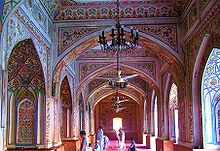
- Mohabbat Khan Mosque
- Speen Jumat
- Ganj Ali Khan Mosque
- Qasim Ali Khan Mosque
- Sonehri Masjid
- Zarghooni Mosque,
- Bilal Masjid,Shami Road
- Museums
- Peshawar Museum (Victoria Memorial Hall)[37]
- Agha Khan Museum, Peshawar University
- Shopping
- Saddar Bazar-The main Shopping Center of Peshawar
- Qissa Khawani Bazaar-Historical Bazar of Peshawar
- Karkhano Market,World biggest smuggled good Market
Transport
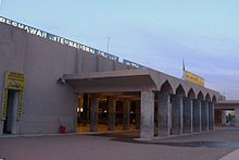
The main transport infrastructure in Peshawar is provided by an international airport (served by all Pakistani airlines and several major foreign airlines), a major railway station (operated by Pakistan Railways), and links to several highways including the Grand Trunk Road and the Karakoram Highway, enabling road, rail and air connections to all Pakistani cities as well as neighbouring countries like Afghanistan and China. Within the city, there are several methods of travel available including coaches, buses, auto rickshaws, and taxis.
Sport
Arbab Niaz Stadium is the Test Cricket ground of Peshawar.Other stadiums are Army Stadium, Peshawar Club Ground and Qayyum Stadium. Cricket is the most popular sport in Peshawar. Peshawar is home to the Peshawar Panthers. Hockey and Squash are the other popular sports here.
NeighbourHoods of Peshawar
- Hashtnagri
- Swati Gate
- Badaber
- Hayatabad
- Gulbhar
- Pahari Pura
- Sethi Town (Haji Camp)
- Momin Town (Dalazak Road)
- Latifabad
- Nishterabad
- Sikander Town
- University Town
- Danish Abad
- Regi Lalma Model town
- Tahkal
- Faqirabad
- Karimpura
- Garhikhana
- Gulberg
- Nothia
Notable people
Main article: List of people from PeshawarSister Cities of Peshawar
See also
References
- ^ http://world-gazetteer.com/wg.php?x=&men=gcis&lng=en&des=wg&geo=-172&srt=npan&col=abcdefghinoq&msz=1500&pt=c&va=&srt=pnan World Gazetteer of population
- ^ "NWFP Introduction". Government of Khyber-Pakhtunkhwa. Archived from the original on 2007-10-30. http://web.archive.org/web/20071030055502/http://www.nwfp.gov.pk/AIS-page.php?pageName=Introduction&DistId=1&DeptId=1&LangId=1. Retrieved 2007-12-12.
- ^ "Administrative System". Government of the Federally Administered Tribal Areas. http://www.fata.gov.pk/index.php?link=3. Retrieved 2007-12-12.
- ^ Current World Archaeology – Durrani, N., Andrew & Wendy Sikirk; 2006; 16.
- ^ Ian Pearce (May 2002). "The Bakhshali manuscript". The MacTutor History of Mathematics archive. http://www-history.mcs.st-andrews.ac.uk/HistTopics/Bakhshali_manuscript.html. Retrieved 2007-07-24.
- ^ a b http://www.bergerfoundation.ch/index_01_08.html
- ^ http://dsal.uchicago.edu/reference/gazetteer/text.html?objectid=DS405.1.I34_V20_130.gif
- ^ http://www.reference.com/browse/Kanishka?jss=1
- ^ http://coinsencyclopedia.org/?p=46
- ^ http://buddhism.lib.ntu.edu.tw/FULLTEXT/JR-ENG/mar.htm
- ^ http://press.princeton.edu/chapters/i7882.pdf
- ^ "Pushpapura to Peshawar". The Khyber Watch. http://khyberwatch.com/nandara/index.php?option=com_content&task=view&id=9. Retrieved 2009-11-25.
- ^ Caroe, Olaf (1957) The Pathans.
- ^ Journal of the Royal Asiatic Society of Great Britain and Ireland, Volume 17. Cambridge University Press for the Royal Asiatic Society. 1860. p. 114. http://books.google.co.in/books?id=lk0ES4KvhJMC&pg=PA114.
- ^ The Frontier Town of Peshawar A Brief History by Sayed Amjad Hussain.
- ^ Top 10 Cities of the Year 100, Four Thousand Years of Urban Growth: An Historical Census by Tertius Chandler. 1987, St. David's University Press.
- ^ Peshawar – History
- ^ a b The Pathans – 550 BC – AD 1957 by Sir Olaf Caroe, 1958, Macmillan Company, Reprinted Oxford University Press, 2003
- ^ "Provincial Capital". Government of the Khyber-Pakhtunkhwa. Archived from the original on 2007-10-30. http://web.archive.org/web/20071030055424/http://www.nwfp.gov.pk/AIS-page.php?DistId=1&DeptId=1&LanId=1&pageName=ProvincailCapital001. Retrieved 2007-12-12.
- ^ Buddhist Past By Fidaullah Sehrai
- ^ History of Peshawar by Asghar Javed
- ^ Gazetteer of the Peshawar District 1897–98
- ^ Keay, John (1996). Explorers of the Western Himalayas: 1820–1895. London: John Murray. p. 41. ISBN 0-7195-5576-0.
- ^ http://www.aaiil.org/aaiil/ra/jalsa/2003/sahibzadaabdullatifshaheed100anniversary/08sahibzadazahoorahmad_sahibzadaabdullatifshaheed. mp3
- ^ Peshawar: The city of contrasts by S. A. Hussain Pakistan Link
- ^ Pakistan Restricts Afghan Refugees by Donatella Lorch for the New York Times. November 16, 1988.
- ^ a b c d e http://www.pakmet.com.pk/cdpc/Climate/Peshawar_Climate_Data.txt
- ^ a b http://www.pakmet.com.pk/FFD/index_files/rainfalljuly10.htm
- ^ Times. Monday, October 16, 2006 Pollution reaches alarming level throughout Peshawar
- ^ History of Peshawar By Asghar Jaaved August 6, 2007 Monday
- ^ "Climatological Normals of Kabul". Hong Kong Observatory. http://www.hko.gov.hk/wxinfo/climat/world/eng/asia/westasia/kabul_e.htm. Retrieved 2011-05-02.
- ^ PESHAWAR: Refugee musicians keep Afghan music alive by Intikhab Amir, Dawn newspaper. December 25, 2001.
- ^ underground: Rocking against all odds August 6, 2007 Monday. The Frontier post. Retrieved 8th August 2007
- ^ Shinwari, Sher Ali (27 August 2010) Monumental Loss
- ^ Gazetteer of Peshawar District, 1897–98, p, 362
- ^ N-W.F.P Gazetteer, Peshawar District, 1931, p. 299
- ^ List of some Historical Monuments of Peshawar By Prof Mohd Said
- ^ "(Pakistan, Indonesia agree to declare Peshawar, Makassar as sister cities)". PPI - Pakistan Press International. 2008-05-29. http://www.accessmylibrary.com/coms2/summary_0286-34563690_ITM.
Further reading
OFFICIAL WEBSITE: http://www.ePeshawar.com
- Ahmad, Aisha and Boase, Roger. 2003. "Pashtun Tales from the Pakistan-Afghan Frontier: From the Pakistan-Afghan Frontier." Saqi Books (March 1, 2003). ISBN 0-86356-438-0.
- Beal, Samuel. 1884. "Si-Yu-Ki: Buddhist Records of the Western World, by Hiuen Tsiang." 2 vols. Trans. by Samuel Beal. London. Reprint: Delhi. Oriental Books Reprint Corporation. 1969.
- Beal, Samuel. 1911. "The Life of Hiuen-Tsiang by the Shaman Hwui Li, with an Introduction containing an account of the Works of I-Tsing". Trans. by Samuel Beal. London. 1911. Reprint: Munshiram Manoharlal, New Delhi. 1973.
- Dani, Ahmad Hasan. 1985. "Peshawar: Historic city of the Frontier" Sang-e-Meel Publications (1995). ISBN 969-35-0554-9.
- Dobbins, K. Walton. 1971. "The Stūpa and Vihāra of Kanishka I". The Asiatic Society of Bengal Monograph Series, Vol. XVIII. Calcutta.
- Elphinstone, Mountstuart. 1815. "An account of the Kingdom of Caubul and its dependencies in Persia, Tartary, and India,: comprising a view of the Afghaun nation." Akadem. Druck- u. Verlagsanst (1969).
- Foucher, M. A. 1901. "Notes sur la geographie ancienne du Gandhâra (commentaire à un chaptaire de Hiuen-Tsang)." BEFEO No. 4, Oct. 1901, pp. 322–369.
- Hargreaves, H. (1910–11): "Excavations at Shāh-jī-kī Dhērī"; Archaeological Survey of India, 1910–11, pp. 25–32.
- Hill, John E. 2003. "Annotated Translation of the Chapter on the Western Regions according to the Hou Hanshu." 2nd Draft Edition.
- Hill, John E. 2004. "The Peoples of the West from the Weilue" 魏略 by Yu Huan 魚豢: A Third Century Chinese Account Composed between 239 and 265 CE. Draft annotated English translation.
- Hopkirk, Peter. 1984. "The Great Game: The Struggle for Empire in Central Asia." Kodansha Globe; Reprint edition. ISBN 1-56836-022-3.
- Moorcroft, William and Trebeck, George. 1841. "Travels in the Himalayan Provinces of Hindustan and the Panjab; in Ladakh and Kashmir, in Peshawar, Kabul, Kunduz, and Bokhara... from 1819 to 1825", Vol. II. Reprint: New Delhi, Sagar Publications, 1971.
- Reeves, Richard. 1985. "Passage to Peshawar: Pakistan: Between the Hindu Kush and the Arabian Sea." Holiday House September, 1985. ISBN 0-671-60539-9.
- Baghaat-i-Peshawar By Imran Rashid Imran
External links
- All About Peshawar - ePeshawar.com
- Peshawar City Portal
- ePeshawar - The Electronic Peshawar
- Peshawar travel guide from Wikitravel
- Peshawar, an external wiki
- Peshawar at the Open Directory Project
City Education University of Peshawar, NWFP Agricultural University, Institute of Management Studies, University of Engineering and Technology (NWFP), Islamia College, Khyber Medical College, Edwardes College, Home Economics College for Women, Government College Peshawar, NWFP Post-Graduate Medical Institute, Jinnah College for Women, Khyber College of DentistryTransport Economy and Culture Sports Other topics Capitals in Pakistan National Provincial Karachi (Sindh) · Lahore (Punjab) · Peshawar (Khyber Pakhtunkhwa and Federally Administered Tribal Areas) · Quetta (Balochistan)Kashmir Districts of Khyber Pakhtunkhwa 
Million-plus cities in Pakistan Faisalabad · Gujranwala · Hyderabad · Karachi · Lahore · Multan · Peshawar · Rawalpindi
Major cities in Pakistan Islamabad Capital Territory Punjab Attock · Bahawalpur · Chakwal · Chiniot · Faisalabad · Gujar Khan · Gujranwala · Gujrat · Jhang · Jhelum · Kasur · Kharian · Lahore** · Mianwali · Multan · Murree · Rahim Yar Khan · Rawalpindi · Sadiqabad · Sahiwal · Sargodha · Sheikhupura · Sialkot · TaxilaSindh Khyber Pakhtunkhwa Balochistan Azad Kashmir Gilgit-Baltistan *Federal capital **Provincial/Territorial capitalsCategories:- Peshawar
- Capitals of Pakistan
- Populated places in Khyber Pakhtunkhwa
- Populated places in Peshawar District
- Metropolitan areas of Pakistan
- Populated places along the Silk Road
Wikimedia Foundation. 2010.

