- Rawalpindi
-
-
- For the British Navy ship see HMS Rawalpindi
Rawalpindi
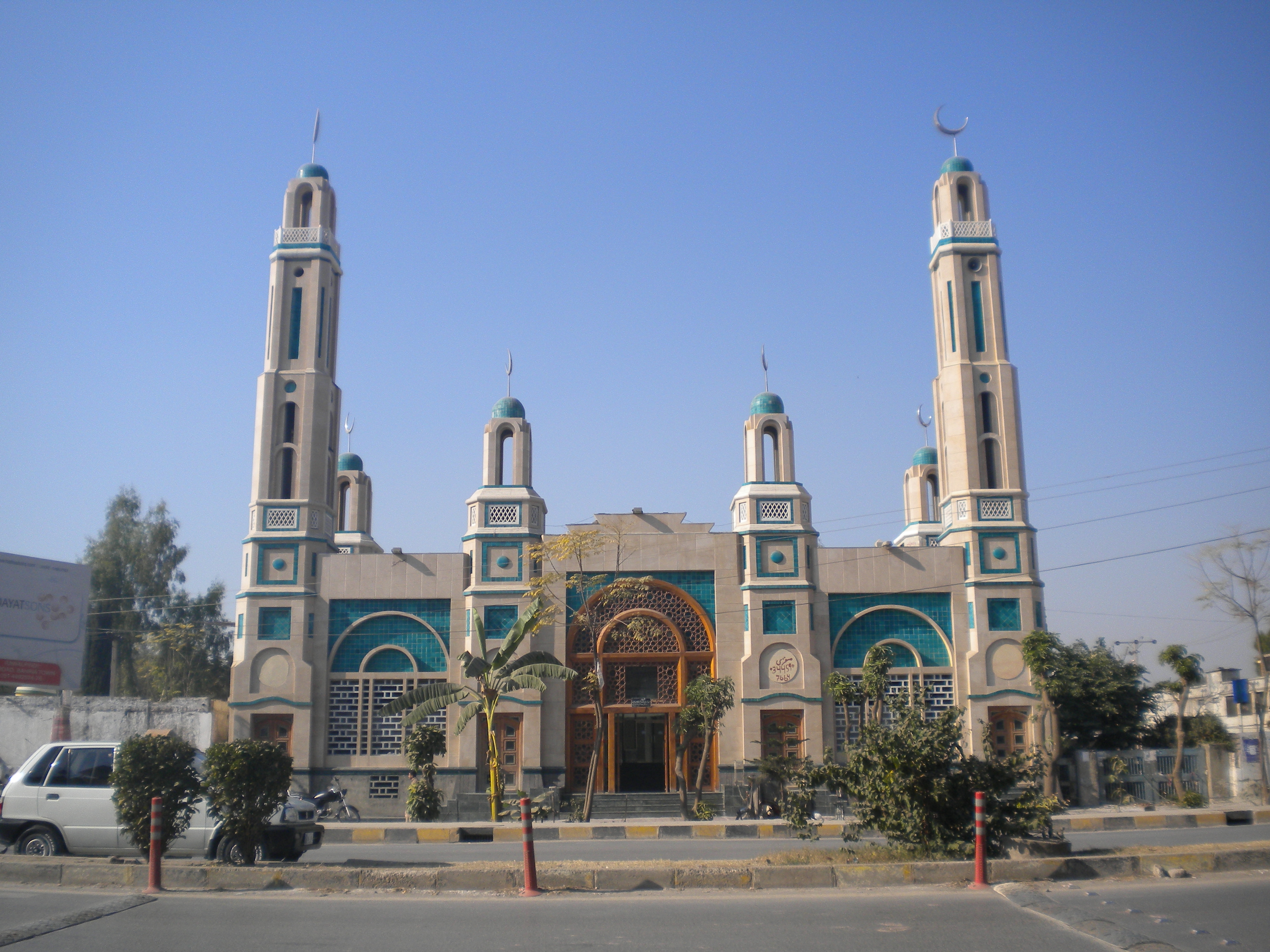
راولپنڈی— City District — The Mosque at Gulshan Dadan Khan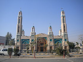 Location in Pakistan
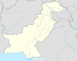
 Rawalpindi
Coordinates: 33°36′0″N 73°02′0″E / 33.6°N 73.033333°ECoordinates: 33°36′0″N 73°02′0″E / 33.6°N 73.033333°E Country  Pakistan
Region Punjab Division Rawalpindi Division Autonomous towns 8 Union councils 170 Elevation 500 m (1,640 ft) Population (2008)[1] – Urban 3,252,123 Time zone PST (UTC+5) – Summer (DST) PDT (UTC+6) Area code(s) 051 Website www.rawalpindi.gov.pk  Rawalpindi (help·info) (Urdu, Potwari, Punjabi: راولپنڈی,Rāwalpindī) is a city in the Pothohar region of Pakistan near Pakistan's capital city of Islamabad, in the province of Punjab. Rawalpindi is the fourth largest city in Pakistan after Karachi, Lahore and Faisalabad. In the 1950s, Rawalpindi was smaller than Hyderabad and Multan, but the city's economy received a boost during the building of Islamabad (1959–1969), during which time Rawalpindi served as the national capital and its population increased from 180,000 at the time of independence to over 4.5 million in 2007.[citation needed] Rawalpindi is located in the northernmost part of the Punjab province, 275 km (171 mi) to the north-west of Lahore. It is the administrative seat of the Rawalpindi District. The total area of the city is approximately 154 square kilometres (59 sq mi). Rawalpindi is the military headquarters of the Pakistani Armed Forces.
Rawalpindi, locally known as Pindi, named after Raja Pindi, is a bustling city on the northernmost part of the Punjab province, strategically located between the NWFP and Pakistan Occupied Kashmir. Many tourists use the city as a stop before traveling towards the northern areas. Rawalpindi is also a prime destination for the expatriat community of Pakistan Occupied Kashmir. Numerous shopping bazaars, parks and a cosmopolitan population attract shoppers from all over Pakistan and abroad. The city is home to several industries and factories. Islamabad's international airport, Benazir Bhutto International Airport, is actually located in Rawalpindi, and serves both cities.
Rawalpindi also maintains strong links with the Pahari-Potwari speaking people of neighbouring Pakistan-administered Kashmir who have many businesses within the city and region.
Contents
Boundary and Expansion
Though Rawalpindi has expanded mostly due to explosive population pressure. NESPAK has been given the responsibility to render the urban planning services for analysing available data and other documents like master plans, structure plans, outline development plans and census reports. It is also responsible for defining the geographical features of the city and provides the a rough idea of how the city could be expanded in the next 20 years.[2][3]
History
 A map representing the Rawalpindi Division.
Rawalpindi has been inhabited for thousands of years, it is believed that a distinct culture flourished on this plateau as far in c1000BC. The material remains found at the site prove the existence of a Buddhist establishment contemporary to Taxila and of a Vedic civilisation. The nearby town of Taxila has another significance; according to the Guinness Book of World Records it has the world's oldest university - Takshashila University.[citation needed]
Sir Alexander Cunningham identified certain ruins on the site of the cantonment with the ancient city of Ganjipur or Gajnipur, the capital of the Bhatti tribe in the ages preceding the Christian era. Graeco-Bactrian coins, together with ancient bricks, occur over an area of 500 ha (2 mi²). Known within historical times as Fatehpur Baori, Rawalpindi fell into decay during one of the Mongol invasions in the fourteenth century.[4]
It appears that the ancient city went into oblivion as a result of the White Hun devastation. The first Muslim invader, Mahmud of Ghazni (979-1030), gave the ruined city to a Gakhar Chief, Kai Gohar. The town, however, being on an invasion route, could not prosper and remained deserted until Jhanda Khan, another Gakhar Chief, restored it and named it Rawalpindi after the village Rawal in 1493. Rawalpindi remained under the rule of the Gakkhars until Muqarrab Khan, the last Gakkhar ruler, was defeated by the Sikhs under Sardar Milka Singh in 1765. Singh invited traders from the neighbouring commercial centres of Jhelum and Shahpur to settle in the territory.[4]
Early in the nineteenth century Rawalpindi became for a time the refuge of Shah Shuja, the exiled king of Afghanistan, and of his brother Shah Zaman. The present native infantry lines mark the site of a battle fought by the Gakhars under their famous chief Sultan Mukarrab Khan in the middle of the eighteenth century. Rawalpindi was taken by Sikh ruler Maharaja Ranjit Singh in 1818. Zahid
British rule
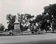 Queen Victoria's Statue sculpted in England was placed in the city during the rule of the British Empire, 1939
Following the British invasion of the region and their occupation of Rawalpindi in 1849, the city became a permanent garrison of the British army in 1851. In the 1880s a railway line to Rawalpindi was laid, and train service was inaugurated on 1 October 1880. The need for a railway link arose after Lord Dalhousie made Rawalpindi the headquarters of the Northern Command and the city became the largest British military garrison in British India.[citation needed]
On the introduction of British rule, Rawalpindi became the site of a cantonment and, shortly afterward, the headquarters of 2nd (Rawalpindi) Division. Its connection with the main railway system by the extension of the North-Western Railway to Peshawar immensely developed its size and commercial importance. The municipality was created in 1867.
The income and expenditure during the ten years ending 1902-3 averaged 2–1 lakhs. In 1903-4 the income and expenditure were 1-8 lakhs and 2-1 lakhs respectively. The chief item of income was octroi (1-6 lakhs); the expenditure included administration (Rs. 35,000), conservancy (Rs. 27,000), hospitals and dispensaries (Rs. 25,000), public works (Rs. 9,000), and public safety (Rs. 17,000). The cantonment, with a population in 1901 of 40,611, was the most important in all of British South Asia. It contained one battery of horse and one of field artillery, one mountain battery, one company of garrison artillery, and one ammunition column of field artillery; one regiment of British and one of Native cavalry; two of British and two of Native infantry; and two companies of sappers and miners, with a balloon section. It was the winter headquarters of the Northern Command and of the Rawalpindi military division. An arsenal was established here in 1883.[4]
It has been recently disclosed that the British Government tested poison gas on Indian troops during a series of experiments that lasted over a decade.[5]
After independence
In 1951, Rawalpindi saw the assassination of the first elected Prime Minister of Pakistan, Liaquat Ali Khan in Company Bagh now known as Liaquat Bagh Park (also called Liaquat Garden.) On 27 December 2007, Liaquat Bagh Park's rear gate in Rawalpindi was the site of the assassination of former Prime Minister Benazir Bhutto.[6] Her father, former Prime Minister Zulfikar Ali Bhutto was hanged in Rawalpindi in 1979.[citation needed]
The famous Murree Road has been a hot spot for various political and social events. Nala Lai, in the middle of city, history describes Nala Lai water as pure enough for drinking but now it has become polluted with the waste water from all sources including factories and houses. Kashmir Road, was renamed from Dalhousie Road, Haider road from Lawrence road, Bank Road from Edwards Road, Hospital Road from Mission Road, Jinnah Road from Nehru Road. Today Rawalpindi is the headquarters of the Pakistani Army. Few years ago it also had headquarters of Air Force.[citation needed]
Climate
Rawalpindi Climate chart (explanation) J F M A M J J A S O N D 5617365196802411363017314132604626258362828734279134242731171424934195Average max. and min. temperatures in °C Precipitation totals in mm Source: World Meteorological Organization Imperial conversion J F M A M J J A S O N D 2.263372.666433.175521.486631.2106902.4115791097821193813.693751.188630.675481.36641Average max. and min. temperatures in °F Precipitation totals in inches Similar to neighboring Islamabad, Rawalpindi features a humid subtropical climate with long and very hot summers, a monsoon and short, mild, wet winters. Rawalpindi during the summer season experiences a number of thunder or wind storms that sometimes cause damage to property. Wind speeds could reach an astonishing 168 km/h in some wind storms which results in the collapse of walls and roofs causing injuries and sometimes death.[citation needed]
Rawalpindi is chaotic but relatively dust-free. The weather is highly variable due to the location of Rawalpindi. The average annual rainfall is 39 inches (990 mm), most of which falls in the summer monsoon season. However, frontal cloudbands also bring quite significant rainfall in the winter. In summer, the maximum temperature can sometimes soar up to 52 °C (126 °F), while it may drop to a minimum of −4 °C (25 °F) in the winter.[citation needed]
Demographics
Main article: Tribes and Castes of Rawalpindi DistrictThe population of Rawalpindi is approximately 1,991,656[7] according to the 2006 census which includes many people who come from Punjab villages looking for work in the city.Punjabi is the language of people and most people speak Pothohari dailect of Punjabi language. The majority of the people of Rawalpindi are Muslims. There are many mosques throughout the city. The most famous Mosques are Jamia Mosque, Raja Bazaar Mosque and Eid Gah Mosque which attract thousands of visitors daily. Other minority religions are Christian, Zoroastrian, Bahai, Parsi, Hinduism and Sikhism. The literacy rate is 80% (2006–07).[8] The population is ethnically and linguistically heterogeneous, comprising Rajputs, Pothohari,Sudhun, Satti, Awans, Kathwals, Paharis, Kashmiris, Pakhtuns, Gilgiti, Muhajirs, Hindkowans, Afghans, Sheikh, Hazaries, Punjabis,Qureshis
Administration
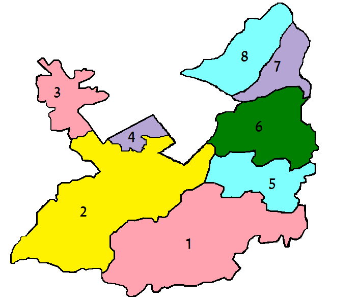
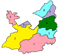 Administrative subdivisions of Rawalpindi District.
The City-District of Rawalpindi comprises eight autonomous tehsils, besides Rawalpindi city (divided into Rawal & Potohar Tehsils):
- Gujar Khan
- Potohar (Southern Rawalpindi)
- Taxila Tehsil
- Rawal (Northern Rawalpindi)
- Kallar Syedan
- Kahuta
- Kotli Sattian
- Murree
Today Rawalpindi is the headquarters of the Pakistani Army and Air Force.
The famous Murree Road has been a hot spot for various political and social events. Nala Lai, in the middle of city, history describes Nala Lai water as pure enough for drinking but now it has become polluted with the waste water from all sources including factories and houses.
Kashmir Road, was renamed from Dalhousie Road, Haider road from Lawrence road, Bank Road from Edwards Road, Hospital Road from Mission Road, Jinnah Road from Nehru Road.
Rawalpindi also holds many private colony's who have developed themselves rapidly for e.g. Pak PWD, Korang Town, Ghori Town, Pakistan Town, Judicial Town, Baharia town which is the Asia's largest private colony
Culture
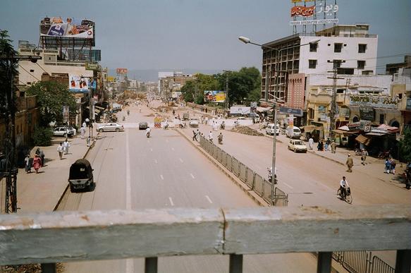
 Peshawar Road Rawalpindi
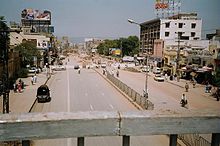 The Murree Road during the construction of Committee Chowk Underpass
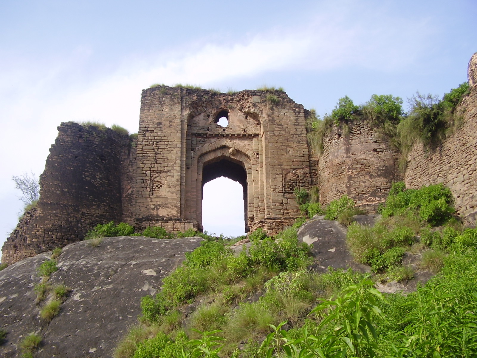
 The gate of Pharwala Fort
Rapidly developing into a large city, Rawalpindi has many good hotels, restaurants, clubs, museums and parks, of which the largest is the Ayub National Park. Rawalpindi forms the base camp for the tourists visiting the holiday resorts and hill stations of the Galiyat area, such as Murree, Nathia Gali, Kotli, Ayubia, Rawlakot, Muzaffarabad, Bagh, Abbottabad, Samahni, Swat, Kaghan, Gilgit, Hunza, Skardu and Chitral.
The city has two main roads: the Grand Trunk Road runs roughly from east to west and is known as The Mall as it passes through the cantonment. Murree Road originates toward north from The Mall, crosses the railway lines and brushes the east end of the old city on its way to Islamabad.
The main bazaar areas are Raja Bazaar in the old city, Moti Bazaar, Commercial Market, China Market and Saddar Bazaar, which developed as the cantonment bazaar between the old city and The Mall. Another developing market is the Commercial Market in the area of Satellite Town near Islamabad.
The crowded alleys of the old city are home to many attractions, including Hindu (in ruins now), Zoroastrian, Sikh temples and Islamic shrines. There are several museums and arts galleries such as the Lok Virsa, Pakistan Museum of Natural History,[9] and the $Idara Saqafat e Pakistan.
Rawalpindi has been a military city since colonial times and remained Army headquarters after independence in 1947. Due to this, the city is home to the Pakistan Army Museum, with displays on colonial and present day armies, armoury of historical significance and war heroes.
Ayub National Park is located beyond the old Presidency on Jhelum Road. It covers an area of about 2,300 acres (930 ha) and has a playland, lake with boating facility, an aquarium and a garden-restaurant. Rawalpindi Public Park is on Murree Road near Shamsabad. The Park was opened to the public in 1991. It has a playland for children, grassy lawns, fountains and flower beds.
In 2008 Jinnah Park was inaugurated at the heart of Rawalpindi and has since become a hotspot of activity for the city. People from as far as out as Peshawer come to Jinnah Park to enjoy its modern facilities. It houses a state-of-the-art cinema, Cinepax, a Metro Cash and Carry supermart, an outlet of McDonalds, gaming lounges, motion rides and other recreational facilities. The vast lawns also provide and adequate picnic spot.
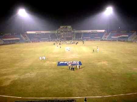
Rawalpindi Cricket Stadium, built in 1992, has a grass pitch, floodlights, and a initial capacity of 20,000. In mid-2008 it was being upgraded and to hold more than 40,000 people. The home team are the Rawalpindi Rams. The Rawalpindi Hockey stadium is a small but well-built facility that plays host to the national side throughout the year.
Rawat Fort is 17 km (11 mi) east of Rawalpindi, on the Grand Trunk (G.T.) Road leading to Lahore. Gakhars, a fiercely independent tribe of the Pothohar Plateau, built the fort in the early 16th century. The grave of a Gakhar Chief, Sultan Sarang Khan is inside the fort. He died in 1546 fighting against the forces of Sher Shah Suri. A climb up the broken steps inside the tomb is rewarded with a panoramic view of the plateau and the Mankiala Stupa. Besides Rawat, about an hour's drive from Rawalpindi on the Grand Trunk Road toward Peshawar, is Attock Fort. The Akbari fort is not open to the public as it is in active military use.
Pharwala Fort is about 40 km (25 mi) from Rawalpindi beyond Lehtrar road. It is a Gakhar fort built it in the 15th century on the ruins of a 10th century Hindi Shahi Fort. Emperor Babur conquered the it in 1519. Later, in 1825, Sikhs expelled Gakhars from this fort. Though in a crumbling state, it is still an attraction for castle lovers. The fort, situated in prohibited area, is only open to Pakistani visitors.
Rawalpindi has numerous sights of architectural masterpieces. A few of the heritage buildings are Purana Qil'aa (The Old Fort), Bagh Sardaran (Chief's Gardens), Haveli Sujaan Sigh (the remains of the Sikh Nawabs of Rawalpindi; the grand building has been converted into Fatima Jinnah Women University, which is the only female university established in the region).
Other ancient buildings include Jain Mandir, Jain Temple. Gordon College, a prestigious institution of high learning was set during the British Raj. The shrine of Hazrat Sakhi Shah Chan Charagh is one of the centres devotees flock to. An institution of high devotion and solace located near the famous Raja Bazar. He is the patron saint of the city and regarded as one of the two protectors of the twin cities, i.e., Islamabad and Rawalpindi, with Hazrat Bari Imam, his cousin brother.
The Rawalpindi Public Library was one of the earliest private public libraries organized after separation from India. The building was donated for a public library by the then-Deputy Commissioner Major Davis on the initiative of philanthropist Khurshid Anwar Jilani, an attorney, writer and social worker. However, the building was confiscated for election and political campaigning during the last days of Field Marshal Ayub Khan's reign, and rare manuscripts and artifacts were taken away by the influential.
Economy
 Bank Alfalah branch in Rawalpindi
According to the general survey of industry conducted by Directorate of Industries and Mineral Development Punjab, there are 939 industrial units operating in the district. This district is not famous for industrial goods like other districts. The progress has been mostly in the private sector. The existing industrial units provide employment to about 35,000 people, i.e., about 1.6% of district population is directly employed in large, medium and small industrial units. Apparently there is no shortage of skilled manpower. The Technical/Vocational Training Institute operating in the district turns out about 1,974 technicians/artisans annually. They are trained in engineering, air conditioning, drafting, metallurgy, welding, auto knitting and commerce, etc.[10]
- Kohinoor Textile Mills is the largest unit in the district. It is located near Naseer Abad and is equipped with 50,000 spindles and 1,021 power looms.
- Wattan Woolen and Hosiery Mills is fitted 10,000 spindles.
- Rahat Woolen Mills, established in 1954, is one of the oldest and most prominent mills in Rawalpindi.
Jinnah Road, formally known as City Saddar Road, is one of the busiest business markets. It could be considered as business headquarters northern Pakistan including retailers, wholesalers, distributors, manufacturers having an approximately cash flow of more than 1 billion rupees[clarification needed] per day. The importance of Jinnah Road can be seen by the presence of more than nine banks on the road with more opening soon.
Transport
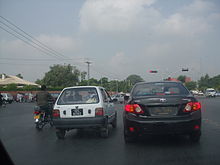
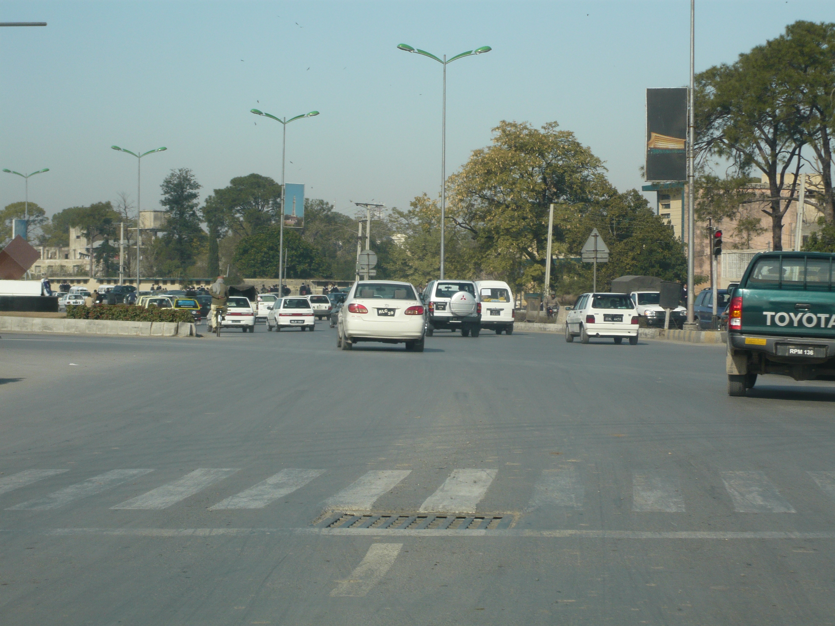
There are many ways to get in and around Rawalpindi. Public transport for travel within Rawalpindi is diverse, ranging from yellow taxis, auto-rickshaws, mini-buses and even tongas (horse-drawn carriages). Due to the lack of planning of roads, traffic jams are found even on smaller roads. For inter-city travel, air-conditioned and non air-conditioned buses and coaches are regularly available to many destinations in Pakistan. There is also an Islamabad/Rawalpindi central railway station that allows travel to every major city in Pakistan. In addition to freight, Pakistan Railways provides passenger rail service throughout the day, with train coaches that have air-conditioning in first-class.
Rail
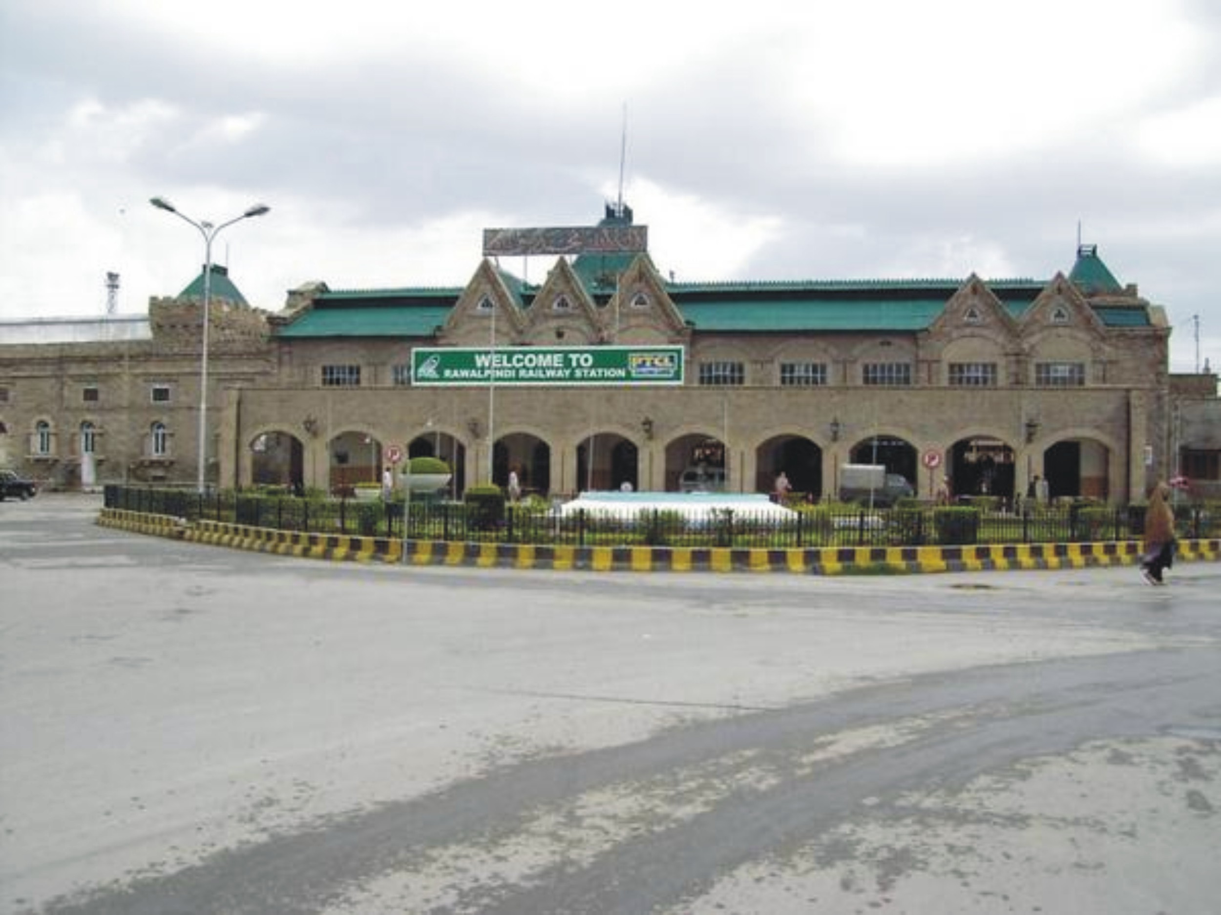
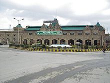 Rawalpindi Railway Station
The Rawalpindi Railway Station is located in the Saddar City. The Railway Station was built in the 1880s by the government of British India. The British built many railways across South Asia to help facilitate trade and more importantly to help consolidate their rule. The routes the British built from Rawalpindi, which contained a major military base, linked to Lahore, Karachi, Peshawar, Quetta, Multan, Faisalabad, Hyderabad, Sindh, Sukkur, Bahawalpur, Jhelum, Gujrat, Gujranwala, Kohat, Khanewal, Nawabshah, Nowshera and the Malakand Pass.
 Rawalpindi-Islamabad freeway
Airport
Benazir Bhutto International Airport is actually located at Chaklala which technically is a part of Rawalpindi. The airport is served by over 25 airlines, both national and international. Pakistan International Airlines (PIA), the national carrier of Pakistan, has numerous routes, with many domestic and international flights every day. Construction on the new Rawalpindi/Islamabad international airport has now been started near the town of Fateh Jang approx 25 kilometres (20 mi) from both cities.
Motorway
 Mall Road
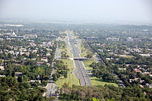
The main route running through Rawalpindi is the Murree Road. This road runs West-East through the city and continues to the hill station of Murree, which is a major summer attraction for Rawalpindi residents. Murree Rd is one of the busiest roads in the Punjab Province of Pakistan.
Rawalpindi is on the ancient Grand Trunk Road (also known as G.T. Road or, more recently, N-5) which links Rawalpindi to nearly every major city in northern Pakistan, from Karachi, to Peshawar, Lahore, Quetta, Multan, Faisalabad, Hyderabad, Sukkur, Bahawalpur, Jhelum, Gujrat, Gujranwala, Kohat, Khanewal, Nawabshah, Nowshera and the Malakand Pass.
The city is also served by two nearby six-lane Motorways, M2 (Lahore-Islamabad) and M1 (Islamabad-Peshawar), which were completed in the 1990s. Somewhat further away is the famous Karakoram Highway, the world's highest international road, which connects Pakistan to China.
General Bus Stand
General Bus Stand, Pir Wadhai is the principal bus station for interstate buses and other public vehicles which regularly transports passengers. GBS, Pir Wadhai caters government and private operated buses. It also constitutes large number of reasonable hotel for stay. Luxury Hino, Mercedes buses also operated from Pir Wadhai.
Telecommunication
The PTCL provides the main network of landline telephone with minority shares of other operators. All major mobile phone companies operating in Pakistan provide service in Rawalpindi. Pakistan's Broadband revolution has had a significant impact on telecommunications in Rawalpindi. The city, along with other major cities of Pakistan, enjoys a widespread coverage from WiFi and WiMAX operators, with Wateen, WiTribe, Qubee having the most shares. DSL internet also has a major coverage in the city with Nayatel and PTCL the main stakeholders. Recently a high speed 3G Network, EVO Nitro, was also set up by PTCL with maximum speeds of 9.3 Mbit/s to add up to the already established EVO 3G Network. Though localized, it is the first instance in the history of telecommunication that EVDO RevB technology was commercially launched.
Parks
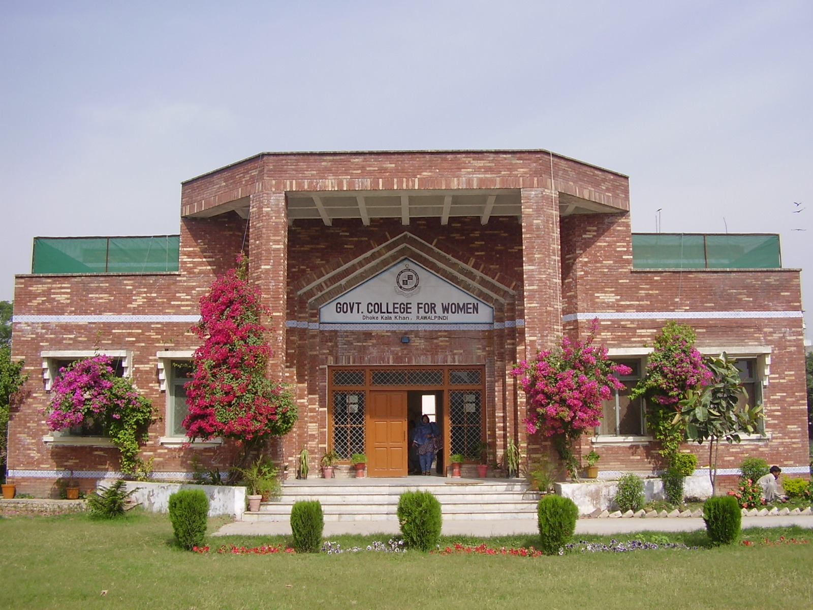
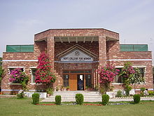 Govt College for Women
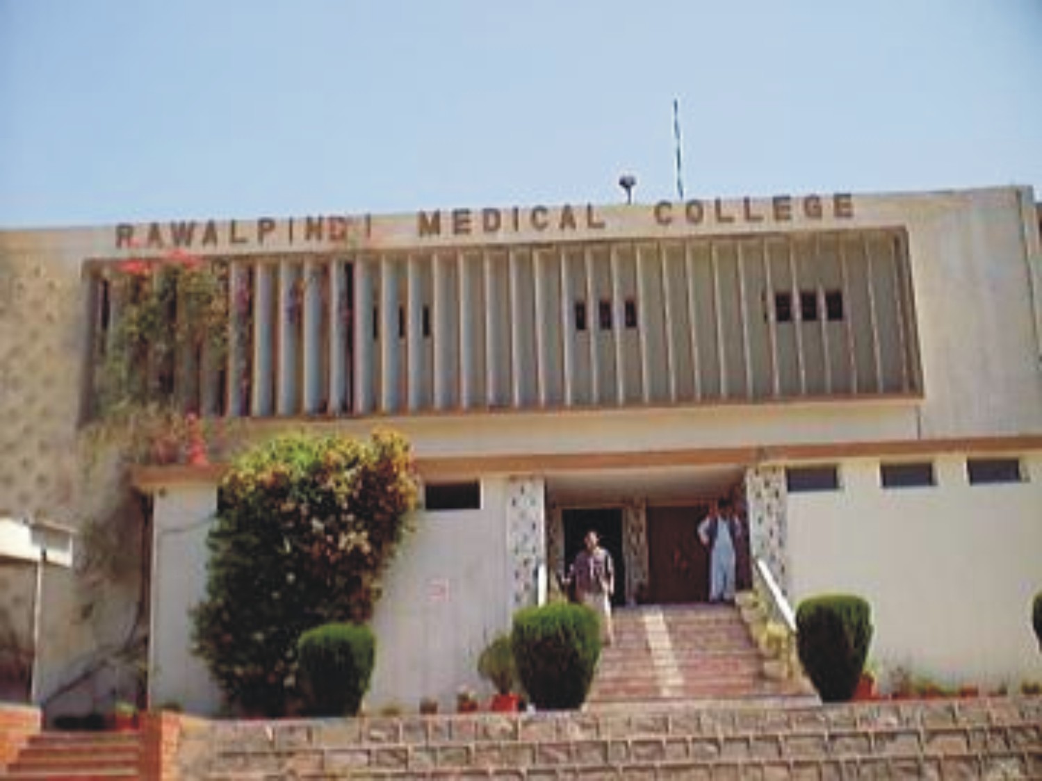
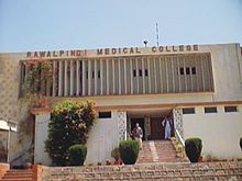 Rawalpindi Medical College, Tipu Road
 Beauty of Mall Road
 Jinnah Park
 Mall Road, Saddar
 Lal Haveli
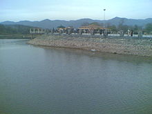 A view of Rawal Dam
- Ayub National Park formerly known as "topi rakh" (stay hat or remove hat) is located by the old Presidency, and between the Murree Brewery Co. and Grand Trunk (G.T.) Road. It covers an area of about 2,300 acres (930 ha) and has a play area, lake with boating facility, an aquarium, a garden-restaurant and an open air theater. This park hosts 'The Jungle Kingdom' which is particularly popular among young residents of the city.
- Liaquat Bagh formerly known as the "company bagh" (East India Company's Garden), is of great historical interest. The first prime minister of Pakistan, Liaquat Ali Khan, was assassinated here in 1950. Pakistan's Prime Minister Banazir Bhutto was assassinated here on 27 December 2007. She was the youngest elected Prime Minister of the world.
- Rawalpindi Golf Course was completed in 1926 by Rawalpindi Golf Club, one of the oldest golf clubs of Pakistan. The facility was initially developed as a nine-hole course. After several phases of development, it is now a 27-hole course. From the clubhouse, there is a panoramic view of Faisal Mosque, the twin cities of Islamabad and Rawalpindi, and the course itself. Major golf tournaments are regularly held here.
- Rawalpindi Public Park (also known as Nawaz Sharif Park) is located on Murree Road. The Park was opened in 1991. It has a play area for children, lawns, fountains and flower beds. A cricket stadium was built in 1992 opposite the Public Park. The 1996 World Cup cricket matches were held on this cricket ground.
- Playland is another public located parallel to Ayub Park, its nearness to many classy colonies and housing schemes makes this wonderland an attractive hotspot during the holidays.
- Liaquat National Bagh
- Jinnah Park
- Ayub Park
- DHA Jungle Park (DHA Phase I, Rawalpindi)
- Rumi Park
- Shah Balot Park
- Race Course
- Ladies Park Dhoke Hassu
- Children Park in Commercial Market
- 502 Workshop Park (Zia Park) Lalazar
- Dussehra Ground Asghar Mall
- Ladies & Childrens Park, Gawalmadi
- Ladies Gym Park,Liaqat Bagh Rwp
Sport
The city has an array of stadiums and grounds to meet the needs of all the popular sports played in the country. Rawalpindi is home to some of the most recognised players in the history of Pakistani cricket. The Rawalpindi Cricket Stadium is the official cricket stadium used for international tests and ODIs. It is also home to the Rawalpindi Rams. However, there are plenty of other cricket grounds such as Army Cricket ground (home to the Pindi Club), KRL Cricket ground, CMTSD Cricket stadium as well as the Attock Oil Refinery cricket ground.
There are stadiums for hockey such as the Army Hockey Stadium, Army Signals Hockey ground as well as the Noor Station Ground Dhoke Hassu. There are stadiums for football including the Municipal Football stadium and the Army Football ground. Other sports complexes include the COD Sports Complex and the Railway Ground Dhoke Matkial.Kabadi.
Media
Rawalpindi, being so close to the capital, has an active media and newspaper climate. There are over a dozen of newspaper companies and television channels based in the city including Daily Nawa-i-Waqt, Daily Jang, Daily Islamabad Times, Daily Asas, Daily Times, Daily Nation, National Herald Tribune, The Daily Sada-e-Haq, Daily Express, Daily Dawn, Daily Din, Daily Aajkal Rawalpindi, Daily Islam, and Daily Pakistan.
See also
- Rawalpindi District
- Demography of Rawalpindi District
- Potwari language
- Lal Haveli
- Rawalpindi Gazetteer
- Liaquat National Bagh
- Christ Church Rawalpindi
- Military Hospital Rawalpindi
- Benazir Bhutto Road
- Jajja Rajput
References
- ^ Density reference
- ^ http://momers.tumblr.com/tagged/rawalpindi
- ^ http://picasaweb.google.com/lh/photo/GFregGyy1C6hNNfzylvSkQ?feat=embedwebsite
- ^ a b c Rawalpindi Town - Imperial Gazetteer of India, v. 21, p. 272.
- ^ UK tested poison gas on Indian soldiers
- ^ "Benazir Bhutto killed in attack". BBC. 2007-12-27. http://news.bbc.co.uk/1/hi/world/south_asia/7161590.stm. Retrieved 2007-12-31.
- ^ http://world-gazetteer.com/wg.php?x=&men=gcis&lng=en&des=wg&geo=-172&srt=npan&col=abcdefghinoq&msz=1500&pt=c&va=&srt=pnan World Gazetteer of population
- ^ http://www.statpak.gov.pk/depts/fbs/statistics/pslm_prov2006-07/2.14a.pdf
- ^ Army Museum of Pakistan
- ^ Rawalpindi Chamber of Commerce
Aamir Hussain Shah
External links
- CDG Rawalpindi, Official Website
- Rawalpindi Blogspot, 2009
- Rawalpindi Swedish Institute of Technology, Technical Institute Website
- Rawalpindi (Pakistan) -- Britannica Online Encyclopedia
- Rawalpindi travel guide from Wikitravel
- Rawalpindi, an external wiki
- Rawalpindi at the Open Directory Project
Million-plus cities in Pakistan Faisalabad · Gujranwala · Hyderabad · Karachi · Lahore · Multan · Peshawar · Rawalpindi
Major cities in Pakistan Islamabad Capital Territory Punjab Attock · Bahawalpur · Chakwal · Chiniot · Faisalabad · Gujar Khan · Gujranwala · Gujrat · Jhang · Jhelum · Kasur · Kharian · Lahore** · Mianwali · Multan · Murree · Rahim Yar Khan · Rawalpindi · Sadiqabad · Sahiwal · Sargodha · Sheikhupura · Sialkot · TaxilaSindh Khyber Pakhtunkhwa Balochistan Azad Kashmir Gilgit-Baltistan *Federal capital **Provincial/Territorial capitalsCategories:- 1493 establishments
- Rawalpindi District
- Populated places established in the 1490s
- Populated places in Rawalpindi District
- Metropolitan areas of Pakistan
- Former national capitals
-


Wikimedia Foundation. 2010.