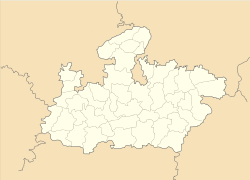
- Maksi
-
Maksi — city — Coordinates 23°16′N 76°09′E / 23.27°N 76.15°ECoordinates: 23°16′N 76°09′E / 23.27°N 76.15°E Country India State Madhya Pradesh District(s) Shajapur Population 98,392 (2001[update]) Time zone IST (UTC+05:30) Area
• 480 metres (1,570 ft)
Codes-
• Telephone • +07334
Maksi is a city and a municipality in Shajapur district in the Indian state of Madhya Pradesh
Contents
Geography
Maksi is located at 23°16′N 76°09′E / 23.27°N 76.15°E[1]. It has an average elevation of 480 metres (1574 feet).
Demographics
As of 2001[update] India census[2], Maksi had a population of 98,392. Make constitute 52% of the population and females 48%. Maksi has an average literacy rate of 63%, higher than the national average of 59.5%: male literacy is 73%, and female literacy is 53%. In Maksi, 17% of the population is under six years of age.Maksi is famous for the holy jain tample shri makshi parshvanath the 23 thirthankar of Jain religion.
Transportation
By Road
Maksi is located on Agra-Bombay Road.
By Train
It was well connected directly to Ujjain, Dewas & Bhopal.
References
- ^ Falling Rain Genomics, Inc - Maksi
- ^ "Census of India 2001: Data from the 2001 Census, including cities, villages and towns (Provisional)". Census Commission of India. Archived from the original on 2004-06-16. http://web.archive.org/web/20040616075334/http://www.censusindia.net/results/town.php?stad=A&state5=999. Retrieved 2008-11-01.
Cities and towns in Ujjain Division Dewas district Mandsaur district Neemuch district Ratlam district Shajapur district Agar · Akodia · Badagoan · Badod · Kanad · Maksi · Polay Kalan · Shajapur · Shujalpur · Soyatkalan · SusnerUjjain district Related topics Cities and towns
in other DivisionsCategories:- Cities and towns in Shajapur district
- Shajapur
- Railway stations in Madhya Pradesh
- Madhya Pradesh geography stubs
-
Wikimedia Foundation. 2010.


