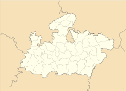
- Malhargarh
-
Malhargarh — city — Coordinates 24°17′N 74°59′E / 24.28°N 74.98°ECoordinates: 24°17′N 74°59′E / 24.28°N 74.98°E Country India State Madhya Pradesh District(s) Mandsaur Population 7,349 (2001[update]) Time zone IST (UTC+05:30) Area
• 458 metres (1,503 ft)
Malhargarh is a town and a nagar panchayat in Mandsaur district in the Indian state of Madhya Pradesh. It is located between Neemuch and Mandsour on the Ratlam- Chittaurgarh Section of Indian railway. The Malhargarh is rich in agriculture and part of Malwa region also famous for Opium agriculture. Before independence of India, the town was under the rule of Nawab of Jaora.
Demographics
As of 2001[update] India census[1], Malhargarh had a population of 7349. Males constitute 51% of the population and females 49%. Malhargarh has an average literacy rate of 73%, higher than the national average of 59.5%: male literacy is 81%, and female literacy is 64%. In Malhargarh, 14% of the population is under 6 years of age.
References
- ^ "Census of India 2001: Data from the 2001 Census, including cities, villages and towns (Provisional)". Census Commission of India. Archived from the original on 2004-06-16. http://web.archive.org/web/20040616075334/http://www.censusindia.net/results/town.php?stad=A&state5=999. Retrieved 2008-11-01.
Cities and towns in Ujjain Division Dewas district Mandsaur district Neemuch district Ratlam district Shajapur district Agar · Akodia · Badagoan · Badod · Kanad · Maksi · Polay Kalan · Shajapur · Shujalpur · Soyatkalan · SusnerUjjain district Related topics Cities and towns
in other DivisionsCategories:- Cities and towns in Mandsaur district
- Mandsaur
- Madhya Pradesh geography stubs
Wikimedia Foundation. 2010.


