- Mandsaur District
-
This article is about the district. For its eponymous headquarters, see Mandsaur.
Mandsaur district
मंदसौर जिला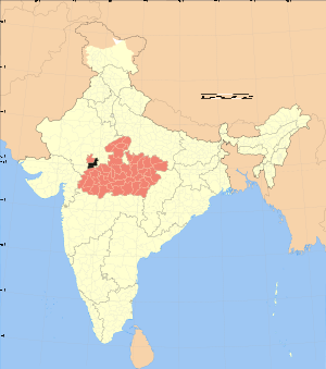
Location of Mandsaur district in Madhya PradeshState Madhya Pradesh,  India
IndiaAdministrative division Ujjain Headquarters Mandsaur Area 9,791 km2 (3,780 sq mi) Population 1,555,481 (2001) Lok Sabha Constituencies Mandsaur Official website Mandsaur District is a District of Madhya Pradesh state in central India. The town of Mandsaur is the administrative headquarters of the district.
Contents
Origin of name
The District takes its name from the headquarters town, Mandsaur. It is considered to have been evolved from Marhsaur, originating from Marh and Saur or Dasaur, two of the villages which merged in the town. The town was known as Dashpur in ancient times.
Geography
The district has an area of 9,791 km². The district is part of the Malwa region, and is bounded by Neemuch District to the north, Rajasthan state to the east and west, and Ratlam District to the south. It is part of Ujjain Division.
Mandsaur District forms the northern projection of Madhya Pradesh from its western Division, i.e., Ujjain Commissioner's Division. It lies between the parallels of latitude 230 45' 50" North and 250 2' 55" North, and between the meridians of longitude 740 42' 30" East and 750 50' 20" East.
The District is an average size district of Madhya Pradesh. It extends for about 142 km. from north to south and 124 km. from east to west.
Climate
The climate of this district is generally dry except in south-west monsoon. Year may be divided in to four seasons. The cold season is from December to February. This is followed by the hot season from March to the middle of June. Thereafter the south west monsoon season starts and continues up to about the middle of September.
The average annual rainfall in the District is 786.6 mm. The rainfall in the Districts in the region round about Sitamau- Mandsaur- Malhargarh, and in general increases in the northern part of the District from the west towards the east. The heaviest rainfall in 24 hours recorded at any station in the District was 323.9 mm. at Garoth on 1945 June 29.
In District there is rapid increase in temperatures after February . May is generally the hottest month with the mean daily maximum temperature at 39.80 C. and the mean daily minimum at 25.40 C. Days are intensely hot in summer and hot dust-laden winds which below during this season add to the discomfort. On individual days in the summer session and in June before the onset of the monsoon the day temperatures often go up above 450 C. January is the coldest month with the mean daily maximum temperature at 35.00 C. and mean daily minimum at 9.30 C.
Industry
It is famous for large production of Opium around the world. The slate pencil industry is the main industry of the district.
Divisions
The District is divided into four sub divisions and eight tehsils. The sub divisional head quarters are at Mandsaur, Malhargarh, Sitamau and Garoth. whether Mandsaur, Malhargah, Garoth, Shamgarh, Dalauda, Bhanpura, Suwasra and Sitamau are eight tehsils of District.
Demographics
According to the 2011 census Mandsaur District has a population of 1,339,832,[1] roughly equal to the nation of Mauritius[2] or the US state of Maine.[3] This gives it a ranking of 361st in India (out of a total of 640).[1] The district has a population density of 242 inhabitants per square kilometre (630 /sq mi) .[1] Its population growth rate over the decade 2001-2011 was 13.19 %.[1] Mandsaur has a sex ratio of 966 females for every 1000 males,[1] and a literacy rate of 72.75 %.[1]
Culture
Mandsaur is rich in archaeological and historical heritage But what makes it famous is the temple of Lord Pashupatinath located on the bank of shivna. Its idol has parallel only in Nepal. The most common language is Malvi (Rajasthani and Hindi Mixed).
Notable personalities
- Manu Bhandari (1931- ) Author. Born in Bhanpura.[4]
References
- ^ a b c d e f "District Census 2011". Census2011.co.in. 2011. http://www.census2011.co.in/district.php. Retrieved 2011-09-30.
- ^ US Directorate of Intelligence. "Country Comparison:Population". https://www.cia.gov/library/publications/the-world-factbook/rankorder/2119rank.html. Retrieved 2011-10-01. "Mauritius 1,303,717 July 2011 est."
- ^ "2010 Resident Population Data". U. S. Census Bureau. http://2010.census.gov/2010census/data/apportionment-pop-text.php. Retrieved 2011-09-30. "Maine 1,328,361"
- ^ Manu Bhandari Profile www.abhivyakti-hindi.org.
External links

Neemuch district Chittaurgarh district, Rajasthan Pratapgarh district, Rajasthan 
Kota district, Rajasthan  Mandsaur district

Ratlam district Jhalawar district, Rajasthan Divisions & Districts of Madhya Pradesh · 
Bhopal Division: Chambal Division: Gwalior Division: Ashoknagar · Datia · Guna · Gwalior · Shivpuri
Indore Division: Jabalpur Division: Narmadapuram Division: Betul · Harda · Hoshangabad
Rewa Division: Sagar Division: Chhatarpur · Damoh · Panna · Sagar · Tikamgarh
Shahdol Division: Ujjain Division: Cities and towns in Ujjain Division Dewas district Mandsaur district Neemuch district Ratlam district Shajapur district Agar · Akodia · Badagoan · Badod · Kanad · Maksi · Polay Kalan · Shajapur · Shujalpur · Soyatkalan · SusnerUjjain district Related topics Cities and towns
in other DivisionsCategories:

Wikimedia Foundation. 2010.