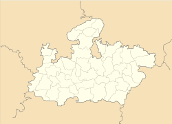
- Chapda
-
Chapda — town — Coordinates 22°42′0″N 76°19′0″E / 22.7°N 76.316667°ECoordinates: 22°42′0″N 76°19′0″E / 22.7°N 76.316667°E Country India State Madhya Pradesh District(s) Dewas Time zone IST (UTC+05:30) Codes-
• Pincode • 455227
Chapda is town in the Dewas District of the Madhya Pradesh state in India.
Contents
Geography
It is located at 22°42′0″N 76°19′0″E / 22.7°N 76.316667°E.[1]
Location
National Highway 59A passes through Chapda.
References
Cities and towns in Ujjain Division Dewas district Mandsaur district Neemuch district Ratlam district Shajapur district Agar · Akodia · Badagoan · Badod · Kanad · Maksi · Polay Kalan · Shajapur · Shujalpur · Soyatkalan · SusnerUjjain district Related topics Cities and towns
in other DivisionsExternal links
Categories:- Cities in Malwa
- Cities and towns in Dewas district
- Dewas
- Madhya Pradesh geography stubs
-
Wikimedia Foundation. 2010.


