- Brahmaputra River
-
Brahmaputra River 
Countries Bangladesh, India, China States Assam, Arunachal Pradesh Autonomous Region Tibet Tributaries - left Dibang River, Lohit River, Dhansiri River - right Kameng River, Raidak River, Jaldhaka River, Teesta River City Guwahati Source Chemayungdung Glacier [1] - location Himalayas, China - elevation 5,210 m (17,093 ft) - coordinates 30°23′N 82°0′E / 30.383°N 82°E Mouth Bay of Bengal - location Ganges Delta, Bangladesh - elevation 0 ft (0 m) - coordinates 25°13′24″N 89°41′41″E / 25.22333°N 89.69472°E Length 2,900 km (1,800 mi) [1] Basin 651,334 km2 (251,500 sq mi) Discharge - average 19,300 m3/s (681,600 cu ft/s) - max 100,000 m3/s (3,531,500 cu ft/s) 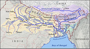 Map of the combined drainage basins of the Brahmaputra (violet), Ganges (orange), and Meghna (green).
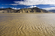 Yarlung Tsangpo River in Tibet.
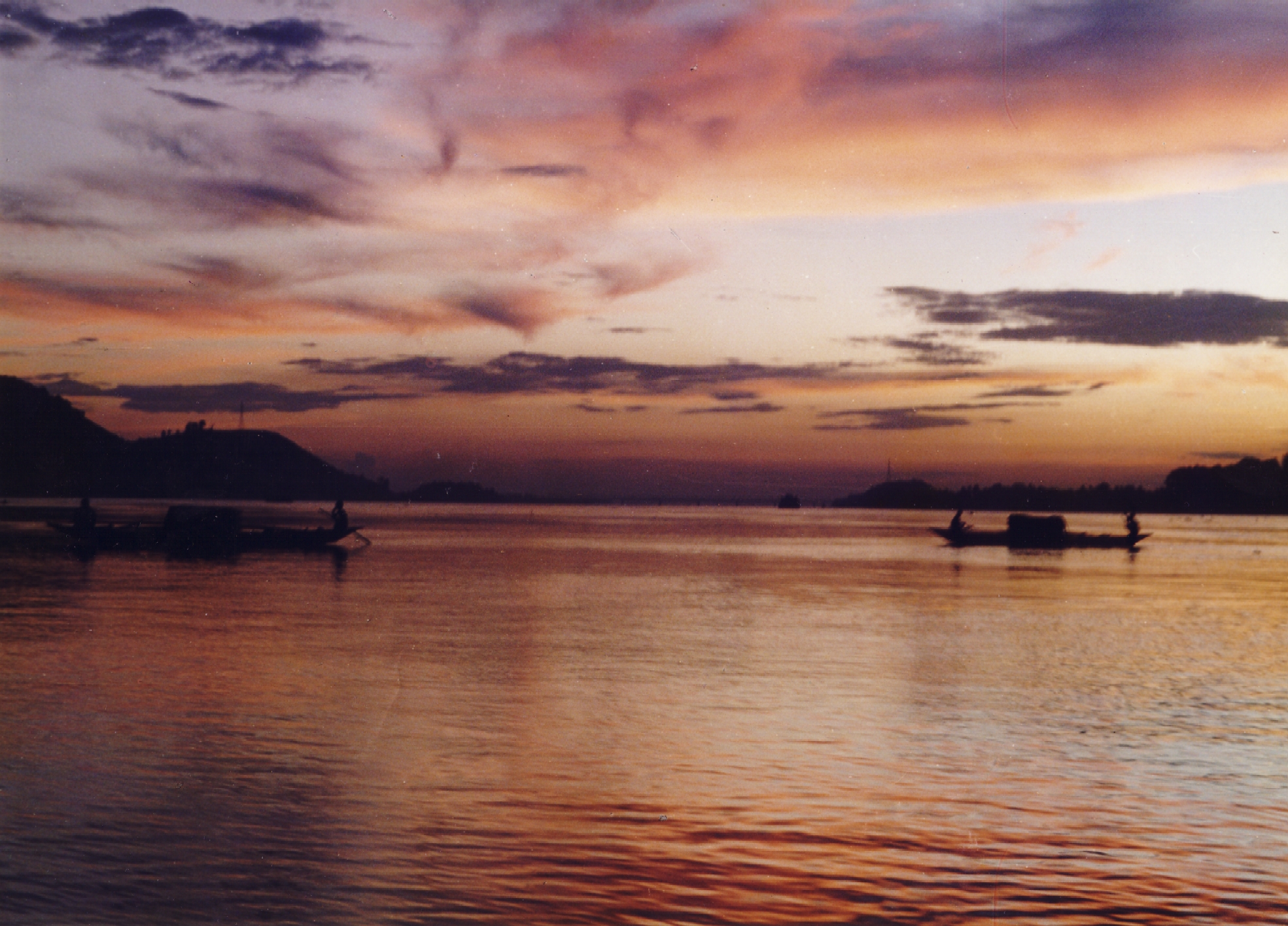
The Brahmaputra (Assamese ব্ৰহ্মপুত্ৰ নদ),[2] also called Tsangpo-Brahmaputra, is a trans-boundary river and one of the major rivers of Asia. It is the only Indian river that is attributed the masculine gender and thus referred to as a नद 'nada in Indo-Aryan languages and languages with Indo-Aryan influence. All other Indian rivers are referred to as नदी 'nadī.
From its origin in southwestern Tibet as the Yarlung Tsangpo River, it flows across southern Tibet to break through the Himalayas in great gorges and into Arunachal Pradesh (India) where it is known as Dihang.[3] It flows southwest through the Assam Valley as Brahmaputra and south through Bangladesh as the Jamuna (not to be mistaken with Yamuna of India). In the vast Ganges Delta it merges with the Padma, the main distributary of the Ganges, then the Meghna, before emptying into the Bay of Bengal.
About 1,800 miles (2,900 km) long, the Brahmaputra is an important river for irrigation and transportation. The average depth of the river is 124 feet (38 m) and maximum depth is 380 feet (120 m). The river is prone to catastrophic flooding in spring when the Himalayan snows melt. The average discharge of the river is about 19,300 cubic metres per second (680,000 cu ft/s), and floods can reach over 100,000 cubic metres per second (3,500,000 cu ft/s).[4] It is a classic example of a braided river and is highly susceptible to channel migration and avulsion.[5] It is also one of the few rivers in the world that exhibit a tidal bore. It is navigable for most of its length.
The Brahmaputra's upper course was long unknown, and its identity with the Yarlung Tsangpo was only established by exploration in 1884-86. This river is often called Tsangpo-Brahmaputra river.
The lower reaches are sacred to Hindus. While most rivers on the Indian subcontinent have female names, this river has a rare male name, as it means "son of Brahma" in Sanskrit (putra means "son").
Contents
Course
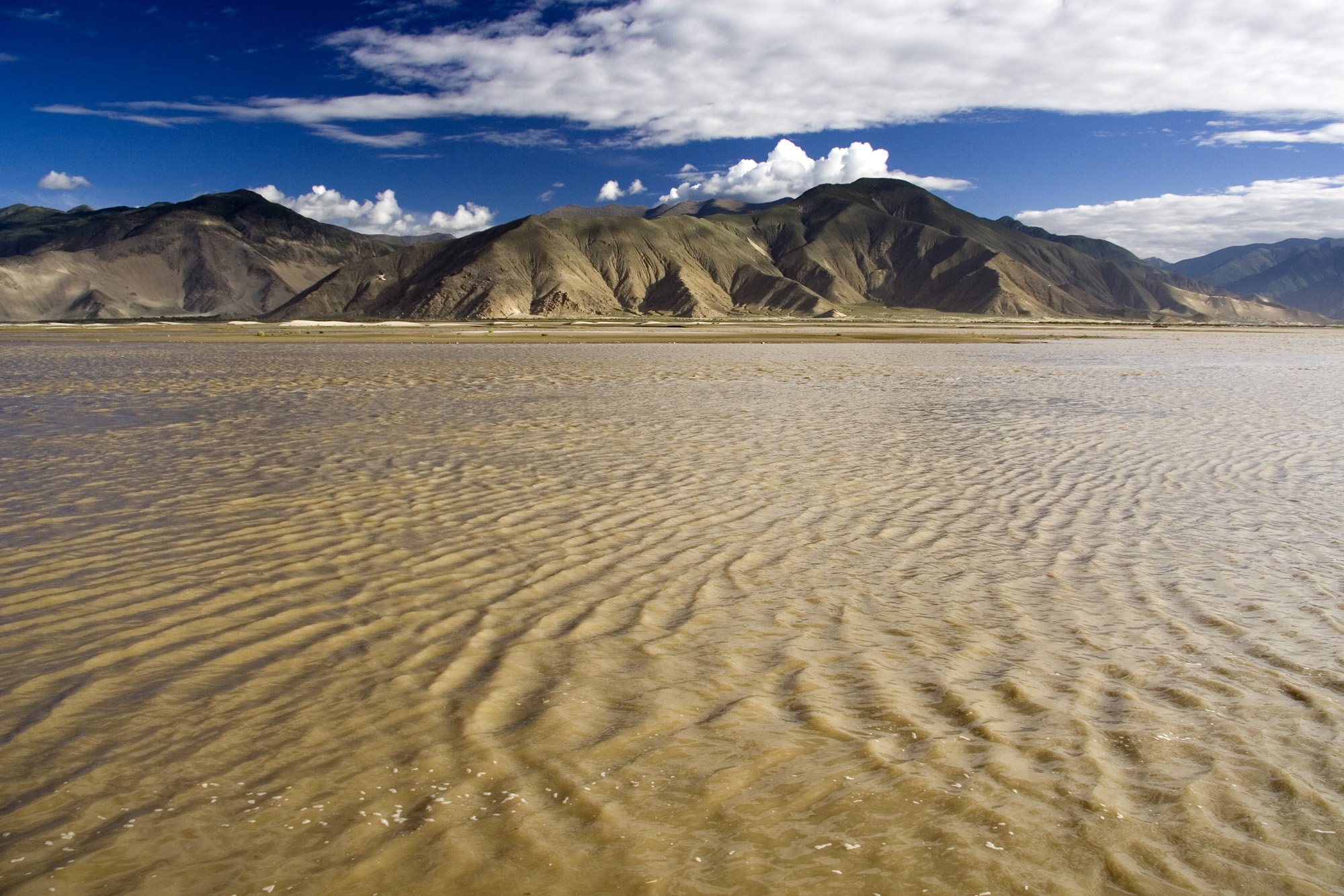
Tibet
The Brahmaputra river, called Yarlung Tsangpo in Tibetan language, originates on the Angsi Glacier located on the northern side of the Himalayas in Burang County of Tibet and not Chema-Yungdung glacier, which was previously identified by geographer Swami Pranavananda in the 1930s.The river is 3,848 km long, and its drainage area is 712,035 square km according to the new findings, while previous documents showed its length varied from 2,900 to 3,350 km and its drainage area between 520,000 and 1.73 million square kms. This finding has been given by Mr. Liu Shaochuang, a researcher with the Institute of Remote Sensing Applications under the analysis using expeditions and satellite imagery from the Chinese Academy of Sciences (CAS). The above article is with reference from http://www.assamtribune.com/aug2411/at096.txt.
Assam and adjoining region
 Map showing part of its course and tributaries in northeastern India and Bangladesh
The Brahmaputra enters India in the state of Arunachal Pradesh, where it is called Siang. It makes a very rapid descent from its original height in Tibet, and finally appears in the plains, where it is called Dihang. It flows for about 35 kilometres (22 mi) and is joined by the Dibang River and the Lohit River at the head of the Assam Valley. Below the Lohit the river is called Brahmaputra, enters the state of Assam and becomes very wide—as wide as 10 kilometres (6.2 mi) in parts of Assam. It is joined in Sonitpur by the Kameng River (or Jia Bhoreli).
Between Dibrugarh and Lakhimpur districts the river divides into two channels—the northern Kherkutia channel and the southern Brahmaputra channel. The two channels join again about 100 kilometres (62 mi) downstream forming the Majuli island, the largest river island in India. At Guwahati, near the ancient pilgrimage center of Hajo, the Brahmaputra cuts through the rocks of the Shillong Plateau, and is at its narrowest at 1 kilometre (1,100 yd) bank-to-bank. Due to the river's narrow width, the Battle of Saraighat was fought here. The first rail-cum-road bridge[clarification needed] across the Brahmaputra was opened to traffic in April 1962 at Saraighat.
The environment of the Brahmaputra floodplains in Assam have been described as the Brahmaputra Valley semi-evergreen forests ecoregion.
Bangladesh
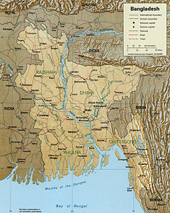 A Map showing major rivers in Bangladesh including both branches of Brahmaputra - Jamuna and lower Brahmaputra.
 Brahmaputra river seen from a Spot satellite
In Bangladesh, the Brahmaputra is joined by the Teesta River (or Tista), one of its largest tributaries. Below the Teesta, the Brahmaputra splits into two distributary branches. The western branch, which contains the majority of the river's flow, continues due south as the Jamuna (Jomuna) to merge with the lower Ganges, called the Padma River (Pôdda). The eastern branch, formerly the larger but now much smaller, is called the lower or old Brahmaputra (Bromhoputro). It curves southeast to join the Meghna River near Dhaka. The Padma and Meghna converge near Chandpur and flow out into the Bay of Bengal. This final part of the river is called Meghna.
In the past the course of the lower Brahmaputra was different and passed through the Jamalpur and Mymensingh districts. About 250 years ago a major earthquake led to its present flow. The Ganges Delta, fed by the waters of numerous rivers, including the Ganges and Brahmaputra, is 59,570 square kilometres (23,000 sq mi) large, one of the largest river deltas in the world.[6]
Flooding
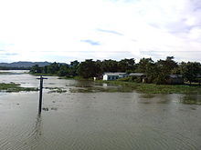 Flooded villages along Brahmaputra
During the monsoon season (June–October), floods are a common occurrence. Deforestation in the Brahmaputra watershed has resulted in increased siltation levels, flash floods, and soil erosion in critical downstream habitat, such as the Kaziranga National Park in middle Assam. Occasionally, massive flooding causes huge losses to crops, life and property. Periodic flooding is a natural phenomenon which is ecologically important because it helps maintain the lowland grasslands and associated wildlife. Periodic floods also deposit fresh alluvium replenishing the fertile soil of the Brahmaputra River Valley. Thus flooding, agriculture, and agricultural practices are closely connected.[7][8][9]
Cooperation on the Brahmaputra
The waters of the River Brahmaputra are shared by China, India, and Bangladesh. In the 1990s and 2000s, there was repeated speculation about China building a dam at the Great Bend, with a view to divert the waters to the north of the country. This was denied by the Chinese government for many years.[10] At the Kathmandu Workshop of Strategic Foresight Group in August 2009 on Water Security in the Himalayan Region, which on a rare occasion brought together leading hydrologists from the Basin countries, the Chinese scientists argued that it was not feasible for China to undertake such a diversion.[11] However on 22 April 2010, China confirmed that it was indeed building the Zangmu Dam on the Brahmaputra,[10] but assured India that the project would not have any significant effect on the downstream flow to India.[12][13]
In a meeting of scientists at Dhaka at 2010, 25 leading experts from the Basin countries issued a Dhaka Declaration on Water Security [14] calling for exchange of information in low flow period, and other means of collaboration. Even though the UN Convention on Trans-boundary Water of 1997 does not prevent any of the Basin countries from building a dam, Customary Law offers relief to the lower riparian countries. Also, there is potential for China, India and Bangladesh to develop hydroelectricity projects and transboundary water navigation.
Early history
Early accounts give its name as Dyardanes [15]. A question in connection with the river system of Mymensingh is when and why the Brahmaputra changed its main channel. It is not improbable that in prehistoric times it flowed directly south more or less along its present main channel. From ancient times up to the end of the eighteenth century it flowed past Jamalpur to Mymensingh and Egarasindur. The river practically stretched from Jamalpur to Sherour, 7 or 8 miles as the crow flies, and the present river Shiri was a part of it. As to its course through Dhaka from Egarasindur, there is some uncertainty.
It may be that the old geographers made mistakes and the fact was that it did not join the Meghna at Bhairab Blzar but struck off a mile below Egarasindur at Aralia to Lakhipur and then flowed in a south-westerly direction past Nangalband and Panchamighat to Rampal, joining the Meghna at Rajbari. The dried up bed between Aralia and Lakhiour is wrongly shown as the Lakshya in the revenue maps. This river branches off from the Brahmaputra at Lakhipur.
It has usually been assumed that the change in the course of the main waters of the Brahmaputra took place suddenly in 1787, the year of the heavy flooding of the river Tista. It is, however, well known that the Tista has always been a wandering river, sometimes joining the Ganges, sometimes being shifted westwards by the superior strength of that river and forced to join the Brahmaputra. It is now proved that the great Tibetan river Tsangpo joined the Brahmaputra about 1780,[citation needed] and this accession was of greater importance than the Tista floods in deciding the Brahmaputra to try a shorter way to the sea.
In the middle of the eighteenth century there Were at least three fair-sized streams flowing between the Rajshahi and Dhaka Divisions, viz., the Daokoba, a branch of the Tista, the Monash or Konai, and the Salangi. The Lahajang and the Elengjany were also important rivers. In Renault's time, the Brahmaputra as a first step towards securing a more direct course to the sea by leaving the Mahdupur Jungle to the east began to send a considerable volume of water down the Jinai or Jabuna from Jamalpur into the Monash and Salangi. These rivers gradually coalesced and kept shifting to the west till they met the Daokoba, which was showing an equally rapid tendency to cut towards the east. The junction of these rivers gave the Brahmaputra a course worthy of her immense power, and the rivers to right and left silted up. In Renault's Altas they very much resemble the rivers of Jessore, which dried up after the hundred mouthed Ganges had cut her new channel to join the Meghna at the south of the Munshiganj subdivision.
In 1809, Buchanan Hamilton wrote that the new channel between Bhawanipur and Dewanranj "was scarcely inferior to the mighty river, and threatens to sweep away the intermediate country". By 1830, the old channel had been reduced to its present insignificance. It was navigable by country boats throughout the year and by launches only during rains, but at the point as low as Jamalpur it was formidable throughout the cold weather. Similar was the position for two or three months just below Mymenensingh also.
As early as in 1830 there were resumption proceedings for chars which had formed in the new bed. Enquiries showed that many of the new formations were on the site of permanently settled villages which had been washed away by the changes in the course of the Jamuna and the Daokoba. The process has gone on ever since, and Buchanan Hamilton's remarks on the villages of Bengal are specially applicable to this area. He says that "a change in the site of a village 4 or 5 miles causes little inconvenience and is considered no more than a usual casualty, which produces on the people no effect of consequence. Even the rich never put up buildings of a durable nature."
See also
- List of rivers in Bangladesh
- List of rivers in China
- List of rivers in India
- List of rivers of Asia
Notes
- ^ a b Brahmaputra River, Encyclopedia Britannica
- ^ The Brahmaputra as it is called in various languages: Assamese: ব্ৰহ্মপুত্ৰ Brôhmôputrô; Bengali: ব্রহ্মপুত্র নদ Bromhoputro; Hindi: ब्रह्मपुत्र, IAST: Brahmaputra; Tibetan: ཡར་ཀླུངས་གཙང་པོ་, Wylie: yar klung gtsang po Yarlung Tsangpo; simplified Chinese: 布拉马普特拉河; traditional Chinese: 布拉馬普特拉河; pinyin: Bùlāmǎpǔtèlā Hé
- ^ "Yarlung Tsangpo River in China". Atmospheric Data Science Center. http://eosweb.larc.nasa.gov/HPDOCS/misr/misr_html/yarlang_tsangpo.html. Retrieved 2007-06-27.
- ^ Water Resources of Bangladesh. Accessed 2010-11-18
- ^ Catling, David (1992). Rice in deep water. International Rice Research Institute. p. 177. ISBN 9789712200052. http://books.google.com/books?id=N5JxwKx1RAgC&pg=PA177. Retrieved 23 April 2011.
- ^ Singh, Vijay P.; Sharma, Nayan; C. Shekhar P. Ojha (2004). The Brahmaputra Basin Water Resources. Springer. p. 113. ISBN 9781402017377. http://books.google.com/books?id=HUXrVyUk0RAC&pg=PA113. Retrieved 7 February 2011.
- ^ Das, D.C. 2000. Agricultural Landuse and Productivity Pattern in Lower Brahmaputra valley (1970-71 and 1994-95). Ph.D. Thesis, Department of Geography, North Eastern Hill University, Shillong.
- ^ Mipun, B.S. 1989. Impact of Migrants and Agricultural Changes in the Lower Brahmaputra Valley : A Case Study of Darrang District. Unpublished Ph.D. Thesis, Department of Geography, North Eastern Hill University, Shillong.
- ^ Shrivastava, R.J. and Heinen, J.T. 2005. Migration and Home Gardens in the Brahmaputra Valley, Assam, India. Journal of Ecological Anthropology 9: 20-34.
- ^ a b China admits to Brahmaputra project - The Economic Times, 22 Apr 2010
- ^ MacArthur Foundation, Asian Security Initiative
- ^ Chinese dam will not impact flow of Brahmaputra: Krishna - The Indian Express, 22 Apr 2010
- ^ Chinese dam will not impact Brahmaputra: Krishna - Times of India, 22 Apr 2010
- ^ The New Nation, Bangladesh, 17th January 2010
- ^ A compendium of ancient and modern geography: for the use of Eton School By Aaron Arrowsmith page 56
References
- This article incorporates text from the public domain 1907 edition of The Nuttall Encyclopædia.
- Rahaman, M.M. & Varis, O. 2009. Integrated Water Management of the Brahmaputra Basin: Perspectives and Hope for Regional Development, Natural Resources Forum, Vol. 33, No. 1. pp. 60–75. DOI: 10.1111/j.1477-8947.2009.01209.x
- Sarma, J N (2005). "Fluvial process and morphology of the Brahmaputra River in Assam, India". Geomorphology 70 (3–4): 226–256. doi:10.1016/j.geomorph.2005.02.007
Further reading
- Bibliography on Water Resources and International Law. Peace Palace Library
- Rivers of Dhemaji and Dhakuakhana
- Background to Brahmaputra Flood Scenario
- The Mighty Brahmaputra
- "The Brahmaputra", a detailed study of the river by renowned writer Arup Dutta. (Published by National Book Trust, New Delhi, India)
 Hydrology of India
Inland Beas · Betwa · Brahmaputra · Chambal · Chenab · Chilika Lake · Dal Lake · Damodar · Ganges · Ganges Basin · Ganges Delta · Ghaghara · Godavari · Indus · Indus Delta · Jhelum · Kali · Kaveri · Kerala backwaters · Koshi · Krishna · Luni · Mahanadi · Malampuzha · Narmada · Nizam Sagar · Padma · Pookode Lake · Powai Lake · Ravi · Red Hills Lake · Roopkund (Skeleton Lake) · Sapt Koshi · Sarasvati · Sharda · Son · Sutlej · Tapti · Vaigai · YamunaCoastal Categories Lakes of India · Reservoirs and dams in India · Rivers of IndiaHydrology of South Asia Inland Indus · Ganges · Yamuna · Chenab · Jhelum · Bhagirathi River · Brahmaputra · Godavari · Narmada · Tapti · Ravi · Beas · Sutlej · Padma · Sarasvati · Sharda · Krishna · Kaveri · Kali River · Meghna · Gandaki River · Mahanadi · Mahaweli · Son · Ghaghara · Betwa · Chambal · Kosi · Sankosh · Ganges Basin · Ganges Delta · Indus Delta · Dal Lake · Pookode Lake · Skeleton Lake · Chilka Lake · Lake Powai · Borith Lake · Saiful Muluk · Gosaikunda · Nizam Sagar · Red Hills Lake · Malampuzha · Kerala Backwaters · Damodar · LuniCoastal Categories Lakes of India / Nepal / Pakistan · Reservoirs and dams in India · Rivers of Bangladesh / Bhutan / India / Nepal / PakistanHydrology of Northeast India1 Rivers Bhogdoi • Siang/Dihang/Brahmaputra • Dhansiri • Dihing • Diphlu • Feni • Gumti • Haora • Iril • Kaladan • Kameng or Jia Bhoreli • Karnaphuli • Khowai • Kolong • Lohit • Manas/ Drangme Chhu • Manu • Mora Dhansiri • Muhuri • Mora Diphlu • Sankosh or Puna Tsang Chhu • Simsang or Someshwari • Surma • Surma-Meghna River System • Thega River • TirapLakes Waterfalls Fluvial islands 1 Assam, Arunachal Pradesh, Nagaland, Manipur, Tripura, Mizoram, Meghalaya Rivers in and around Bengal Southeast Bangladesh Assam / Meghalaya /
TripuraNorthern Bangladesh
North BengalAtrai · Balason · Bangali · Baral · Dharla · Dhepa · Gumani · Jaldhaka · Karatoya · Khong Khola · Mahananda · Mechi · Punarbhaba · Raidak or Wong Chhu · Rangeet · Tangon · Teesta · Torsa/Machu/Amo ChhuCentral Bangladesh Bangshi · Buriganga · Dhaleshwari · Gorai-Madhumati · Jamuna · Louhajang · Padma · Shitalakhya · TuragChotanagpur Ajay · Bakreshwar · Bansloi · Barakar · Brahmani · Damodar · Dwarka · Dwarakeswar · Gandheswari · Haldi · Hinglo · Kangsabati · Keleghai · Kopai · Kosai · Kunur · Mayurakshi · Mundeswari · Rasulpur · Rupnarayan · Sali · Shilabati · SubarnarekhaSouth Bengal
Ganges DeltaAdi Ganga · Baleshwar · Bidyadhari · Bura Gauranga · Churni · Gosaba · Hariabhanga · Hooghly · Ichamati · Jalangi · Kalindi · Matla · Muri Ganga · Pasur · Piyali · Raimangal · Saptamukhi · Saraswati · ThakuranRelated topics Beel · Country boats in Bangladesh · Chalan Beel · Ganges · Haor · Haors in Bangladesh · List of rivers of Bangladesh · of India · Waters of South Asia · Damodar Valley CorporationHydrology of surrounding areas Orissa • Jharkhand • Bihar • Nepal • Sikkim • Bhutan • North-east IndiaCategories:- Brahmaputra River
- Rivers of Bangladesh
- Rivers of China
- Rivers of India
- Rivers of Tibet
- Rivers of Assam
- International rivers of Asia
- Geography of Assam
- Sacred rivers


Wikimedia Foundation. 2010.