- Boundaries between continents
-
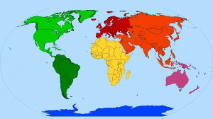 Color-coded map of continents:
Africa
Americas
North America
South America
Antarctica
Australasia/Oceania
Eurasia
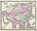
Asia
Europe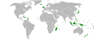 Map of island countries: these states are not located on any continent (landmass), but they are usually grouped geographically with a neighbouring continent
The borders or boundaries separating the various continents of the topography of Earth are a matter of geographical convention. Several slightly different conventions are in use, just as the number of continents is most commonly considered to be seven but may range as low as five, depending on whether the Americas and Eurasia are each considered a single continent. According to the definition of a continent in the strict sense, an island cannot be part of any continent, but in practice most major islands are associated with a continent by convention.
There are three overland boundaries subject to definition:
- between Asia and Africa (dividing Afro-Eurasia into Africa and Eurasia): at the Isthmus of Suez
- between Asia and Europe (dividing Eurasia): along the Bosporus, the Caucasus and the Urals (historically also north of the Caucasus, along the Kuma–Manych Depression or along the Don River)
- between North America and South America (dividing the Americas): the Isthmus of Panama
While the isthmus between Asia and Africa and that between the two Americas are today navigable, via the Suez and Panama canals, man-made diversions and canals are generally not accepted on their own accord as continent-defining boundaries; the Suez Canal happens to traverse the isthmus between the Mediterranean Sea and Red Sea, dividing Asia and Africa. The remaining boundaries concern the association of islands and archipelagos with specific continents, notably:
- the delineation of Southeast Asia from Australasia
- the delineation between Africa, Europe and Asia in the Mediterranean
- the delineation between Asia and Europe in the Arctic Ocean
- the delineation between Europe and North America in the Atlantic
- the delineation between North and South America in the Caribbean
- the delineation of Asia from North America in the North Pacific
Contents
Europe and Asia
 Conventions used for the boundary between Europe and Asia during the 18th and 19th centuries. The red line shows the modern convention, in use since ca. 1850.EuropeAsiahistorically placed in either continent, today mostly classified as within Europe.
History
The threefold division of the Old World into Europe, Asia and Africa has been in use since the 6th century BC, due to Greek geographers such as Anaximander and Hecataeus. Anaximander placed the boundary between Asia and Europe along the Phasis River (the modern Rioni) in the Caucasus, a convention still followed by Herodotus in the 5th century BC.[1] As geographic knowledge of the Greeks increased during the Hellenistic period,[2] this archaic convention was revised, and the boundary between Europe and Asia was now considered to be the Tanais (the modern Don River). This is the convention used by Roman era authors such as Posidonius,[3] Strabo[4] and Ptolemy.[5]
Throughout the Middle Ages and into the 18th century, the traditional division of the landmass of Eurasia into two continents Europe and Asia followed Ptolemy, with the boundary following the Agean Sea, the Dardanelles, the Sea of Marmara, the Bosporus, the Black Sea, the Kerch Strait, the Sea of Azov and the Don (ancient Tanais). But maps produced during the 16th to 18th century tended to differ in how to continue the boundary beyond the Don bend at Kalach-na-Donu (where it is closest to the Volga, now joined with it by the Volga–Don Canal), into territory not described in any detail by the ancient geographers.
Philip Johan von Strahlenberg in 1725 was the first to depart from the classical Don boundary by drawing the line further east, from Kalach to the Volga, following the Volga north until the Samara bend, east along Obshchy Syrt (the drainage divide between Volga and Ural) and then north along Ural mountains.[6][7] The mapmakers continued to differ on the boundary between the lower Don and Samara well into the 19th century. The 1745 atlas published by the Russian Empire has the boundary follow the Don beyond Kalach as far as Serafimovich before cutting north towards Archangelsk, while other 18th to 19th century mapmakers such as John Cary followed Strahlenberg's prescription. To the south, the Kuma-Manych Depression was identified circa 1773 by a German naturalist Peter Simon Pallas as a valley that, once upon a time, connected the Black Sea and the Caspian Sea,[7][8] and subsequently was proposed as a natural boundary between continents.
By the mid-19th century, there were three main conventions, one following the Don, the Volga–Don Canal and the Volga, the other following the Kuma-Manych Depression to the Caspian and then the Ural River, and the third abandoning the Don altogether, following the Greater Caucasus watershed to the Caspian. The question was still treated as a "controversy" in geographical literature of the 1860s, with Douglas Freshfield advocating the Caucasus crest boundary as the "best possible", citing support from various "modern geographers".[9]
In Russia and the Soviet Union, the boundary along the Manych Depression was the most commonly used as early as 1906.[10] In 1958, the Soviet Geographical Society formally recommended that the boundary between the Europe and Asia be drawn in textbooks along the eastern foot of Ural mountains, Emba river, and Kuma-Manych depression,[11] thus placing the Caucasus entirely in Asia and the Urals entirely in Europe. [12] However, most geographers in the Soviet Union favoured the boundary along the Caucasus crest [13] and this became the standard convention in the latter 20th century, although the Kuma-Manych boundary remained in use in some 20th-century maps.
-
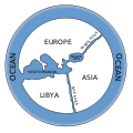
Map of the world according to Anaximander (6th c. BC). Only the parts of Europe, Asia and Africa directly adjacent to the Mediterranean and the Black Sea are known. The Phasis River of the Caucasus is imagined as separating Europe from Asia, while the Nile separates Asia from Africa (Libya).
-
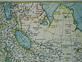
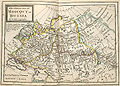
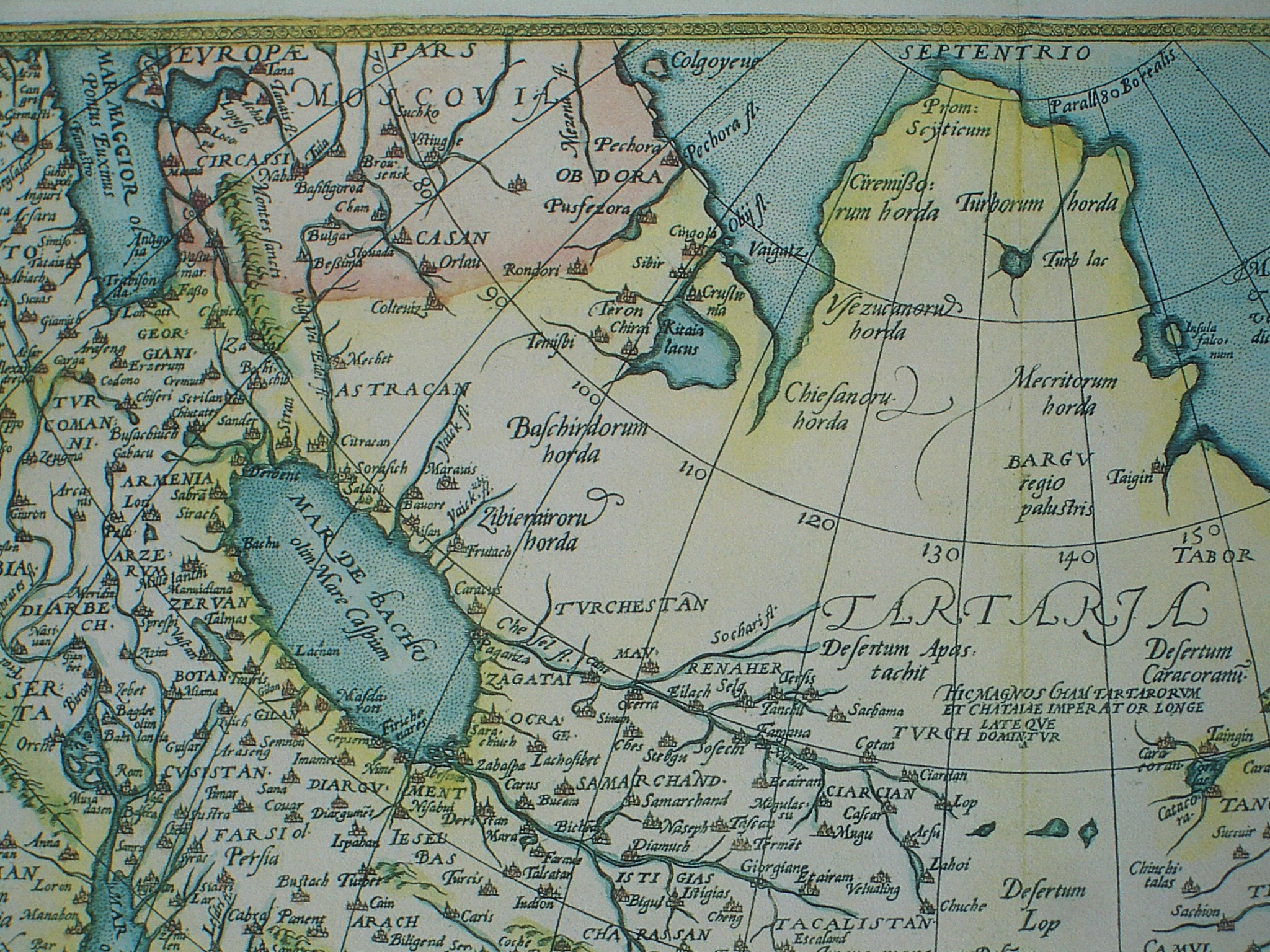
In this 1570 map of Asia (Asia Nova Descriptio), the Tanais is used as continental boundary. Moscovia is represented as "transcontinental", having an Asiatic and a European part (labelled Europae pars).
-

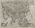
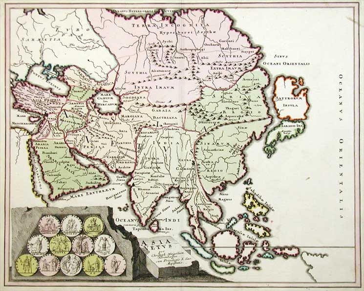
This 1719 map of "ancient Asia" (Asia Vetus) divides Sarmatia into Sarmatia Europea and Sarmatia Asiatica. The continental boundary is drawn along the Tanais (Don), the Volga and the Northern Dvina.
-
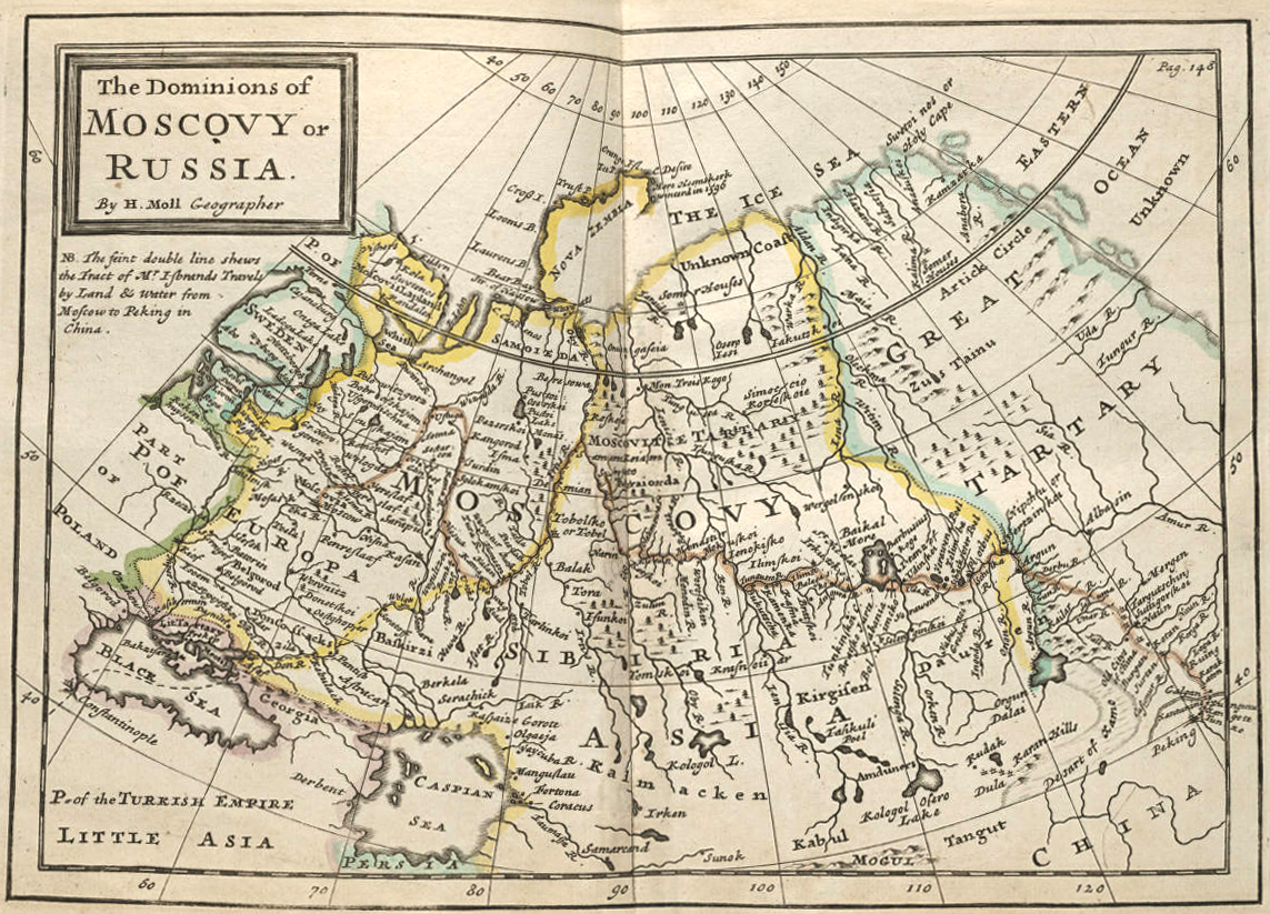
Herman Moll (ca. 1715) draws the boundary along the Don, the Volga, cutting across land from Samara to the Tobol River, following the lower Irtysh and finally the Ob River, placing Novaya Zemlya in Europe.
-

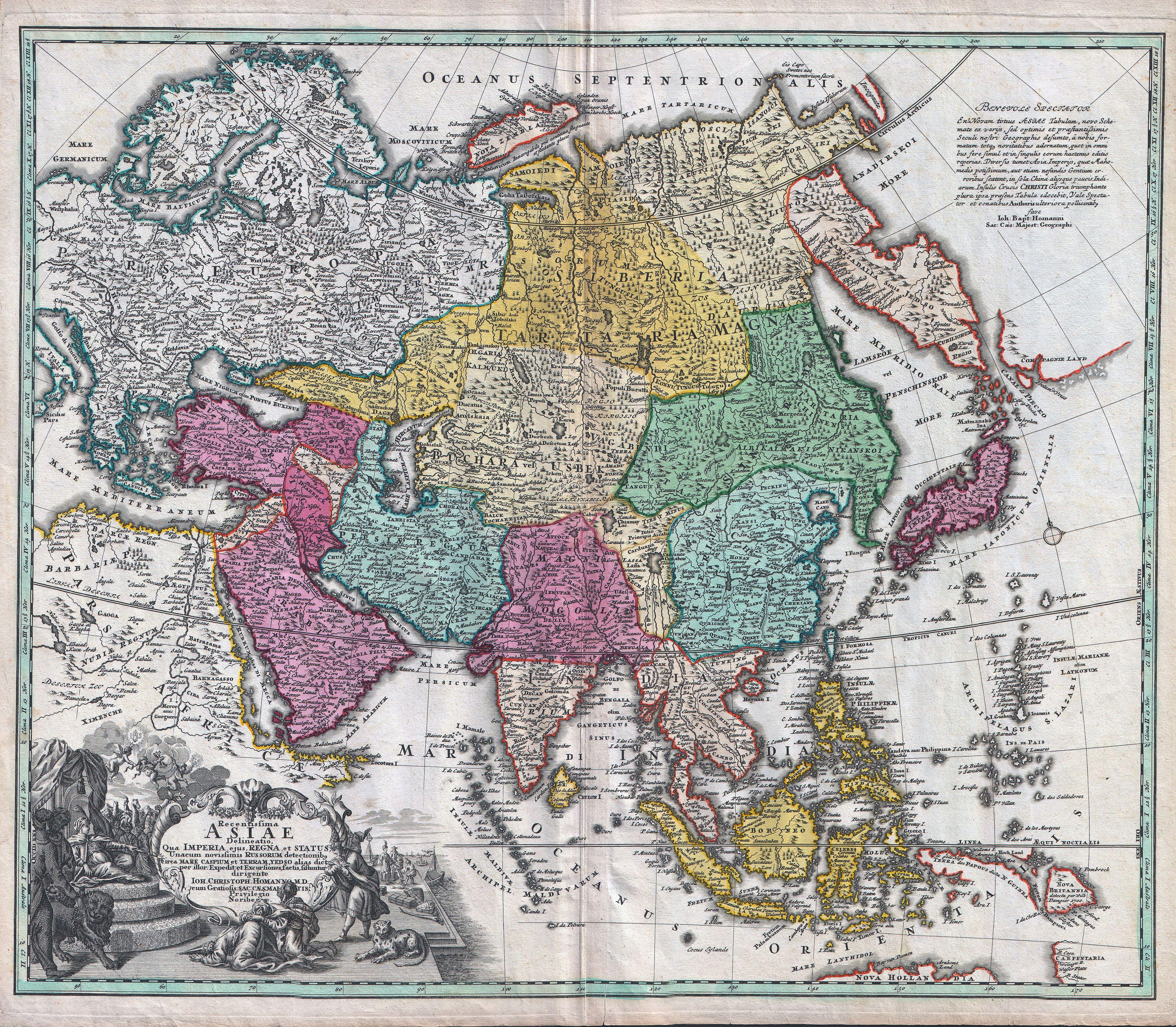
A German map of 1730 by Johann Christoph Homann has a similar boundary to the one shown by Moll, but following the full length of the Samara bend and then cutting across to the Irtysh directly, placing the Tobol and Tobolsk in Asia.
-
The "Academy Atlas" of the Russian Empire, published by The Saint Petersburg Academy of Sciences in 1745, draws the boundary along the Don, but then west of the Volga to Arkhangelsk
-
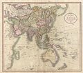
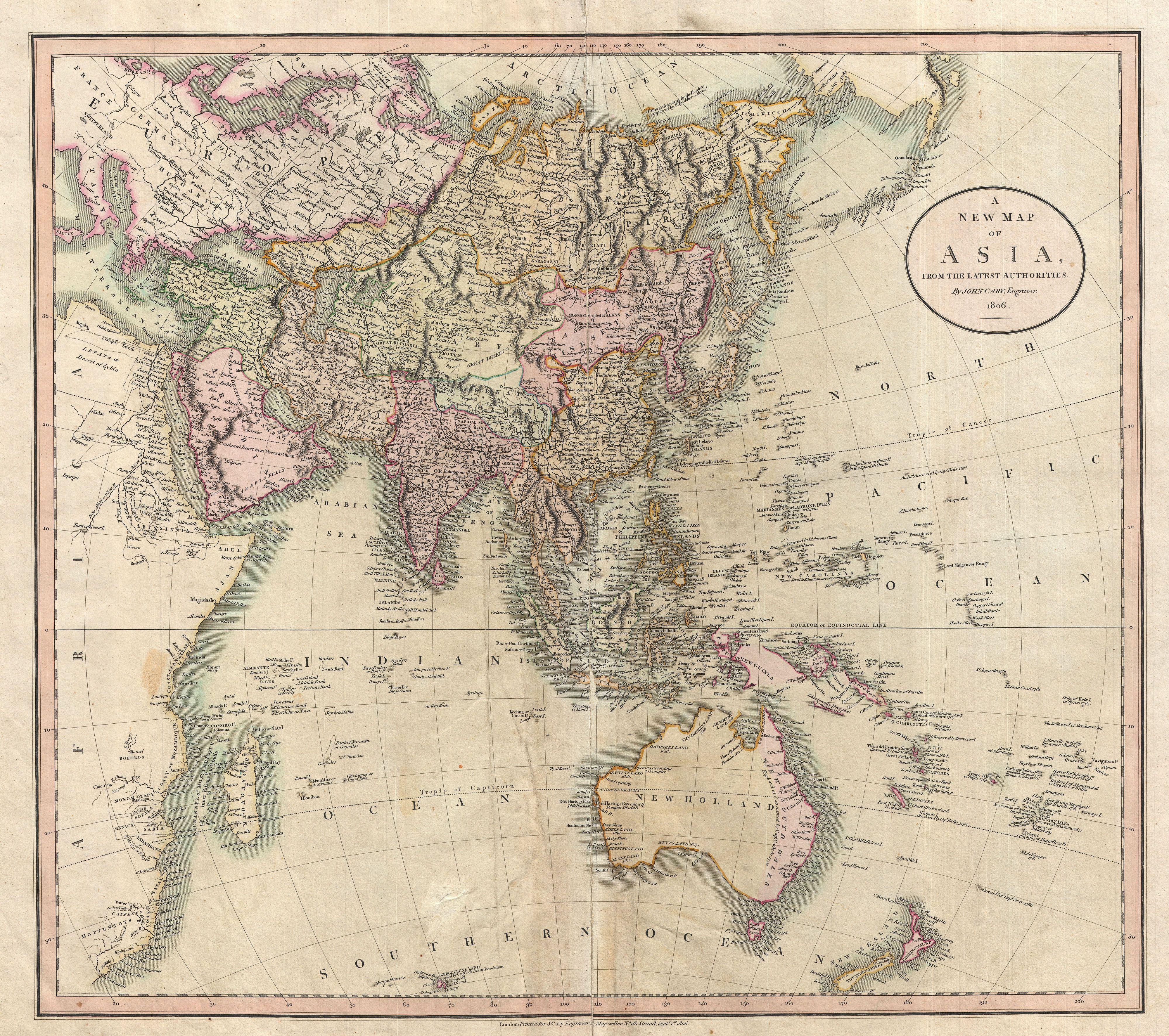
1806 map of Asia by John Cary, boundary along the Don and then the Volga until Samara, and north of Perm following the Urals, placing Novaya Zemlya in Asia.
-
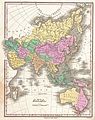
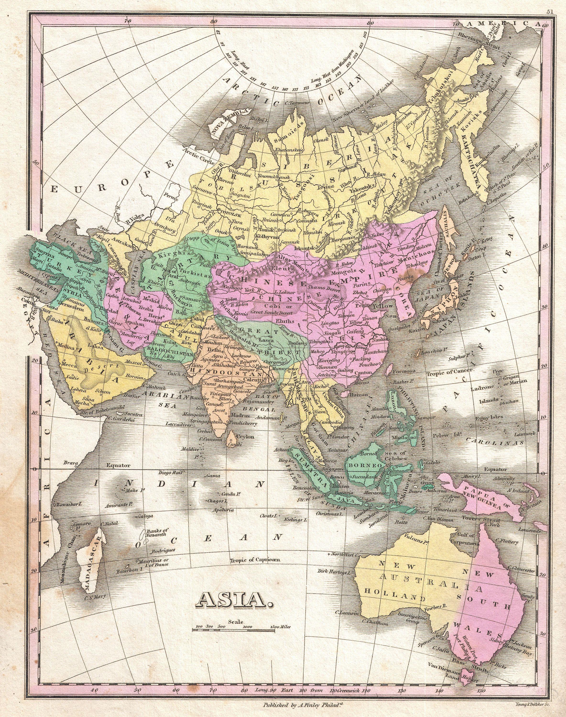
1827 map by Anthony Finley, showing the boundary as running along the Don, the Volga, passing between Perm and Ufa, and running north over land to the Sea of Kara, placing Novaya Zemlya in Europe.
-
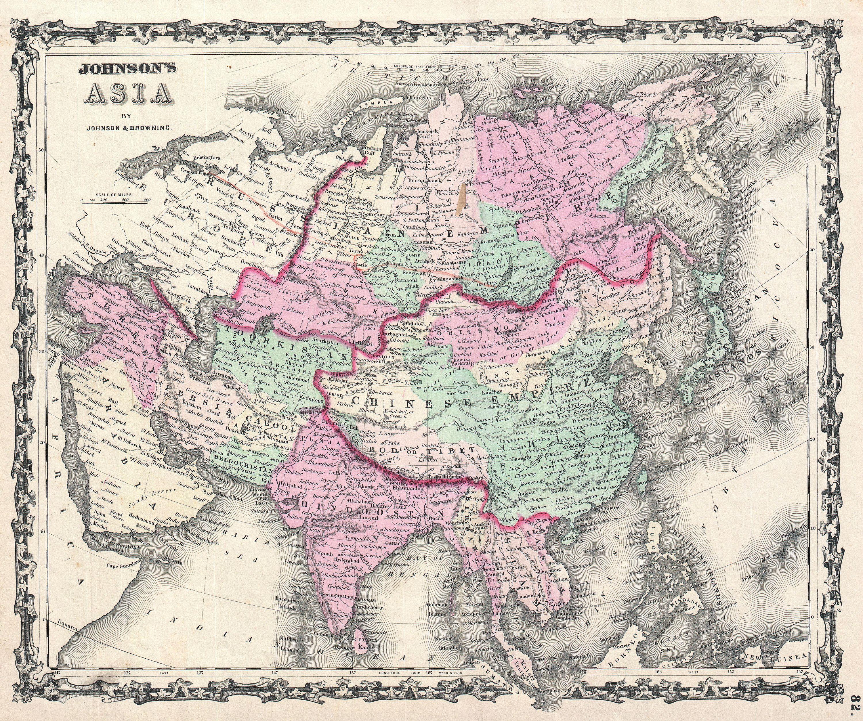
1861 map by A. J. Johnson, illustrating the modern convention, Caucasus crest, Ural River, Urals.
-
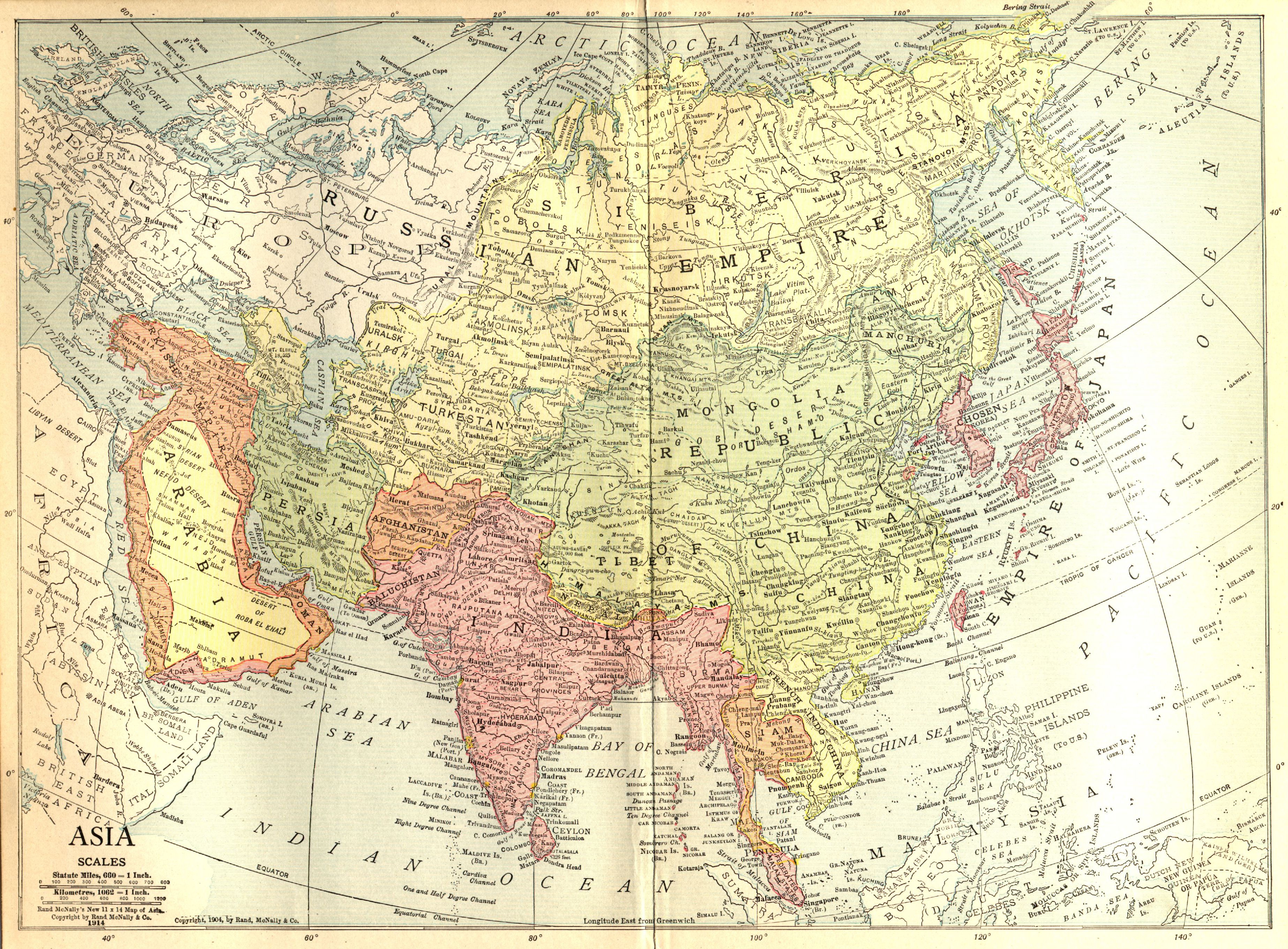
1914 map showing the boundary along the Manych River, placing Stavropol Krai in Asia
-
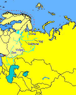
Miles Clark in his 1992 "circumnavigation of Europe" followed the White Sea – Baltic Canal until Lake Onega and the Volga–Baltic Waterway to the Rybinsk Reservoir before joining the classical boundary along the Volga and Don rivers.[14][15]
Modern definition
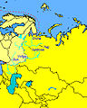
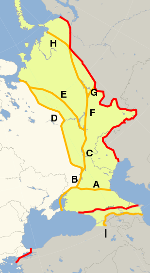
 Transcontinental states, European territoryTranscontinental states, Asian territory
The modern definition of Europe delimits it from Asia at the Aegean Sea, the Dardanelles-Sea of Marmora-Bosporus, the Black Sea, along the watershed of the Greater Caucasus, the northwestern portion of the Caspian Sea and along the Ural Mountains, as both mapped and listed in many atlases including that of the National Geographic Society and as described in the World Factbook.
According to this definition, Georgia and Azerbaijan both have most of their territory in Asia, although each has small parts of their northern borderlands north of the Greater Caucasus watershed and thus in Europe. The Turkish city Istanbul lies in on both sides of the Bosporus, making it a transcontinental city. Russia and Turkey are transcontinental countries with territory in both Europe and Asia by any definition. While Russia is historically a European country with a history of imperial conquests in Asia, the situation for Turkey is inverse, as that of an Asian country with imperial conquests in Europe. Kazakhstan is also a transcontinental country by this definition, its West Kazakhstan and Atyrau provinces extending on either side of the Ural River.
The Kuma–Manych Depression (more precisely, the Manych River, the Kuma–Manych Canal and the Kuma River) remains cited less commonly as one possible natural boundary in contemporary sources.[16]
There are other definitions for Europe and Asia limits, such as political definitions made by:
- The United Nations Statistics Division lists transcontinental countries under the continent in which they have the majority of their population:[17]
- listed as part of Eastern Europe: Russian Federation
- listed as part of Central Asia: Kazakhstan
- listed as part of Western Asia: Azerbaijan, Georgia, Turkey and Cyprus
- The Council of Europe statute for membership:[18]
- Members include: Russian Federation, Armenia, Georgia, Azerbaijan, Turkey and Cyprus
- Although not a member, Kazakhstan is granted the right to request full membership [19]
Islands
The geographical notion of a continent stands in opposition to islands and archipelagos.[20] Nevertheless, there are some islands that are considered part of Europe in a political sense. This most notably includes the British Isles, besides the islands of the North Sea, the Baltic Sea and the Mediterranean which are part of the territory of a country situated on the European mainland, and usually also the island states of Iceland and Malta.
Russia's Vaygach Island and Novaya Zemlya extend northward from the northern end of the Ural Mountains and are a continuation of that chain into the Arctic Ocean. While Novaya Zemlya was variously grouped with Europe or with Asia in 19th century maps, it is now usually grouped with Europe, the continental boundary considered to join the Arctic Ocean along the southern shore of the Kara Sea. The Russian Arctic archipelago of Franz Josef Land farther north is also associated with Europe.
Europe ends in the west at the Atlantic Ocean, although Iceland and the Azores archipelago (in the Atlantic, between Europe and North America) are usually considered European, as is the Norwegian Svalbard archipelago in the Arctic Ocean. Greenland is geographically part of North America, but politically associated with Europe as it is part of the Kingdom of Denmark, although it has extensive home rule and EU law no longer applies there.
Cyprus is an island of the Mediterranean but located close to Asia Minor, so that it is usually associated with Asia and/or the Middle East, as in the World Factbook, but it was nevertheless admitted to the Council of Europe in 1961 and joined the EU in 2004.
North Aegean Islands and the Dodecanese lie on the coast of Asian Turkey (Asian continental shelf), but are politically part of Greece, a European country.
Africa and Asia
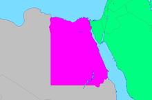 African part of EgyptAsian part of EgyptRest of AsiaRest of Africa
The natural geographical boundaries of Africa are the Mediterranean Sea, the Red Sea, and the Gulf of Aden. The usual line taken to divide Africa from Asia today is at the Isthmus of Suez, the narrowest gap between the Mediterranean Sea and Gulf of Suez, a route today followed by the Suez Canal. This makes the Sinai Peninsula geographically Asian, and Egypt a transcontinental country.
Less than 2% of Egyptian population live in the Sinai, and hence Egypt even though technically transcontinental is usually considered an African country. But when discussing the geopolitical region of the Middle East and North Africa, Egypt is usually grouped with the Asian countries as part of the Middle East, while Egypt's western neighbor Libya is grouped with the remaining North African countries as the Maghreb. Historically, in Greco-Roman geography, Egypt was also considered part of Asia, and Africa (Libya) was taken to begin in Marmarica, at the Catabathmus Magnus.
The Seychelles, Mauritius, and Comoros are island nations in the Indian ocean associated with Africa. The island of Socotra may be considered African as it lies on this continent's shelf, but is part of Yemen, an Asian country.
Africa and Europe
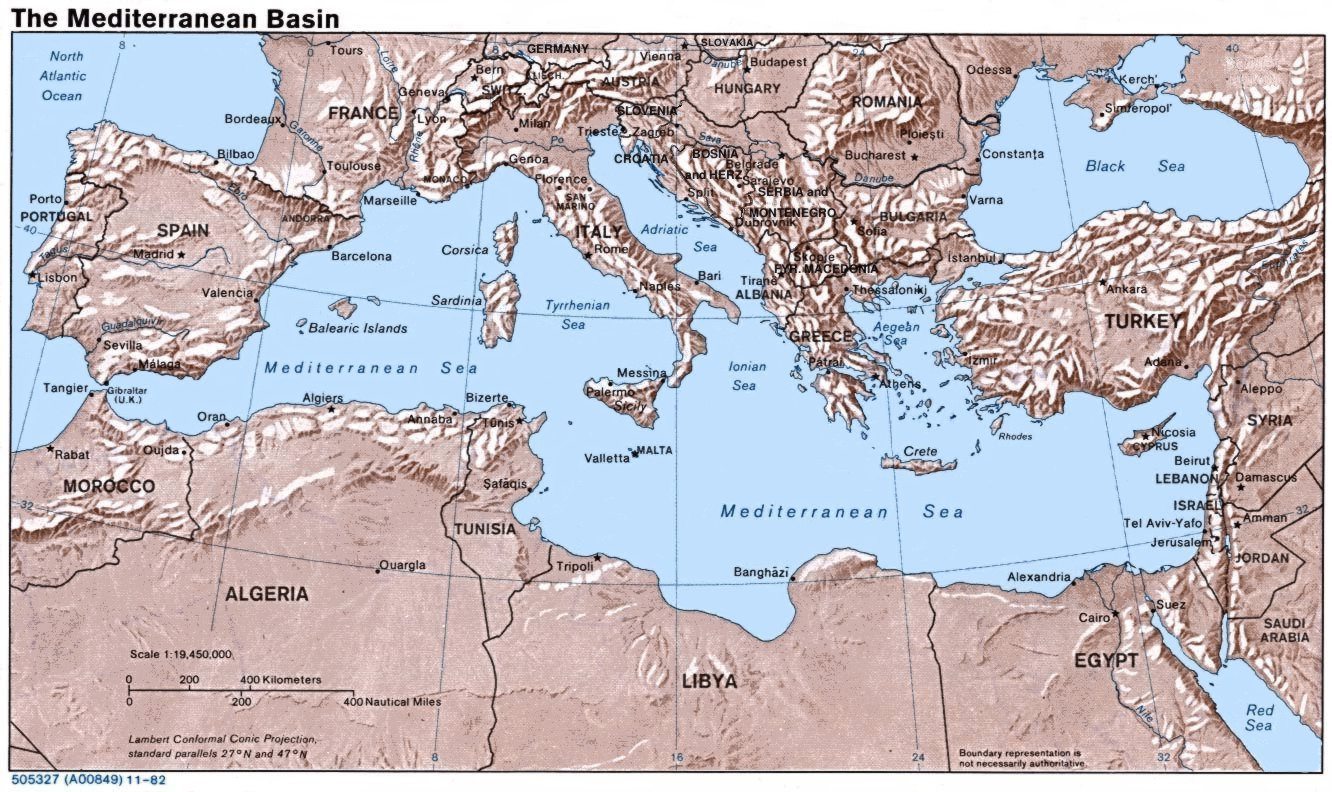
 The Mediterranean Sea
The European and African mainlands are non-contiguous, and the delineation between these continents is thus merely a question of which islands are to be associated with which continent.
Sicily and Malta are usually grouped with Europe, while the Pelagie Islands are often grouped with Africa.[citation needed]
The Portuguese Atlantic island possession of the Azores is slightly closer to Europe than Africa, and is usually grouped with Europe.[citation needed] By contrast, the Canary and Madeira islands off the Atlantic coast of Morocco are usually grouped with Africa.[citation needed]
North and South America
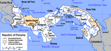 PanamaFurther information: Americas and Central America
Mainland
The border between North America and South America is at some point on the Isthmus of Panama. The most common demarcation in atlases and other sources follows the Darién Mountains watershed divide along the Colombia-Panama boundary where the isthmus meets the South American continent. Virtually all atlases list Panama as a state falling entirely within North America and/or Central America.[21][22] .[23][24][25][26] Another demarcation, less common, reckons the continental divide at the man-made Panama Canal, which would place some Panamanian territory on both continents.[citation needed]
Islands
Often most of the Caribbean islands are considered part of North America, but Aruba, Bonaire, Curaçao, Trinidad and Tobago lie on the continental shelf of South America. On the other hand, the Venezuelan Isla Aves and the Colombian San Andrés and Providencia lie on the North American shelf.
Europe and North America
Europe and North America are separated by the North Atlantic. In terms of associating islands with either continent, the boundary is usually drawn between Greenland and Iceland. The Norwegian islands of Jan Mayen and Svalbard in the Arctic Ocean are usually associated with Europe. Iceland and the Azores are protrusions of the Mid-Atlantic Ridge and are associated with and peopled from Europe, even though they have areas on the North American plate. (Definitions of "continents" are a physical and cultural construct dating back centuries, long before the advent or even knowledge of plate tectonics; i.e., defining a "continent" falls into the realm of physical and cultural geography, while continental plate definitions fall under plate tectonics in the realm of geology.)
Asia and North America
The Bering Strait and Bering Sea separate the landmasses of Asia and North America, as well as forming the international boundary between Russia and the United States. This national and continental boundary separates the Diomede Islands in the Bering Strait, with Big Diomede in Russia and Little Diomede in the US. The Aleutian Islands are an island chain extending westward from the Alaska Peninsula toward Russia's Komandorski Islands and Kamchatka Peninsula. Most of them are always associated with North America, except for the westernmost Near Islands group, which is on Asia's continental shelf beyond the North Aleutians Basin and on rare occasions could be associated with Asia, which could then allow the US to be considered a transcontinental country.[citation needed]
St. Lawrence Island in the northern Bering Sea belongs to Alaska and may be associated with either continent but are almost always considered part of North America, as with the Rat Islands in the Aleutian chain.
The Americas and Oceania
The Galápagos Islands and Malpelo Island in the eastern Pacific Ocean are possessions of Ecuador and Colombia, respectively, and associated with South America. The uninhabited French possession of Clipperton Island 600 miles (970 km) off the Mexican coast is associated with North America.
Easter Island, a territory of Chile, is considered to be in Oceania, though politically it is associated with South America.
The United States controls numerous territories in Oceania, including the state of Hawaii. These are politically associated with North America.
Asia and Oceania
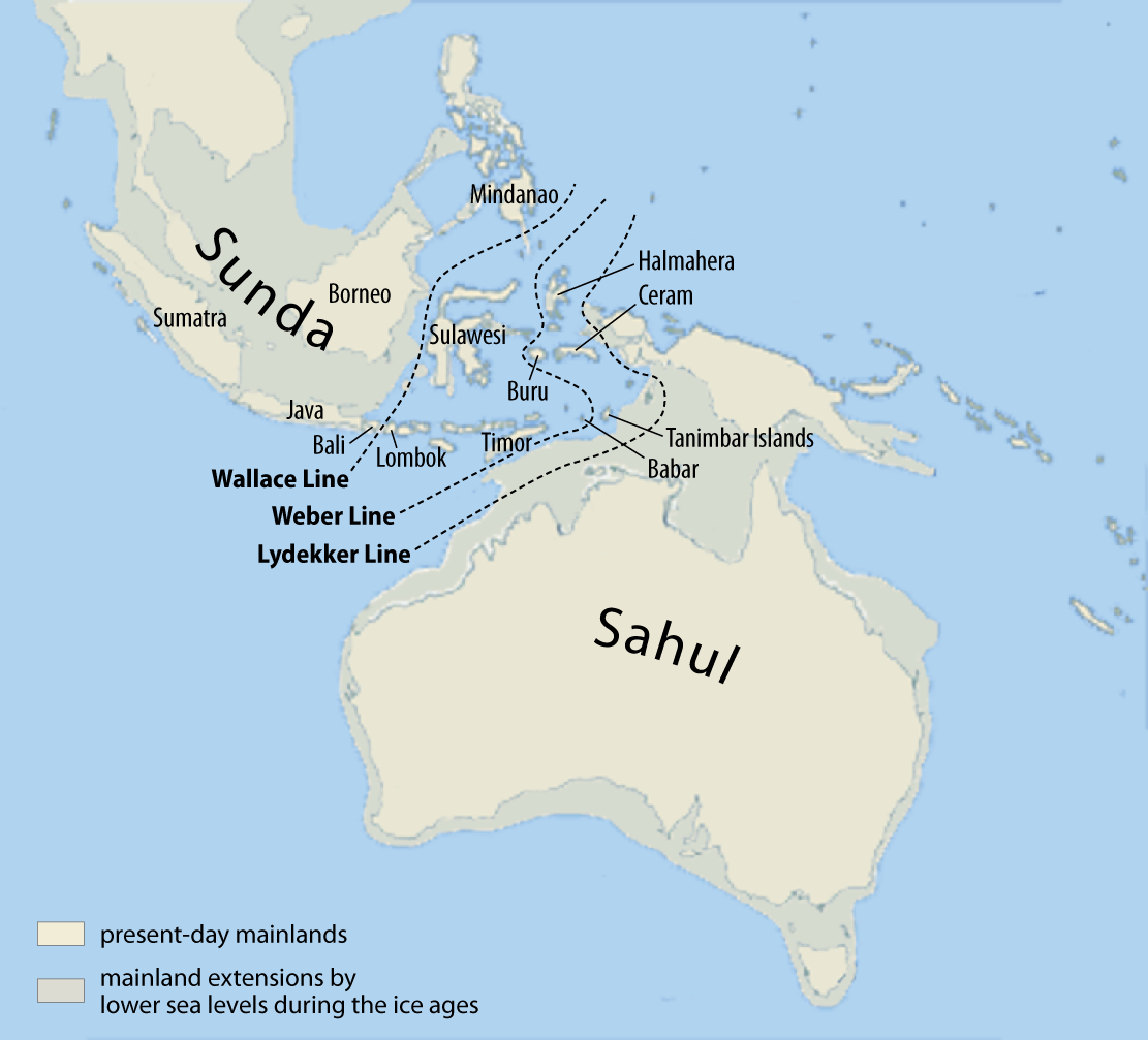
 Wallace, Lydekker and Weber Lines, the principals on Melanesia
Indonesia is today more commonly referred to as one of the Southeast Asian countries, and thus simply Asian. However, the Malay Archipelago is sometimes divided between Asia and Australasia, usually along the anthropologic Melanesian line or the Weber Line. Indonesia controls the western half of New Guinea, geographically part of Australasia. The eastern half of the island is part of Papua New Guinea which is considered to be part of the Pacific. East Timor, an independent state that was formerly a territory of Indonesia, which is geographically part of Asia, is classified by the United Nations as part of the "South-Eastern Asia" block. It is expected to join the Association of Southeast Asian Nations [1], having been involved as an ASEAN Regional Forum member since independence, and has participated in the Southeast Asian Games since 2003. Occasionally, all of the Malay Archipelago is included in Oceania, although this is extremely rare, especially as most of the archipelago lies on the Asian continental shelf.
The Commonwealth of Australia includes island possessions in Oceania and closer to Indonesia than Australia.
Antarctica
Antarctica along with its outlying islands have no permanent population. All land claims south of 60°S latitude is held in abeyance by the Antarctic Treaty System.
The South Georgia and the South Sandwich Islands are closer to Antarctica than to any other continent. However, they are politically associated with the inhabited Falkland Islands which are closer to South America. Furthermore, Argentina, a South American country, maintains its irredentist claims on the islands. The continental shelf boundary separates the two island groups.
The Prince Edward Islands are located between Africa and Antarctica, and are the territory of South Africa, an African country. The Australian Macquarie Island and the New Zealand Antipodes Islands, Auckland Islands, and Campbell Islands, are all located between the Oceanian countries of Australia and New Zealand and Antarctica.
Australia's Heard Island and McDonald Islands and the French Kerguelen Islands are located on the Kerguelen Plateau, on the Antarctic continental plate. The French Crozet Islands, Île Amsterdam, Île Saint-Paul, and the Norwegian Bouvet Island are also located on the Antarctic continental plate, and are not often associated with other continents.
See also
- List of countries bordering on two or more oceans
- List of countries spanning more than one continent
- List of sovereign states and dependent territories by continent
- Continental divide
- Borders of the oceans
References
- ^ Histories 4.38. C.f. James Rennell, The geographical system of Herodotus examined and explained, Volume 1, Rivington 1830, p. 244
- ^ according to Strabo (Geographica 11.7.4) even at the time of Alexander, "it was agreed by all that the Tanais river separated Asia from Europe" (ὡμολόγητο ἐκ πάντων ὅτι διείργει τὴν Ἀσίαν ἀπὸ τῆς Εὐρώπης ὁ Τάναϊς ποταμός; c.f. Duane W. Roller, Eratosthenes' Geography, Princeton University Press, 2010, ISBN 9780691142678, p. 57)
- ^ W. Theiler, Posidonios. Die Fragmente, vol. 1. Berlin: De Gruyter, 1982, fragm. 47a.
- ^ I. G. Kidd (ed.), Posidonius: The commentary, Cambridge University Press, 2004, ISBN 9780521604437, p. 738.
- ^ Geographia 7.5.6 (ed. Nobbe 1845, vol. 2, p. 178)) Καὶ τῇ Εὐρώπῃ δὲ συνάπτει διὰ τοῦ μεταξὺ αὐχένος τῆς τε Μαιώτιδος λίμνης καὶ τοῦ Σαρματικοῦ Ὠκεανοῦ ἐπὶ τῆς διαβάσεως τοῦ Τανάϊδος ποταμοῦ. "And [Asia] is connected to Europe by the land-strait between Lake Maiotis and the Sarmatian Ocean where the river Tanais crosses through."
- ^ Philipp Johann von Strahlenberg (1730) (in German). Das Nord-und Ostliche Theil von Europa und Asia. p. 106.
- ^ a b "Boundary of Europe and Asia along Urals" (in Russian). http://oren-icn.ru/index.php/discussmenu/retrospectiva/685-eagraniza.
- ^ Peter Simon Pallas, "Journey through various provinces of the Russian Empire", vol. 3 (1773)
- ^ Douglas W. Freshfield, "Journey in the Caucasus", Proceedings of the Royal Geographical Society, Volumes 13-14, 1869. Cited as de facto convention by Baron von Haxthausen, "Transcaucasia" (1854); review Dublin university magazine
- ^ "Europe", Brockhaus and Efron Encyclopedic Dictionary, 1906
- ^ "Do we live in Europe or in Asia?" (in Russian). http://velikijporog.narod.ru/st_evraz_gran.htm.
- ^ Orlenok V. (1998). "Physical Geography" (in Russian). http://www.i-u.ru/biblio/archive/orlenok_fisicheskaja/06.aspx.
- ^ E. M. Moores, R. W. Fairbridge, Encyclopedia of European and Asian regional geology, Springer, 1997, ISBN 9780412740404, p. 34: "most Soviet geographers took the watershed of the Main Range of the Greater Caucasus as the boundary between Europe and Asia."
- ^ Clark, Miles. Russian Voyage. National Geographic Magazine, june 1994. p. 114 a 138.
- ^ Purves, Libby (1993-04-30). "Obituary: Miles Clark". The Independent (London). http://www.independent.co.uk/news/people/obituary-miles-clark-1458295.html.
- ^ e.g. Encyclopedia Britannica Online (2011) s.v. "Kuma-Manych Depression": "It is often regarded as the natural boundary between Europe and Asia."
- ^ "Composition of macro geographical (continental) regions, geographical sub-regions, and selected economic and other groupings". United Nations Statistics Division. http://unstats.un.org/unsd/methods/m49/m49regin.htm.
- ^ "Statute of the Council of Europe". Council of Europe. 5 May 1949. http://conventions.coe.int/Treaty/en/Treaties/Html/001.htm. Retrieved 5 August 2008.
- ^ II General information, point 11 on Council of Europe document 11007 dated 07 July 2006 at http://assembly.coe.int/Main.asp?link=/Documents/WorkingDocs/Doc06/EDOC11007.htm
- ^ See continent on Wiktionary. "from Latin continent-, continens 'continuous mass of land, mainland'" (http://www.merriam-webster.com/dictionary/continent?show=1&t=1301917145 merriam-webster.com])
- ^ "National Geographic Education". National Geographic Society. http://education.nationalgeographic.com/education/mapping/outline-map/?map=Panama. Retrieved 2011-05-12.
- ^ National Geographic Atlas (list). National Geographic Society. 2010. p. 4.
- ^ Webster's New Geographical Dictionary (list and map). Meriam-Webster Inc.. 1984. pp. 856, 859.
- ^ "Americas" Standard Country and Area Codes Classifications (M49), United Nations Statistics Division
- ^ "North America" Atlas of Canada
- ^ North America Atlas National Geographic
Continents Historical continentsArctica · Asiamerica · Atlantica · Avalonia · Baltica · Cimmeria · Congo craton · Euramerica · Kalaharia · Kazakhstania · Laurentia · North China · Siberia · South China · East Antarctica · IndiaSubmerged continents
Kerguelen Plateau · ZealandiaMythical and theorized continents
Atlantis · Kumarikkandam · Lemuria · Meropis · Mu · Terra AustralisSee also Regions of the worldCategories:- Continents
- Definitions


Wikimedia Foundation. 2010.