- Svalbard
-
For other uses, see Svalbard (disambiguation).
Svalbard 
Flag 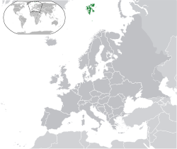
Capital
(and largest city)Longyearbyen Official language(s) Norwegian Ethnic groups 72% Norwegian
16% Russian/Ukrainian
12% otherGovernment Region of Norway - Governor Odd Olsen Ingerø (2009–) Area - Total 61,022 km2
23,561 sq miPopulation - estimate 2,394 (2011)[1] Currency Norwegian krone ( NOK)Time zone CET (UTC +1)
(CEST (UTC+2))Internet TLD .no (.sj allocated but not used[2]) Calling code 47 Svalbard is an archipelago in the Arctic, constituting the northernmost part of Norway. It is located north of mainland Europe, midway between mainland Norway and the North Pole. The group of islands range from 74° to 81° north latitude (inside the Arctic Circle), and from 10° to 35° east longitude. Spitsbergen is the largest island, followed by Nordaustlandet and Edgeøya. The administrative center is Longyearbyen, and other settlements include the Russian mining community of Barentsburg, the research community of Ny-Ålesund and the mining outpost of Sveagruva. The archipelago is administered by the Governor of Svalbard.
The islands were first utilized as a whaling base in the 17th and 18th centuries, after which they were abandoned. Coal mining started at the beginning of the 20th century, and several permanent communities were established. The Spitsbergen Treaty of 1920 recognizes Norwegian sovereignty, and the 1925 Svalbard Act made Svalbard a full part of the Kingdom of Norway. This act also established Svalbard as a free economic zone and a demilitarized zone. The Norwegian Store Norske and the Russian Arktikugol are the only mining companies remaining on the islands. Research and tourism have become important supplementary industries. Two major research facilities are the University Centre in Svalbard and the Svalbard Global Seed Vault. No roads connect the settlements; instead snowmobiles, aircraft and boats serve inter-community transport. Svalbard Airport, Longyear serves as the main gateway to the rest of Europe.
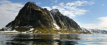
The archipelago features an Arctic climate, although with significantly higher temperatures than other areas at the same latitude. The flora take advantage of the long period of midnight sun to compensate for the polar night. Svalbard is a breeding ground for many seabirds, and also features polar bears, reindeer and marine mammals. Seven national parks and twenty-three nature reserves cover two-thirds of the archipelago, protecting the largely untouched, yet fragile, nature. Sixty percent of the archipelago is glacier, and the islands feature many mountains and fjords.
Contents
Geography
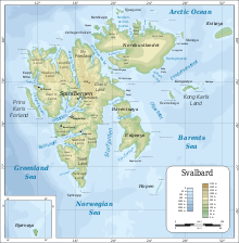 A topographical map of Svalbard
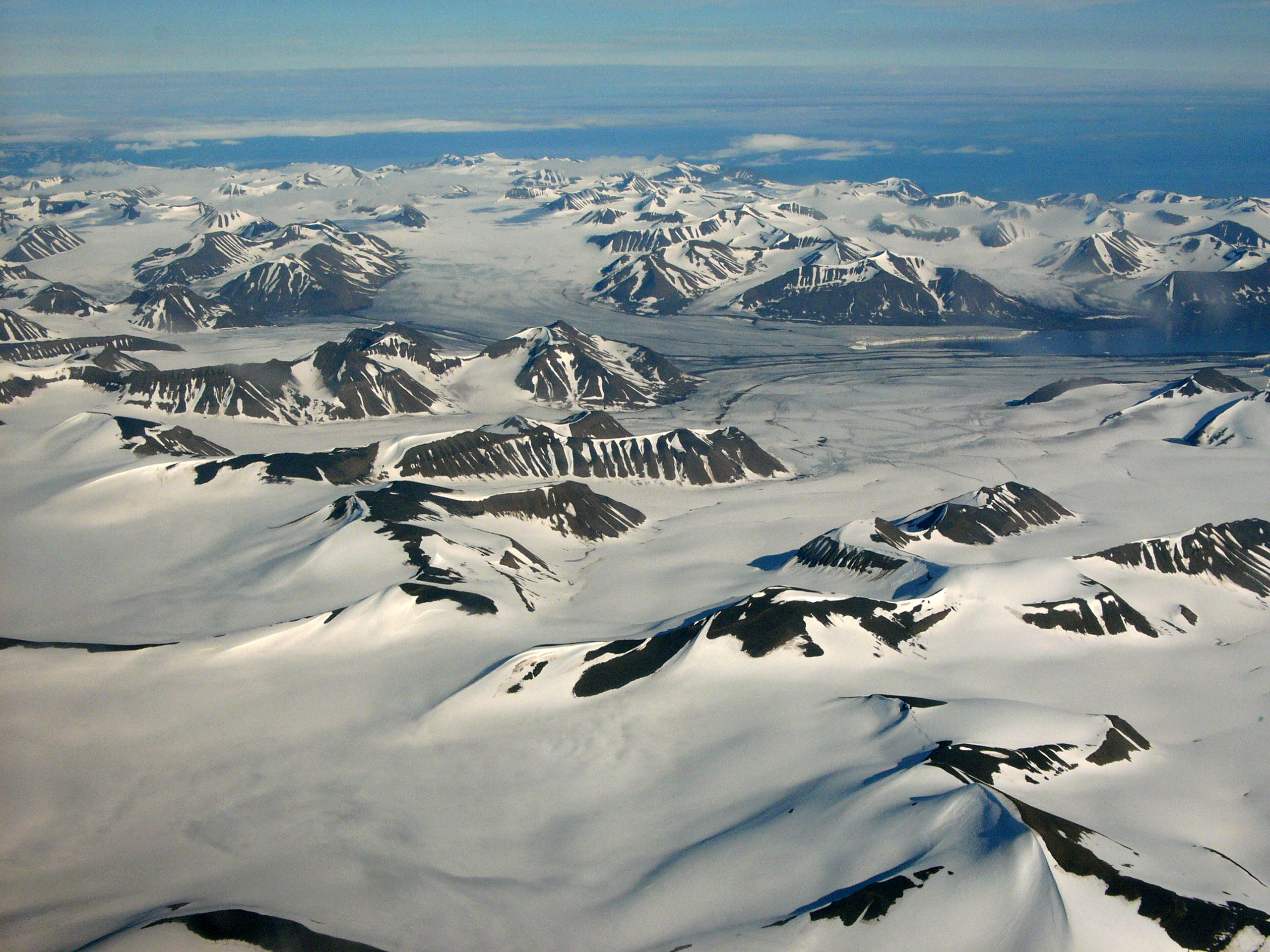
Svalbard is an archipelago between the Arctic Ocean, Barents Sea, Greenland Sea and Norwegian Sea, constituting the northernmost part of Norway.[3] The treaty defines Svalbard as all islands, islets and skerries from 74° to 81° north latitude, and from 10° to 35° east longitude.[4][5] The land area is 61,022 km2 (23,561 sq mi), and dominated by the island Spitsbergen, which constitutes more than half the archipelago, followed by Nordaustlandet and Edgeøya.[1] All settlements are located on Spitsbergen, except the meteorological outposts on Bjørnøya and Hopen.[3] The Norwegian state took possession of all unclaimed land, or 95.2% of the archipelago, at the time the Spitsbergen Treaty entered into force; Store Norske owns 4%, Arktikugol owns 0.4%, while other private owners hold 0.4%.[6]
Svalbard is located in the north-western corner of the Eurasian Plate. To the south and east, the seabed is shallow at 200 to 300 metres (660 to 980 ft), while to the north and west it sinks down to about 4 kilometres (2.5 mi). North of Svalbard there is pack ice and the North Pole, and to the south mainland Norway. The Russian archipelago Franz Josef Land and Novaya Zemlya are located to the east, Greenland is to the west.[7]
Being located north of the Arctic Circle, Svalbard experiences both midnight sun in summer and polar night in winter. At 74° north, the midnight sun lasts 99 days and polar night 84 days, while the respective figures at 81° are 141 and 128 days.[8] In Longyearbyen, midnight sun lasts from 20 April until 23 August, and polar night lasts from 26 October to 15 February.[4] In winter, the combination of full moon and reflective snow can give additional light.[8]
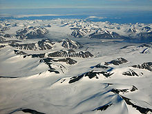
Glaciation covers 36,502 km2 (14,094 sq mi) or 60% of Svalbard; 30% is barren rock while 10% is vegetated.[7] The largest glacier is Austfonna (8,412 km2/3,248 sq mi) on Nordaustlandet, followed by Olav V Land and Vestfonna. During summer, it is possible to ski from Sørkapp in the south to the north of Spitsbergen, with only a short distance not being covered by snow or glacier. Kvitøya is 99.3% covered by glacier.[9]
The landforms of Svalbard were created through repeated ice ages, where glaciers cut the former plateau into fjords, valleys and mountains.[7] The tallest peak is Newtontoppen (1,713 m/5,620 ft), followed by Perriertoppen (1,712 m/5,617 ft), Ceresfjellet (1,675 m/5,495 ft), Chadwickryggen (1,640 m/5,380 ft) and Galileotoppen (1,637 m/5,371 ft). The longest fjord is Wijdefjorden (108 km/67 mi), followed by Isfjorden (107 km/66 mi), Van Mijenfjorden (83 km/52 mi), Woodfjorden (64 km/40 mi) and Wahlenbergfjorden (46 km/29 mi).[10] Svalbard is part of the High Arctic Large Igneous Province,[11] and experienced Norway's strongest earthquake on 6 March 2009, which hit 6.5 on the Richter scale.[12]
History
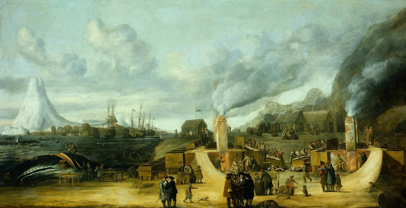
 The whaling station of the Amsterdam chamber of the Northern Company in Smeerenburg, by Cornelis de Man (1639), but based on a painting of a Dansk hvalfangststation (Danish whaling station) by A.B.R. Speeck (1634), which represented the Danish station in Copenhagen Bay (Kobbefjorden).
Scandinavians may have discovered Svalbard as early as the 12th century. Traditional Norse accounts exist of a land known as Svalbarð—literally "cold shores"—although this may have referred to Jan Mayen, or a part of eastern Greenland.[13][14] Contemporary understanding was that both Svalbard and Greenland were connected to the mainland.[clarification needed][15] The archipelago may in that period have been used for fishing and hunting.[16] The Dutchman Willem Barentsz made the first indisputable discovery of Svalbard in 1596, in an attempt to find the Northern Sea Route.[17][18] In 1604, an English ship landed at Bjørnøya and started hunting walrus; annual expeditions followed.[19][20] From 1611, Spitsbergen became a base for whaling, where they targeted the bowhead whale. Because of the lawless nature of the area, English, Danish, Dutch and French companies and authorities tried to use force to keep out other countries' fleets.[21][22]
Smeerenburg was one of the first settlements, established by the Dutch in 1619.[23] Smaller bases were also built by the English, Danish and French. At first the outposts were merely summer camps, but from the early 1630s, a few individuals started to overwinter. Whaling at Spitsbergen lasted until the 1820s, when the Dutch, British and Danish whalers moved elsewhere in the Arctic.[24] By the late 17th century, Russian hunters arrived; they overwintered to a greater extent and hunted land mammals such as the polar bear and fox.[25] After British ships destroyed most of the Russian fleet in 1812, Russian activity on Svalbard diminished, and became non-existent from the 1820s.[26] Norwegian hunting—mostly for walrus—started in the 1790s, but was abandoned about the same time as the Russians left.[27] Whaling continued around Spitsbergen until the 1830s, and around Bjørnøya until the 1860s.[28]
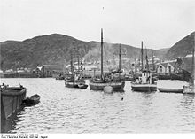
By the 1890s, Svalbard had become a destination for Arctic tourism, coal deposits had been found and the islands were being used as a base for Arctic exploration.[29] The first mining was done along Isfjorden by Norwegians in 1899; by 1904, British interests had established themselves in Adventfjorden and started the first all-year operations.[30] Production in Longyearbyen commenced by American interests in 1908;[31] and Store Norske established itself in 1916, as did other Norwegian interests during the war, in part by buying American interests.[32]
Discussions to establish the sovereignty of the archipelago commenced in the 1910s,[33] but were interrupted by World War I.[34] On 9 February 1920, following the Paris Peace Conference, the Spitsbergen Treaty was signed, granting full sovereignty to Norway. However, all signatory countries were granted non-discriminatory rights to fishing, hunting and mineral resources.[35] The treaty took effect on 14 August 1925, at the same time as the Svalbard Act regulated the archipelago and the first governor, Johannes Gerckens Bassøe, took office.[36] The archipelago has traditionally been known as Spitsbergen, and the main island itself as West Spitsbergen. From the 1920s, Norway renamed the archipelago Svalbard, and the main island became Spitsbergen.[37] Kvitøya, Kong Karls Land, Hopen and Bjørnøya were not regarded as part of the Spitsbergen archipelago.[38] Russians have traditionally called the archipelago Grumant (Грумант).[39] The Soviet Union retained the name Spitsbergen (Шпицберген) to support undocumented claims that Russians were the first to discover the island.[40][41] In 1928, Italian explorer Umberto Nobile and the crew of the airship Italia crashed on the icepack off the coast of Foyn Island. The subsequent rescue attempts were covered extensively in the press and Svalbard received short-lived fame as a result.

In 1941 Operation Gauntlet, all Norwegian and Soviet settlements on Svalbard were evacuated,[42] and a German presence was established with a meteorological outpost,[43] although a small Norwegian garrison was kept on Spitsbergen. The German Operation Zitronella took this garrison by force in 1943, and at the same time destroying the settlements at Longyearbyen and Barentsburg.[44] After the war, the Soviet Union proposed common Norwegian and Soviet administration and military defense of Svalbard. This was rejected in 1947 by Norway, which two years later joined NATO. The Soviet Union retained high civilian activity on Svalbard, in part to ensure that the archipelago was not used by NATO.[45]
After the war, Norway had re-established operations at Longyearbyen and Ny-Ålesund,[46] while the Soviet Union had established mining in Barentsburg, Pyramiden and Grumant.[47] The mine at Ny-Ålesund had several fatal accidents, killing 71 people while it was in operation from 1945 to 1954 and from 1960 to 1963. The Kings Bay Affair, caused by the 1962-accident killing 21 workers, forced Gerhardsen's Third Cabinet to withdraw.[48][49] From 1964, Ny-Ålesund became a research outpost, and a facility for the European Space Research Organisation.[50] Petroleum test drilling was started in 1963 and continued until 1984, but no commercially viable fields were found.[51] From 1960, regular charter flights were made from the mainland to a field at Hotellneset;[52] in 1975, Svalbard Airport, Longyear opened, allowing year-round services.[53]
During the Cold War, the Soviet Union retained about twice the population on the island as Norway—with the archipelago's population slightly under 4,000.[47] Russian activity has diminished considerably since then, falling from 2,500 to 450 people from 1990 to 2010.[54][55] Grumant was closed after it was depleted in 1962.[47] Pyramiden was closed in 1998,[56] and since 2006, no coal has been exported from Barentsburg.[57] The Russian community has also experienced two air accidents, Vnukovo Airlines Flight 2801, which killed 141 people,[58] and the Heerodden helicopter accident.[59]
Longyearbyen remained a pure company town until 1989, when utilities, culture and education was separated into Svalbard Samfunnsdrift.[60] In 1993, it was sold to the national government, and the University Centre was established.[61] Through the 1990s, tourism increased and the town developed an economy independent of Store Norske and the mining.[62] Longyearbyen was incorporated on 1 January 2002, receiving a community council.[60]
Population

In 2009, Svalbard had a population of 2,753, of which 423 were Russian and Ukrainian, 10 were Polish and 322 were other non-Norwegians living in Norwegian settlements.[1] The largest non-Norwegian groups in Longyearbyen in 2005 were from Thailand, Sweden, Denmark, Russia and Germany.[55] Svalbard is among the safest places on Earth, with virtually no crime.[63]
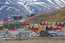
Longyearbyen is the largest settlement on the archipelago, the seat of the governor and the only town to be incorporated. The town features a hospital, primary and secondary school, university, sports center with a swimming pool, library, culture center, cinema, [57] bus transport, hotels, a bank,[64] and several museums.[65] The newspaper Svalbardposten is published weekly.[66] Only a small fraction of the mining activity remains at Longyearbyen; instead, workers commute to Sveagruva (or Svea) where Store Norske operates a mine. Sveagruva is a dorm town, with workers commuting from Longyearbyen on a weekly basis.[57]
Ny-Ålesund is a permanent settlement based entirely around research. Formerly a mining town, it is still a company town operated by the Norwegian state-owned Kings Bay. While there is some tourism at the village, Norwegian authorities limit the access to the outpost to minimize impact on the scientific work.[57] Ny-Ålesund has a winter population of 35 and a summer population of 180.[67] The Norwegian Meteorological Institute has outposts at Bjørnøya and Hopen, with respectively ten and four people stationed. Both outposts can also house temporary research staff.[57] Poland operates the Polish Polar Station at Hornsund, with ten permanent residents.[57]
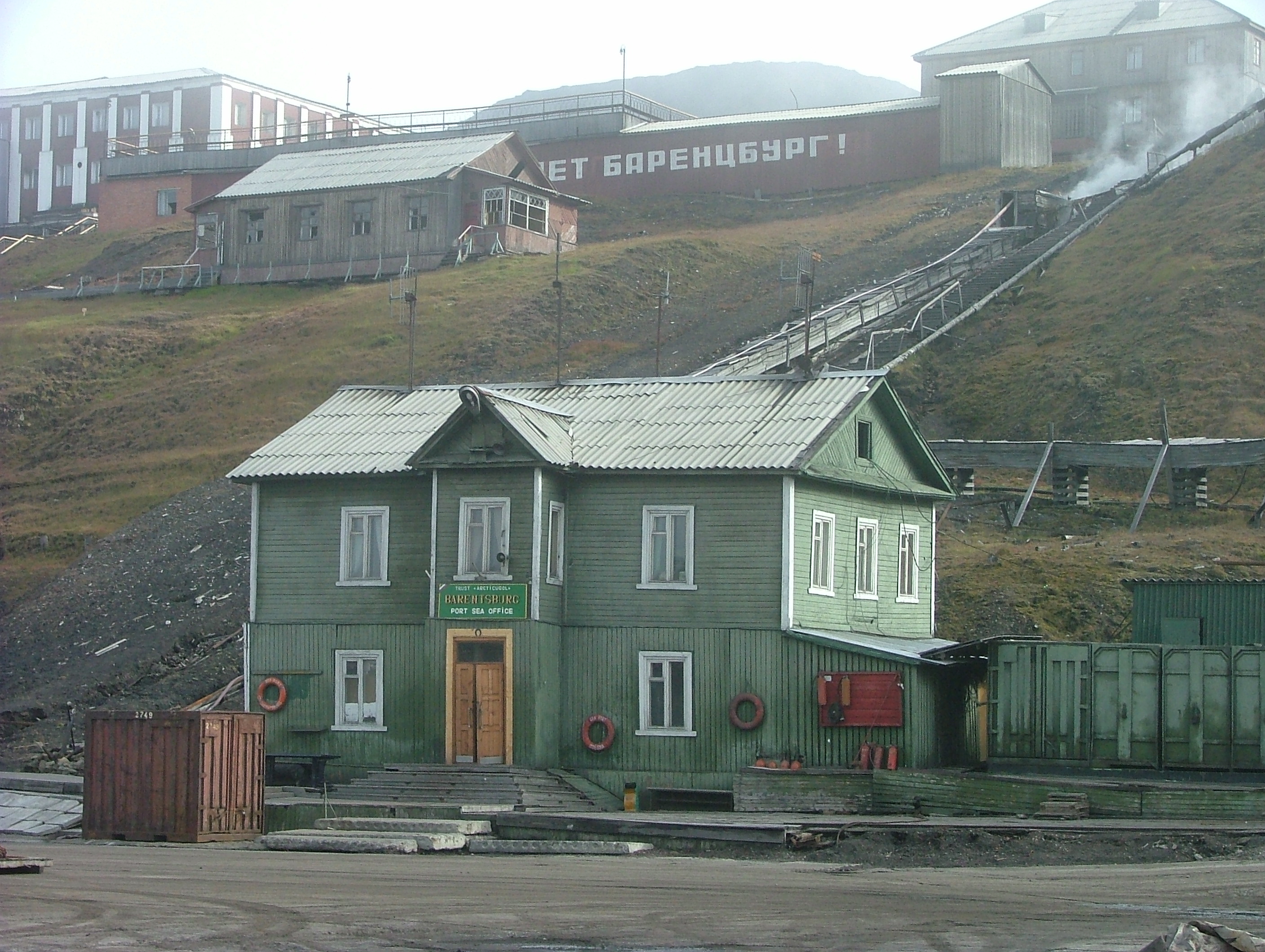
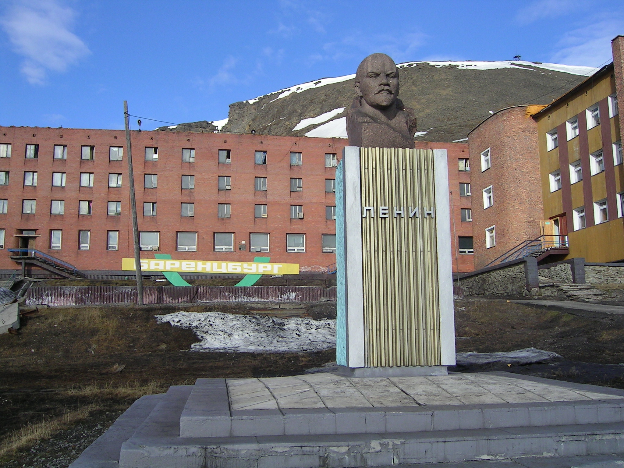
Barentsburg is the only remaining Russian settlement, after Pyramiden was abandoned in 1998 (although as of April 2010, a small Russian community of 15-20 people exists at Pyramiden, involved mainly in dismantling and transporting usable equipment to Barentsburg). A company town, all facilities are owned by Arktikugol, who operate a coal mine, although operation has been halted since 2006. In addition to the mining facilities, Arktikugol has opened a hotel and souvenir shop, catering to tourists taking day trips or hikes from Longyearbyen.[57] The village features facilities such as a school, library, sports center, community center, swimming pool, farm and greenhouse. Pyramiden features similar facilities; both are built in typical post-World War II Soviet architectural and planning style and contain the world's two most northerly Lenin statues and other socialist realism artwork.[68]
Politics
The Svalbard Treaty of 1920 established full Norwegian sovereignty over the archipelago. The islands are, unlike the Norwegian Antarctic Territory, part of the Kingdom of Norway and not a dependency. The treaty came into effect in 1925, following the Svalbard Act. All forty signatory countries of the treaty have the right to conduct commercial activities on the archipelago without discrimination, although all activity is subject to Norwegian legislation. The treaty limits Norway's right to collect taxes to that of financing services on Svalbard. Therefore, Svalbard has a lower income tax than mainland Norway, and there is no value added tax. There is a separate budget for Svalbard to ensure compliance. Svalbard is a demilitarized zone, as the treaty prohibits the establishment of military installations. Norwegian military activity is limited to fishery surveillance by the Norwegian Coast Guard as the treaty requires Norway to protect the natural environment.[5][69]
The Svalbard Act established the institution of the Governor of Svalbard (Norwegian: Sysselmannen), who holds the responsibility as both county governor and chief of police, as well as holding other authority granted from the executive branch. Duties include environmental policy, family law, law enforcement, search and rescue, tourism management, information services, contact with foreign settlements, and judge in some areas of maritime inquiries and judicial examinations—albeit never in the same cases as acting as police.[70][71] Since 2009, Odd Olsen Ingerø has been governor;[72] he is assisted by a staff of 26 professionals. The institution is subordinate to the Ministry of Justice and the Police, but reports to other ministries in matters within their portfolio.[73]
Since 2002, Longyearbyen Community Council has had many of the same responsibilities of a municipality, including utilities, education, cultural facilities, fire department, roads and ports.[62] No care or nursing services are available, nor is welfare payment available. Norwegian residents retain pension and medical rights through their mainland municipalities.[74] The hospital is part of University Hospital of North Norway, while the airport is operated by state-owned Avinor. Ny-Ålesund and Barentsburg remain company towns with all infrastructure owned by Kings Bay and Arktikugol, respectively.[62] Other public offices with presence on Svalbard are the Norwegian Directorate of Mining, the Norwegian Polar Institute, the Norwegian Tax Administration and the Church of Norway.[75] Svalbard is subordinate to Nord-Troms District Court and Hålogaland Court of Appeal, both located in Tromsø.[76]
Although Norway is part of the European Economic Area (EEA) and the Schengen Agreement, Svalbard is not part of the Schengen Area nor EEA.[77] Non-Norwegian Svalbard residents do not need Schengen visas, but are prohibited from reaching Svalbard from mainland Norway without such. People without a source of income can be rejected by the governor.[78] Nationals of any treaty signatory country may visit the archipelago without a visa.[79] Russia retains a consulate in Barentsburg.[80]
In September, 2010 a treaty was made between Russia and Norway fixing the boundary between the Svalbard archipelago and the Novaya Zemlya archipelago. Increased interest in petroleum exploration in the Arctic increased interest in resolution of the dispute. The agreement takes into account the relative position of the archipelagos, rather than being based simply on northward extension of the continental border of Norway and Russia.[81]
Economy
Main article: Economy of Svalbard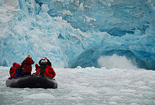
The three main industries on Svalbard are coal mining, tourism and research. In 2007, there were 484 people working in the mining sector, 211 people working in the tourism sector and 111 people working in the education sector. The same year, the mining gave a revenue of NOK 2,008 million, tourism NOK 317 million and research NOK 142 million.[62] In 2006, the average income for economically active people was NOK 494,700—23% higher than on the mainland.[82] Almost all housing is owned by the various employers and institutions and rented to their employees; there are only a few privately owned houses, most of which are recreational cabins. Because of this, it is nearly impossible to live on Svalbard without working for an established institution.[78]
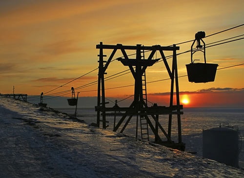
Since the resettlement of Svalbard in the early 20th century, coal mining has been the dominant commercial activity. Store Norske Spitsbergen Kulkompani, a subsidiary of the Norwegian Ministry of Trade and Industry, operates Svea Nord in Sveagruva and Mine 7 in Longyearbyen. The former produced 3.4 million tonnes in 2008, while the latter uses 35% of its output to Longyearbyen Power Station. Since 2007, there has not been any significant mining by the Russian state-owned Arktikugol in Barentsburg. There have previously been performed test drilling for petroleum on land, but these did not give satisfactory results for permanent operation. The Norwegian authorities do not allow offshore petroleum activities for environmental reasons, and the land formerly test-drilled on has been protected as natural reserves or national parks.[62] In 2011 a 20 year plan to develop offshore oil and gas resources around Svalbard was announced.[83]
Svalbard has historically been a base for both whaling and fishing. Norway claimed a 200 nautical miles (370 km; 230 mi) exclusive economic zone (EEZ) around Svalbard in 1977,[6] with 31,688 square kilometres (12,235 sq mi) of internal waters and 770,565 square kilometres (297,517 sq mi) of EEZ.[84] Norway retains a restrictive fisheries policy in the zone,[6] and the claims are disputed by Russia.[3] Tourism is focused on the environment and is centered around Longyearbyen. Activities include hiking, kayaking, walks through glacier caves and snow-scooter and dog-sled safari. Cruise ships generate a significant portion of the traffic, including both stops by offshore vessels and expeditionary cruises starting and ending in Svalbard. Traffic is strongly concentrated between March and August; overnights have quintupled from 1991 to 2008, when there were 93,000 guest-nights.[62]
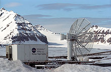
Research on Svalbard centers around Longyearbyen and Ny-Ålesund, the most accessible areas in the high Arctic. Norway grants permission for any nation to conduct research on Svalbard, resulting in the Polish Polar Station and the Chinese Arctic Yellow River Station, plus Russian facilities in Barentsburg.[85] The University Centre in Svalbard in Longyearbyen offers undergraduate, graduate and postgraduate courses to 350 students in various arctic sciences, particularly biology, geology and geophysics. Courses are provided to supplement studies at the mainland universities; there are no tuition fees and courses are held in English, with Norwegian and international students equally represented.[61] The Svalbard Global Seed Vault is a "doomsday" seedbank to store seeds from as many of the world's crop varieties and their botanical wild relatives as possible. A cooperation between the Government of Norway and the Global Crop Diversity Trust, the vault is cut into rock near Longyearbyen, keeping it at a natural −6 °C (21 °F) and refrigerating the seeds to −18 °C (−0 °F).[86][87] The Svalbard Undersea Cable System is a 1,440 km (890 mi) fibre optic lines from Svalbard to Harstad, needed for communicating with polar orbiting satellite through Svalbard Satellite Station and installations in Ny-Ålesund.[88][89]
Transport
Main article: Transport in Svalbard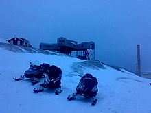 Snowmobiles are an important mode of transport in Svalbard, such as here at Longyearbyen. Photo taken at 03:00 in the morning, mid-April.
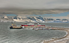
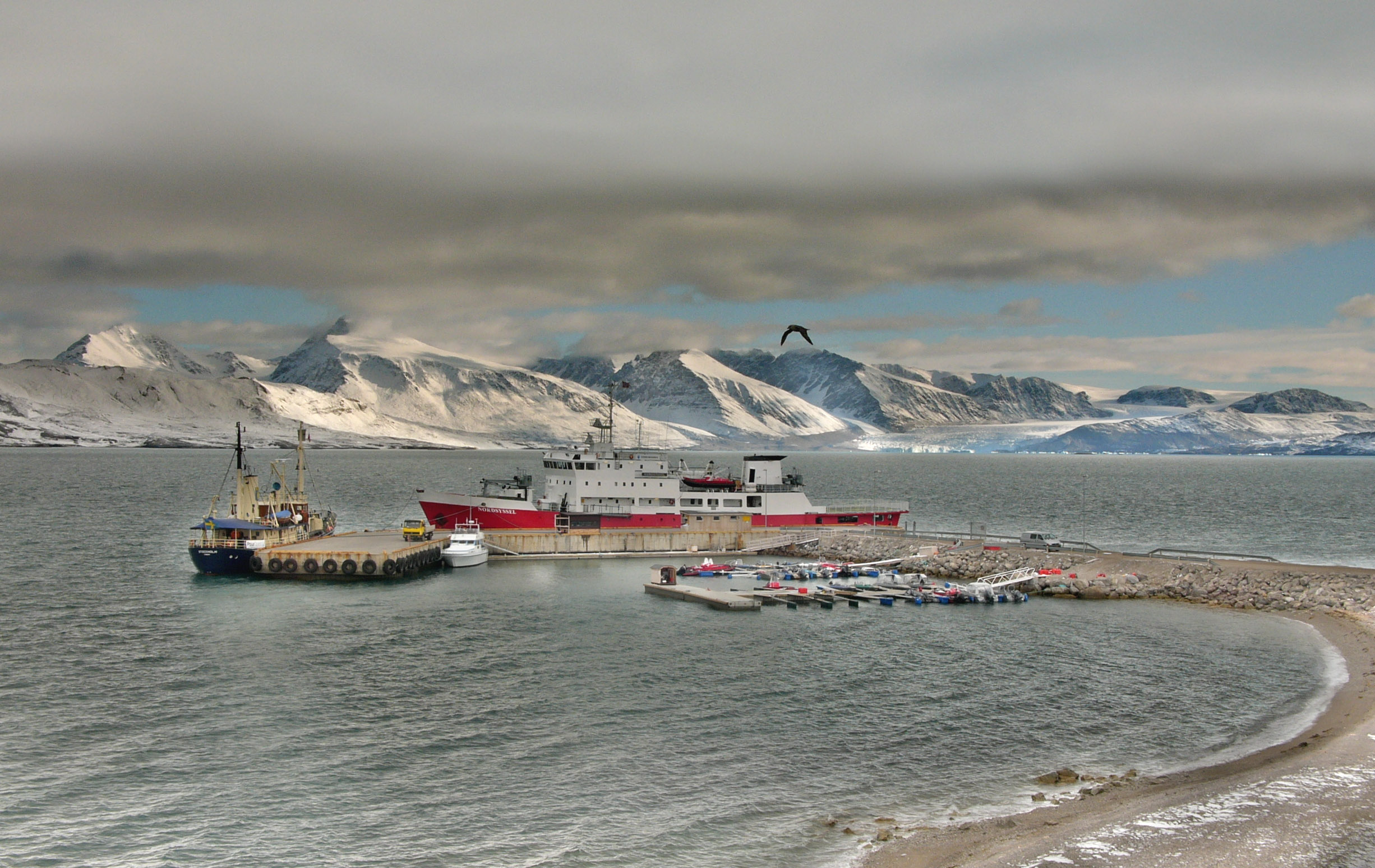
Within Longyearbyen, Barentsburg and Ny-Ålesund, there are road systems, but they do not connect with each other. Off-road motorized transport is prohibited on bare ground, but snowmobiles are used extensively during winter—both for commercial and recreational activities. Transport from Longyearbyen to Barentsburg (45 km/28 mi) and Pyramiden (100 km/62 mi) is possible by snowmobile by winter, or by ship all year round. All settlements have ports and Longyearbyen has a bus system.[90]
Svalbard Airport, Longyear, located 3 kilometres (2 mi) from Longyearbyen, is the only airport offering air transport off the archipelago. Scandinavian Airlines has daily scheduled services to Tromsø and Oslo; there are also irregular charter services to Russia.[91] Lufttransport provides regular corporate charter services from Longyearbyen to Ny-Ålesund Airport and Svea Airport for Kings Bay and Store Norske; these flights are in general not available to the public.[92] There are heliports in Barentsburg and Pyramiden, and helicopters are frequently used by the governor and to a less extent the mining company Arktikugol.[93]
Climate
The climate of Svalbard is dominated by its high latitude, with the average summer temperature at 4 °C (39 °F) to 6 °C (43 °F) and January averages at −16 °C (3 °F) to −12 °C (10 °F).[94] The North Atlantic Current moderates Svalbard's temperatures, particularly during winter, giving it up to 20 °C (36 °F) higher winter temperature than similar latitudes in Russia and Canada. This keeps the surrounding waters open and navigable most of the year. The interior fjord areas and valleys, sheltered by the mountains, have larger temperature differences than the coast, giving about 2 °C (4 °F) warmer summer temperatures and 3 °C (5 °F) colder winter temperatures. On the south of Spitsbergen, the temperature is slightly higher than further north and west. During winter, the temperature difference between south and north is typically 5 °C (9 °F), while about 3 °C (5 °F) in summer. Bear Island has average temperatures even higher than the rest of the archipelago.[95]
Svalbard is the meeting place for cold polar air from the north and mild, wet sea air from the south, creating low pressure and changing weather and fast winds, particularly in winter; in January, a strong breeze is registered 17% of the time at Isfjord Radio, but only 1% of the time in July. In summer, particularly away from land, fog is common, with visibility under 1 kilometre (0.62 mi) registered 20% of the time in July and 1% of the time in January, at Hopen and Bjørnøya.[96] Precipitation is frequent, but falls in small quantities, typically less than 400 millimetres (16 in) in western Spitsbergen. More rain falls in the uninhabited east side, where there can be more than 1,000 millimetres (39 in).[96]
Nature
Main article: Environment of SvalbardIn addition to humans, four primarily terrestrial mammalian species inhabit the archipelago: the Arctic Fox, the Svalbard reindeer, polar bears and accidentally introduced Southern Vole—which is only found in Grumant.[97] Attempts to introduce the Arctic Hare and the muskox have both failed.[98] There are fifteen to twenty types of marine mammals, including whales, dolphins, seals and walruses.[97]
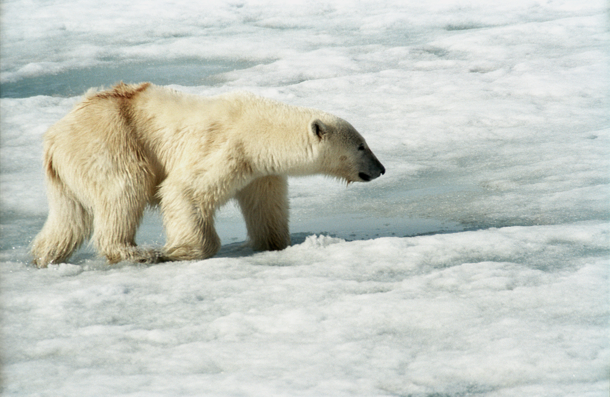
Polar bears are the iconic symbol of Svalbard, and one of the main tourist attractions.[99] While protected, anyone outside of settlements is required to carry a rifle to kill polar bears in self defense, as a last resort, should they attack.[100] Svalbard and Franz Joseph Land share a common population of 3,000 polar bears, with Kong Karls Land being the most important breeding ground. The Svalbard reindeer (R. tarandus platyrhynchus) is a distinct sub-species, and while previously almost extinct, hunting is permitted for both it and the Arctic Fox.[97] There are a limited number of domesticated animals in Russian settlements.[101]
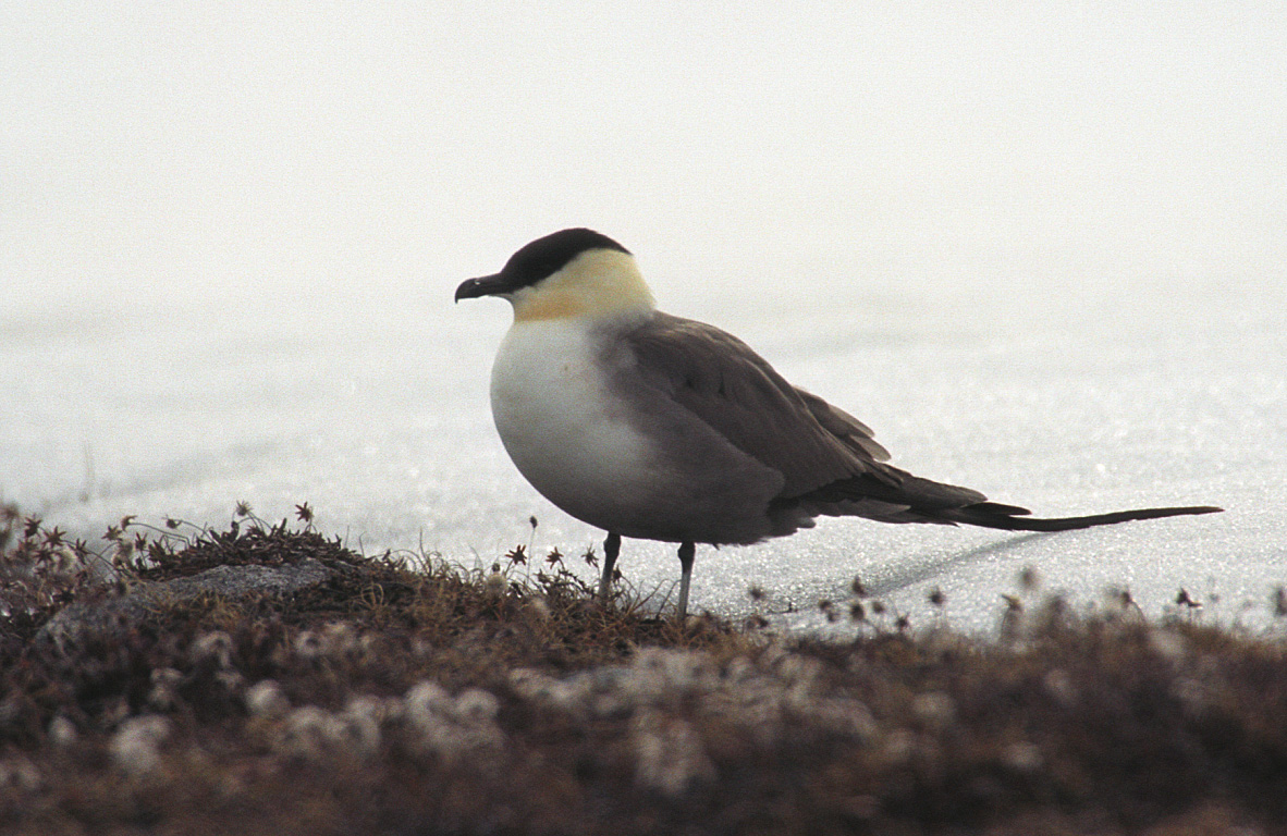
About thirty species of bird are found on Svalbard, most of which are migratory. The Barents Sea is among the areas in the world with most seabirds, with about 20 million individuals during late summer. The most common are Little Auk, Northern Fulmar, Thick-billed Murre and Black-legged Kittiwake. Sixteen species are on the IUCN Red List. Particularly Bjørnøya, Storfjorden, Nordvest-Spitsbergen and Hopen are important breeding ground for seabirds. The Arctic Tern has the furthest migration, all the way to Antarctica.[97] Only two songbirds migrate to Svalbard to breed: the Snow Bunting and the Wheatear. Rock Ptarmigan is the only bird to overwinter.[102] Remains of Predator X from the Jurassic period have been found; it is the largest dinosaur-era marine reptile ever found—a pliosaur estimated to be almost 15 m (49 ft) long.[103]
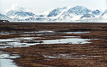
Svalbard has permafrost and tundra, with both low, middle and high Arctic vegetation. 165 species of plants have been found on the archipelago.[97] Only those areas which defrost in the summer have vegetations, which accounts for about 10% of the archipelago.[104] Vegetation is most abundant in Nordenskiöld Land, around Isfjorden and where affected by guano.[105] While there is little precipitation, giving the archipelago a steppe climate, plants still have good access to water because the cold climate reduces evaporation.[96][97] The growing season is very short, and may only last a few weeks.[106]
There are seven national parks in Svalbard: Forlandet, Indre Wijdefjorden, Nordenskiöld Land, Nordre Isfjorden Land, Nordvest-Spitsbergen, Sassen-Bünsow Land and Sør-Spitsbergen.[107] The archipelago has fifteen bird sanctuaries, one geotopic protected area and six nature reserves—with Nordaust-Svalbard and Søraust-Svalbard both being larger than any of the national parks. Most of the nature reserves and three of the national parks were protected in 1973, with the nearly all the remaining protected occurring in the 2000s.[108] All human traces dating from before 1946 are automatically protected.[100] The protected areas make up 65% of the archipelago.[82] Svalbard is on Norway's tentative list for nomination as a UNESCO World Heritage Site.[109]
See also
References
- ^ a b c "Population in the settlements. Svalbard". Statistics Norway. 22 October 2009. http://www.ssb.no/english/subjects/02/befsvalbard_en/tab-2009-10-22-01-en.html. Retrieved 24 March 2010.
- ^ "The .bv and .sj top level domains". Norid. http://www.norid.no/domenenavnbaser/bv-sj.html. Retrieved 24 March 2010.
- ^ a b c "Svalbard". World Fact Book. Central Intelligence Agency. 15 January 2010. https://www.cia.gov/library/publications/the-world-factbook/geos/sv.html. Retrieved 24 March 2010.
- ^ a b "Svalbard". Norwegian Polar Institute. http://npweb.npolar.no/english/geografi/svalbard. Retrieved 24 March 2010.
- ^ a b "Svalbard Treaty". Wikisource. 9 February 1920. http://en.wikisource.org/wiki/Svalbard_Treaty. Retrieved 24 March 2010.
- ^ a b c "7 Industrial, mining and commercial activities". Report No. 9 to the Storting (1999-2000): Svalbard. Norwegian Ministry of Justice and the Police. 29 October 1999. http://www.regjeringen.no/en/dep/jd/Documents-and-publications/Reports-to-the-Storting-White-Papers/Reports-to-the-Storting/19992000/report-no-9-to-the-storting-/7.html?id=456920. Retrieved 24 March 2010.
- ^ a b c Umbreit (2005): 3
- ^ a b Torkilsen (1984): 96–97
- ^ Torkildsen (1984): 102–104
- ^ "Geographical survey. Fjords and mountains". Statistics Norway. 22 October 2009. http://www.ssb.no/english/subjects/00/00/20/nos_svalbard_en/nos_d330_en/tab/013.html. Retrieved 24 March 2010.
- ^ Maher, Harmon D. Jr. (November 1999). "Research Project on the manifestation of the High Arctic Large Igneous Province (HALIP) on Svalbard". University of Nebraska at Omaha. http://maps.unomaha.edu/maher/svalbard/wwwHALIP/. Retrieved 24 March 2010.
- ^ "Svalbard hit by major earthquake". The Norway Post. Norwegian Broadcasting Corporation. 7 March 2009. http://www.norwaypost.no/news/svalbard-hit-by-major-earthquake.html. Retrieved 24 March 2010.
- ^ Torkildsen (1984): 25–26
- ^ Arlov (1996): 46
- ^ Arlov (1996): 26
- ^ Torkildsen (1984): 26
- ^ Torkildsen (1984): 30
- ^ Arlov (1996): 39–40
- ^ Torkildsen (1984): 32
- ^ Arlov (1996): 62
- ^ Torkildsen (1984): 34–36
- ^ Arlov (1996): 63–67
- ^ Torkildsen (1984): 37
- ^ Torkildsen (1984): 39
- ^ Torkildsen (1984): 40
- ^ Torkildsen (1984): 44
- ^ Torkildsen (1984): 47
- ^ Torkildsen (1984): 50
- ^ Arlov (1996): 239
- ^ Arlov (1996): 249
- ^ Arlov (1996): 261
- ^ Arlov (1996): 273
- ^ Arlov (1996): 288
- ^ Arlov (1996): 294
- ^ Arlov (1996): 305–306
- ^ Arlov (1996): 319
- ^ Umbriet (2005): XI–XII
- ^ "Place names of Svalbard". Norwegian Polar Institute. http://miljo.npolar.no/placenames/pages/detaile.asp?placeNameID=813614P. Retrieved 24 March 2010.
- ^ Arlov (1996): 51
- ^ Fløgstad (2007): 18
- ^ Arlov (1996): 50
- ^ Arlov (1996): 397
- ^ Arlov (1996): 400
- ^ Arlov (1996): 402–403
- ^ Arlov (1996): 407–408
- ^ Torkildsen (1984): 206
- ^ a b c Torkildsen (1984): 202
- ^ "Kings Bay" (in Norwegian). Caplex. http://www.caplex.no/Web/ArticleView.aspx?id=9318238. Retrieved 24 March 2010.
- ^ "Kings Bay-saken" (in Norwegian). Caplex. http://www.caplex.no/web/ArticleView.aspx?id=9318239. Retrieved 24 March 2010.
- ^ Arlov (1996): 412
- ^ Torkildsen (1984): 261
- ^ Tjomsland and Wilsberg (1995): 163
- ^ Tjomsland and Wilsberg (1995):162–164
- ^ "Persons in settlements 1 January. 1990-2005". Statistics Norway. http://www.ssb.no/english/subjects/00/00/20/nos_svalbard_en/nos_d330_en/tab/045.html. Retrieved 24 March 2010.
- ^ a b "Non-Norwegian population in Longyearbyen, by nationality. Per 1 January. 2004 and 2005. Number of persons". Statistics Norway. http://www.ssb.no/english/subjects/00/00/20/nos_svalbard_en/nos_d330_en/tab/049.html. Retrieved 24 March 2010.
- ^ Fløgstad (2007): 127
- ^ a b c d e f g "10 Longyearbyen og øvrige lokalsamfunn". St.meld. nr. 22 (2008-2009): Svalbard. Norwegian Ministry of Justice and the Police. 17 April 2009. http://www.regjeringen.no/nb/dep/jd/dok/regpubl/stmeld/2008-2009/stmeld-nr-22-2008-2009-/10.html?id=555006. Retrieved 24 March 2010.
- ^ "29 Aug 1996". Aviation Safety Network. http://aviation-safety.net/database/record.php?id=19960829-0. Retrieved 24 March 2010.
- ^ Eisenträger, Stian and Per Øyvind Fange (30 March 2008). "- Kraftig vindkast trolig årsaken". Verdens Gang. http://www.vg.no/nyheter/innenriks/artikkel.php?artid=513681. Retrieved 24 March 2010.
- ^ a b Arlov and Holm (2001): 49
- ^ a b "Arctic science for global challenges". University Centre in Svalbard. http://www.unis.no/30_ABOUT_UNIS/4010_Root/intro.htm. Retrieved 24 March 2010.
- ^ a b c d e f "9 Næringsvirksomhet". St.meld. nr. 22 (2008-2009): Svalbard. Norwegian Ministry of Justice and the Police. 17 April 2009. http://www.regjeringen.no/nb/dep/jd/dok/regpubl/stmeld/2008-2009/stmeld-nr-22-2008-2009-/9.html?id=554987. Retrieved 24 March 2010.
- ^ Umbreit (2005): 117
- ^ "Shops/services". Svalbard Reiseliv. http://www.svalbard.net/reiser/uk/Shops-services-1-280.html. Retrieved 24 March 2010.[dead link]
- ^ "Attractions". Svalbard Reiseliv. http://www.svalbard.net/reiser/uk/Attractions-1-78.html. Retrieved 24 March 2010.[dead link]
- ^ Umbreit (2005): 179
- ^ "Ny-Ålesund". Kings Bay. http://www.kingsbay.no/index.php?option=com_content&view=article&id=70&Itemid=29. Retrieved 24 March 2010.
- ^ Umbreit (2005): 194–203
- ^ "Svalbard Treaty". Governor of Svalbard. http://www.sysselmannen.no/hovedEnkel.aspx?m=45301. Retrieved 24 March 2010.
- ^ "5 The administration of Svalbard". Report No. 9 to the Storting (1999-2000): Svalbard. Norwegian Ministry of Justice and the Police. 29 October 1999. http://www.regjeringen.no/en/dep/jd/Documents-and-publications/Reports-to-the-Storting-White-Papers/Reports-to-the-Storting/19992000/report-no-9-to-the-storting-/5-The-administration-of-Svalbard.html?id=456897. Retrieved 24 March 2010.
- ^ "Lov om Svalbard" (in Norwegian). Lovdata. 19 June 2009. http://lovdata.no/all/hl-19250717-011.html. Retrieved 24 March 2010.
- ^ "Dagens sysselmann på Svalbard" (in Norwegian). Governor of Svalbard. http://www.sysselmannen.no/enkel.aspx?m=44327. Retrieved 24 March 2010.
- ^ "Organisation". Governor of Svalbard. http://www.sysselmannen.no/enkel.aspx?m=44377. Retrieved 24 March 2010.
- ^ "From the cradle, but not to the grave". Statistics Norway. http://www.ssb.no/this_is_svalbard/velferdstilbud.pdf. Retrieved 24 March 2010.
- ^ "6 Administrasjon". St.meld. nr. 22 (2008-2009): Svalbard. Norwegian Ministry of Justice and the Police. 17 April 2009. http://www.regjeringen.no/nb/dep/jd/dok/regpubl/stmeld/2008-2009/stmeld-nr-22-2008-2009-/6.html?id=554944. Retrieved 24 March 2010.
- ^ "Nord-Troms tingrett". Norwegian National Courts Administration. http://www.domstol.no/DAtemplates/CourtDetails____2995.aspx?epslanguage=EN. Retrieved 24 March 2010.
- ^ "Lov om gjennomføring i norsk rett av hoveddelen i avtale om Det europeiske økonomiske samarbeidsområde (EØS) m.v. (EØS-loven)." (in Norwegian). Lovdata. 10 aug 2007. http://www.lovdata.no/all/tl-19921127-109-0.html. Retrieved 24 March 2010.
- ^ a b "Entry and residence". Governor of Svalbard. http://www.sysselmannen.no/hovedEnkel.aspx?m=45270. Retrieved 24 March 2010.
- ^ Umbreit (2005): 106
- ^ "Diplomatic and consular missions of Russia". Ministry of Foreign Affairs of Russia. http://www.mid.ru/zu_r.nsf/strawebeng?OpenView&Start=1&Count=300&Expand=120#120. Retrieved 24 March 2010.
- ^ "Russia and Norway Agree on Boundary" article by Andrew E. Kramer in The New York Times September 15, 2010, accessed September 16, 2010
- ^ a b "Focus on Svalbard". Statistics Norway. http://www.ssb.no/english/subjects/00/00/20/svalbard_en/. Retrieved 24 March 2010.
- ^ Gibbs, Walter; Koranyi, Balazs (18 November 2011). "Norway mobilises for oil push into Arctic". Reuters. http://www.reuters.com/article/2011/11/18/norway-highnorth-idUSL5E7MI1GK20111118. Retrieved 20 November 2011.
- ^ "Oversikt over geografiske forhold". Statistics Norway. 2009. http://www.ssb.no/aarbok/kart/i.html. Retrieved 24 March 2010.
- ^ "8 Research and higher education". Report No. 9 to the Storting (1999-2000): Svalbard. Norwegian Ministry of Justice and the Police. 29 October 1999. http://www.regjeringen.no/en/dep/jd/Documents-and-publications/Reports-to-the-Storting-White-Papers/Reports-to-the-Storting/19992000/report-no-9-to-the-storting-/8.html?id=456921. Retrieved 24 March 2010.
- ^ "Norway Reveals Design of Doomsday' Seed Vault". Nature 445. 15 February 2007.
- ^ "Life in the cold store". BBC News. 26 February 2008. http://news.bbc.co.uk/2/hi/science/nature/7262525.stm. Retrieved 24 March 2010.
- ^ Gjesteland, Eirik (2004). "Technical solution and implementation of the Svalbard fibre cable". Telektronic (3). http://www.telenor.com/telektronikk/volumes/pdf/3.2004/Page_140-152.pdf. Retrieved 24 March 2010.
- ^ Skår, Rolf (2004). "Why and how Svalbard got the fibre". Telektronic (3). http://www.telenor.com/telektronikk/volumes/pdf/3.2004/Page_134-139.pdf. Retrieved 24 March 2010.
- ^ Umbriet (1997): 63–67
- ^ "Direkteruter" (in Norwegian). Avinor. http://www.avinor.no/lufthavn/svalbard/direkteruter. Retrieved 9 September 2009.
- ^ "Charterflygning" (in Norwegian). Lufttransport. http://www.lufttransport.no/index.php?option=com_content&view=article&id=60&Itemid=65. Retrieved 9 September 2009.
- ^ "11 Sjø og luft – transport, sikkerhet, redning og beredskap". St.meld. nr. 22 (2008-2009): Svalbard. Norwegian Ministry of Justice and the Police. 17 April 2009. http://www.regjeringen.no/nb/dep/jd/dok/regpubl/stmeld/2008-2009/stmeld-nr-22-2008-2009-/11.html?id=555023. Retrieved 24 March 2010.
- ^ "Temperaturnormaler for Spitsbergen i perioden 1961 - 1990" (in Norwegian). Norwegian Meteorological Institute. http://retro.met.no/observasjoner/svalbard/normaler_for_kommune_2111.html?kommuner. Retrieved 24 March 2010.
- ^ Torkilsen (1984): 98–99
- ^ a b c Torkilsen (1984): 101
- ^ a b c d e f "Protected Areas in Svalbard" (in Norwegian). Norwegian Directorate for Nature Management. http://www.dirnat.no/attachment.ap?id=1043. Retrieved 24 March 2010.
- ^ Umbreit (2005): 33
- ^ Torkildsen (1984): 174
- ^ a b Umbriet (2005): 132
- ^ Torkildsen (1984): 165
- ^ Torkilsen (1984): 162
- ^ "Enormous Jurassic Sea Predator, Pliosaur, Discovered In Norway". Science Daily. 29 February 2008. http://www.sciencedaily.com/releases/2008/02/080229101002.htm. Retrieved 24 March 2010.
- ^ Torkilsen (1984): 144
- ^ Umbreit (2005): 29–30
- ^ Umbreit (2005): 32
- ^ "Norges nasjonalparker" (in Norwegian). Norwegian Directorate for Nature Management. http://www.dirnat.no/nasjonalparker/. Retrieved 24 March 2010.
- ^ "Verneområder i Svalbard sortert på kommuner" (in Norwegian). Norwegian Directorate for Nature Management. http://dnweb12.dirnat.no/nbinnsyn/status/NBdata.asp?FyNr=21&Datasett=VV&Overskrift=true&knrSort=true. Retrieved 24 March 2010.
- ^ "Svalbard". UNESCO. http://whc.unesco.org/en/tentativelists/5161/. Retrieved 24 March 2010.
- Sources
- Arlov, Thor B. (1996) (in Norwegian). Svalbards historie. Oslo: Aschehoug. ISBN 82-03-22171-8.
- Arlov, Thor B. and Arne O. Holm (2001) (in Norwegian). Fra company town til folkestyre. Longyearbyen: Svalbard Samfunnsdrift. ISBN 82-996168-0-8.
- Fløgstad, Kjartan (2007) (in Norwegian). Pyramiden: portrett av ein forlaten utopi. Oslo: Spartacus. ISBN 82-430-0398-9.
- Tjomsland, Audun and Wilsberg, Kjell (1995). Braathens SAFE 50 år: Mot alle odds. Oslo. ISBN 82-990400-1-9.
- Torkildsen, Torbjørn et. al. (1984) (in Norwegian). Svalbard: vårt nordligste Norge. Oslo: Forlaget Det Beste. ISBN 82-7010-167-2.
- Umbreit, Andreas (2005). Guide to Spitsbergen. Bucks: Bradt. ISBN 1-84162-092-0.
External links
- Sysselmannen.no – website of the Governor of Svalbard
- Svalbard Tourism – website of the official tourist board
- TopoSvalbard – Interactive Svalbard map by the Norwegian Polar Institute
- Svalbard: nature and history, useful tips
- The Svalbard Islands – from Visitnorway.com
Articles Relating to Svalbard Svalbard General Politics Settlements Former settlements Bölscheøya · Grumant · Kobbefjorden · Lægerneset · Pyramiden · Smeerenburg · Virgohamna · Ytre NorskøyaEnvironment Islands Barentsøya · Bjørnøya · Edgeøya · Hopen · Kong Karls Land · Kvitøya · Nordaustlandet · Prins Karls Forland · Sjuøyane · Spitsbergen · Tusenøyane · WilhelmøyaLand areas Albert I Land · Andrée Land · Bünsow Land · Dickson Land · Haakon VII Land · Heer Land · James I Land · Nathorst Land · Nordenskiöld Land · Ny-Friesland · Olav V Land · Oscar II Land · Sabine Land · Sørkapp Land · Torell Land · Wedel Jarlsberg LandNational parks Forlandet National Park · Indre Wijdefjorden · Nordenskiöld Land · Nordre Isfjorden Land · Northwest Spitsbergen · Sassen – Bünsow Land · Sør-SpitsbergenCompanies Research Arctic Yellow River Station · Norwegian Polar Institute · Polish Polar Station · Seed Vault · Undersea Cable · University Centre · Himadri StationTransport Integral overseas areas and dependencies of Norway Integral territories 
Svalbard · Jan Mayen
Dependent territories Categories:- Svalbard
- Landforms of the Barents Sea
- Subdivisions of Norway
- Regions of the Arctic
- Archipelagoes of the Arctic Ocean
- Integral overseas territories


Wikimedia Foundation. 2010.