- Arctic Circle
-
This article is about one of the five major circles of latitude. For other uses, see Arctic Circle (disambiguation).
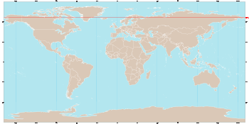 World map showing the Arctic Circle in red.
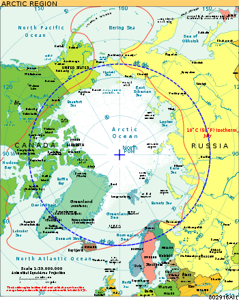 Map of the Arctic with the Arctic Circle in blue.
The Arctic Circle is one of the five major circles of latitude that mark maps of the Earth. For Epoch 2011, it is the parallel of latitude that runs 66° 33′ 44″ (or 66.5622°) north of the Equator.[1]
The region north of this circle is known as the Arctic, and the zone just to the south is called the Northern Temperate Zone. The equivalent polar circle in the Southern Hemisphere is called the Antarctic Circle.
The Arctic Circle marks the extremity of the polar day (24-hour sunlit day, often referred to as the "midnight sun") and polar night (24-hour sunless night). North of the Arctic Circle, the sun is above the horizon for 24 continuous hours at least once per year and below the horizon for 24 continuous hours at least once per year. On the Arctic Circle those events occur, in principle, exactly once per year, at the June and December solstices, respectively.
In fact, because of atmospheric refraction and because the sun appears as a disk and not a point, part of the midnight sun may be seen on the night of the northern summer solstice up to about 50′ (90 km (56 mi)) south of the Arctic Circle; similarly, on the day of the northern winter solstice, part of the sun may be seen up to about 50′ north of the Arctic Circle. That is true at sea level; those limits increase with elevation above sea level although in mountainous regions, there is often no direct view of the true horizon.
The position of the Arctic Circle is not fixed, but directly depends on the Earth's axial tilt, which fluctuates within a margin of 2° over a 40,000 year period,[2] notably due to tidal forces resulting from the orbit of the Moon. The Arctic Circle is currently drifting northwards at a speed of about 15 m (49 ft) per year, see Circle of latitude for more information.
Contents
Geography
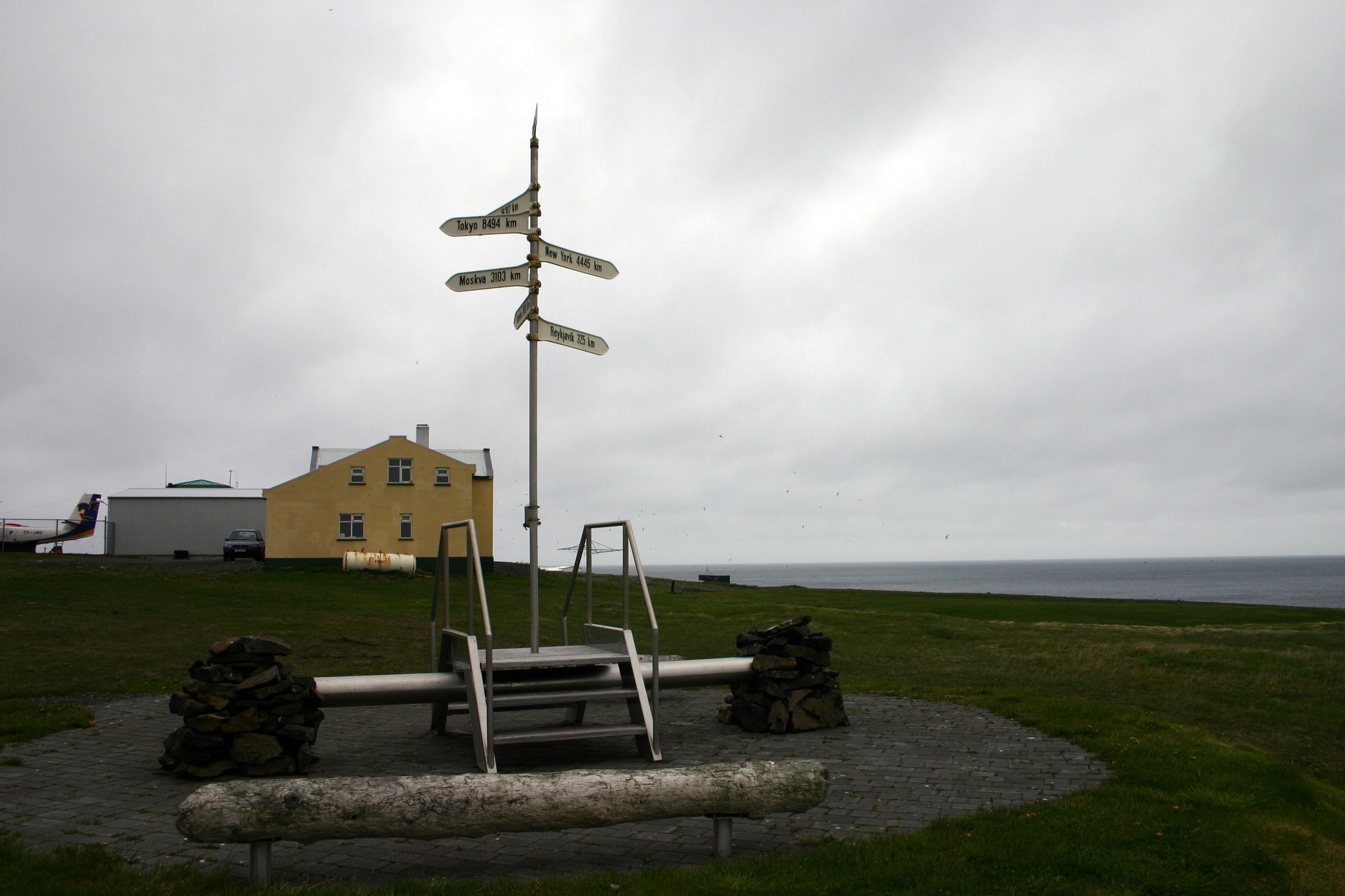
Relatively few people live north of the Arctic Circle due to the Arctic climate. The three largest communities above the Arctic Circle are situated in Russia: Murmansk (population 325,100), Norilsk (135,000), and Vorkuta (85,000). Tromsø (in Norway) has about 62,000 inhabitants. In contrast, the largest North American community north of the circle, Sisimiut (Greenland), has approximately 5,000 inhabitants, while between Canada and the USA, Barrow, Alaska is the largest settlement with circa 4,000 inhabitants. Rovaniemi (in Finland), which lies slightly south of the line, has a population of approximately 58,000, and is the largest settlement in the immediate vicinity of the Arctic Circle.
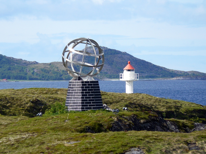
The Arctic Circle passes through the Arctic Ocean, the Scandinavian Peninsula, North Asia, Northern America and Greenland. The land on the Arctic Circle is divided among eight countries: Norway, Sweden, Finland, Russia, the United States (Alaska), Canada, Denmark (Greenland), and Iceland (where it passes through the small offshore island of Grímsey).
Starting at the Prime Meridian and heading eastwards, the Arctic Circle passes through:
See also
- Antarctic Circle
- Arctic haze
- Scott Polar Research Institute
- Territorial claims in the Arctic
- Tropic of Cancer
- Tropic of Capricorn
- Arctic Cooperation and Politics
- Circumpolar Circle
References
External links
- Terra Incognita: Exploration of the Canadian Arctic—Historical essay about early expeditions to the Canadian Arctic, illustrated with maps, photographs and drawings
- Temporal Epoch Calculations ©2006 by James Q. Jacobs Download: Epoch v2009.xls (modify D4)
- Useful constants" See: Obliquity of the ecliptic
- ArcticFocus Facts and news about Arctic
- (English) (French) Documentaries and films about Arctic and Inuit
Arctic topics History Arctic research • Exploration of the Arctic • History of whalingGeo Politics Arctic Council • Arctic Ocean Conference • Chief Directorate of the Northern Sea Route • Convention on the Law of the Sea • Ilulissat Declaration • Inuit Circumpolar Council • Saami Council • Territorial claims in the ArcticGeography Arctic Circle • Arctic ecology • Arctic Ocean • Arctic geography terminology • Arctic Passage • Countries bordering the Arctic Ocean • Greenland ice sheet • Impact craters of the Arctic • North Pole • Populated places in the Arctic • TundraRegions Arctic Alaska • British Arctic Territories • Canadian Arctic Archipelago • Finnmark • Greenland • Northern Canada • Northwest Territories • Nunavik • Nunavut • Russian Arctic • Sápmi (area) • Yukon • North American ArcticClimate Arctic Climate Impact Assessment • Arctic dipole anomaly • Arctic sea ice ecology • Arctic shrinkage • Climate of Alaska • Polar climate • Effects of climate change on marine mammals • Polar amplification • Polar ice packsFauna Walrus • Narwhal • Bowhead Whale • Polar Bear • Arctic Fox • Snowy Owl • Reindeer • Beluga • Lemming • Muskox • Ribbon Seal • Bearded Seal • Hooded Seal • Harp Seal • Ringed SealEconomy Arctic Refuge drilling controversy • Parks, reserves and refuges • Transportation in the ArcticCulture Circles of latitude / Meridians  Arctic CircleArctic CircleArctic Circle145°145°65°75°Categories:
- Lines of latitude
- Geography of the Arctic


Wikimedia Foundation. 2010.