- Murmansk
-
For the Soviet-era warships, see Soviet cruiser Murmansk.
Murmansk (English)
Мурманск (Russian)- City[citation needed] - 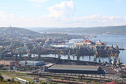
Murmansk Port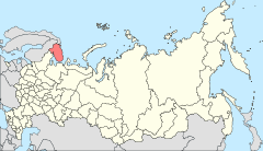
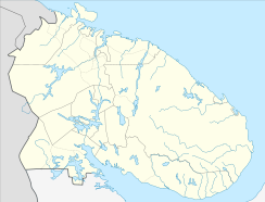
Location of Murmansk Oblast in RussiaCoordinates: 68°58′N 33°05′E / 68.967°N 33.083°ECoordinates: 68°58′N 33°05′E / 68.967°N 33.083°E Coat of arms Flag City Day October 4[citation needed] Administrative status Country Russia Federal subject Murmansk Oblast Administrative center of Murmansk Oblast[citation needed] Municipal status Urban okrug Murmansk Urban Okrug[citation needed] Head[citation needed] Stepan Tananykin[1] Representative body Council of Deputies[citation needed] Statistics Area 150.55 km2 (58.13 sq mi)[citation needed] Population (2010 Census,
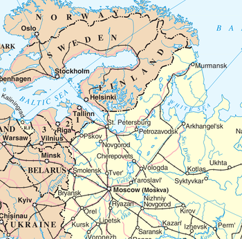
preliminary)307,664 inhabitants[2] - Rank in 2010 61st Population (2002 Census) 336,137 inhabitants[3] - Rank in 2002 52nd Density 2,044 /km2 (5,290 /sq mi)[4] Time zone MSD (UTC+04:00)[5] Founded October 4, 1916[citation needed] Previous names Romanov-on-Murman (until April 1917)[citation needed] Postal code(s) 183000..183099[6] Dialing code(s) +7 8152[citation needed] Official website Murmansk (Russian: Му́рманск; Kildin Sami: Мурман ланнҍ; Northern Sami: Murmanska; Skolt Sami: Muurman) is a city and the administrative center of Murmansk Oblast, Russia. It serves as a seaport and is located in the extreme northwest part of Russia, on the Kola Bay, 12 kilometers (7.5 mi) from the Barents Sea on the northern shore of the Kola Peninsula, not far from Russia's borders with Norway and Finland. Population: 307,664 (2010 Census preliminary results);[2] 336,137 (2002 Census);[3] 468,039 (1989 Census).[7] Despite its rapidly declining population, Murmansk remains the largest city north of the Arctic Circle.
Contents
History
Murmansk was the last city founded in the Russian Empire.[citation needed] In 1915, World War I needs led to the construction of the railroad from Petrozavodsk to an ice-free location on the Murman coast in the Russian Arctic, to which Russia's allies shipped military supplies.[8] The terminus became known as the Murman station, and soon boasted a port, a naval base, and an adjacent settlement with a population which quickly grew in size and soon surpassed the nearby towns of Alexandrovsk and Kola.[8]
On June 29 [O.S. July 12], 1916, Russian Transport Minister Alexander Trepov petitioned to grant urban status to the railway settlement.[8] On July 6 [O.S. July 19], 1916, the petition was approved, and the town was named Romanov-on-Murman (Рома́нов-на-Му́рмане, Romanov-na-Murmane), after the royal Russian dynasty of Romanovs.[8] On September 21 [O.S. October 4], 1916, the official ceremony was performed,[8] and the date is now considered the official date of the city's foundation. After the February Revolution of 1917, on April 3 [O.S. April 16], 1917, the town was given its present name.
From 1918 to 1920 during the Russian Civil War, the town was occupied by the Western powers, who had been allied in World War I, and by the White Army forces.[9]
During World War II, Murmansk was a link with the Western world for Russia, with large quantities of goods important to the respective military efforts traded with the Allies: primarily manufactured goods and raw materials into the Soviet Union. The supplies were brought to the city in the Arctic convoys.
German forces in Finnish territory launched an offensive against the city in 1941 as part of Operation Silver Fox, and Murmansk suffered extensive destruction, second only to Leningrad and Stalingrad of all Soviet cities.[10][11] However, fierce Soviet resistance and harsh geography prevented the Germans from capturing the city and cutting off the vital Karelian railway line and the ice-free harbor. For the rest of the war, it served as transit point for weapons and other supplies entering the Soviet Union from other Allied nations. This unyielding resistance was commemorated at the fortieth anniversary of the victory over the Germans in the formal designation of Murmansk as a Hero City on May 6, 1985.[12] During the Cold War Murmansk was a center of Soviet submarine and icebreaker activity and, past the breakup of the Soviet Union, the nearby city and naval base of Severomorsk remains the headquarters of the Russian Northern Fleet.
In 1974, a massive 35.5-meter-tall statue Alyosha, depicting a Russian World War II soldier, was installed on a 7-meter-high foundation. In 1984, the Hotel Arctic, the tallest building above the Arctic Circle, opened.
To commemorate the 85th anniversary of the city's foundation, the snow-white church of the Savior-on-the-Waters was modeled after the White Monuments of Vladimir and Suzdal and built on the shore for the sailors of Murmansk (photograph).
Murmansk's evening newspaper is Vecherny Murmansk, published since 1991.
The city is home to the world's northernmost Jewish synagogue at 68°58' N latitude.[13]
Transport
The port of Murmansk remains ice-free year round due to the warm North Atlantic drift ocean current and is an important fishing and shipping destination. It is home port to Atomflot, the world's only fleet of nuclear powered icebreakers.[14]
The port is the headquarters of Sevmorput (Northern Sea Route), and the administration of Russian Arctic maritime transport.
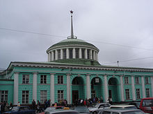
Murmansk is linked by the Murman Railway to St. Petersburg and is also linked to the rest of Russia by the M18 Kola Motorway. Murmansk Airport provides air links to Moscow and St. Petersburg, as well as an international connection to Tromsø, Norway.
Local public transport consists of buses and trolleybuses.
Arctic Bridge
Murmansk is set to be the Russian terminus of the Arctic Bridge (or Arctic Sea Bridge), a sea route linking it to the Canadian port of Churchill, Manitoba. The passage has not been fully tested for commercial shipping yet but Russia has shown interest in it. It is believed that, once developed (along with the Northwest Passage), the bridge will serve as major trade route between Europe and Asia.
Education
Murmansk is home to Murmansk State Technical University, the Murmansk State Pedagogical University and the Murmansk Institute of Humanities.
Murmansk also has eighty-six primary schools and fifty-six secondary schools, two boarding schools, and three reform schools.
Sports
The city football team, FC Sever Murmansk plays in the Russian Second Division.
Murman plays in the highest division of the Russian Bandy League. And the city is one of only three places with representation in the female league, through the team Arktika.
Culture
Murmansk has two main (and several small) museums: The Murmansk Oblast Museum and the Murmansk Oblast Art Museum. There are also three professional theaters, libraries and oceanarium in Murmansk.
People from Murmansk
- Nikita Alexeev, KHL ice hockey player
- Aleksey Goman, Russian pop singer
- Irina Kovalenko, supermodel and Miss Russia winner
- Vladimir Konstantinov, NHL ice hockey player
- Larisa Kruglova, sprinter
- Sergey Kuryokhin, actor and musician
- Irina Malgina, triathlete
- Sergey Rozhkov, biathlete
- Alexei Semenov, NHL ice hockey player
- Avraham Shmulevich, Israeli politician
- Kirill Kompaniets, Geologist
Twin towns/sister cities
Murmansk is twinned or has sister city relationships with:
Climate
Murmansk features a subarctic climate, with long and cold winters and short but relatively mild summers. In the city, sub-freezing temperatures are routinely experienced from October through May. Average temperatures exceed 0 degrees Celsius only from May through October. The average low during the coldest part of the year in Murmansk is approximately −14 °C (7 °F). However temperatures routinely plunge below −20 °C (−4 °F) during the winter. Murmansk’s brief summer is mild, with average highs in July exceeding 17 °C (63 °F). Murmansk is slightly wetter during the summer than the winter, seeing on average roughly 470 mm (18.50 in) of precipitation each year.
Climate data for Murmansk Month Jan Feb Mar Apr May Jun Jul Aug Sep Oct Nov Dec Year Record high °C (°F) 7.0
(44.6)6.6
(43.9)9.0
(48.2)16.9
(62.4)27.2
(81.0)30.8
(87.4)32.9
(91.2)29.1
(84.4)24.2
(75.6)15.0
(59.0)9.6
(49.3)7.2
(45.0)32.9
(91.2)Average high °C (°F) −7.3
(18.9)−6.8
(19.8)−2.4
(27.7)1.8
(35.2)7.3
(45.1)13.7
(56.7)17.2
(63.0)14.7
(58.5)9.5
(49.1)2.9
(37.2)−2.9
(26.8)−5.7
(21.7)3.5 Average low °C (°F) −13.9
(7.0)−13
(9)−8.6
(16.5)−4.4
(24.1)0.8
(33.4)5.6
(42.1)9.0
(48.2)7.8
(46.0)4.3
(39.7)−1.1
(30.0)−8
(18)−11.8
(10.8)−2.8 Record low °C (°F) −39.4
(−38.9)−38.6
(−37.5)−32.6
(−26.7)−21.7
(−7.1)−10.4
(13.3)−2.5
(27.5)1.7
(35.1)−2
(28)−5.4
(22.3)−21.2
(−6.2)−30.5
(−22.9)−35
(−31)−39.4
(−38.9)Precipitation mm (inches) 28
(1.1)22
(0.87)20
(0.79)23
(0.91)31
(1.22)57
(2.24)65
(2.56)68
(2.68)52
(2.05)45
(1.77)41
(1.61)34
(1.34)486
(19.13)% humidity 84 83 79 73 72 70 73 78 81 83 86 85 78.9 Avg. rainy days 0.1 0.3 0.7 3 9 17 20 21 19 8 1 0.4 99.5 Avg. snowy days 23 21 20 14 7 0.5 0 0 0.5 9 19 24 138.0 Sunshine hours 0 33.9 120.9 183.0 192.2 228.0 235.6 155.0 90.0 46.5 6.0 0 1,291.1 Source no. 1: Pogoda.ru.net[17] Source no. 2: HKO (sunshine hours)[18] References
Notes
- ^ "Meet new head of Murmansk". Barentsnova.com. July 2011. http://barentsnova.com/news/show/1923. Retrieved 2010-08-05.
- ^ a b Федеральная служба государственной статистики (Federal State Statistics Service) (2011). "Предварительные итоги Всероссийской переписи населения 2010 года (Preliminary results of the 2010 All-Russian Population Census)" (in Russian). Всероссийская перепись населения 2010 года (All-Russia Population Census of 2010). Federal State Statistics Service. http://www.perepis-2010.ru/results_of_the_census/results-inform.php. Retrieved 2011-04-25.
- ^ a b Федеральная служба государственной статистики (Federal State Statistics Service) (2004-05-21). "Численность населения России, субъектов Российской Федерации в составе федеральных округов, районов, городских поселений, сельских населённых пунктов – районных центров и сельских населённых пунктов с населением 3 тысячи и более человек (Population of Russia, its federal districts, federal subjects, districts, urban localities, rural localities—administrative centers, and rural localities with population of over 3,000)" (in Russian). Всероссийская перепись населения 2002 года (All-Russia Population Census of 2002). Federal State Statistics Service. http://www.perepis2002.ru/ct/doc/1_TOM_01_04.xls. Retrieved 2010-03-23.
- ^ The value of density was calculated automatically by dividing the 2010 Census population by the area specified in the infobox. Please note that this value may not be accurate as the area specified in the infobox does not necessarily correspond to the area of the entity proper or is reported for the same year as the population.
- ^ Правительство Российской Федерации. Постановление №725 от 31 августа 2011 г. «О составе территорий, образующих каждую часовую зону, и порядке исчисления времени в часовых зонах, а также о признании утратившими силу отдельных Постановлений Правительства Российской Федерации». Вступил в силу по истечении 7 дней после дня официального опубликования. Опубликован: "Российская Газета", №197, 6 сентября 2011 г. (Government of the Russian Federation. Resolution #725 of August 31, 2011 On the Composition of the Territories Included into Each Time Zone and on the Procedures of Timekeeping in the Time Zones, as Well as on Abrogation of Several Resolutions of the Government of the Russian Federation. Effective as of after 7 days following the day of the official publication).
- ^ Main Murmansk post office
- ^ "Всесоюзная перепись населения 1989 г. Численность наличного населения союзных и автономных республик, автономных областей и округов, краёв, областей, районов, городских поселений и сёл-райцентров. (All Union Population Census of 1989. Present population of union and autonomous republics, autonomous oblasts and okrugs, krais, oblasts, districts, urban settlements, and villages serving as district administrative centers.)" (in Russian). Всесоюзная перепись населения 1989 года (All-Union Population Census of 1989). Demoscope Weekly (website of the Institute of Demographics of the State University—Higher School of Economics. 1989. http://demoscope.ru/weekly/ssp/rus89_reg.php. Retrieved 2010-03-23.
- ^ a b c d e Administrative-Territorial Division of Murmansk Oblast, p. 24
- ^ "Bolshevik, North Russian, Royal Navy, Expeditionary Force, Archangel, Dvina River". Naval-history.net. http://www.naval-history.net/WW1z05NorthRussia.htm. Retrieved 2010-12-08.
- ^ Мурманску исполняется 90 лет(Russian)
- ^ Газета «Вечерний Мурманск» Выпуск № 93 от 28 мая 2005 (Russian)
- ^ "Nature Administrative-territorial system". 2004.murman.ru. 1916-10-04. http://2004.murman.ru/nature/adm_delenie/murmansk/index-eng.shtml. Retrieved 2009-05-05.
- ^ "Synagogues at extreme latitudes". Safon.org. 2007-09-28. http://safon.org/en/index.php?title=Synagogues_at_extreme_latitudes. Retrieved 2009-05-05.[dead link]
- ^ "Atomflot – Bellona". Bellona. http://www.bellona.org/english_import_area/international/russia/civilian_nuclear_vessels/radwaste/30138. Retrieved 2010-12-07.
- ^ "Kaliningrad -Partner Cities". © 2000-2006 Kaliningrad City Hall. http://www.klgd.ru/en/search/index.php?q=partner+cities&where=. Retrieved 2008-12-08.[dead link]
- ^ "Groningen — Partner Cities". © 2008 Gemeente Groningen, Kreupelstraat 1,9712 HW Groningen. http://www.groningen.nl/functies/pagfunctie.cfm?parameter=1285. Retrieved 2008-12-08.
- ^ "Pogoda.ru.net" (in Russian). July 2011. http://pogoda.ru.net/climate/22113.htm. Retrieved September 8, 2007.
- ^ "Climatological Information for Murmansk, Russia". Hong Kong Observatory. http://www.hko.gov.hk/wxinfo/climat/world/eng/europe/russia/murmansk_e.htm. Retrieved 2010-12-24.
Sources
- Архивный отдел Администрации Мурманской области. Государственный Архив Мурманской области. (1995). Административно-территориальное деление Мурманской области (1920-1993 гг.). Справочник. Мурманск: Мурманское издательско-полиграфическое предприятие "Север".
External links
- Murmansk: Info, News, Photo
- Murmansk: on-line map, city guide
- Barentsnova.com, Murmansk business news, statistics
- Atomic ice breaker fleet
- Murmansk's gorgeous garages — a photo journal by BBC news journalist Jorn Madslien
- Murmansk travel guide
- Map of Murmansk
- Views of Murmansk group on Flickr
- Video overview of Murmansk in English, 4½ minutes, 2009
- Murmansk State Technical University
- British North Russian Expeditionary Force 1918–1919 (based at Murmansk)
- "Big-dollar deals tempt Arctic firms" BBC article on the energy industry's effect on Murmansk
Cities and towns in Murmansk Oblast Administrative center: Murmansk Apatity · Gadzhiyevo · Kandalaksha · Kirovsk · Kola · Kovdor · Monchegorsk · Olenegorsk · Ostrovnoy · Polyarny · Polyarnye Zori · Severomorsk · Snezhnogorsk · Zaozyorsk · Zapolyarny
Hero Cities of the former Soviet Union Leningrad · Odessa · Sevastopol · Stalingrad · Kiev · Brest Fortress · Moscow · Kerch · Novorossiysk · Minsk · Tula · Murmansk · Smolensk
Categories:- Cities and towns in Murmansk Oblast
- Murmansk
- Arctic convoys of World War II
- Barents Sea
- Hero Cities of the Soviet Union
- Populated coastal places in Russia
- Populated places established in 1916
- Populated places of Arctic Russia
- Port cities and towns in Russia
- Russian and Soviet Navy bases
Wikimedia Foundation. 2010.

