- Dalton Highway
-
Dalton Highway
Route information Maintained by Alaska DOT&PF Length: 414 mi (666 km) Existed: 1974 – present Major junctions South end:  Elliot Highway near Livengood
North end: North Slope Borough near Deadhorse; service road extends to Prudhoe Bay Highway system ←  AK-10
AK-10AK-98  →
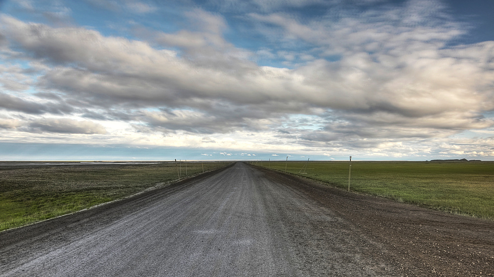
→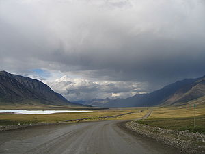 Mile 256 on the Dalton Highway, north of the Continental Divide in the Brooks Range.
 The highway facing south from Deadhorse, near the Arctic Ocean.
The James W. Dalton Highway, usually Dalton Highway (Alaska Route 11) is a 414-mile[1] (667 km) road in Alaska. It begins at the Elliott Highway, north of Fairbanks, and ends at Deadhorse near the Arctic Ocean and the Prudhoe Bay oil fields. Once called the North Slope Haul Road (a name by which it is still sometimes known), it was built as a supply road to support the Trans-Alaska Pipeline System in 1974. It is named for James Dalton, a lifelong Alaskan and an engineer who supervised construction of the Distant Early Warning Line in Alaska and, as an expert in Arctic engineering, served as consultant in early oil exploration in northern Alaska.[2]
Contents
Overview
The highway, which directly parallels the pipeline, is one of the most isolated roads in the United States. There are only three towns along the route: Coldfoot (population 13) at Mile 175,[3] Wiseman (population 22) at Mile 188,[3] and Deadhorse (25 permanent residents, 3,500-5,000 or more seasonal residents depending on oil production) at the end of the highway at Mile 414.[3] Gas is available at the E. L. Patton Yukon River Bridge (Mile 56), as well as Coldfoot and Deadhorse.[3]
Despite its remoteness the Dalton Highway carries a good amount of truck traffic: about 160 trucks daily in the summer months and 250 trucks daily in the winter.[3] The highway comes to within a few miles of the Arctic Ocean. Beyond the highway's terminus at Deadhorse are private roads owned by oil companies, which are restricted to authorized vehicles only. There are, however, commercial tours that take people to the Arctic Ocean. All vehicles must take extreme precaution when driving on the road, and drive with headlights on at all times. There are quite a few steep grades (up to 12%) along the route, as well.
Truckers on the Dalton have given their own names to its various features, including: The Taps, The Shelf, The Bluffs, Oil Spill, Beaver Slide, Two and a Half Mile, Oh Shit Corner,[4][5] and the Roller Coaster. The road reaches its highest altitude as it crosses the Brooks Range at Atigun Pass.
The highway is the featured road on the third, fourth and fifth seasons of the History reality television series Ice Road Truckers, which aired May 31, 2009 through August 23, 2009. It is also the subject of the second episode of America's Toughest Jobs and the first episode of the BBC's World's Most Dangerous Roads featuring Charley Boorman and Sue Perkins[6].
Google Street View has recently[when?] completed its coverage of nearly the entire highway, which can now be seen on Google Maps (imaging stops at the security gate leading to the Prudhoe Bay oil field). It is one of the most northerly routes of Google street view[citation needed].
Places along the Dalton Highway
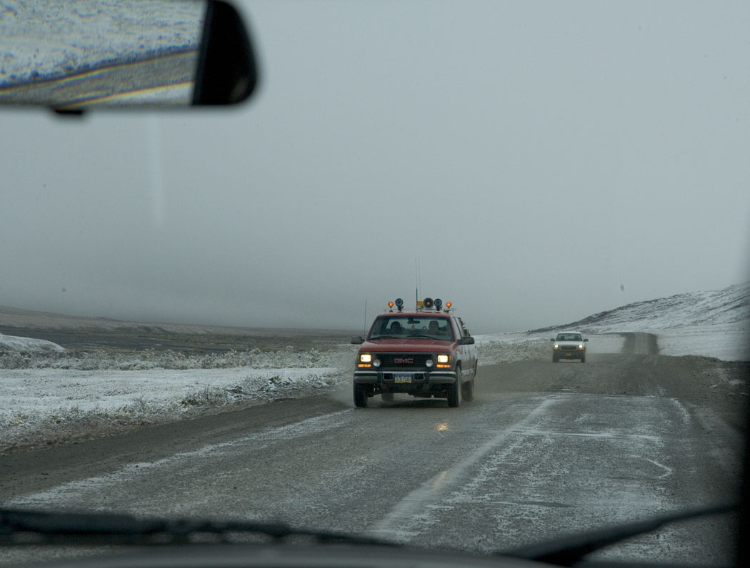
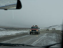 August snow storm on Dalton Highway
- Elliott Highway (Dalton Highway Junction), mile 0 (km 0)
- The Taps, mile 0 - 15 (km 0 - 24)
- Hess Creek Overlook, mile 21 (km 34) -- A pullout overlooking Hess Creek, which heads west to meet the Yukon River.[7]
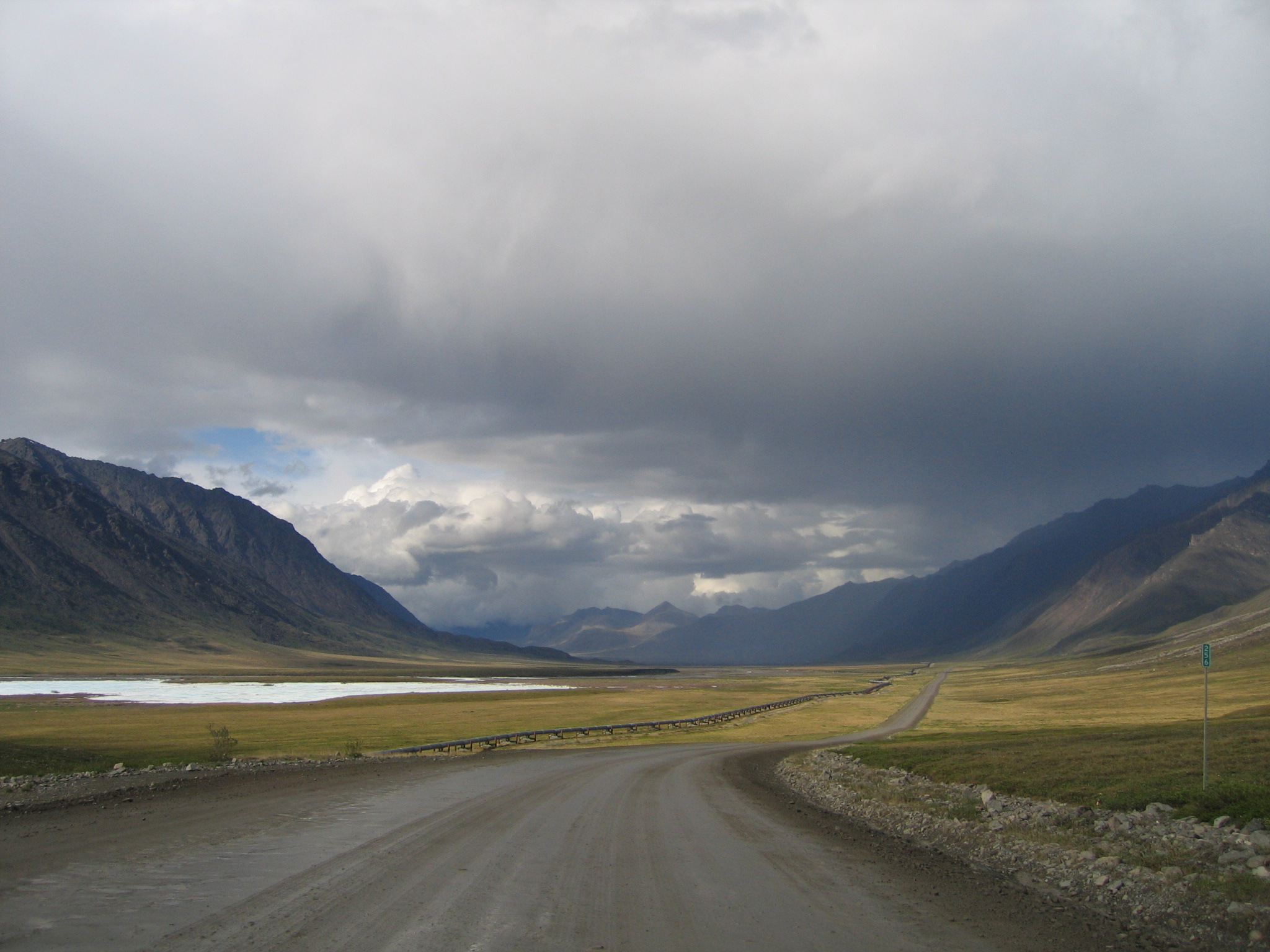
- Trans-Alaska Pipeline System (TAPS) Pump Station No. 6, mile 54 (km 87)
- E. L. Patton Yukon River Bridge, mile 55 (km 90)
- Roller Coaster, mile 76 (km 122)
- Finger Mountain Wayside, mile 98 (km 158) [7]
- Beaver Slide, mile 110 (km 177)
- Arctic Circle Wayside, mile 115 (km 185) – A short side road leads to viewing deck with interpretive displays.[7]
- Gobblers Knob ("Two and a Half Mile"), mile 132 (km 212) – A pullout offering a view of the Brooks Range to the north.[7]
- Prospect Creek, mile 135 (km 217) – Site of the lowest recorded temperature in the United States.
- Junction Bettles Winter Access Road, mile 136 (km 219)
- TAPS Pump Station No. 5, mile 137 (km 221)
- Jim River Bridges, mile 140 - 144 (km 225 - 232)
- Grayling Lake Wayside, mile 150 (km 241) – A glacier carved this U-shaped valley and left a shallow lake.[7]
- South Fork Koyukuk River Bridge, mile 156 (km 251)
- Koyukuk, mile 157 (km 253)
- Coldfoot, mile 175 (km 282) [7]
- Marion Creek Campground, mile 180 (km 290) – A developed campground operated by the U.S. Bureau of Land Management (BLM).
- Wiseman, mile 189 (km 304) [7]
- Sukakpak Mountain, mile 203 (km 327) [7]
- Dietrich River Bridge, mile 207 (km 333)
- Alaska Department of Transportation Camp, mile 209 (km 337)
- Chandalar Shelf ("The Shelf"), mile 237 (km 381) [7]
- Continental Divide / Atigun Pass, mile 244 (km 393) – The highest-altitude point on the road (elevation 4,739 ft / 1,422 m). Rivers to the south flow to the Pacific Ocean or Bering Sea; rivers north of here flow into the Arctic Ocean.[7]
- TAPS Pump Station No. 4, mile 269 (km 433)
- Galbraith Lake, mile 275 (km 443) – The remains of a large glacial lake that once occupied the entire Atigun Valley. Downstream from the bridge is the Atigun Gorge and the western boundary of the Arctic National Wildlife Refuge.[7] The Galbraith Lake Airport is located to the northwest of the lake.
- Island Lake, mile 278 (km 447)
- Toolik Lake, mile 284 (km 457) – The University of Alaska Fairbanks built a research station here in 1975.[7]
- Toolik Hill, mile 288 (km 463)
- Kuparuk River Bridge, mile 290 (km 467)
- Sage River Maintenance Station, mile 307 (km 494)
- TAPS Pump Station No. 3, mile 312 (km 502)
- Oil Spill Hill, mile 321 (km 516)
- Ice Cut, mile 327 (km 526)
- Happy Valley, mile 336 (km 541) – Originally the site of a pipeline construction camp. Offers access to the Sagavanirktok River as well as room for camping. There is an active airstrip here.[7]
- Roadside Rest Area, mile 356 (km 573)
- Sag River Overlook, mile 348 (km 560) – Trail leads to a viewing deck with interpretive displays. The Philip Smith Mountains, located 35 miles away, are visible on a clear day.[7]
- TAPS Pump Station No. 2, mile 359 (km 577)
- Franklin Bluffs ("The Bluffs"), mile 379 (km 610) – Named for John Franklin, a British explorer who mapped the arctic coastline and searched for the Northwest Passage.[7]
- Deadhorse, mile 414 (km 666) – The public highway ends here, about 8 miles (13 km) from the Arctic Ocean.[7]
See also
References
- ^ "Dalton Highway". United States Department of the Interior, Bureau of Land Management. http://www.blm.gov/ak/st/en/prog/recreation/dalton_hwy.html. Retrieved 2009-09-04.
- ^ "The Dalton Highway Visitor Guide". Bureau of Land Management. Summer 2009. http://www.alaskageographic.org/uploads/pdf/dalton-vg2009.pdf. Retrieved 6 December 2009.
- ^ a b c d e 2008 edition of The Milepost, pp. 517-529 (Morris Communications Company)
- ^ Nephler, Ed (November 3, 2010). "Oh Shit Corner". Blog.dog-berry.com. http://blog.dog-berry.com/index.php/2010/11/03/oh-shit-corner. Retrieved September 5, 2011.
- ^ "Day 8 - The Dalton Highway". Alaskapade.com. June 26, 2011. http://www.alaskapade.com/2011/06/day-8-dalton-highway.html. Retrieved September 5, 2011.
- ^ http://www.bbc.co.uk/programmes/b014hnld
- ^ a b c d e f g h i j k l m n o p "The Dalton Highway: Visitor Guide" (PDF). U.S. Bureau of Land Management. Summer 2009. http://www.alaskageographic.org/uploads/pdf/dalton-vg2009.pdf.
External links
Categories:- State highways in Alaska
- Transportation in North Slope Borough, Alaska
- Transportation in Unorganized Borough, Alaska

Wikimedia Foundation. 2010.