- Geography of Seychelles
-
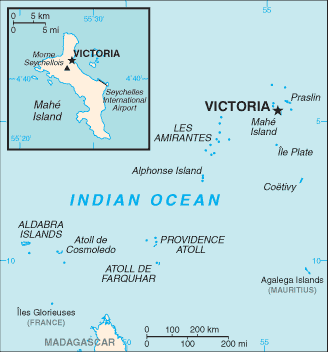
 Map of Seychelles
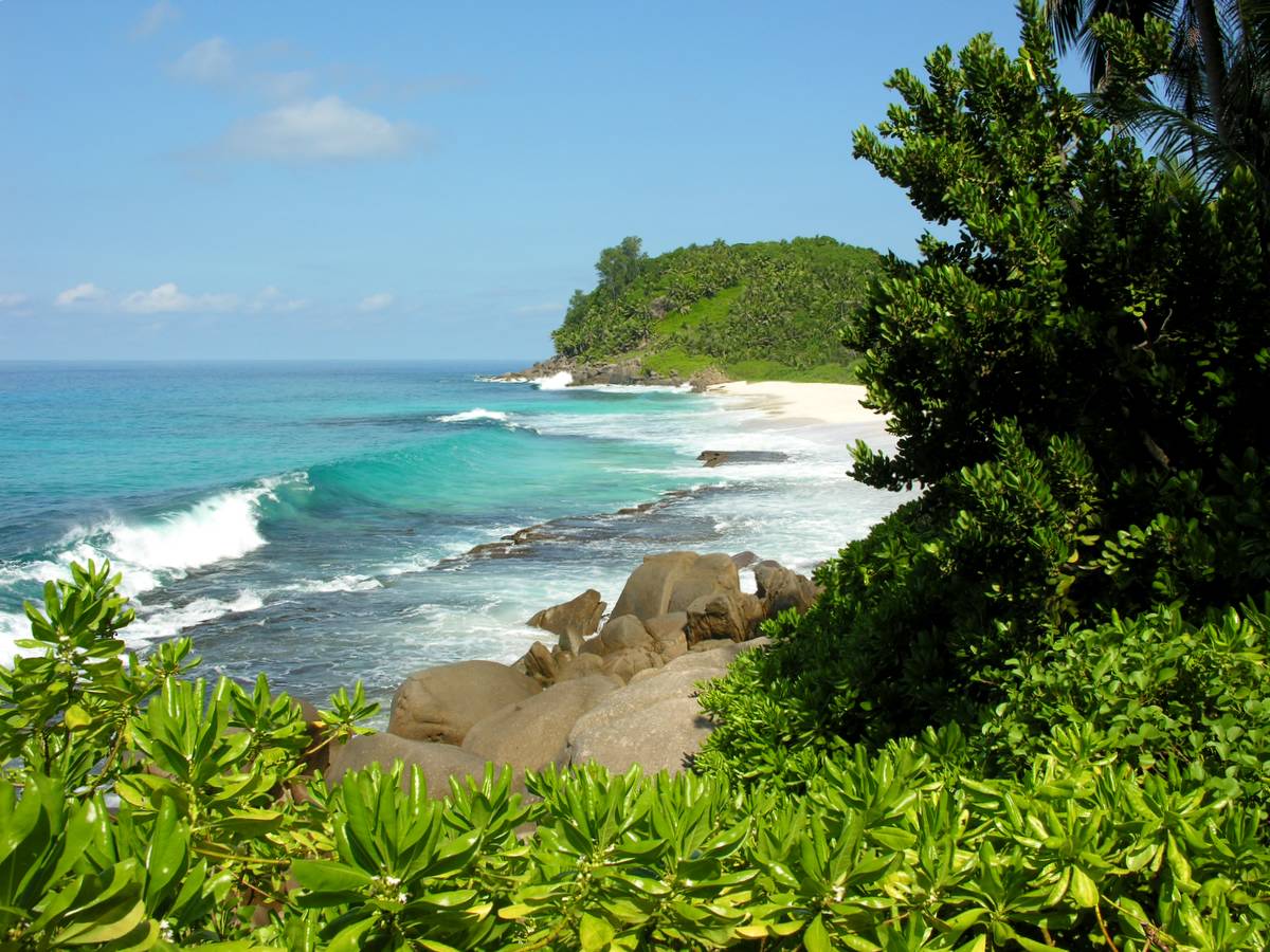
The Seychelles is a small island nation located in the Indian Ocean northeast of Madagascar and about 1,600 km (994 mi) east of Kenya. Seychelles lies between approximately 4ºS and 10ºS and 46ºE and 54ºE. The nation is an archipelago of 155 tropical islands, some granite and some coral. the majority of which are small and uninhabited. The landmass is only 457 km², but the islands are spread over an Exclusive Economic Zone of 1,374,000 km². About 90 percent of the population of 82,500 live on Mahé, 9 percent on Praslin and La Digue. Around a third of the land area is the island of Mahé and a further third the atoll of Aldabra.
There are two distinct regions, the granitic islands, the world's only oceanic islands of granitic rock and the coralline outer islands. The granite islands are the world’s oldest ocean islands, while the outer islands are mainly very young, though the Aldabra group and St Pierre (Farquhar Group) are unusual, raised coral islands that have emerged and submerged several times during their long history, the most recent submergence dating from about 125,000 years ago.
Contents
Inner Islands
The Inner Islands is the collective term for 42 islands with a total area of 243.7 km², 54% of the Seychelles area but with more than 98% of the population.
The Granitic Group consists of 40 granite islands, all within a 56 km (35 mi) radius of the main island of Mahé. These islands are rocky, and most have a narrow coastal strip and a central range of hills rising as high as 914 metres (2,999 ft). The most important islands of this group are:
- Mahé is the largest island, with a size of 142 km2 (55 sq mi). Victoria, the capital, is on Mahé.
- Praslin Island,
- Silhouette Island,
- La Digue,
- Fregate Island,
- Curieuse Island,
- North Island,
- Aride Island.
Two coralline islands, at 90 km to the north, make up the remainder of the Inner Islands:
Millions of years ago, the archipelago was created by a combination of the separation of India from Africa as well as undersea volcanoes similar to those from which Mauritius and Réunion were created. Subsequently the vast majority of this huge land area became submerged over time.
Outer Islands (also known as Zil Elwannyen Sesel)
Main article: Outer Islands (Seychelles)The Outer Islands consist of five groups of coralline islands:
- Southern Coral Group, a collective term for Île Platte and Coëtivy Island
- Amirante Islands
- Alphonse Group (Alphonse Atoll and St. François Atoll)
- Aldabra Group (Aldabra Atoll, Assumption Island, and the Cosmoledo Group, consisting of Cosmoledo Atoll and Astove Island)
- Farquhar Group (Farquhar Atoll, Providence Atoll and St. Pierre Island)
The Outer Islands comprise 211.3 km² (46% of the Seychelles), but less than 2% of the population.
The coral islands are flat with elevated coral reefs at different stages of formation. They have no fresh water and can sustain human life only with difficulty.
Geology
The Seychelles is part of the granitic Mascarene Plateau which broke off from the Indian Plate about 65 mya. This rift formation is associated with the Réunion hotspot which is also responsible for Réunion Island and the Deccan Traps in India. Because of its long isolation, the Seychelles hosts several unique species including the Coco de mer, a palm which has the largest seeds of any plant and the world's largest population of giant tortoises.
Climate
The climate is equable and healthy, although quite humid, as the islands are small and subject to marine influences. The temperature varies little throughout the year. Temperatures on Mahé vary from 24 to 30 °C (75.2 to 86 °F), and rainfall ranges from 2,900 mm (114.2 in) annually at Victoria to 3,600 mm (141.7 in) on the mountain slopes. Precipitation is somewhat less on the other islands. During the coolest months, July and August, it drops to as low as 24 °C (75.2 °F). The southeast trade winds blow regularly from May to November, and this is the most pleasant time of the year. The hot months are from December to April, with higher humidity (80%). March and April are the hottest months, but the temperature seldom exceeds 31 °C (87.8 °F). Most of the islands lie outside the cyclone belt, so high winds are rare.
Flora and fauna
Main article: Flora and fauna of SeychellesThe uniqueness of the Seychelles' ecology is reflected in the US$1.8 million project of the Global Environment Trust Fund of the World Bank (see Glossary) entitled Biodiversity Conservation and Marine Pollution Abatement, that began in 1993. The World Bank study for this project states that the islands contain, out of a total of 1,170 flowering plants, "at least 75 species of flowering plants, 15 of birds, 3 of mammals, 30 of reptiles and amphibians, and several hundred species of snails, insects, spiders and other invertebrates" found nowhere else. The diversity of species in the islands is being assessed by the Nature Protection Trust of Seychelles. In addition, the waters contain more than 1000 kinds of fish, of which more than one-third are associated with coral reefs. Specific examples of unique birds are the Black Paradise Flycatcher, the Black Parrot, the brush warbler, and a flightless rail. Most famous of all the Seychelles animals are the giant tortoises of the genus Dipsochelys.
Environmental threats
As a result of extensive shipping to Seychelles that brings needed imports and the discharge of commercial tuna fishing, the waters suffer some pollution. Furthermore, goats brought to Aldabra Islands are destroying much of the vegetation on which giant tortoises feed or seek shade. Rats have reduced biodiversity on many islands. Climate change is also a significant issue; it was recently realised that this has caused the extinction of the endemic snail Rhachistia aldabrae.
Seychelles began addressing the conservation problem in the late 1960s by creating the Nature Conservancy Commission, later renamed the Seychelles National Environment Commission. A system of national parks and animal preserves covering 42% of the land area and about 260 km² of the surrounding water areas has been set aside. Legislation protects wildlife and bans various destructive practices. In Seychelles' 1990 to 1994 National Development Plan, an effort was made to include in the appropriate economic sectors of the development plan environment and natural resources management aspects.
Also connected with ecology is a World Bank project dealing with the environment and transportation. Launched in 1993 with a loan of US$4.5 million, it is designed to improve the infrastructure of Seychelles with regard to roads and airports or airstrips so as to encourage tourism as a source of income, while simultaneously supporting environmental programs in resource management, conservation, and the elimination of pollution.
Another major project has been funded by Fonds Francais pour l'environnement Mondiale (FFEM) and implemted by Island Conservation Society. This aims to rehabilitate and enhance islands for the maintenance of native biodiversity in Seychelles through eradication of introduced predator species, rehabilitation of habitats and reintroduction of rare or threatened species. Rats have been eliminated from North Island under this project and more schemes are planned, including at Cosmoledo Atoll and on Conception Island.
Facts and figures
 Detailed map of Seychelles
Geographic coordinates: 4°35′S 55°40′E / 4.583°S 55.667°E
Area:
total: 455 km²
land: 455 km²
water: 0 km²Land boundaries: 0 km
Coastline: 491 km
Maritime claims:
continental shelf: 200 nmi (370.4 km; 230.2 mi) or to the edge of the continental margin
exclusive economic zone: 200 nmi (370.4 km; 230.2 mi)
territorial sea: 12 nmi (22.2 km; 13.8 mi)Elevation extremes:
lowest point: Indian Ocean 0 m
highest point: Morne Seychellois 905 mNatural resources: fish, copra, cinnamon trees
Land use:
arable land: 2%
permanent crops: 13%
permanent pastures: 0%
forests and woodland: 11%
other: 74% (1993 est.)Irrigated land: 0 km²
Environment - international agreements:
party to: Biodiversity, Climate Change, Desertification, Endangered Species, Hazardous Wastes, Law of the Sea, Marine Dumping, Nuclear Test Ban, Ozone Layer Protection, Ship Pollution, Whaling
signed, but not ratified: Climate Change-Kyoto ProtocolExtreme points
This is a list of the extreme points of [[]], the points that are farther north, south, east or west than any other location.
- Northernmost point – Aride Island, La Digue and Inner Islands district
- Easternmost point – Coëtivy Island, Outer Islands district
- Southernmost point - Goelette Island, Farquhar Group, Outer Islands district
- Westernmost point - West Island, Aldabra Islands, Outer Islands district
References
 This article incorporates public domain material from websites or documents of the Library of Congress Country Studies.
Sovereign
states- Algeria
- Angola
- Benin
- Botswana
- Burkina Faso
- Burundi
- Cameroon
- Cape Verde
- Central African Republic
- Chad
- Comoros
- Democratic Republic of the Congo
- Republic of the Congo
- Côte d'Ivoire (Ivory Coast)
- Djibouti
- Egypt
- Equatorial Guinea
- Eritrea
- Ethiopia
- Gabon
- The Gambia
- Ghana
- Guinea
- Guinea-Bissau
- Kenya
- Lesotho
- Liberia
- Libya
- Madagascar
- Malawi
- Mali
- Mauritania
- Mauritius
- Morocco
- Mozambique
- Namibia
- Niger
- Nigeria
- Rwanda
- São Tomé and Príncipe
- Senegal
- Seychelles
- Sierra Leone
- Somalia
- South Africa
- South Sudan
- Sudan
- Swaziland
- Tanzania
- Togo
- Tunisia
- Uganda
- Zambia
- Zimbabwe
States with limited
recognition- Sahrawi Arab Democratic Republic
- Somaliland
Dependencies and
other territories- Canary Islands / Ceuta / Melilla / Plazas de soberanía (Spain)
- Madeira (Portugal)
- Mayotte / Réunion (France)
- Saint Helena / Ascension Island / Tristan da Cunha (United Kingdom)
- Western Sahara
Climate of Africa Sovereign
states- Algeria
- Angola
- Benin
- Botswana
- Burkina Faso
- Burundi
- Cameroon
- Cape Verde
- Central African Republic
- Chad
- Comoros
- Democratic Republic of the Congo
- Republic of the Congo
- Côte d'Ivoire (Ivory Coast)
- Djibouti
- Egypt
- Equatorial Guinea
- Eritrea
- Ethiopia
- Gabon
- The Gambia
- Ghana
- Guinea
- Guinea-Bissau
- Kenya
- Lesotho
- Liberia
- Libya
- Madagascar
- Malawi
- Mali
- Mauritania
- Mauritius
- Morocco
- Mozambique
- Namibia
- Niger
- Nigeria
- Rwanda
- São Tomé and Príncipe
- Senegal
- Seychelles
- Sierra Leone
- Somalia
- South Africa
- South Sudan
- Sudan
- Swaziland
- Tanzania
- Togo
- Tunisia
- Uganda
- Zambia
- Zimbabwe
States with limited
recognition- Sahrawi Arab Democratic Republic
- Somaliland
Dependencies and
other territories- Canary Islands / Ceuta / Melilla / Plazas de soberanía (Spain)
- Madeira (Portugal)
- Mayotte / Réunion (France)
- Saint Helena / Ascension Island / Tristan da Cunha (United Kingdom)
- Western Sahara
Seychelles topics Culture and society 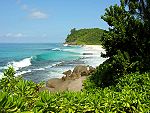
Economy and infrastructure Geography Government and politics History Governors · Prime MinistersCategories:

Wikimedia Foundation. 2010.