- Geography of Zimbabwe
-
Geography of Zimbabwe 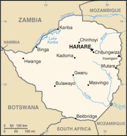
Continent Africa Region Southern Africa Coordinates 20°S 30°E / 20°S 30°ECoordinates: 20°S 30°E / 20°S 30°E Area Ranked 61st
390,757 km2Coastline 0 km (landlocked) Borders 3,066 km
(Botswana 813 km, Mozambique 1231 km, South Africa 225 km, Zambia 797 km)Highest point Inyangani
2,592 mLowest point junction of the Runde and Save rivers. 162 m Longest river Zambezi River
2,650 kmLargest lake Lake Kariba
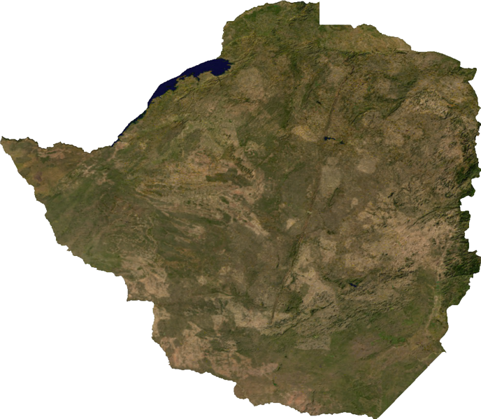
7,770 km2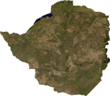 Satellite image of Zimbabwe
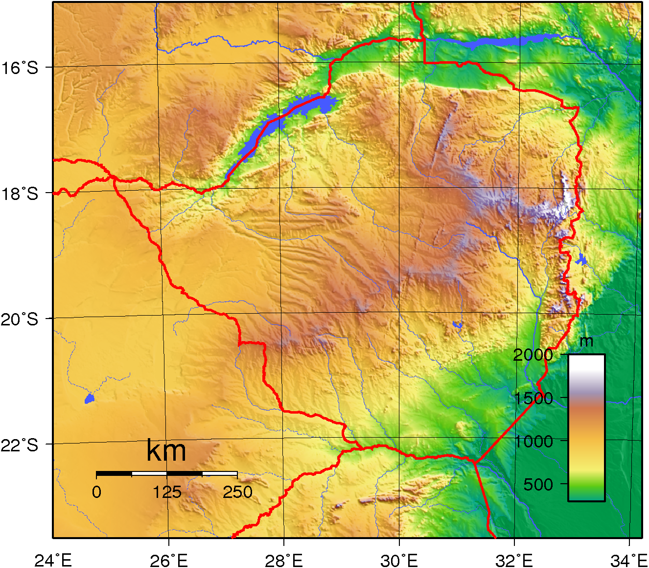
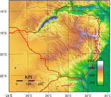 Topography of Zimbabwe
 Zimbabwe's cities, main towns, selected villages and archaeological sites, rivers and its highest point
Zimbabwe is a landlocked country in southern Africa lying while within the tropics. It straddles an extensive high inland plateau that drops northwards to the Zambezi valley where the border with Zambia is and similarly drops southwards to the Limpopo valley and the border with South Africa. The country has borders with Botswana 813 km, Mozambique 1,231 km, South Africa 225 km, Zambia 797 km and meets Namibia at its westernmost point.
Contents
Area
It is the 61st largest country in the world (although below average size for Africa) just larger than Japan or Montana but smaller than Paraguay, with a total area of 390,580 km², of which 3,910 km² comprises lakes and reservoirs.
Climate
The climate is tropical, although markedly moderated by altitude. There is a dry season, including a short cool season during the period May to September when the whole country has very little rain. The rainy season is typically a time of heavy rainfall from November to March. The whole country is influenced by the Intertropical Convergence Zone during January. In years when it is poorly defined there is below average rainfall and a likelihood of serious drought in the country (as happened in 1983 and 1992). When it is well-defined rainfall is average or well above average, as in 1981 and 1985.
Terrain
Much of the country is high plateau with higher central plateau (high veld) forming a watershed between the Zambezi and Limpopo river systems. The Limpopo and the lower Zambezi valleys are broad and relatively flat plains. The eastern end of the watershed terminates in a north-south mountain spine, called the Eastern Highlands.
Elevation extremes:
lowest point: junction of the Runde and Save rivers 162 m
highest point: Mount Nyangani 2,592 mNatural resources: coal, chromium ore, asbestos, gold, nickel, copper, iron ore, vanadium, lithium, tin, platinum group metals
Land use:
arable land: 8.24% (2005)
permanent crops: 0.33% (2005)
other: 91.43% (2005)Irrigated land: 1,740 km² (2003)
Natural hazards: recurring droughts; floods and severe storms are rare
Environment - current issues: deforestation; soil erosion; land degradation; air and water pollution; the black rhinoceros herd - once the largest concentration of the species in the world - has been significantly reduced by poaching; poor mining practices have led to toxic waste and heavy metal pollution
Environment - international agreements: party to: Biodiversity, Climate Change, Desertification, Endangered Species, Law of the Sea, Ozone Layer Protection signed, but not ratified: none of the selected agreements
Hydrology: The country is divided into six drainage basins. The largest are the Zambezi and the Limpopo. Western parts of Matabeleland connect to the Okavango inland drainage basin through the Nata river. Most of the southern Mashonaland and adjacent parts of Masvingo drain through the Save river into the Indian ocean. Two smaller drainage basins cover parts of Manicaland, and drain into the Indian Ocean through Mozambique. These are the Pungwe river to the north and the Buzi river to the south. Sediment transport has been studied for rivers in Zimbabwe using the HBV hydrology transport model.
Table 1.
Rainfall and land use suitability options in Zimbabwe's natural regions
Natural region
Rainfall
Main land use type:
- Above 1050 mm/annum with some precipitation in all months of the year Afforestation, fruit, tea, coffee and intensive livestock production
- 750–1000 mm/annum seasonally confined with well-defined dry season Large scale intensive crop and livestock production
- 650–800 mm/annum with regular mid-season dry spells Livestock production with fodder crops. Marginal production of maize, tobacco and cotton
- 450-650 mm/annum with periodic seasonal drought and severe rainy season dry spells Livestock production and drought resistant crops
- Too low and erratic for even drought resistant fodder and grain crops Extensive livestock and/or game ranching. [1]
Extreme points
This is a list of the extreme points of Zimbabwe, the points that are farther north, south, east or west than any other location.
- Northernmost point - unnamed location on the border with Zambia in the Zambezi river immediately north of the town of Kanyemba, Mashonaland West province
- Easternmost point - unnamed location on the border with Mozambique immediately west of the Mozambican town of Vera, Manicaland province
- Southernmost point - the tripoint with South Africa and Mozambique, Masvingo Province
- Westernmost point - the tripoint with Botswana and Zambia, Matabeleland North province
See also
References
- ^ Source: CSO (1997, 144)
External links
- Soil Maps of Zimbabwe European Digital Archive on the Soil Maps of the world
Subdivisions of Zimbabwe Provinces Districts Beitbridge · Bikita · Bindura · Binga · Bubi · Buhera · Bulawayo · Bulilimamangwe · Chegutu · Chikomba · Chimanimani · Chipinge · Chiredzi · Chirumhanzu · Chivi · Gokwe North · Gokwe South · Goromonzi · Guruve · Gutu · Gwanda · Gweru · Harare · Hurungwe · Hwange · Hwedza · Insiza · Kadoma · Kariba · Kwekwe · Lupane · Makonde · Makoni · Marondera · Masvingo · Matobo · Mazowe · Mberengwa · Mount Darwin · Mudzi · Mukumbura · Murehwa · Mutare · Mutasa · Mutoko · Muzarabani · Mwenezi · Nkayi · Nyanga · Rushinga · Seke · Shamva · Shurugwi · Tsholotsho · Umguza · Umzingwane · Uzumba-Maramba-Pfungwe · Wedza · Zaka · Zvimba · ZvishavaneWards Largest cities Sovereign
states- Algeria
- Angola
- Benin
- Botswana
- Burkina Faso
- Burundi
- Cameroon
- Cape Verde
- Central African Republic
- Chad
- Comoros
- Democratic Republic of the Congo
- Republic of the Congo
- Côte d'Ivoire (Ivory Coast)
- Djibouti
- Egypt
- Equatorial Guinea
- Eritrea
- Ethiopia
- Gabon
- The Gambia
- Ghana
- Guinea
- Guinea-Bissau
- Kenya
- Lesotho
- Liberia
- Libya
- Madagascar
- Malawi
- Mali
- Mauritania
- Mauritius
- Morocco
- Mozambique
- Namibia
- Niger
- Nigeria
- Rwanda
- São Tomé and Príncipe
- Senegal
- Seychelles
- Sierra Leone
- Somalia
- South Africa
- South Sudan
- Sudan
- Swaziland
- Tanzania
- Togo
- Tunisia
- Uganda
- Zambia
- Zimbabwe
States with limited
recognition- Sahrawi Arab Democratic Republic
- Somaliland
Dependencies and
other territories- Canary Islands / Ceuta / Melilla / Plazas de soberanía (Spain)
- Madeira (Portugal)
- Mayotte / Réunion (France)
- Saint Helena / Ascension Island / Tristan da Cunha (United Kingdom)
- Western Sahara
Climate of Africa Sovereign
states- Algeria
- Angola
- Benin
- Botswana
- Burkina Faso
- Burundi
- Cameroon
- Cape Verde
- Central African Republic
- Chad
- Comoros
- Democratic Republic of the Congo
- Republic of the Congo
- Côte d'Ivoire (Ivory Coast)
- Djibouti
- Egypt
- Equatorial Guinea
- Eritrea
- Ethiopia
- Gabon
- The Gambia
- Ghana
- Guinea
- Guinea-Bissau
- Kenya
- Lesotho
- Liberia
- Libya
- Madagascar
- Malawi
- Mali
- Mauritania
- Mauritius
- Morocco
- Mozambique
- Namibia
- Niger
- Nigeria
- Rwanda
- São Tomé and Príncipe
- Senegal
- Seychelles
- Sierra Leone
- Somalia
- South Africa
- South Sudan
- Sudan
- Swaziland
- Tanzania
- Togo
- Tunisia
- Uganda
- Zambia
- Zimbabwe
States with limited
recognition- Sahrawi Arab Democratic Republic
- Somaliland
Dependencies and
other territories- Canary Islands / Ceuta / Melilla / Plazas de soberanía (Spain)
- Madeira (Portugal)
- Mayotte / Réunion (France)
- Saint Helena / Ascension Island / Tristan da Cunha (United Kingdom)
- Western Sahara
 Topics related to Zimbabwe
History Timeline · Pre-colonial · First Matabele War · Second Matabele War · World War II · Colonial · Unilateral Declaration of Independence · Rhodesia · Rhodesian Bush War · Military · CricketPolitics Geography Provinces · Districts · Municipalities · Limpopo River · Zambezi River · Chimanimani District · Cities and towns · Place names · Rivers · Great Zimbabwe National Monument · WildlifeEconomy Demographics Zimbabweans · Ethnic groups in Zimbabwe|Ethnic groups (Whites · Shona people · Ndebele people) · Holidays · Languages (English · Shona · Northern Ndebele)Culture Coat of arms · National flag · National anthem · National emblem · National flower · National animal · Art · Music · Language · DiasporaCategories:


Wikimedia Foundation. 2010.