- Manicaland Province
-
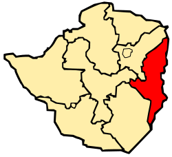 Map of Zimbabwe with the province highlighted
Manicaland is a province of Zimbabwe. It has an area of 36,459 km2 (14,077 sq mi) and a population of approximately 1.6 million (2002). Mutare is the capital of the province. [1] [2]
Contents
Background
 Manicaland Province division for the 2008 elections
The name derives from the fact that the area has been occupied in recent history by the Manyika people. The Manyika are a Shona sub-tribal grouping with their own language variant, the Manyika language.
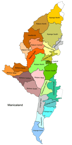
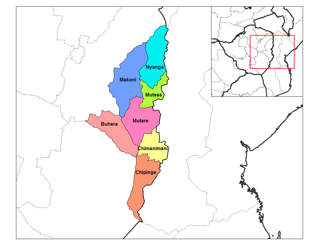
Manicaland districts
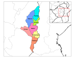 Districts of Manicaland
The province is subdivided into seven districts, Buhera, Chimanimani, Chipinge, Makoni, Mutare in the center, including the city Mutare, Mutasa and Nyanga in the northeast of the province.
The People
The people of Manicaland speaks Shona, but different districts have own sub-dialects. For example Mutasa district uses the Manyika sub-dialect. In Makoni District, the people use the Maungwe dialect, Chipinge, the Ndau and Mutare, the Bocha and Jindwi dialects. The majority of people practise their own traditional way of worshiping, but also practice Christianity with the majority falling under the Methodist Church, the Anglican Church and the Roman Catholic Church. Some fall under the Apostolic Churches. A higher proportion of the Apostolic followers in Mutare and Buhera district and polygamy is quite prevalent among church members.
Schools in Manicaland
In general, in Manicaland, there is a school within a 5 km radius. The number of both primary and secondary schools scattered across the province. Distribution of schools by district is shown in the table below.
District Primary Secondary Buhera 140 55 Chimanimani 68 24 Chipinge 125 40 Makoni 170 60 Mutare 172 67 Mutasa 72 27 Nyanga 75 25 Total 822 298 Places of Interest
- Troutbeck, Manicaland
- Nyanga
- Vumba
- Chimanimani
- Hot Springs, Manicaland
See also
References
- ^ Central Statistical Office, Zimbabwe, Census 2002, Unpublished Data.
- ^ Zimbabwe Population data
- ^ [Manicaland Regional Education Office, 2004.
External links
- Energy Sector Background for Manicaland Province
- Manicaland Publicity Association
- The Catholic Church In Manicaland 1896-1996
Subdivisions of Zimbabwe Provinces Bulawayo · Harare · Manicaland · Mashonaland Central · Mashonaland East · Mashonaland West · Masvingo · Matabeleland North · Matabeleland South · MidlandsDistricts Beitbridge · Bikita · Bindura · Binga · Bubi · Buhera · Bulawayo · Bulilimamangwe · Chegutu · Chikomba · Chimanimani · Chipinge · Chiredzi · Chirumhanzu · Chivi · Gokwe North · Gokwe South · Goromonzi · Guruve · Gutu · Gwanda · Gweru · Harare · Hurungwe · Hwange · Hwedza · Insiza · Kadoma · Kariba · Kwekwe · Lupane · Makonde · Makoni · Marondera · Masvingo · Matobo · Mazowe · Mberengwa · Mount Darwin · Mudzi · Mukumbura · Murehwa · Mutare · Mutasa · Mutoko · Muzarabani · Mwenezi · Nkayi · Nyanga · Rushinga · Seke · Shamva · Shurugwi · Tsholotsho · Umguza · Umzingwane · Uzumba-Maramba-Pfungwe · Wedza · Zaka · Zvimba · ZvishavaneWards Largest cities Categories:- Zimbabwe geography stubs
- Provinces of Zimbabwe
- Manicaland
- Populated places in Zimbabwe
- Geography of Zimbabwe


Wikimedia Foundation. 2010.